
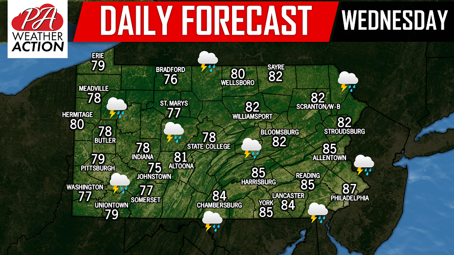
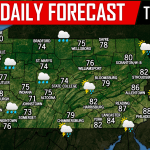
Scattered strong to severe thunderstorms are expected as the Storm Prediction Center has placed many areas under a Marginal and Slight risk for severe weather today. While there is a chance for showers and storms this morning, the greater potential for showers and strong to severe thunderstorms will arrive this evening.
Below is a look at the future radar valid for 5:00 PM: 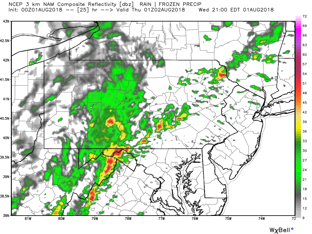
The main threat with the storm cells this evening is the potential for damaging winds greater than 60 MPH.
Taking the future radar to 7:00 PM, the line of strong to severe storms continues to push east: 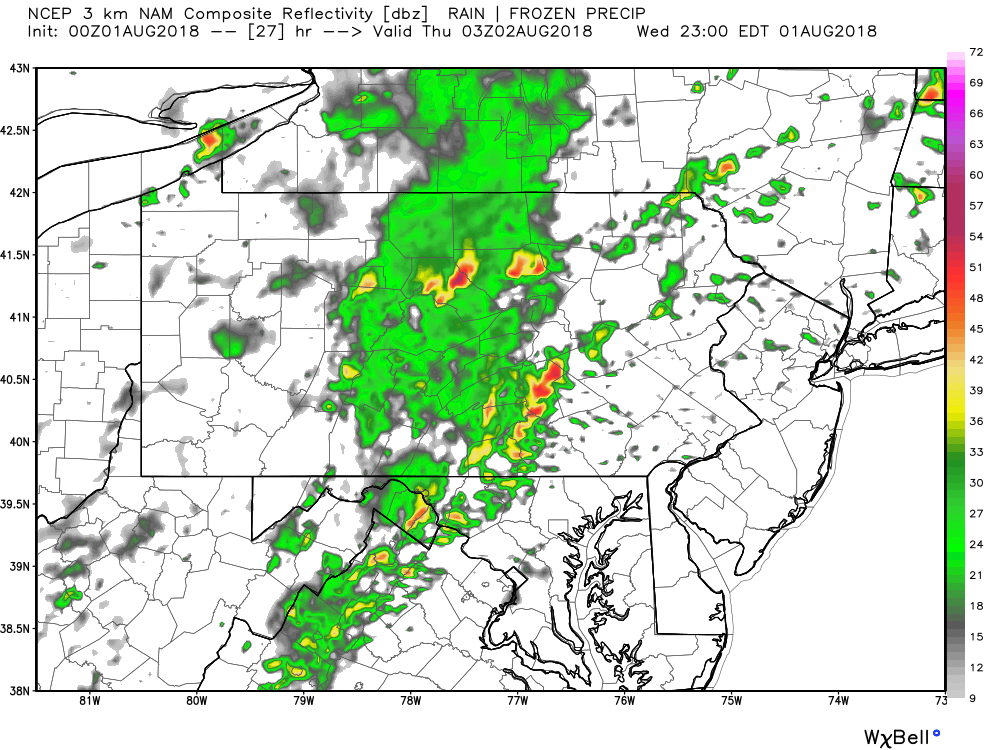
Eastern Pennsylvania will likely still see rain this evening and into the nighttime hours, however the severe threat is slightly less than areas in Central and Western Pennsylvania due to the lack of daylight as the line passes through. Stay tuned to our Facebook page for the latest watches and warnings throughout the day!
You must be logged in to post a comment.