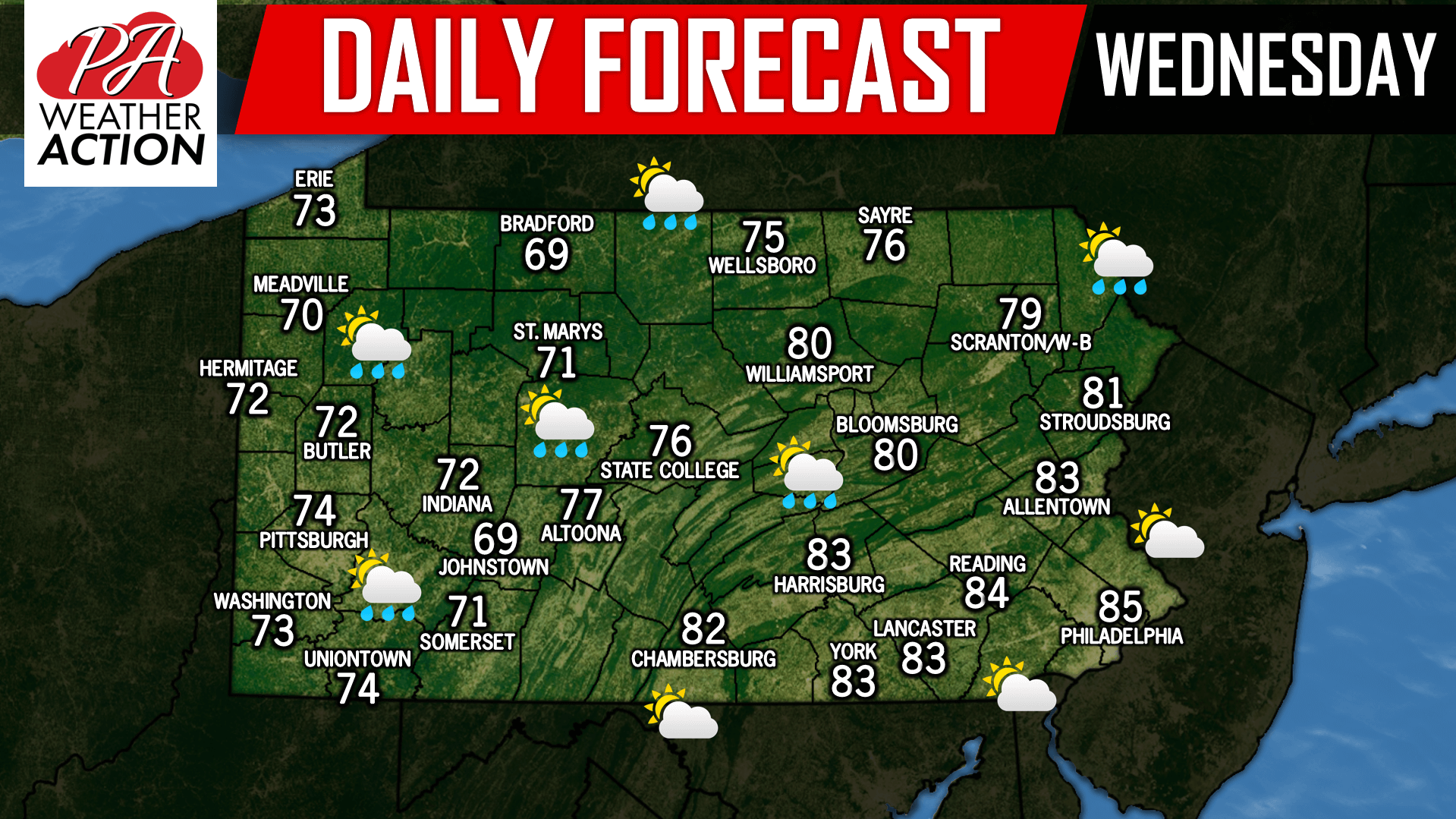
After yesterday’s severe weather, we slowly begin to dry out. However, today remains a transition day. A chance for an isolated shower or thunderstorm is possible especially the farther northwest you live in Pennsylvania. With that being said, most areas will remain dry with mostly cloudy skies. The area with the greatest chance for peaks of sunshine will be across Southeast PA where temperatures will rise into the 80s. Have a nice day!
Josh has been passionate about weather as long as his memory dates! From watching the Weather Channel at age 7, to making hand-drawn hurricane maps at age 11, starting his first weather site at 13, and founding PWA at 15 and forecasting for the state for the past 9 years, Josh's interest in weather has never dwindled! As difficult as it is, he greatly enjoys forecasting for Pennsylvania due to its countless microclimates. The state is an East Coast severe weather hotspot and nearly always home to the rain/snow line during winter storms!
Post navigation
Previous Post
Daily Forecast for Tuesday, August 21st, 2018
You must be logged in to post a comment.