
Another near record breaking day for parts of Pennsylvania today with temperatures soaring well into the 60s and 70s for many areas. Locations closer to the Pennsylvania/Maryland border may reach 80 degrees today! There is the chance for scattered showers, especially in Western Pennsylvania today. Do not be surprised to hear a rumble of thunder. 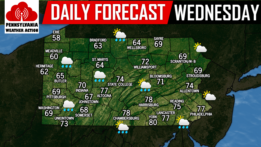
Unfortunately our temperatures will crash significantly going into tonight and tomorrow morning. Temperatures will crash ahead of another system that will lead to rain for most, but at the onset areas North of Interstate 80 may start off as freezing rain and/or sleet around lunchtime tomorrow. Below is a look at the future radar valid for 1:00 PM Thursday: 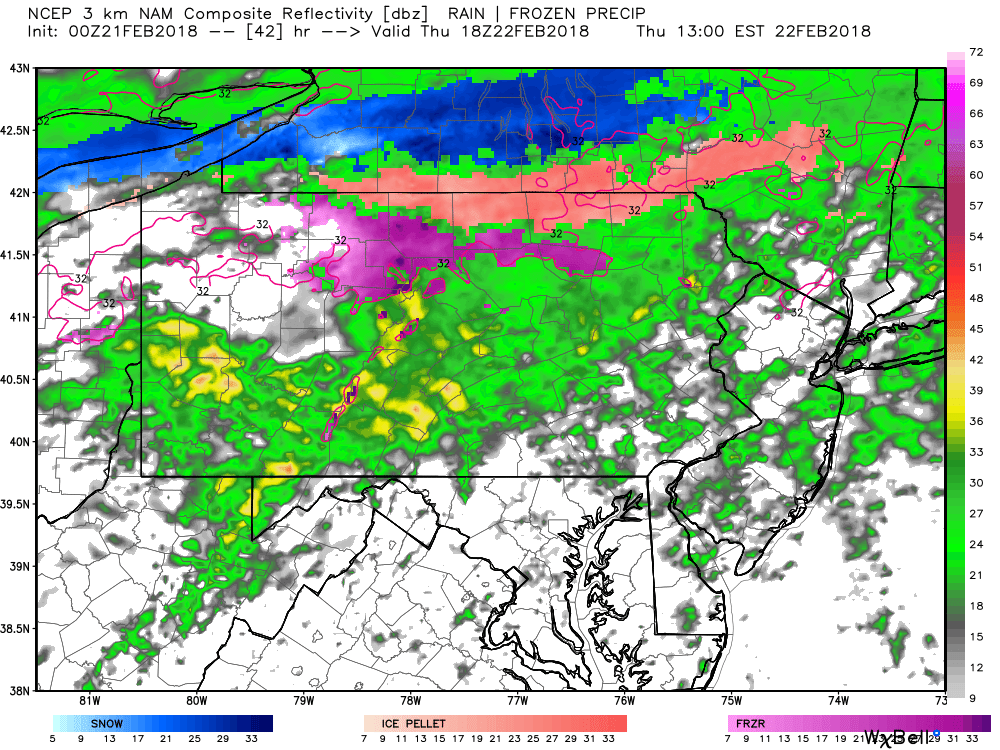
The sleet and freezing rain will not be a huge deal, but some slick spots are certainly possible for areas North of Interstate 80 during the day tomorrow. The bigger story will be the significant drop in temperatures. High temperatures tomorrow will be in the 30s and 40s throughout the state. That means temperatures will drop between 30 and 40 degrees in less than 24 hours!
You must be logged in to post a comment.