
Back to a seasonal winter day with even a chance for morning flurries and snow showers across parts of Northwest Pennsylvania. 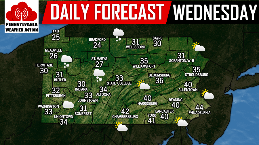
The good news is, the next round of meaningful precipitation does not arrive here until late Saturday night into Sunday morning in the form of some rain. It is possible far interior parts of Pennsylvania changes over to a bit of snow, but early projections keeps both rain and snow totals to minor amounts. Below is a look at the GFS valid for Sunday 7:00 AM: 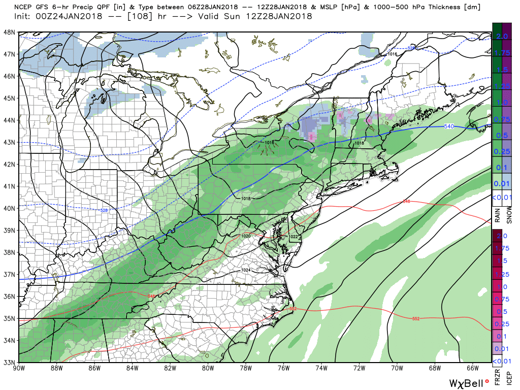
A possible big system is being shown on model guidance around February 2nd. This storm could produce either rain or snowfall for the area, but it is after that system, our pattern changes to sustain cold and plenty of snow chances that will last for most, if not all of February!
You must be logged in to post a comment.