
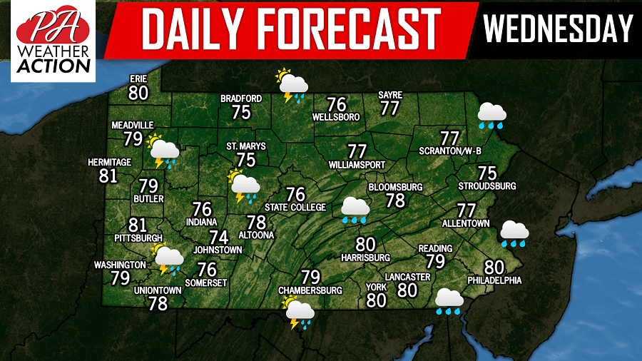
Another day, but the same story. A chance for on and off heavy rain showers across the state today with the best chance being across Eastern Pennsylvania. Some areas across Central Pennsylvania have now received a record shattering 10-14″+ of rainfall since Saturday alone. Any additional rainfall today will once again cause significant to major flooding across those towns. If you see a flooded roadway, turn around, don’t drown.
Below is a look at the future radar for 6:00 PM this evening: 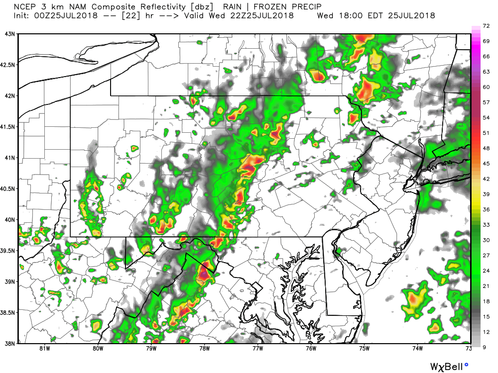
The only good news we can offer right now is that today will be the last day of consistent rainfall. Tomorrow rainfall chances diminish greatly. Stay safe!
You must be logged in to post a comment.