
The flooding rains will soon be over, as the system causing this “atmospheric river” finally moves away Thursday. However, creeks and rivers will continue to rise tomorrow, potentially causing flooding in low-lying areas near them. The SPC has labeled parts of Central and Eastern PA under a slight risk Friday.
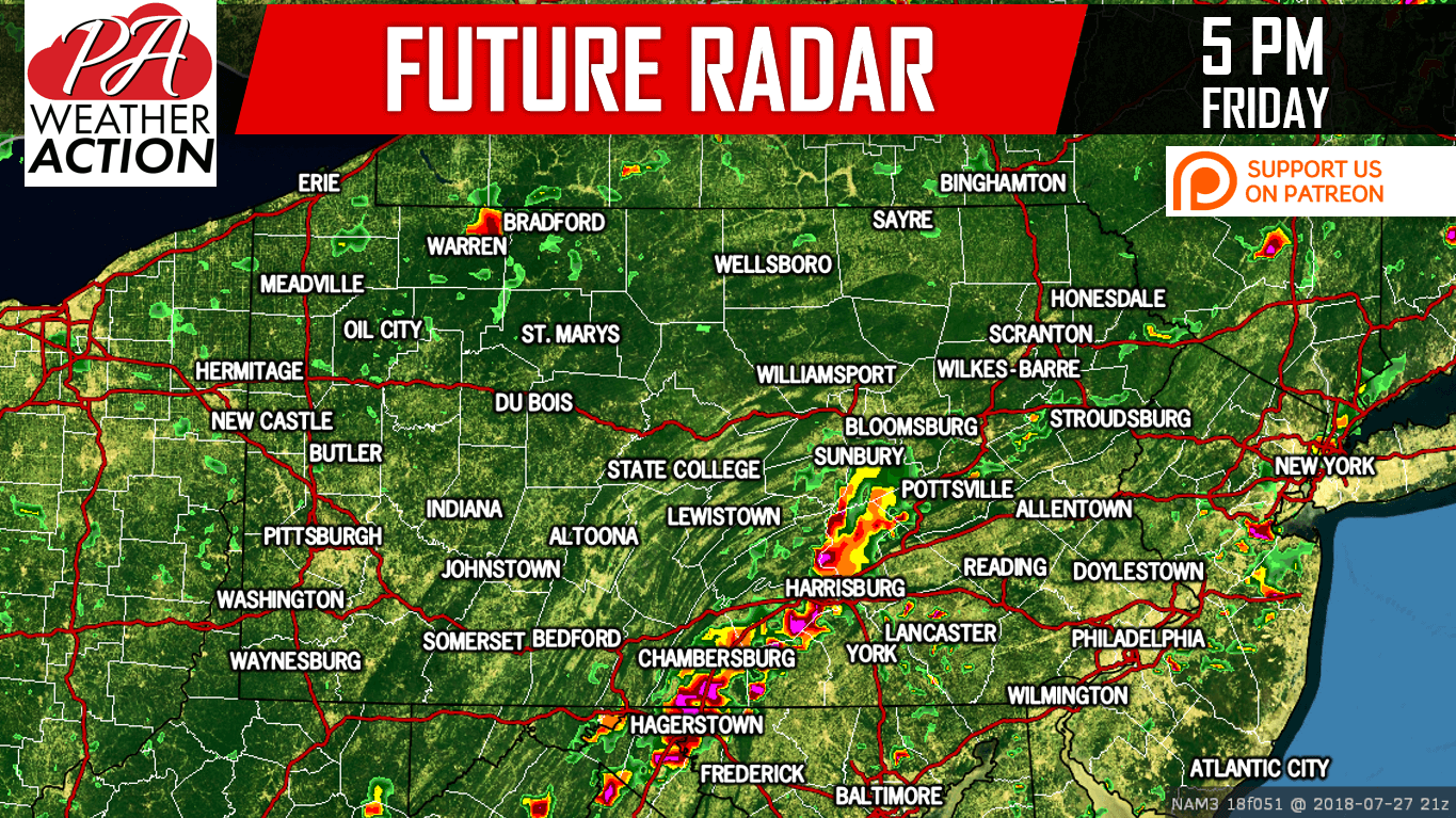
A line of strong to severe storms will likely develop in Southcentral PA Friday afternoon, while more individualized cells will pop-up in the Coal Region and the Poconos. These storms will move east in the late afternoon and early evening, through the Lehigh Valley and Southeast PA.
Here is the Hi-Res NAM for 5:00 PM Friday:
SPC RISK MAP
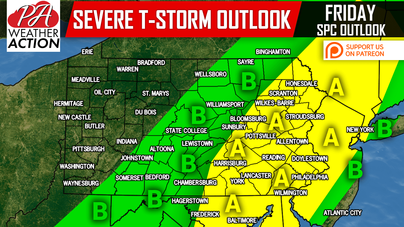
Area A: SLIGHT RISK – Scattered strong to severe storms possible between 3-8 PM, especially near the organized line. Damaging winds will be the main threat with these storms.
Area B: MARGINAL RISK – Isolated strong to severe storms possible between 2-6 PM, mainly east of Bedford, State College, and Williamsport. Damaging winds will be the main threat with these storms.
Be prepared for rapidly changing conditions Friday Afternoon/Evening. If you appreciate our work, please consider supporting us on Patreon >>> Our Patreon Page!
Share this important update with your family and friends using the button below!
You must be logged in to post a comment.