
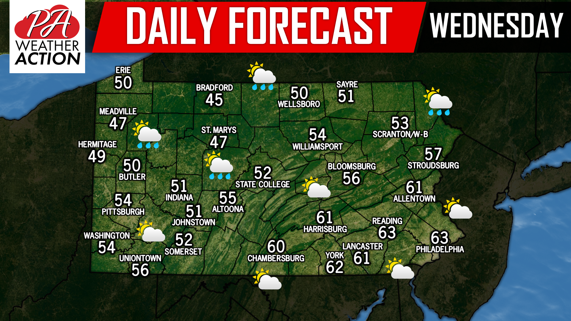
Temperatures will range from the 40s to lower 60s today depending where you are in the state. Scattered showers are possible across Northwest Pennsylvania as well as the rest of northern counties across the state. Winds will be on the increase today and temperatures will drop off rather quickly later this evening and into the overnight hours leading to many locations first frost and freezes of the season. Scattered snow showers and flurries are also possible across Northwest Pennsylvania during the overnight hours and into the early morning hours as temperatures drop off.
Speaking of snow, last night we released our preliminary winter forecast for this upcoming winter, if you missed it, click here to view it: https://paweatheraction.com/preliminary-2018-2019-winter-outlook-for-pennsylvania
You must be logged in to post a comment.