
After a few days of exceptional warmth for late March, a cold front will come crashing through Monday. But don’t be discouraged, we will still see some very mild days in the next week. A few thunderstorms will also reach Western PA late Sunday evening into early Monday morning. Some of those storms may be strong to severe near the Ohio border.
Another round of thunderstorms is possible later this week before winter makes one last stand the second week of April. Don’t be surprised to see some flakes flying during that period, so definitely keep your winter coat around for now.
A low pressure pushing through Ontario and Quebec will be responsible for Monday’s cold front, and we will have some instability out ahead. This will create an opportunity for gusty winds and very isolated hail and perhaps a tornado. The damaging wind threat shouldn’t be downplayed, as it can lead to power outages as seen a few weeks ago in the Alleghenies.
THUNDERSTORM TIMING IN PA
Models have slightly different timing and outputs regarding the coverage of thunderstorms tomorrow. Be on the lookout from the early afternoon through the evening. Guidance has storms developing near I-81 in the mid-afternoon Monday and then pushing east.
Below is a look at the HRRR Future Radar for 4:00 PM Monday. We think storms will pop up about an hour sooner.
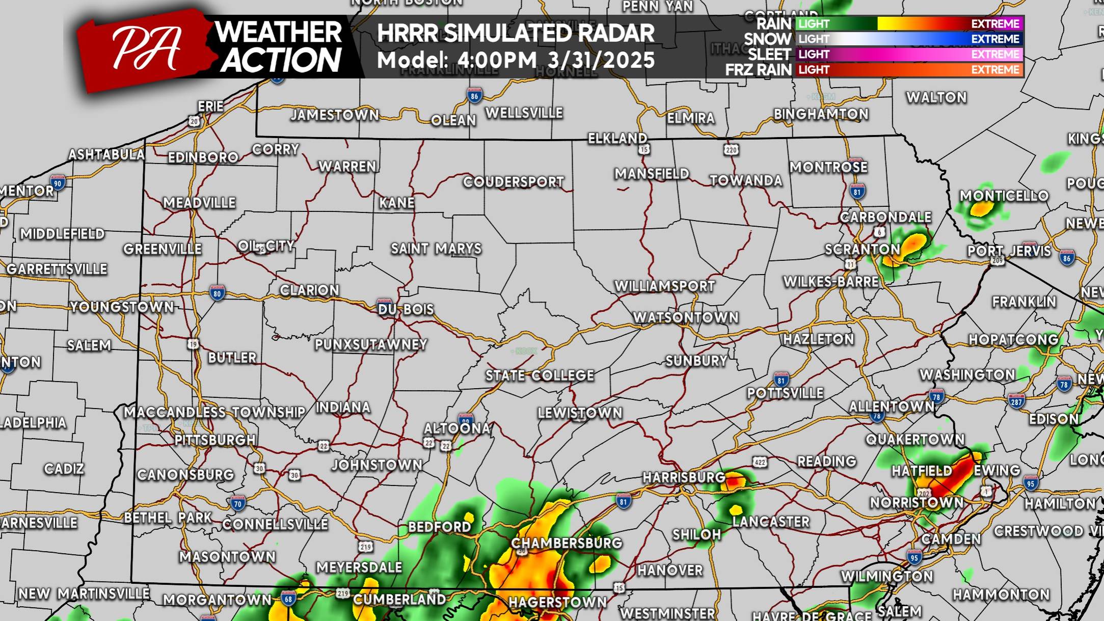
Coverage of these storms in South Central PA will expand as we head into late Monday afternoon. Expect a rough commute in the Lower Susquehanna Valley with strong to severe thunderstorms in the area.
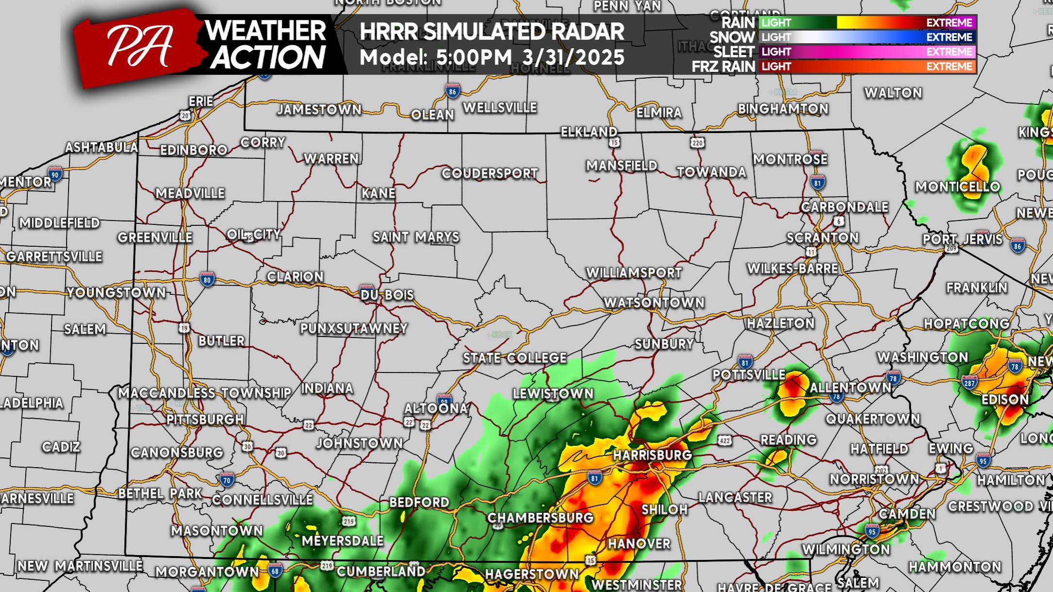
Around dinnertime Monday, storms will likely extend from the Poconos to Amish Country. This is the small window when a brief spin-up tornado is possible, mainly in Southeast PA.
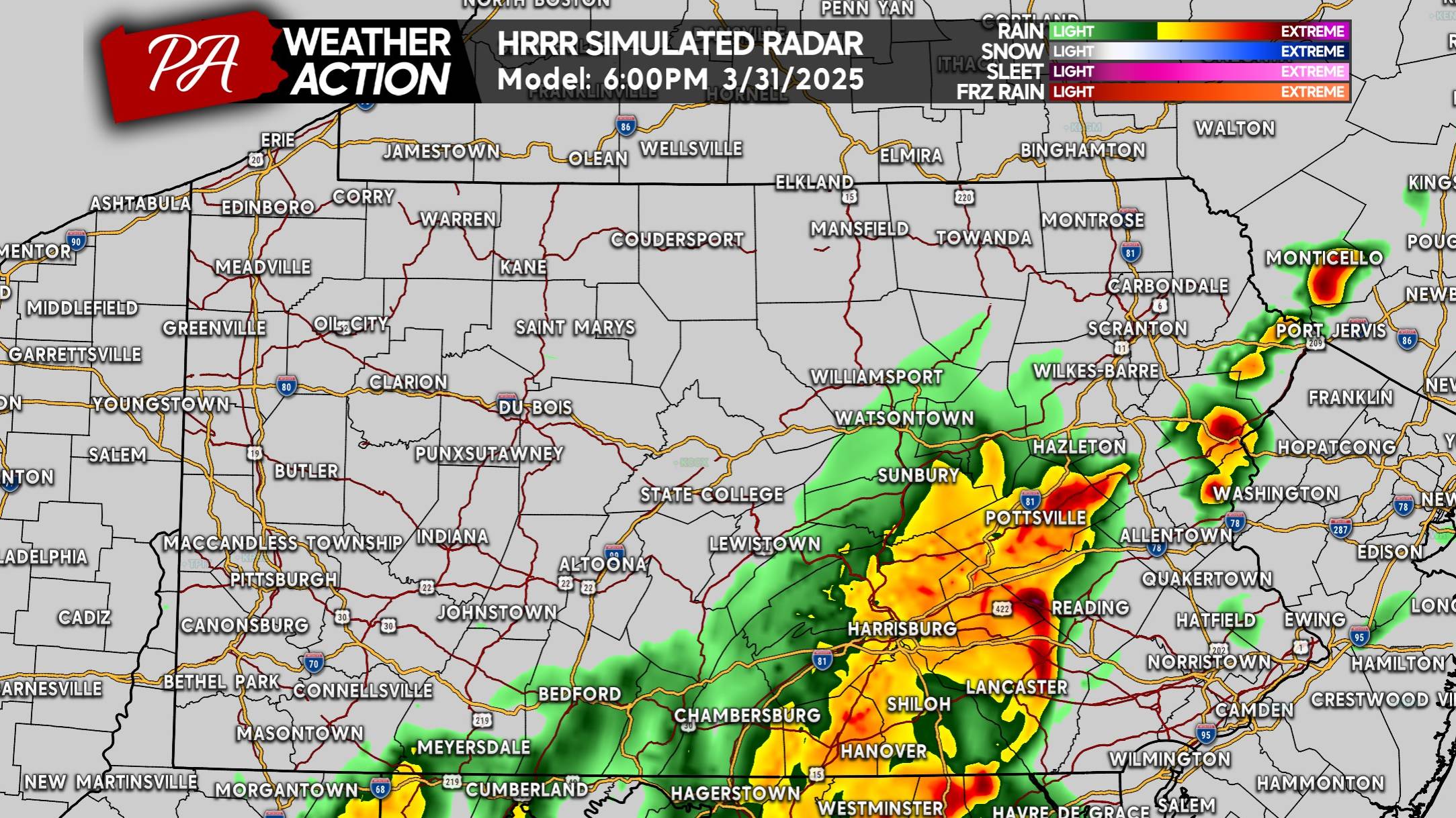
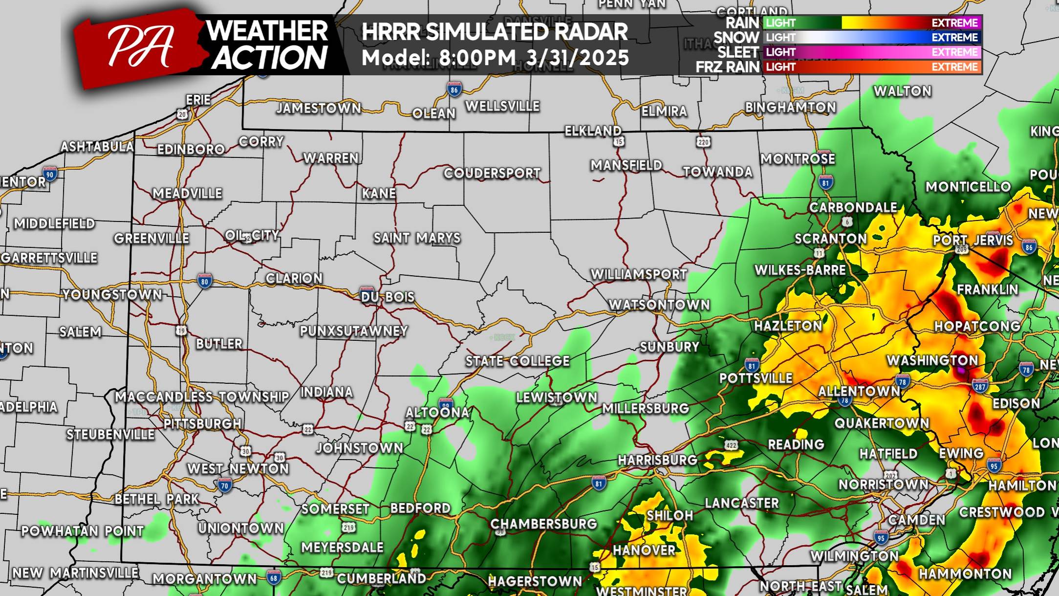
Strong to severe thunderstorms are anticipated to push into the I-476 corridor from Philadelphia to the Lehigh Valley by 6-7 PM Monday. Here is the HRRR Model Future Radar for 7:00 PM Monday.
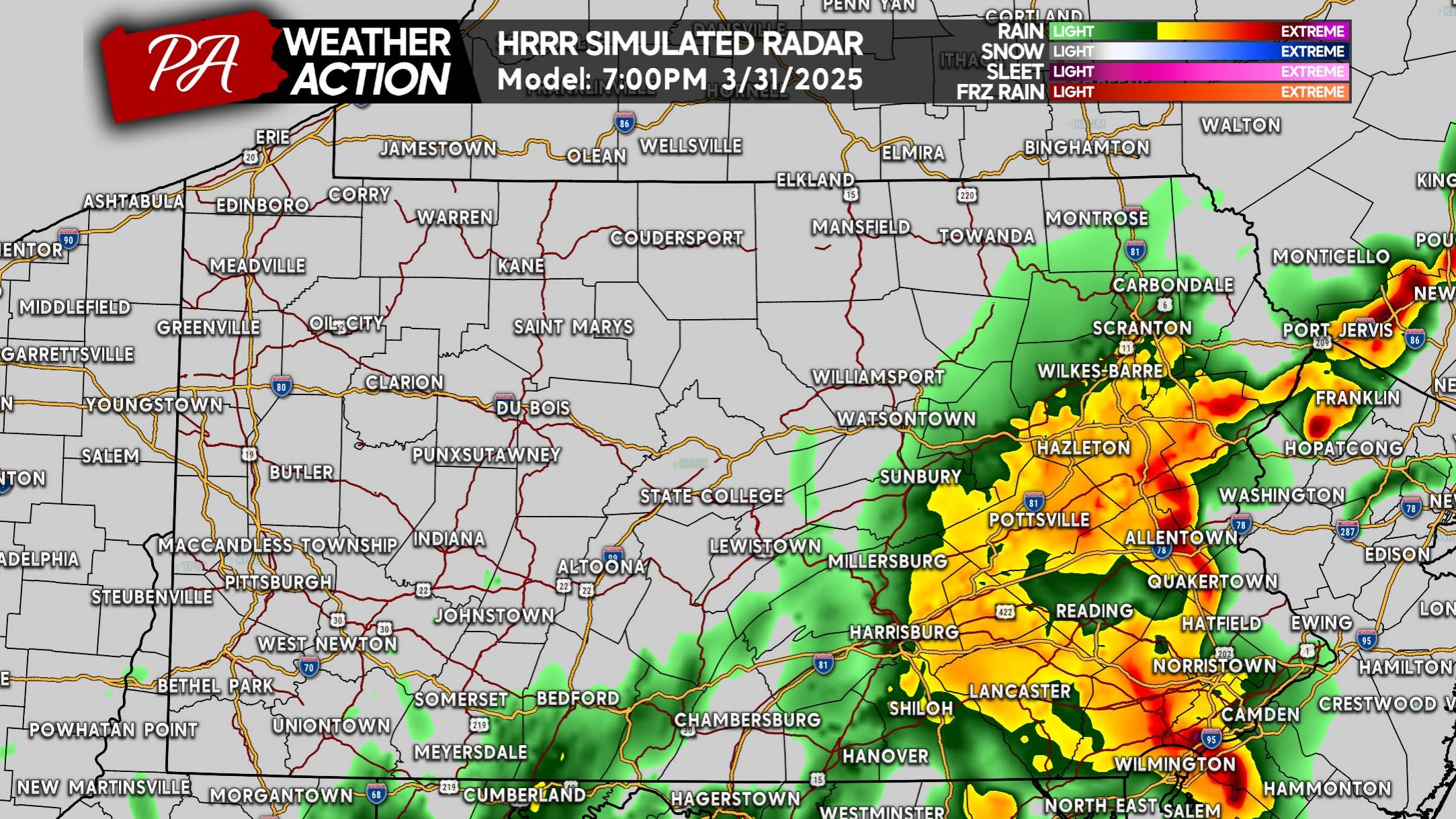
And finally by mid-Monday evening, storms should clear the Delaware River with some beneficial moderate to heavy rain leftover east of I-81.
MONDAY’S SEVERE THUNDERSTORM THREAT FORECAST
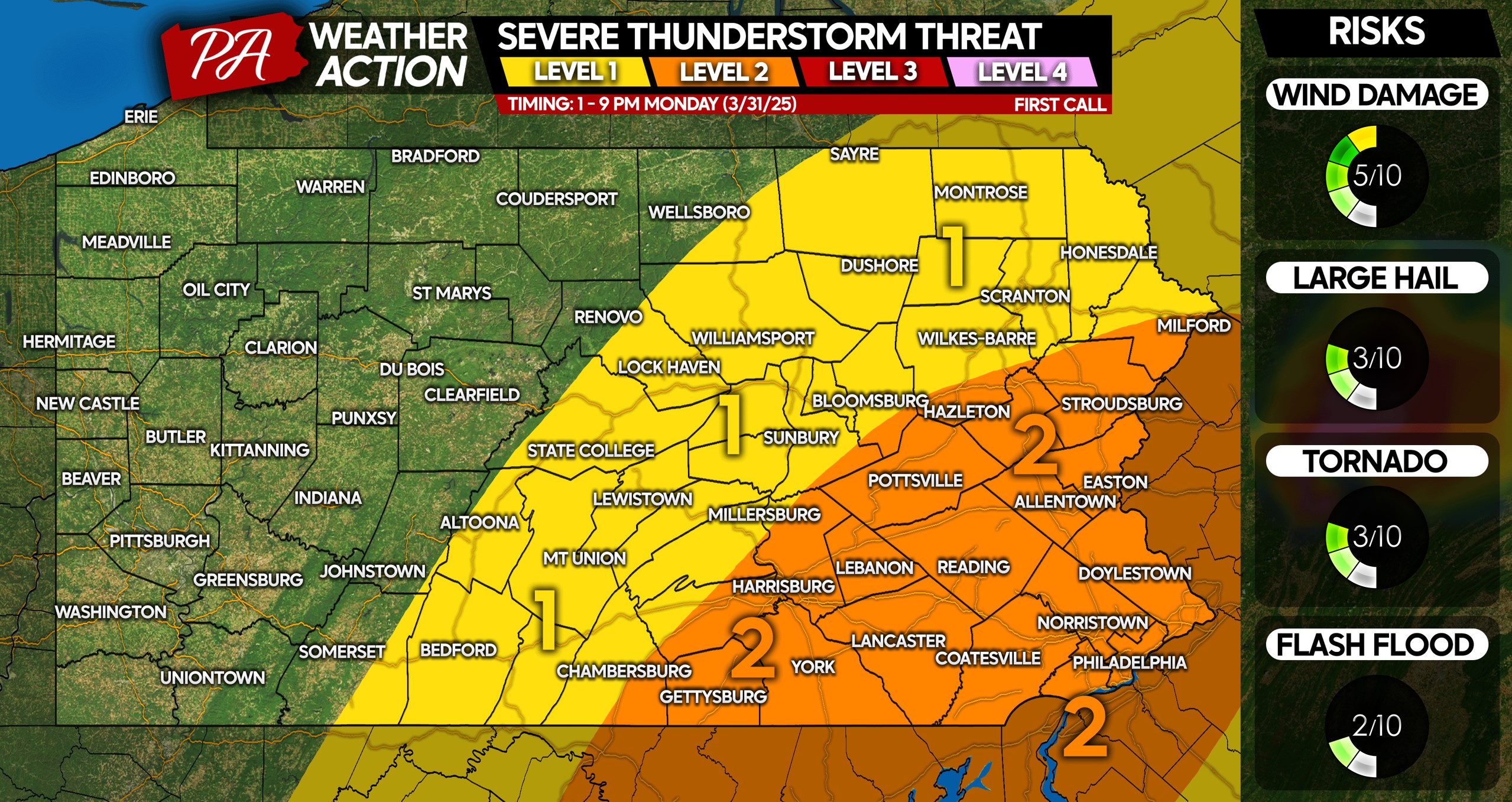
Level 2 Risk: Strong to severe thunderstorms possible, with damaging winds of 50-70 MPH the main concern within the risk area. A brief spin-up tornado is possible in Southeast PA, although it’s unlikely. The strongest cells may contain hail up to 1″ in diameter.
Level 1 Risk: Isolated strong to severe thunderstorms are possible, with gusty winds of 40-60 MPH a potential within strongest storms. A very minimal hail and tornado threat exists in this area.
Don’t forget to sure to share this forecast with friends and family in affected areas. Have a way to be notified of latest alerts for your town!

You must be logged in to post a comment.