Severe thunderstorm season is nearing its peak across the Plains and Midwest, and this weekend will provide no shortage of unwanted excitement as a classic setup for a multi-day tornado outbreak unfolds.
A strong low pressure system will come out of the Colorado Rockies and head northeast through the Plains and Midwest Saturday evening all the way through Monday. The severe weather this evening (Friday evening) will be associated with a different. low pressure in the Dakotas.
TODAY’S SEVERE THUNDERSTORM RISK
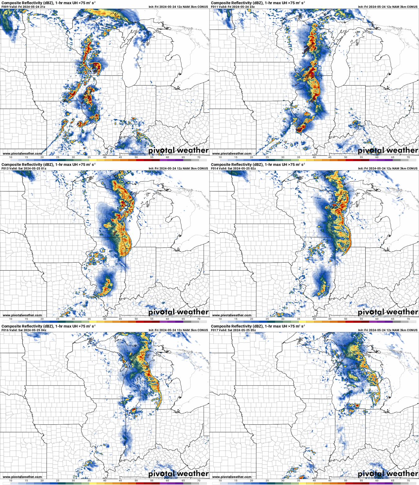
We will focus more on the risk in Wisconsin and Illinois here. Severe thunderstorms will fire up late this afternoon across Western Wisconsin and Illinois and push east. Storms will intensify as they push east, and pose an isolated tornado risk mainly in Illinois.
The linear severe mode in Wisconsin will pose more of a damaging wind risk, but a tornado or two can’t be ruled out in Southern Wisconsin. Here is the latest Hi-Res NAM future radar for this evening’s storms.
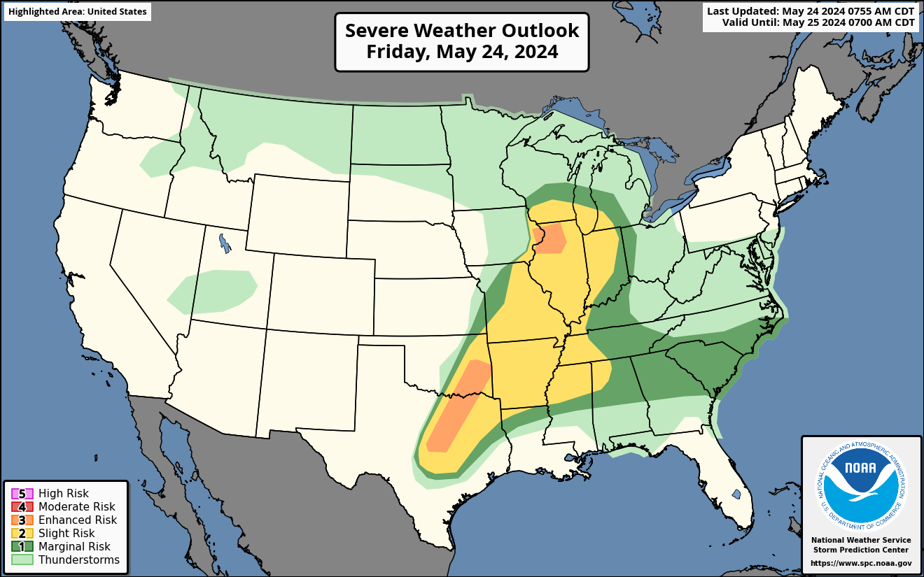
Below is today’s Storm Prediction Center risk map showing the enhanced risk in Northwest Illinois and also across DFW into Southeastern Oklahoma. Watch out for a few lone supercells around DFW to cause extremely large hail.
SATURDAY’S SEVERE THUNDERSTORM RISK
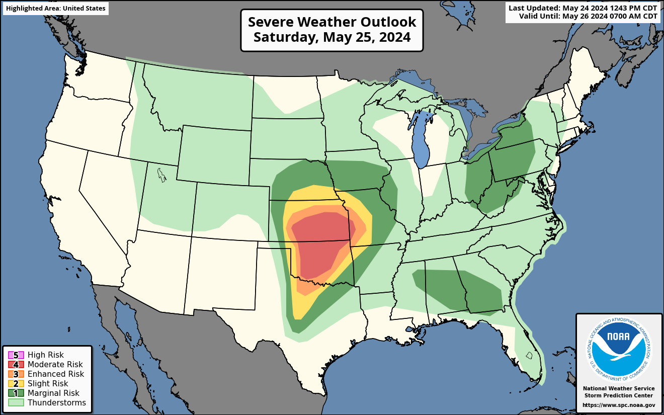
Saturday is when the tornado concern will really elevate specifically across much of Kansas and Oklahoma as storms fire off just east of the dry line around dinnertime Saturday. Storms will then push east with intense strength, and are viable to produce strong tornadoes into the Wichita and OKC Metro areas.
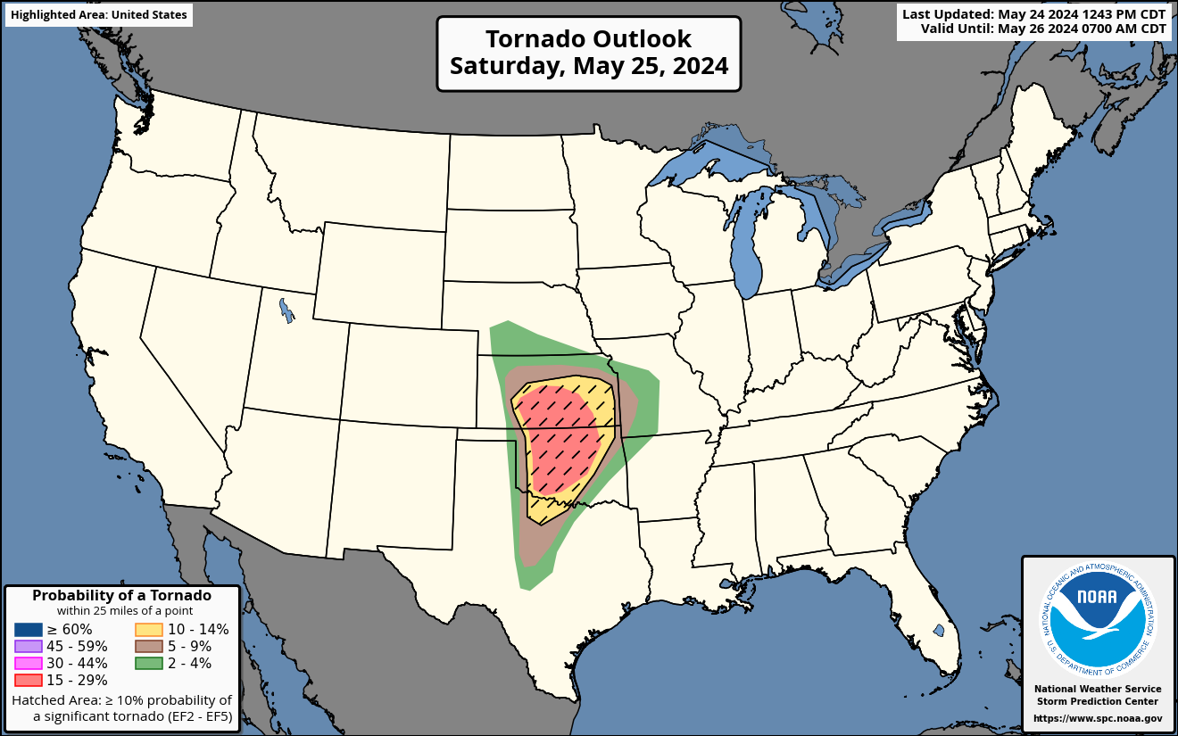
Here is the newest tornado risk from for Saturday into Sunday early morning from the SPC, featuring a significant upgrade.
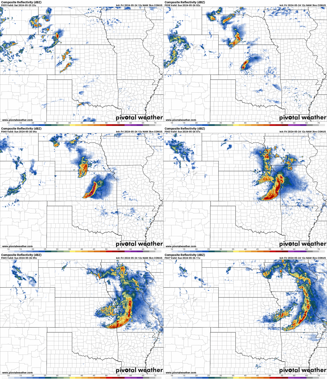
There is a possibility of a derecho from Central and Eastern Kansas late Saturday evening into Missouri early Sunday morning as a very potent, widespread line of storms moves east. View future radar from the Hi-Res NAM below.
Below is the current SPC outlook for Saturday, as of 1 PM Central Friday. The latest update features a major expansion of the moderate risk area, with a significant threat of tornadoes and damaging straight line winds.
SUNDAY’S SEVERE THUNDERSTORM RISK
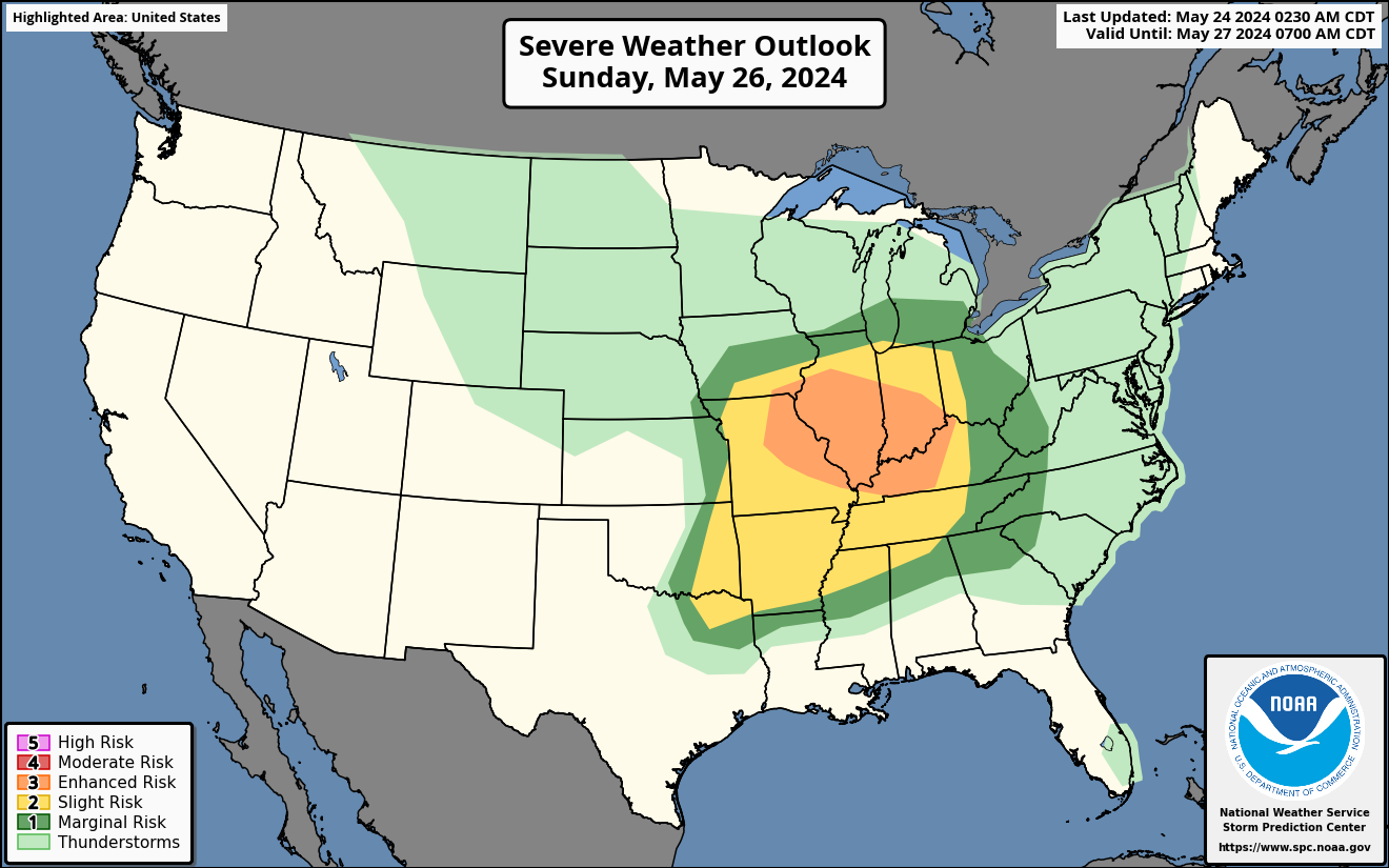
The severe threat will push into the Central Mississippi Valley and Western Ohio Valley Sunday. Storms will likely fire up across Southeast MO, Southern IL, and Central IN by late Sunday afternoon. Storms will then push east, and at this point it appears the main concern will be damaging winds.
Some tornadoes cannot be ruled out though, with brief but intense spin-ups still possible within the organized line of storms as they push east into Southern IN and the western half of Kentucky. Below is the latest risk map from the SPC.
On Memorial Day itself, the severe threat will move into the Mid-Atlantic and Northeast US. Be sure to share this article with friends and family!



You must be logged in to post a comment.