
December is nearly upon us, meaning winter weather is just about here. However if this December is anything like December 2015, every other morning will be foggy and snow will be nonexistent. Those of you who read our Official Winter Outlook know that will not be the case this December.
In fact, there are already two periods of interest in the first 10 days of December. The first, less promising period is December 4th/5th. The next period that looks fairly interesting is December 9th/10th. By then the cold will be more established and numerous models have a storm system on the East Coast during that time-frame.
By Mid-December, the cold air will be locked in and there will be increased winter storm chances. Late December around Christmas and New Years also has a good chance of being on the cold side, with an active pattern as well.
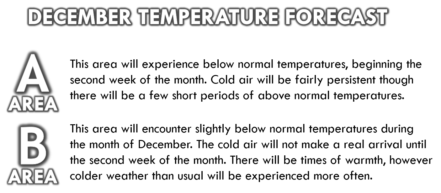
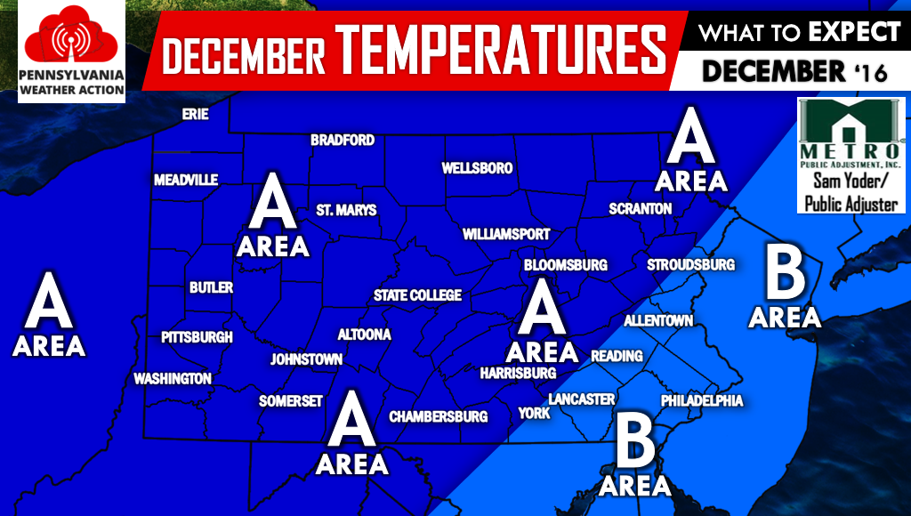
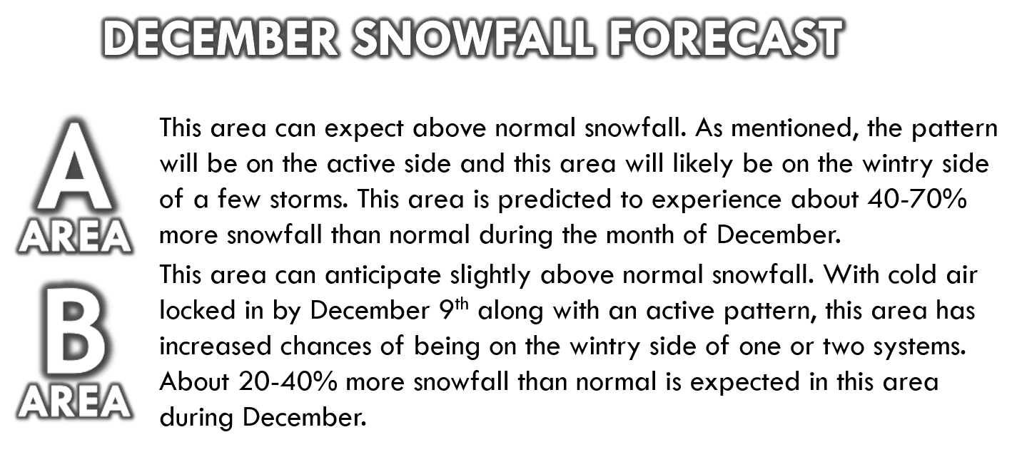
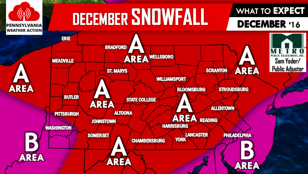
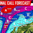
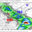
Based off what you’ve just read, you can probably guess what’s coming next. Below is our Map Forecasts, featuring temperatures and snowfall compared to normal.
It is clear the upcoming month will be on the active side when it comes to winter weather. Be sure to like Pennsylvania Weather Action on facebook and don’t forget to share this forecast using the icons below. Stay safe!
You must be logged in to post a comment.