

Good afternoon, folks! I hope you had a fantastic weekend despite the cooler conditions and higher winds. I have been noticed that the fall foliage has become more vibrant and widespread over the last few days, which means that the colors are likely peaking if not very close to peak. If you are planning to view fall foliage across the local region, this week will be the week to do it as a see a consistent pattern of warm and dry days lined up. However, with us going into late October into early November, we all know this pattern will be rather short-lived, so make the best out of it as you can!
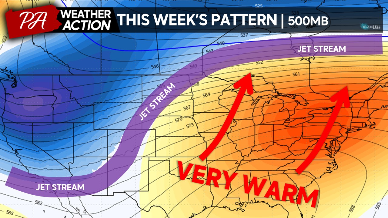
Taking a look at the 500MB heights (roughly 18,000 feet up in the atmosphere), a deep trough will be settled across the West Coast. Thinking of the pattern like a see-saw, when something goes down on one end, it goes up on the other end. With that said, across the central and eastern United States, a dominants ridge will set up over the area allowing for dry and warm conditions. Temperatures will likely peak as much as 15-20 degrees above average for both daytime highs and overnight lows, making it feel like late August into early September rather than late October.
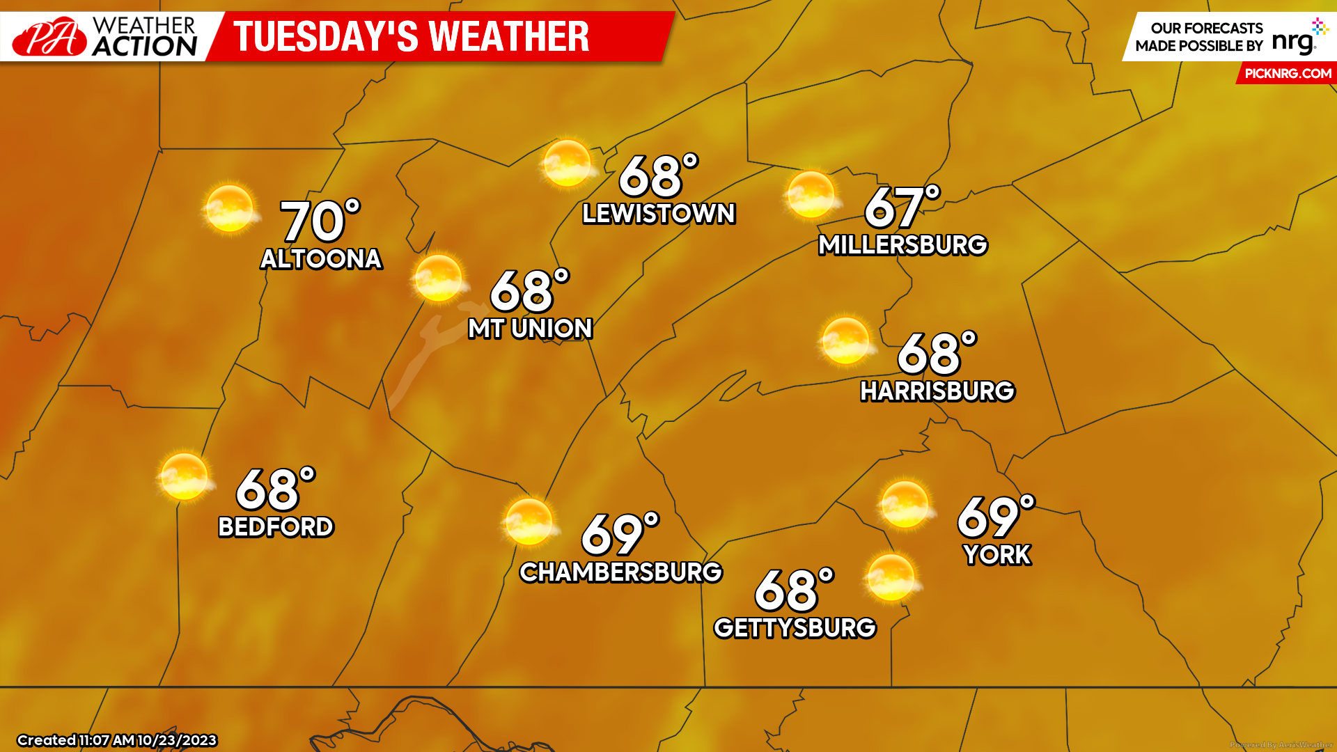
TUESDAY:
Tuesday will be the first day of the warmer and drier than average stretch this week. Expect high temperatures to climb into the upper-60s to low-70s across the region under mostly sunny skies. Accompanying the warmer conditions, expect a slight southerly wind of 5-10 MPH making it for a pleasant afternoon.
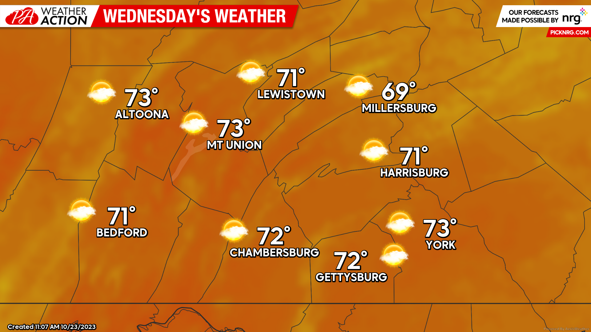
WEDNESDAY:
Wednesday will bring even warmer conditions to the region with high temperatures climbing into the low-70s for much of the area under partly cloudy skies. Expect a calm southerly wind of 2-5 MPH during the afternoon hours. It will be an absolutely perfect afternoon for any outdoor activities – make sure to get outdoors and enjoy it!
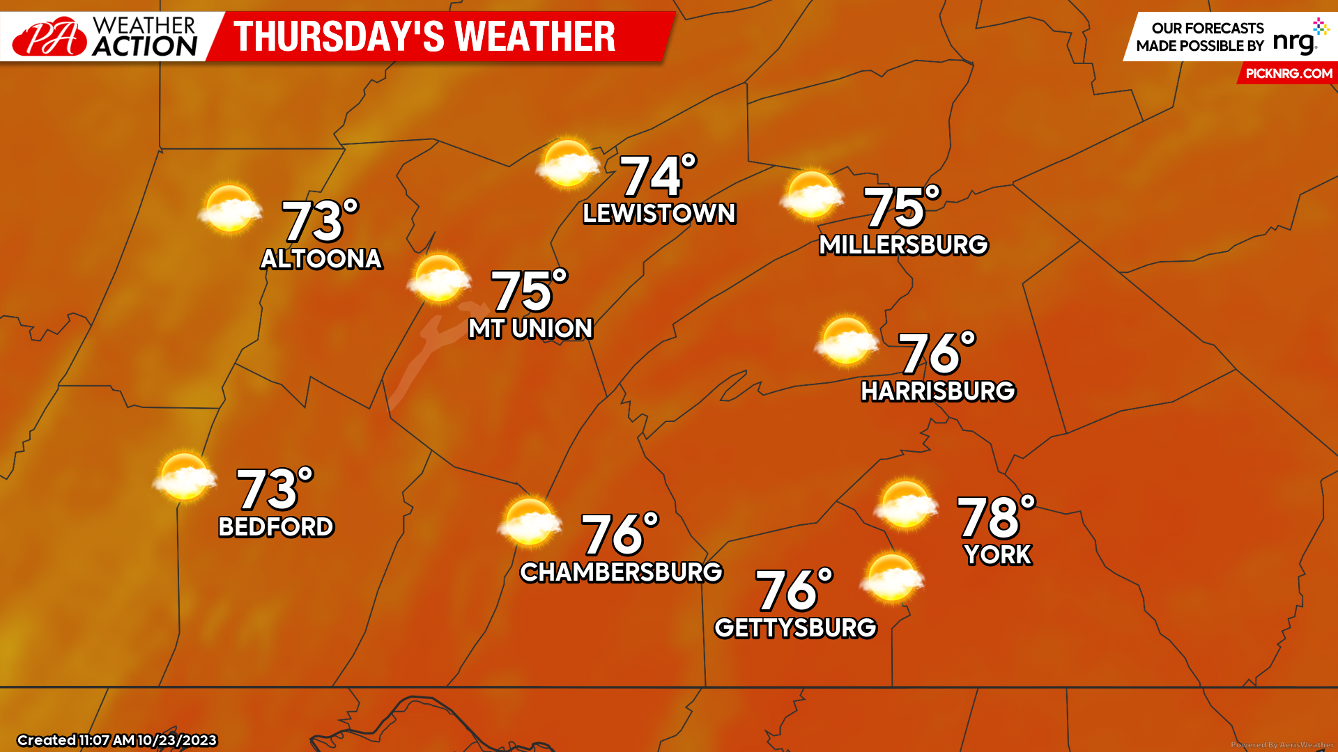
THURSDAY:
As if Wednesday is not warm enough for you- Thursday we will be turning it up another notch! Expect partly cloudy skies throughout the afternoon on Thursday with high temperatures reaching into the mid-to-upper 70s for much of the area. These temperatures will be roughly 15-20 degrees above average for this time of the year. Expect southerly winds of around 5 MPH during the afternoon hours as well.
BEYOND THURSDAY:
The warm conditions will likely hold throughout Friday and into much of the weekend as high temperatures remain around the mid-70s for the region. Saturday and/or Sunday will be the warmest days, with a few locations possibly flirting with the 80-degree mark, especially in the far southern towns and counties. Additionally, you will feel the humidity in the air on Saturday and Sunday as dew points will rise into the lower-60s for much of the area, making it feel quite muggy in the afternoon hours. With the humidity in place, overnight low temperatures may only drop into the upper-50s to lower-60s throughout the weekend. Saturday will likely be the driest day and Sunday will be mostly dry, depending on the timing of the cold front. However, the next cold front will bring an end to the warmth. Depending on the timing of the front, it may move through as early as Sunday evening and as late as Monday afternoon. After the passage of this cold front, we will likely see the coldest air of the season move in, bringing in **MUCH** lower temperatures and the potential for the first flakes of snow!
As you can see by the 500MB pattern next week, the eastern United States ridge will be replaced with a trough, which will allow for much cooler temperatures to settle into the region with cold air flowing in from Canada. This will allow for the coldest air of the season yet (potentially highs in the upper-30 to mid-40s) and the first flakes of the season (especially in the highest elevations & lake effect snow). If you enjoy sunny and warm conditions, make sure to enjoy the next 5-7 days as this may be the last warm pattern in quite awhile!

If you have any questions or concerns regarding the forecast, feel free to reach out! I highly suggest you to get outdoors and view the foliage over the next several days as next week’s blast of colder air and winds will likely lead to the end of the foliage season.
Denys Khrulov
You must be logged in to post a comment.