
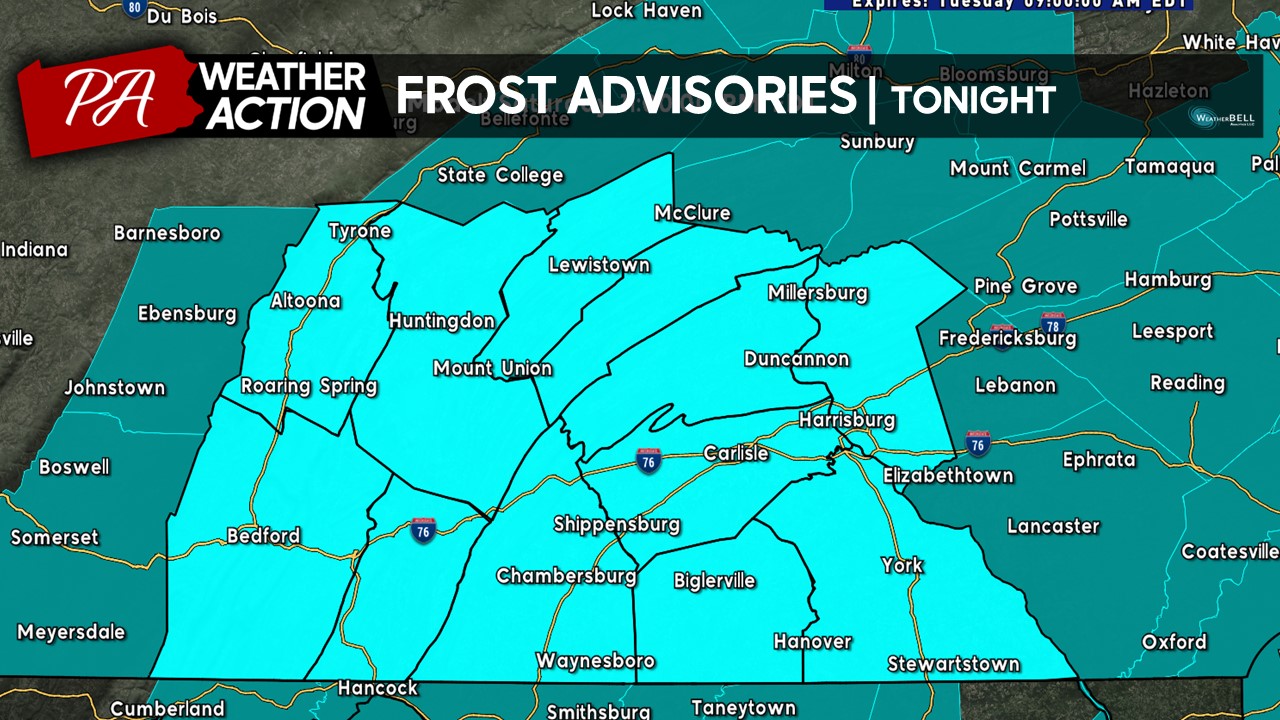
Ahead of another cool and clear night, a perfect process for rapid radiative cooling, temperatures will take a tumble as we head into the overnight hours and into early tomorrow morning. It will be cold enough for frost to develop across the region, which in place the NWS has issued Frost Advisories for the entire region (blue-shaded counties). Temperatures will be dropping into the low-to-mid 30s overnight which will allow for frost formation the NWS has noted.
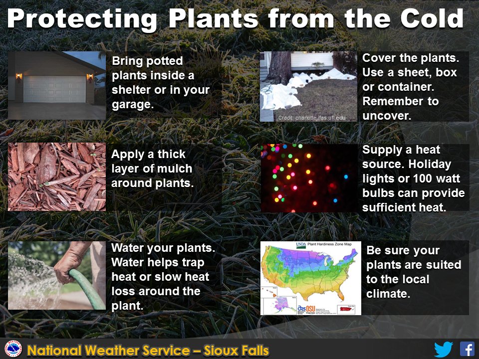
 If you have sensitive outdoor vegetation, make sure to bring these plants indoors as they will likely be damaged and/or killed in tonight’s frost event. Here are some additional frost/freeze tips provided by the National Weather Service.
 If you have any questions or concerns, feel free to reach out! It will be quite chilly tomorrow morning- so make sure to bundle up and have your ice scraper ready to go in the morning. However, warmer conditions are in forecast for the remainder of the week, read the latest forecast here: https://paweatheraction.com/dry-and-calm-week-late-summer-conditions-return/?fbclid=IwAR1wBNvrcT1mSLDf064XSWx0XJolxW5scm33mzDAoPEAXhKssD6YxUY6llk
-Denys

You must be logged in to post a comment.