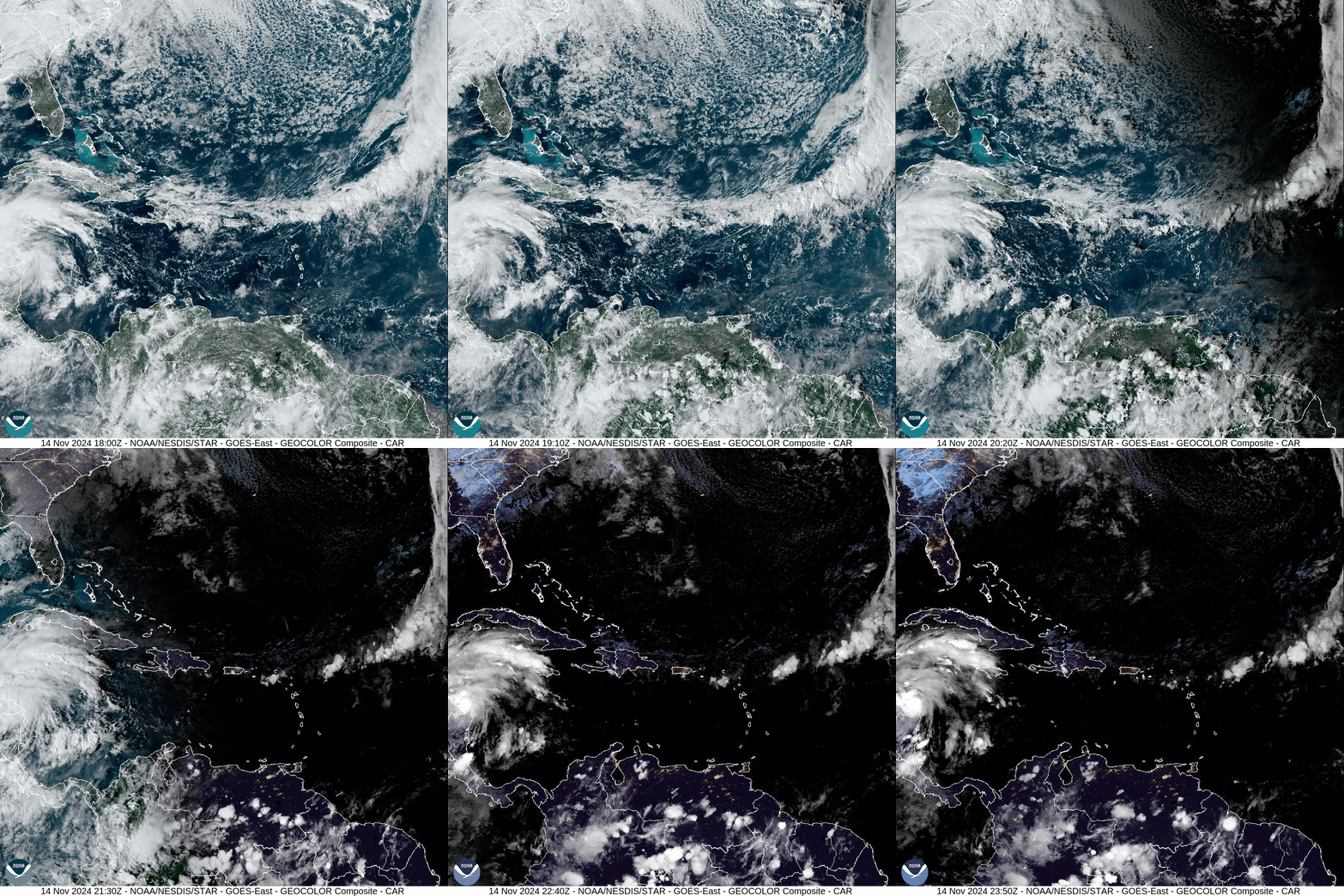
Unfortunately today’s opportunity for rain will be shunted to our south as it approaches. Our next opportunity will be next Wednesday-Thursday. Meanwhile Tropical Storm Sara was just birthed in the Caribbean southeast of the Yucatan Peninsula (south of Cuba). Sara will impact the Yucatan with flooding rainfall over the next several days, and could impact Florida next week. You can see Sara congealing in the lower left side of this satellite loop:
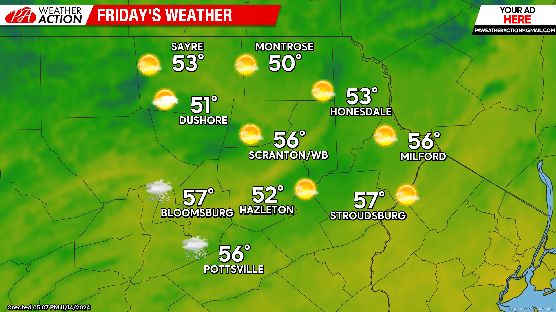
FRIDAY
Friday will feature a return to above-normal temperatures, albeit not as warm as the extended late-summer conditions we’ve recently experienced. Skies should be clear for the final “Supermoon” of 2024 Friday night. Enjoy!
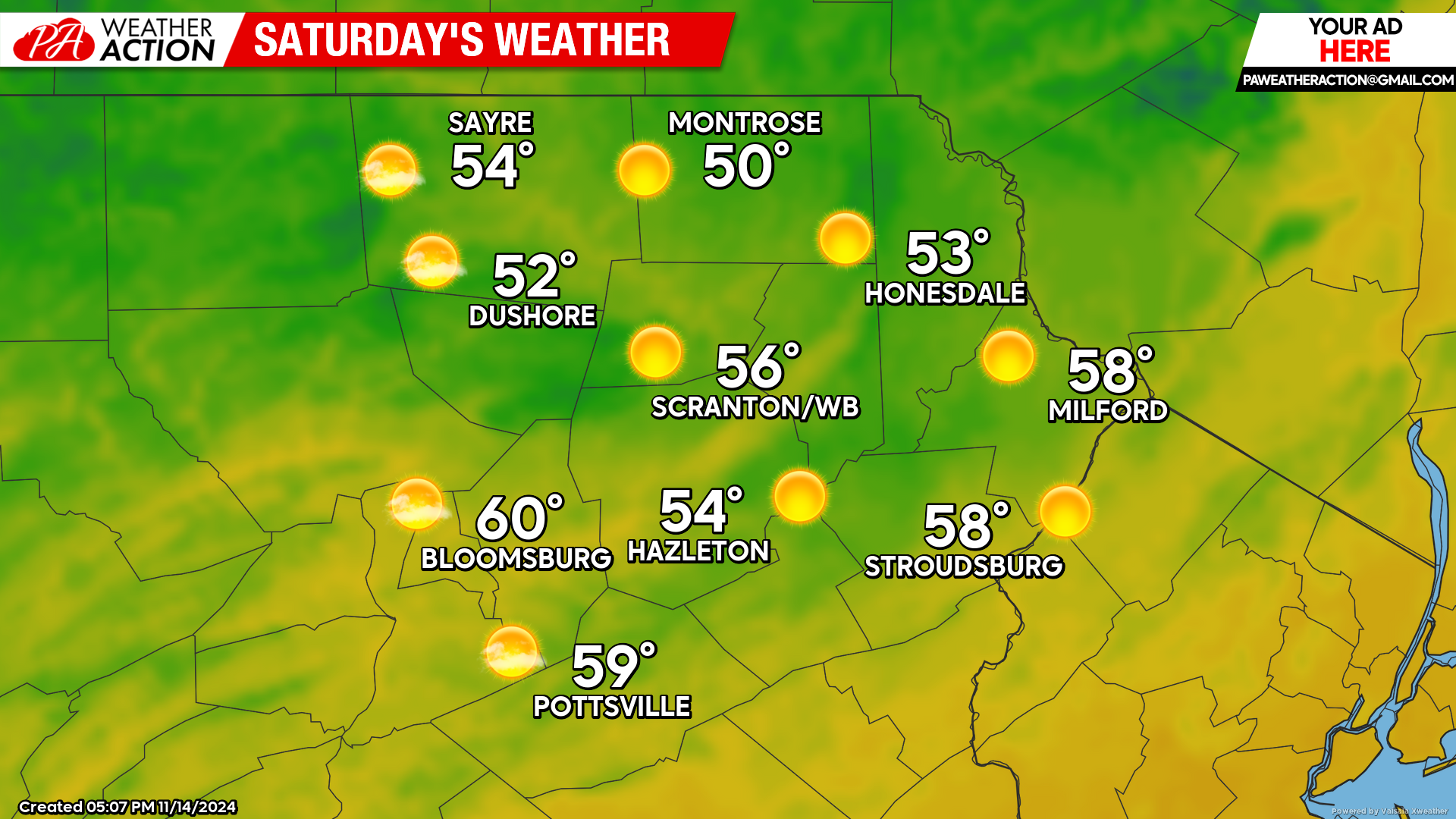
SATURDAY
Saturday will be another dry, very-mild day for this time of year. Conserve water and be careful with open flame!
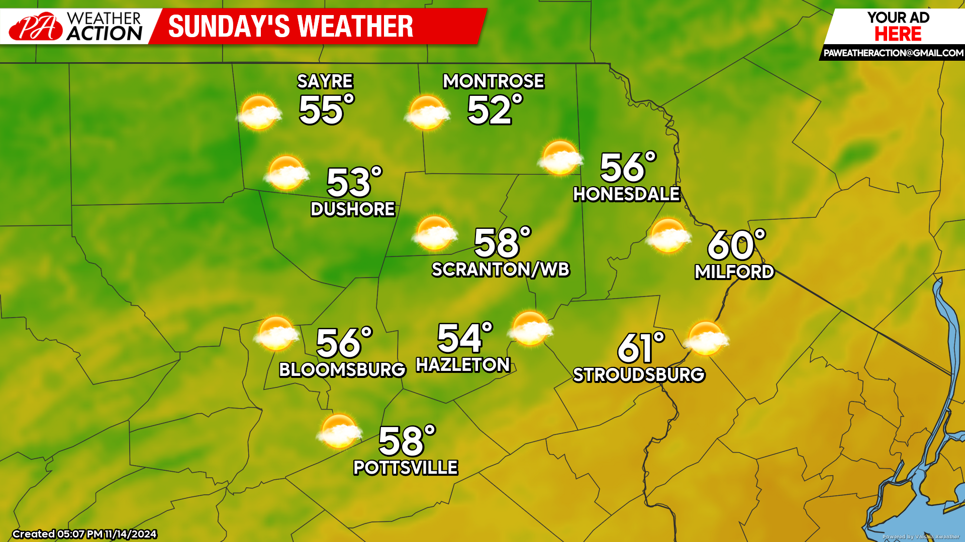
SUNDAY
Sunday will be milder yet, with overnight lows struggling to fall to freezing, and afternoon temperatures climbing to near 60!
BEYOND SUNDAY (Mon-Fri Nov 18-22)
Warmer-than-normal temperatures are expected to continue, with another opportunity for rain Wed-Thu Nov 20-21. This is a serious drought and water conservation is encouraged.

You must be logged in to post a comment.