
Sunny skies today will lead to one of the hottest days of the year so far. Below is a look at the latest satellite imagery:

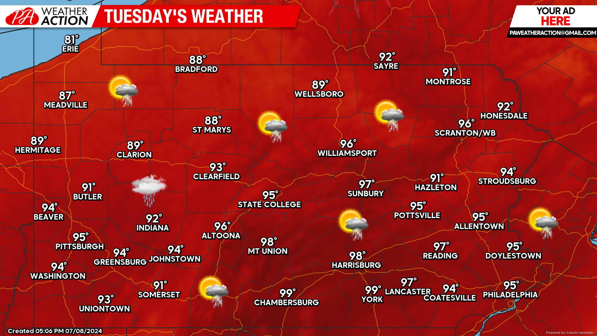
Today’s Weather Forecast: 6/10
While there is the slightest chance for an isolated shower, today will be mostly sunny with temperatures soaring well into the middle and upper 90s for many areas. Heat indexes will be into the triple digits. Please make sure you are staying hydrated today!
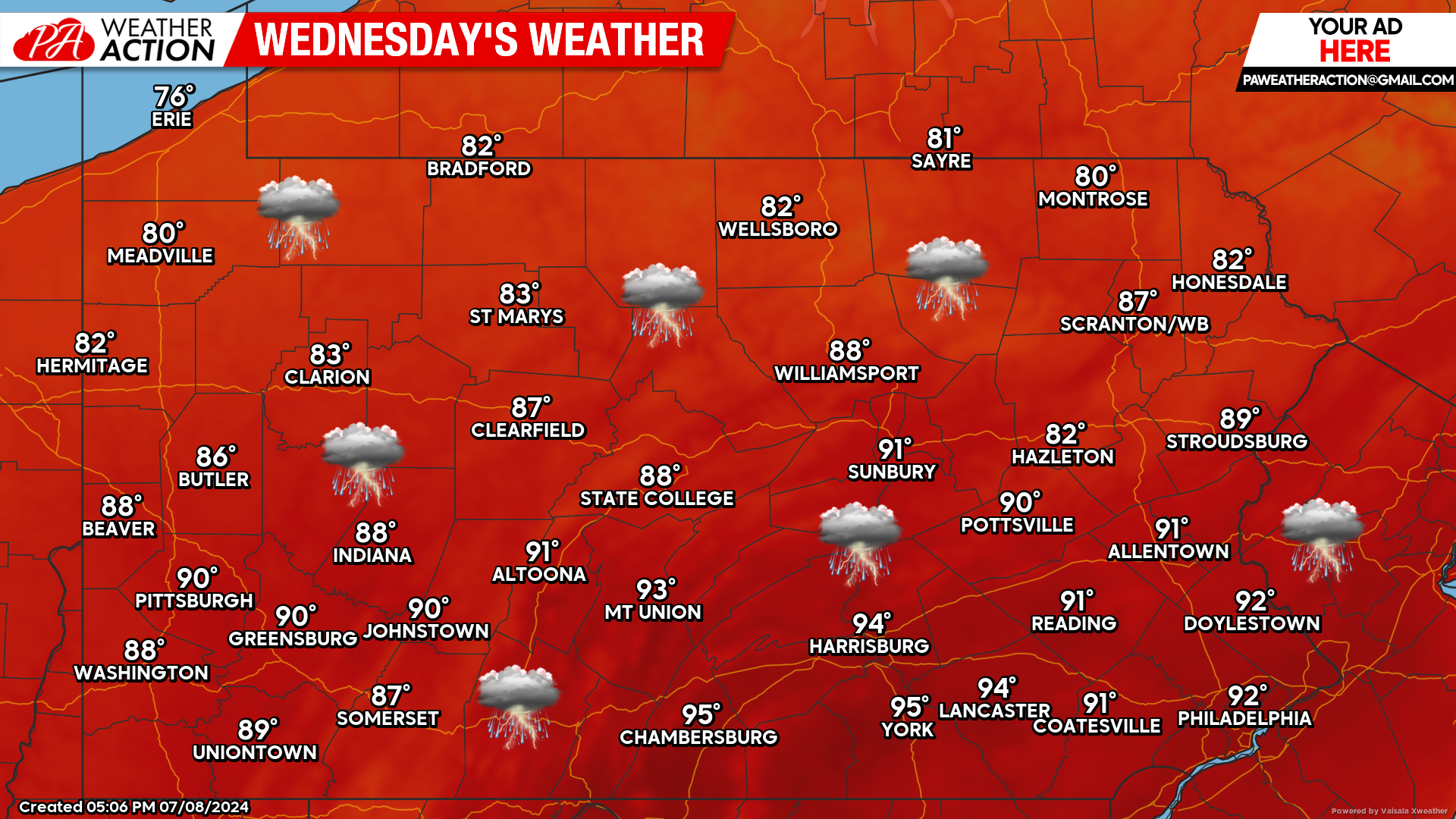
Wednesday’s Weather Forecast: 6/10
Wednesday will still be hot, however the bigger story will be the strong to severe thunderstorms that will impact many locations. Best chance for thunderstorms will be during the afternoon and evening hours.
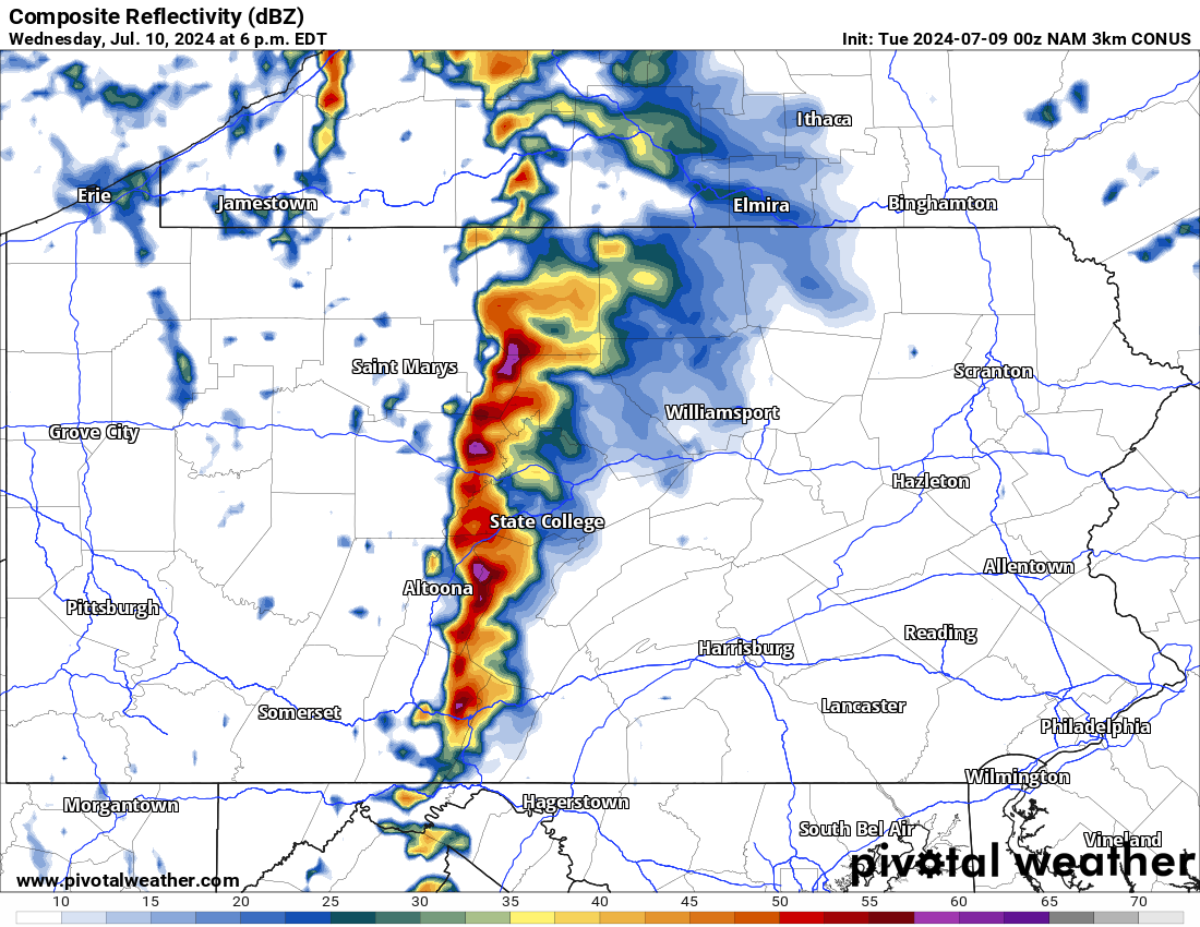
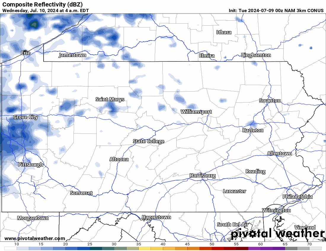
Hi-Res NAM Future Radar for Wednesday:
Wednesday has the potential to produce strong to severe thunderstorms. Taking a look at the Hi-Res NAM radar valid from 4:00 AM Wednesday through 4:00 AM Thursday, this particular model shows the potential for a powerful line of storms to develop during the afternoon hours. These thunderstorms will have the potential to produce damaging winds and large hail.
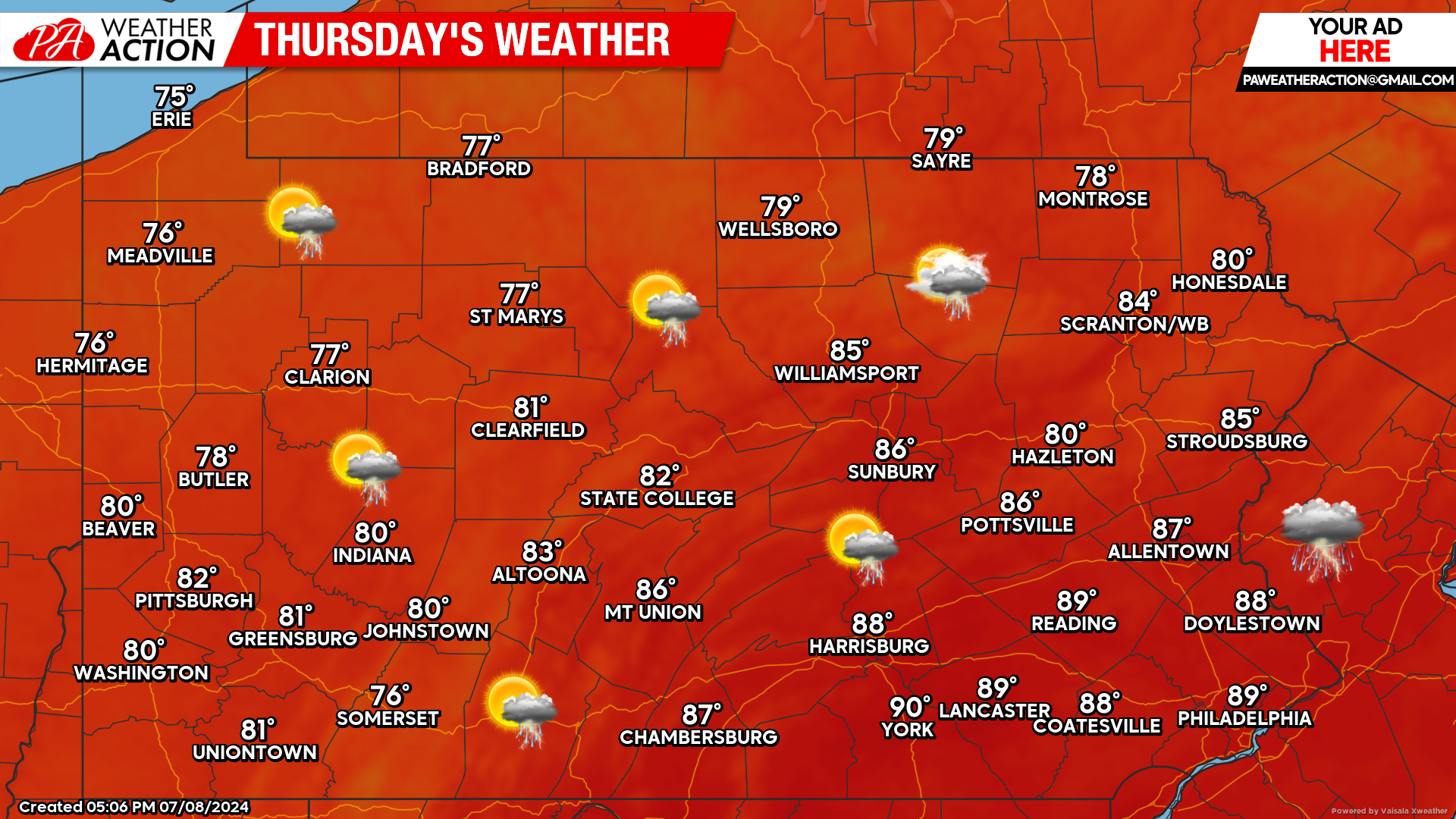
Thursday’s Weather Forecast: 9/10
Thursday will offer “cooler” conditions with temperatures ranging from the upper 70s to upper 80s across the state. A scattered shower or thunderstorm cannot be completely ruled out.


You must be logged in to post a comment.