
Severe thunderstorm season is hitting its stride with a very favorable pattern for storms here in PA ongoing. Another round of severe weather is likely Sunday, and it has trended upwards in the last 24 hours.
Originally, models suggested storm coverage would be light similar to Friday, but they’re now going all in on widespread strong to severe thunderstorms. Damaging winds up to 80 MPH are the main threat, followed well behind by minimal risks of hail and tornadoes.
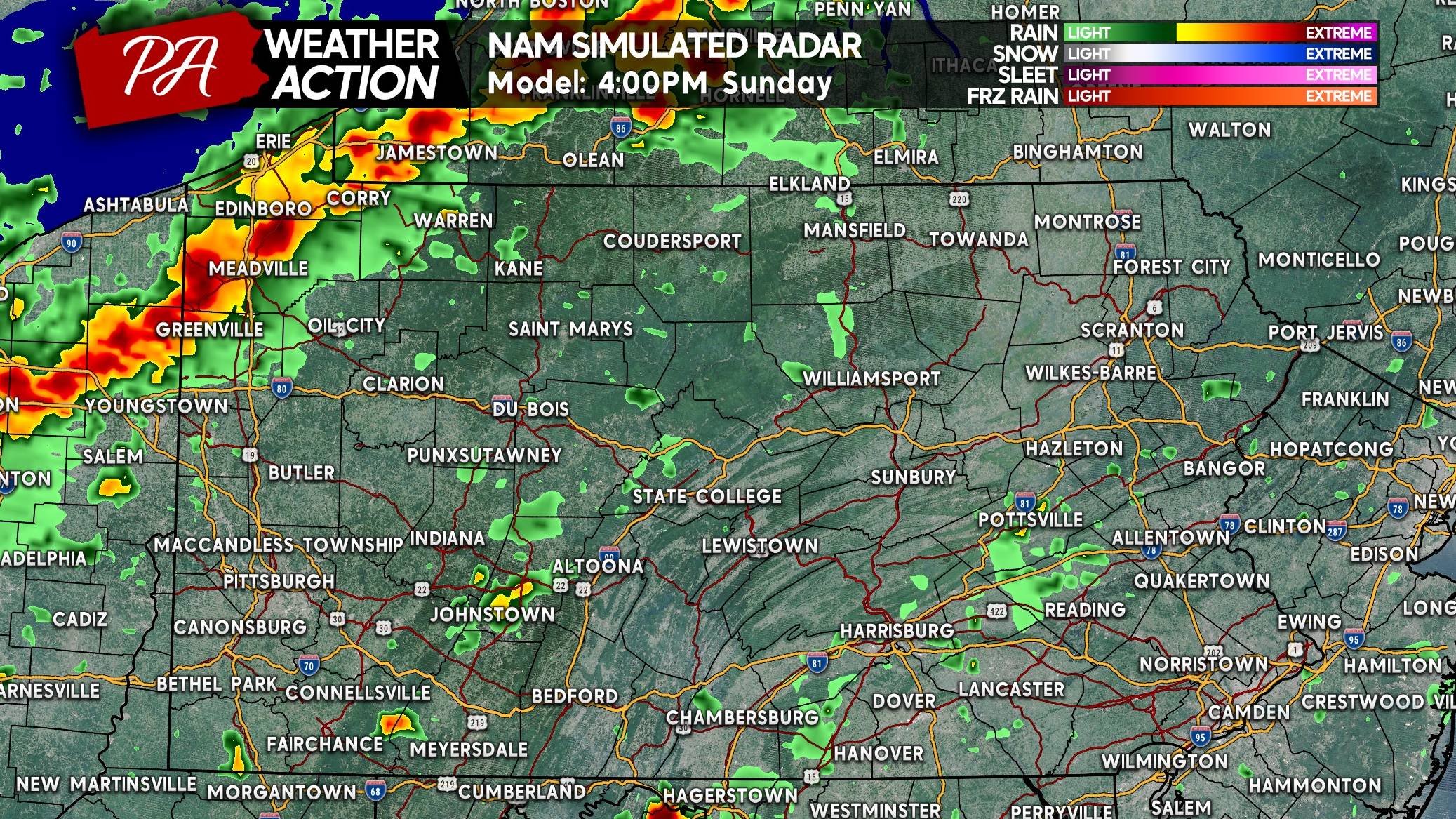
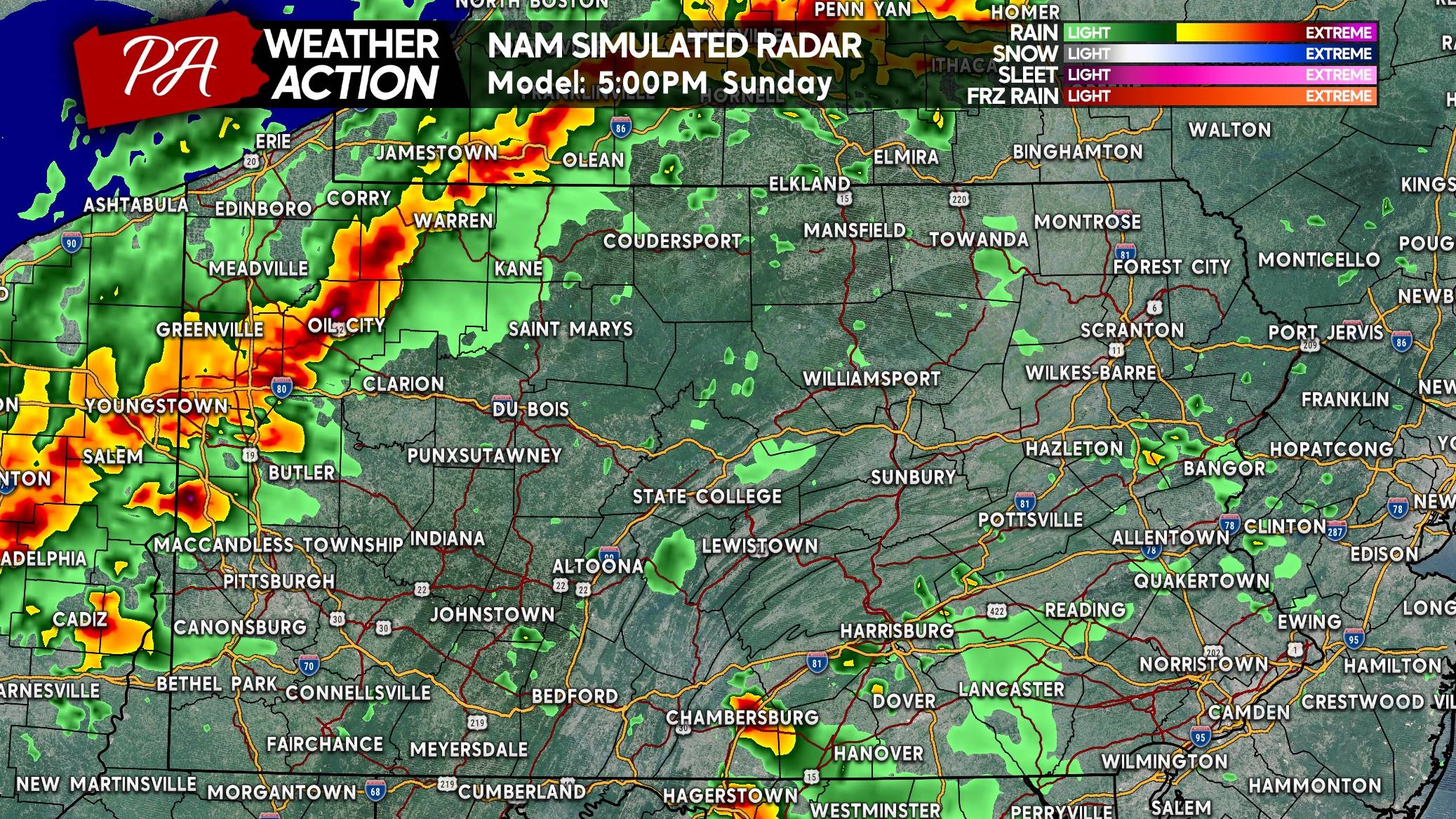
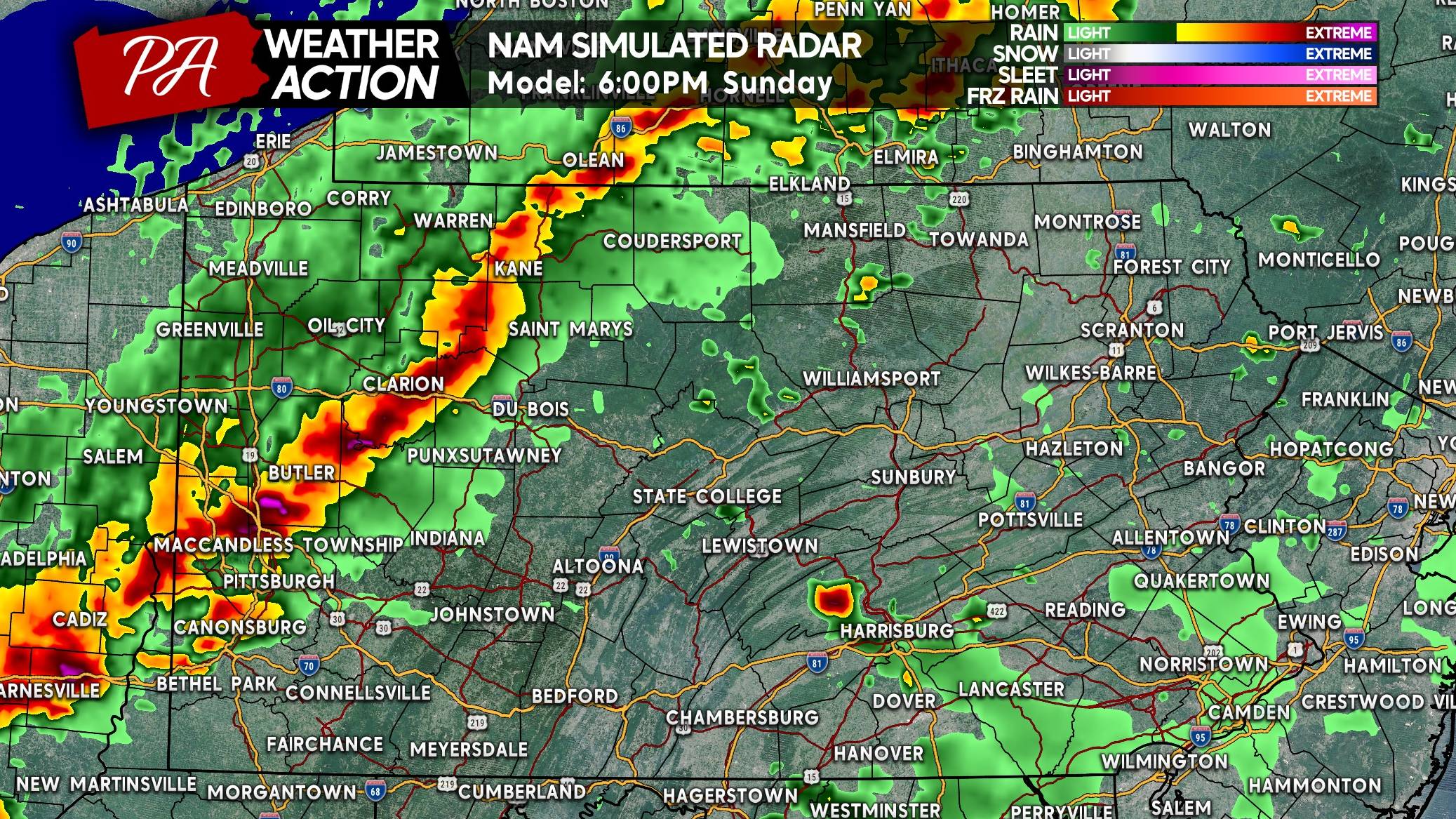
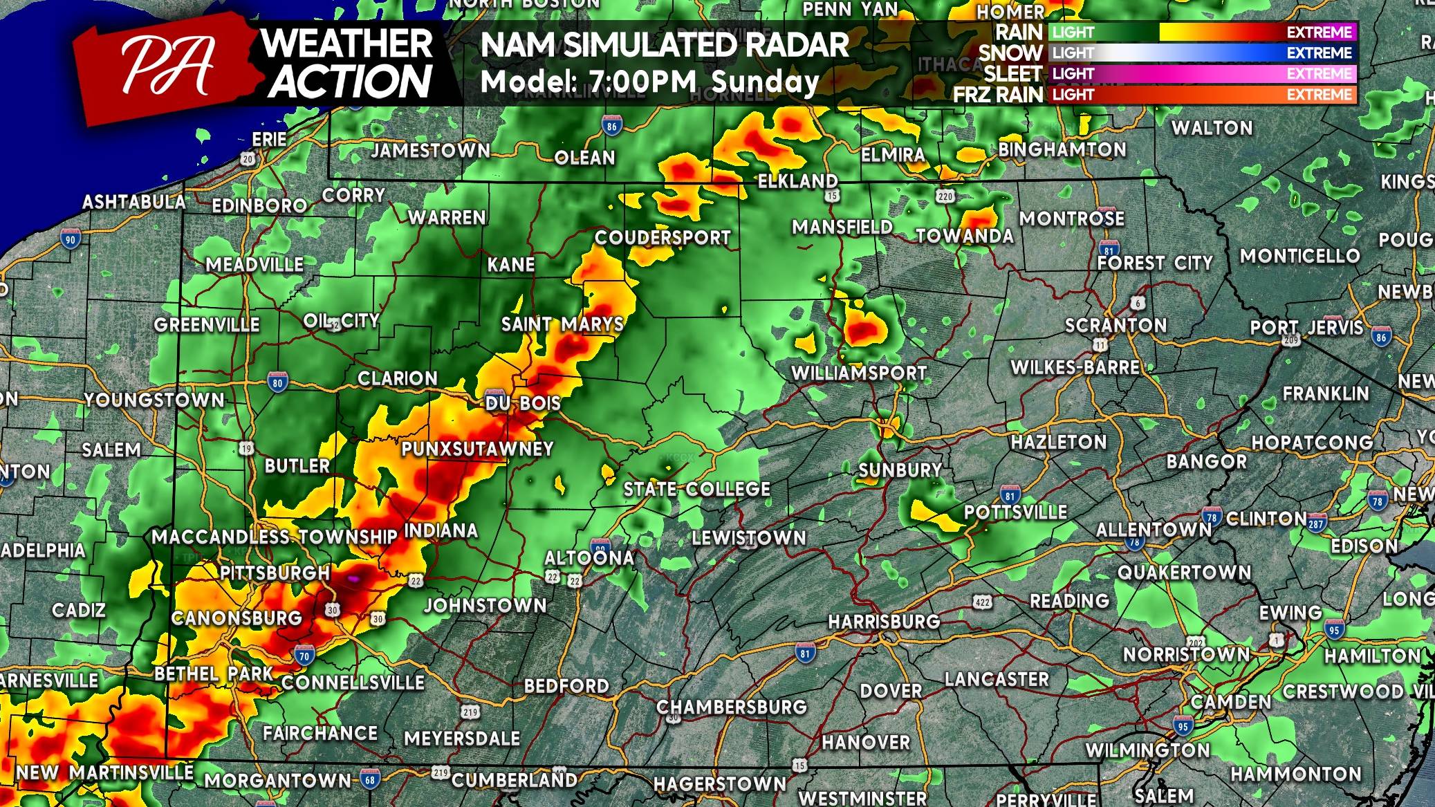
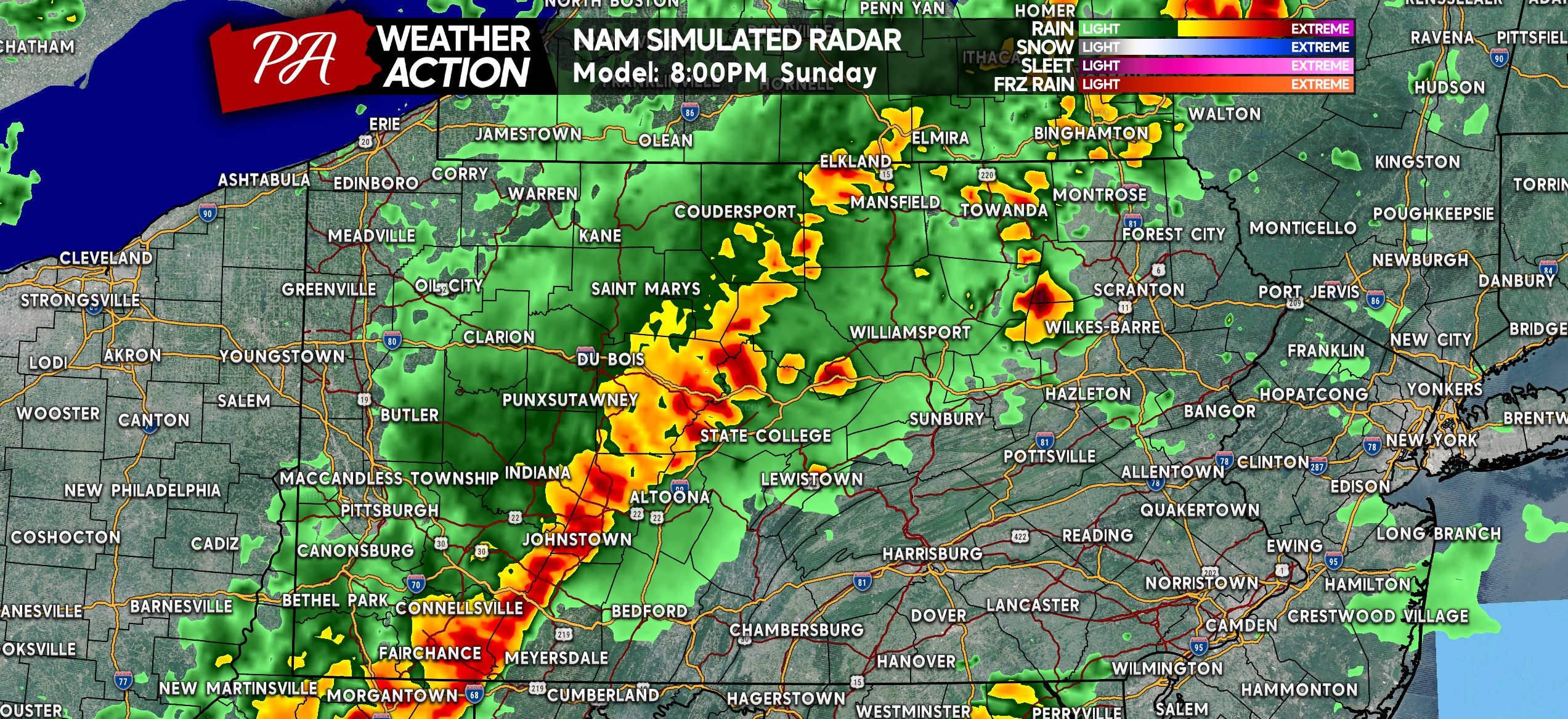
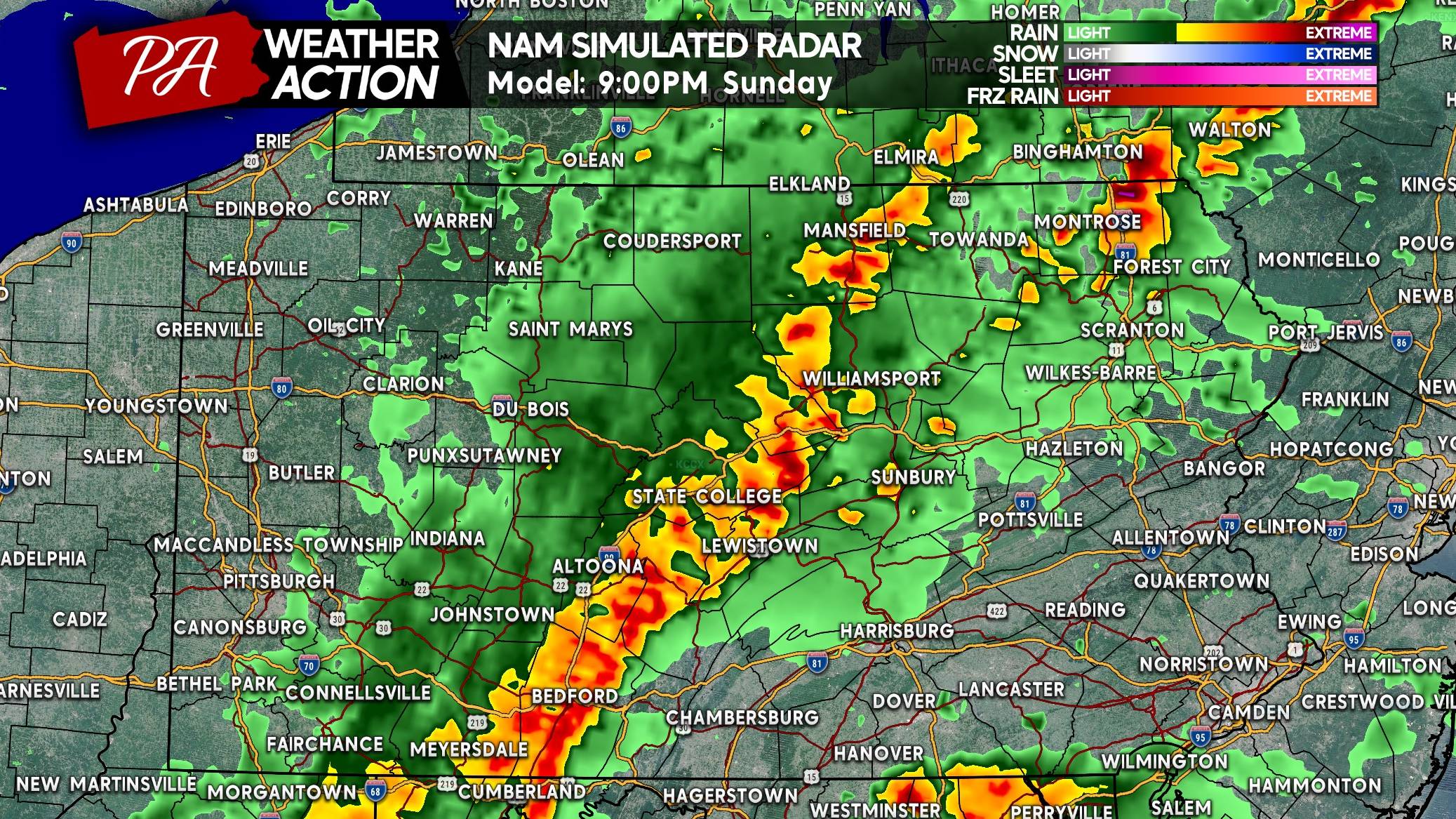
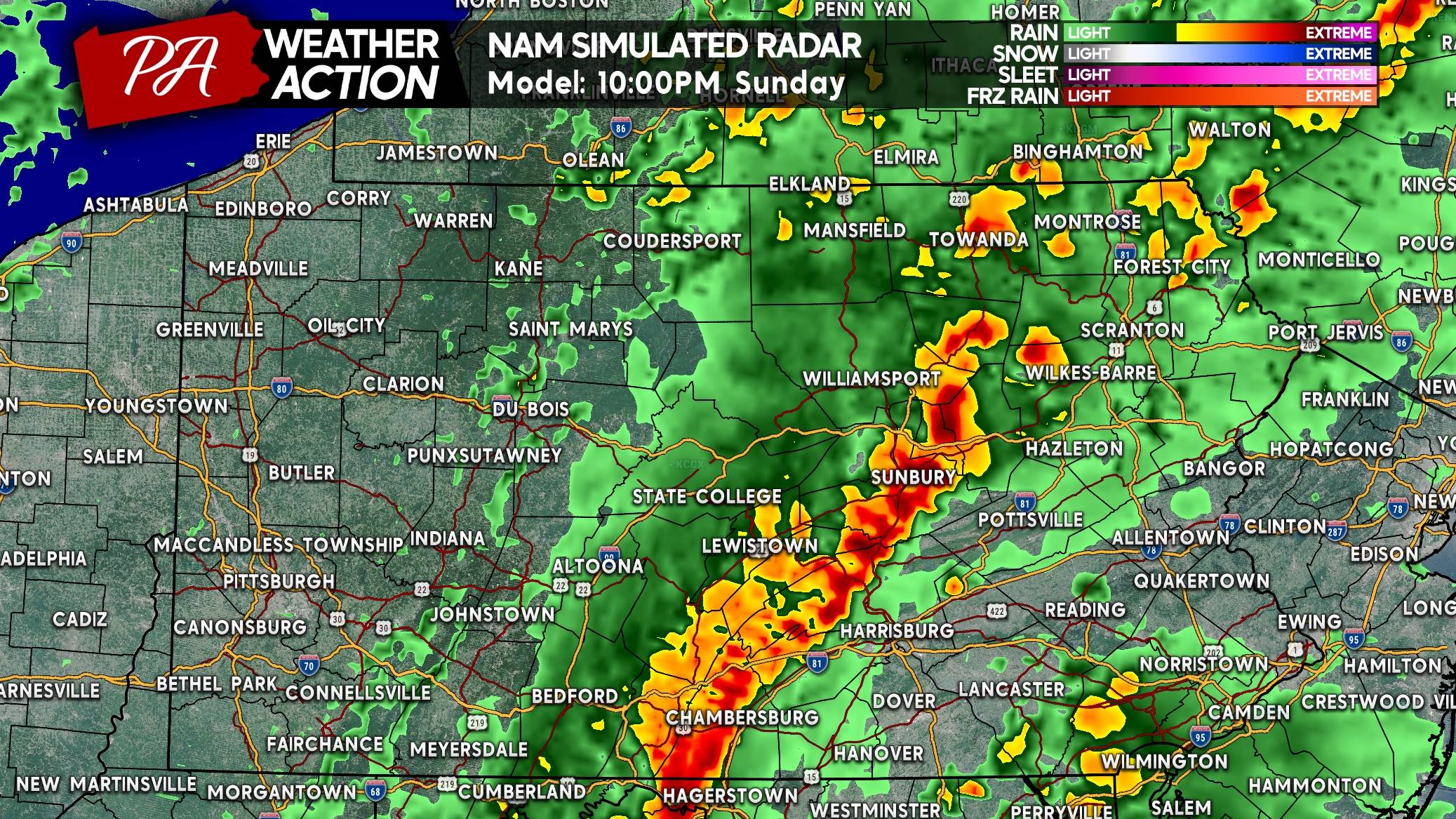
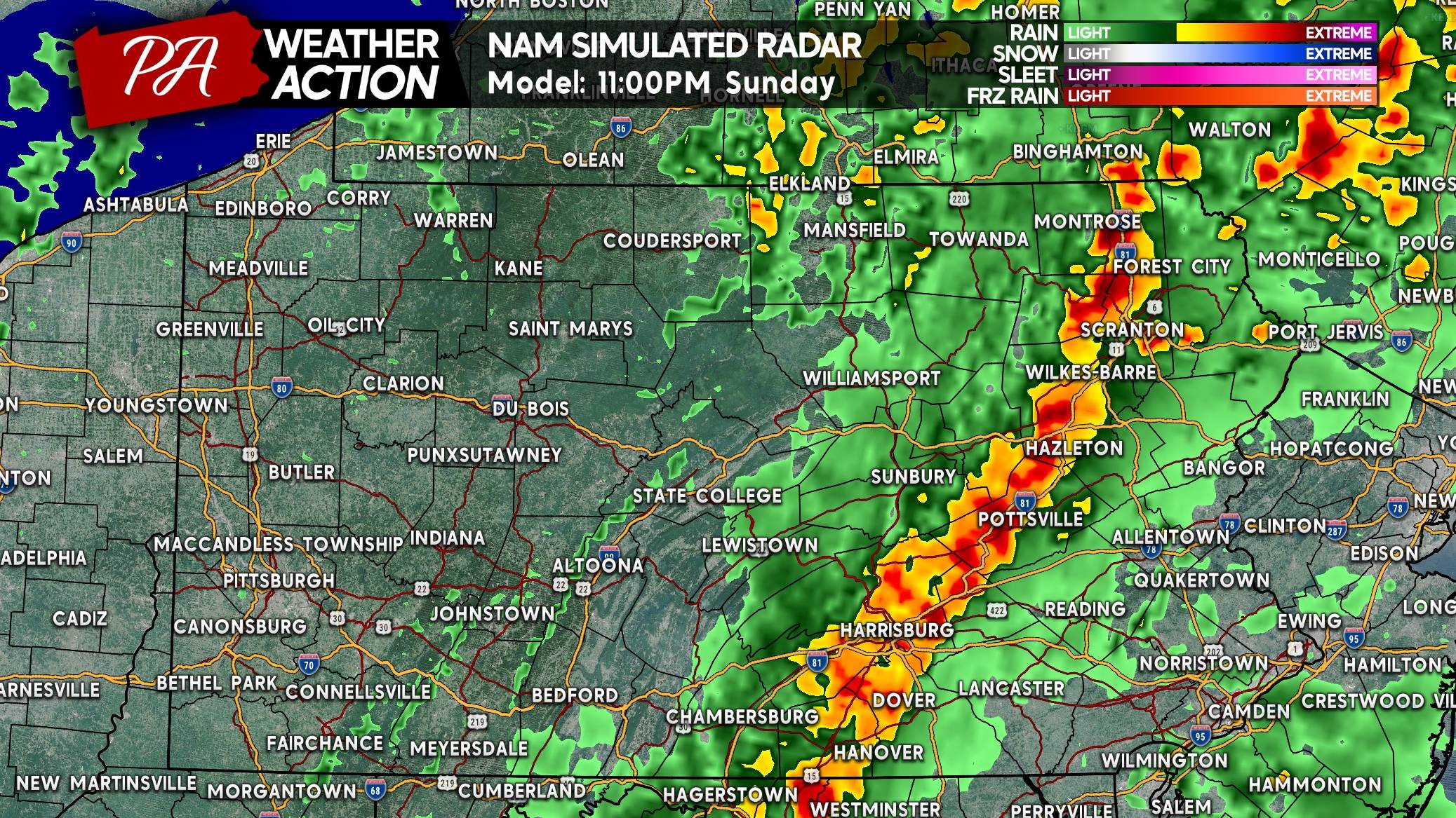
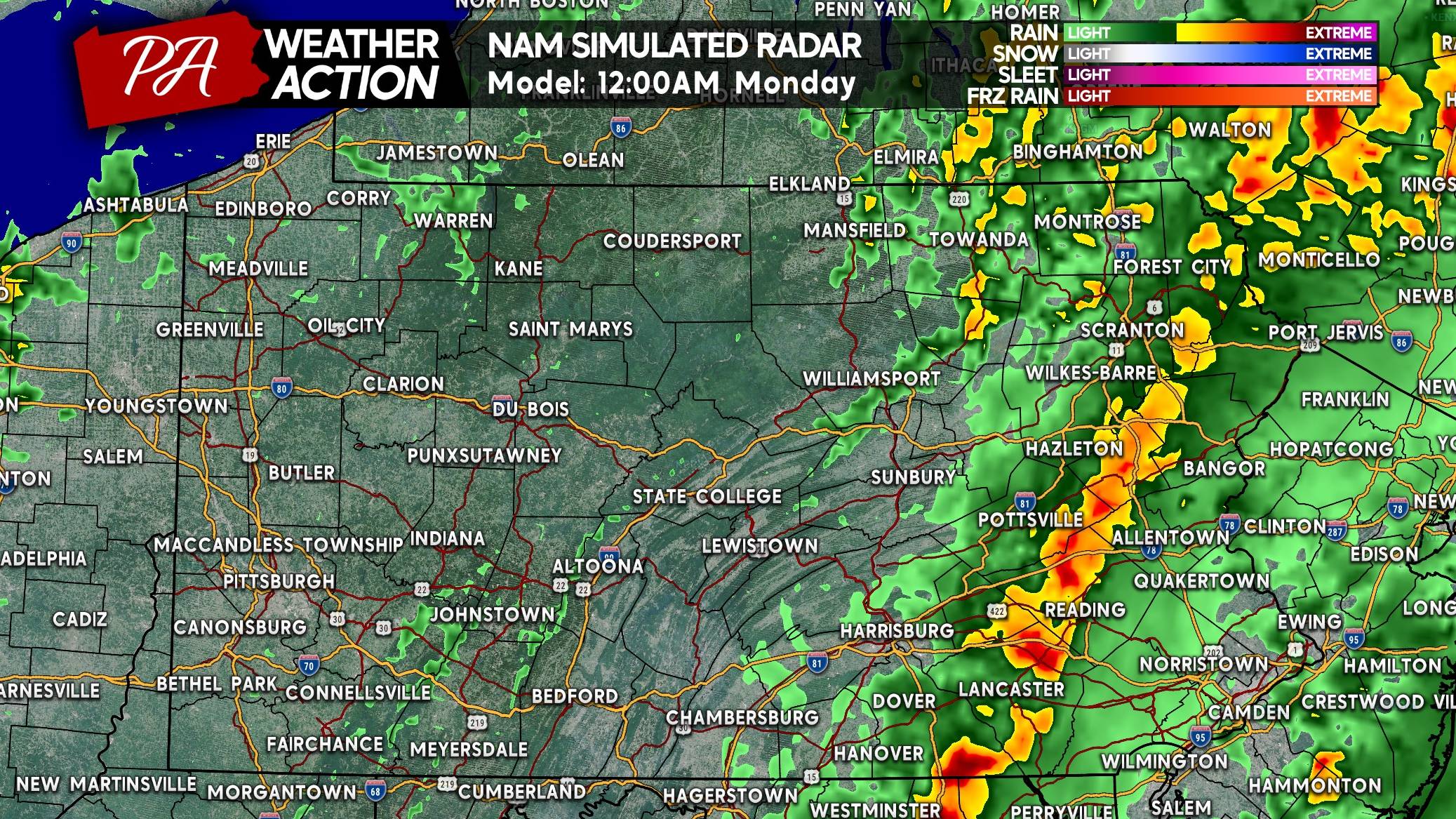
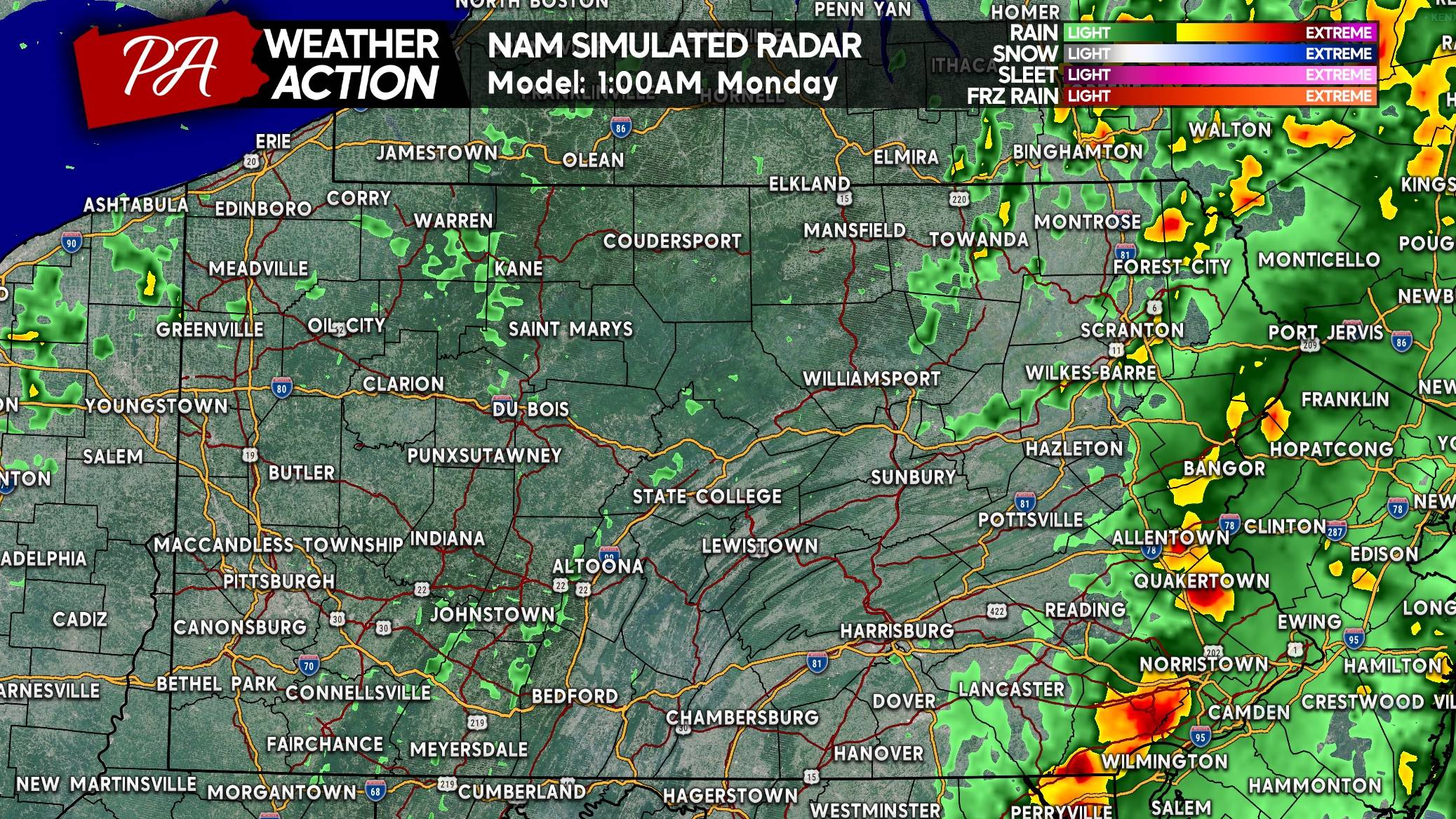
Storms will develop in Western PA early to middle Sunday afternoon and push east. At first, they may be discrete cells before becoming a more defined and wider-impacting line of storms as they push into Central PA later afternoon to dinnertime and Eastern PA by late Sunday evening.
FUTURE RADAR TIMING
Below is the Hi-Res NAM’s best guess for how Sunday will play out on radar. As always, it will be a great idea to track the storms in real time tomorrow.
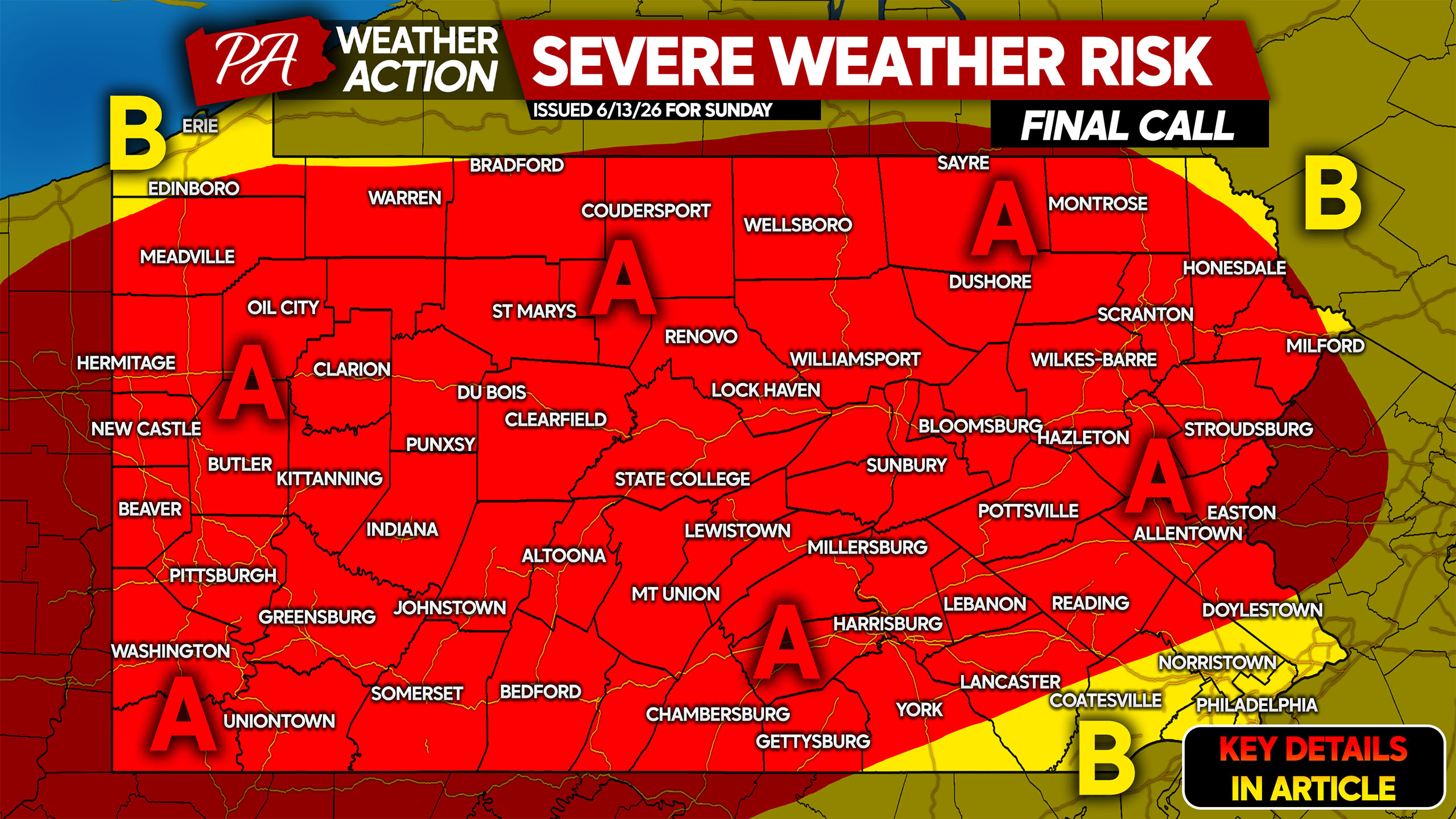
SEVERE THUNDERSTORM THREAT FORECAST FOR SUNDAY 6/14
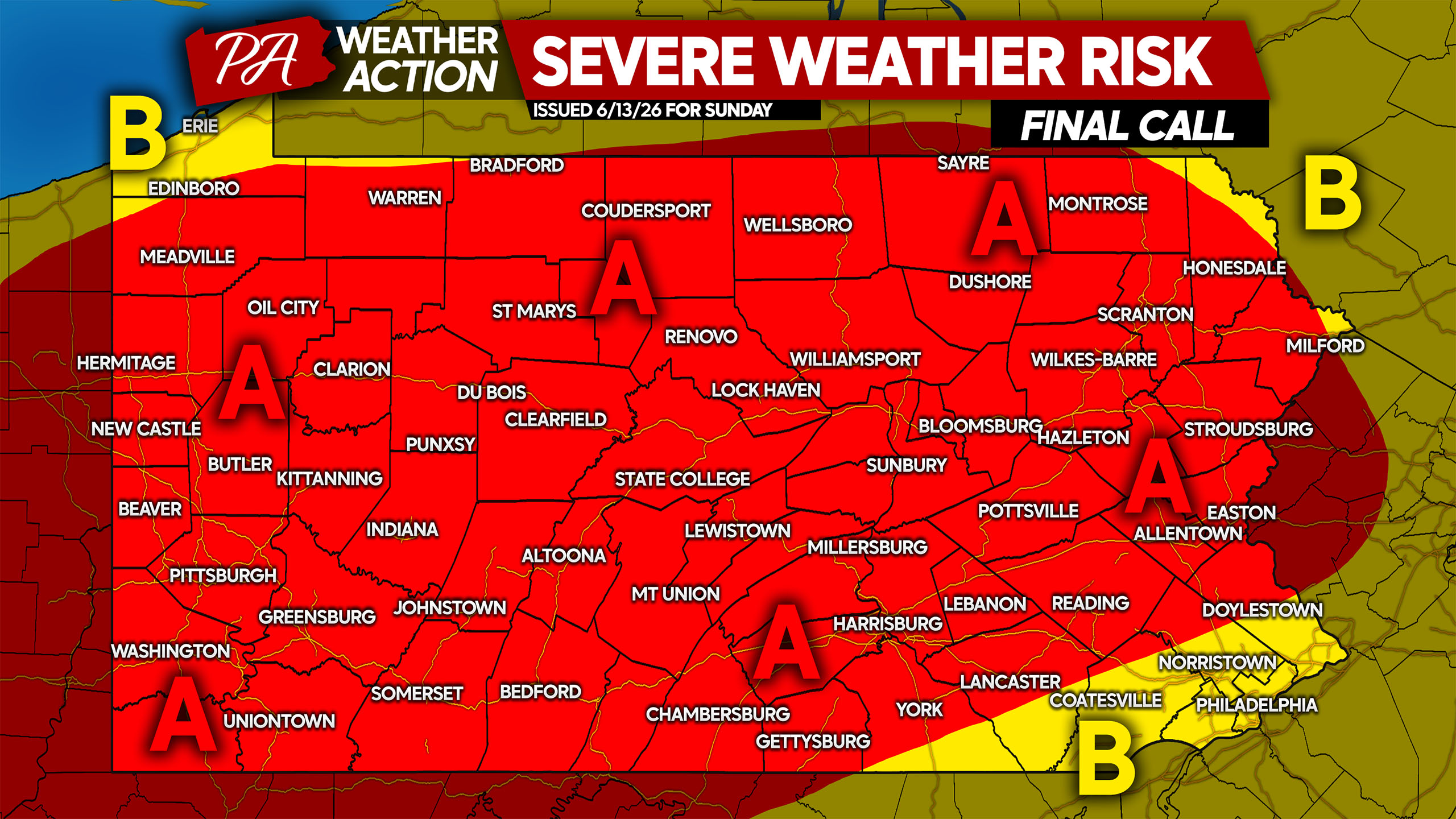
Area A: Scattered to widespread strong to severe thunderstorms expected later in the day Sunday. Damaging winds as high as 80 MPH are the main concern, with a very low chance of hail or an isolated tornado.
Area B: Isolated strong to severe thunderstorms expected. If storms develop earlier and reach Eastern PA before 9-10 PM, Southeast PA will join the Area A threat. That solution may happen but it’s the most favored at this point.
Many people have outdoor plans Sunday! Be sure to share this forecast with family and friends.


You must be logged in to post a comment.