
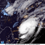
Dry conditions with extreme high temperatures will continue to begin the week before the remnants of Hurricane Beryl brings chances for showers and thunderstorms beginning Tuesday night. Heat indices approaching 100 degrees can be expected Tuesday and possibly Wednesday.
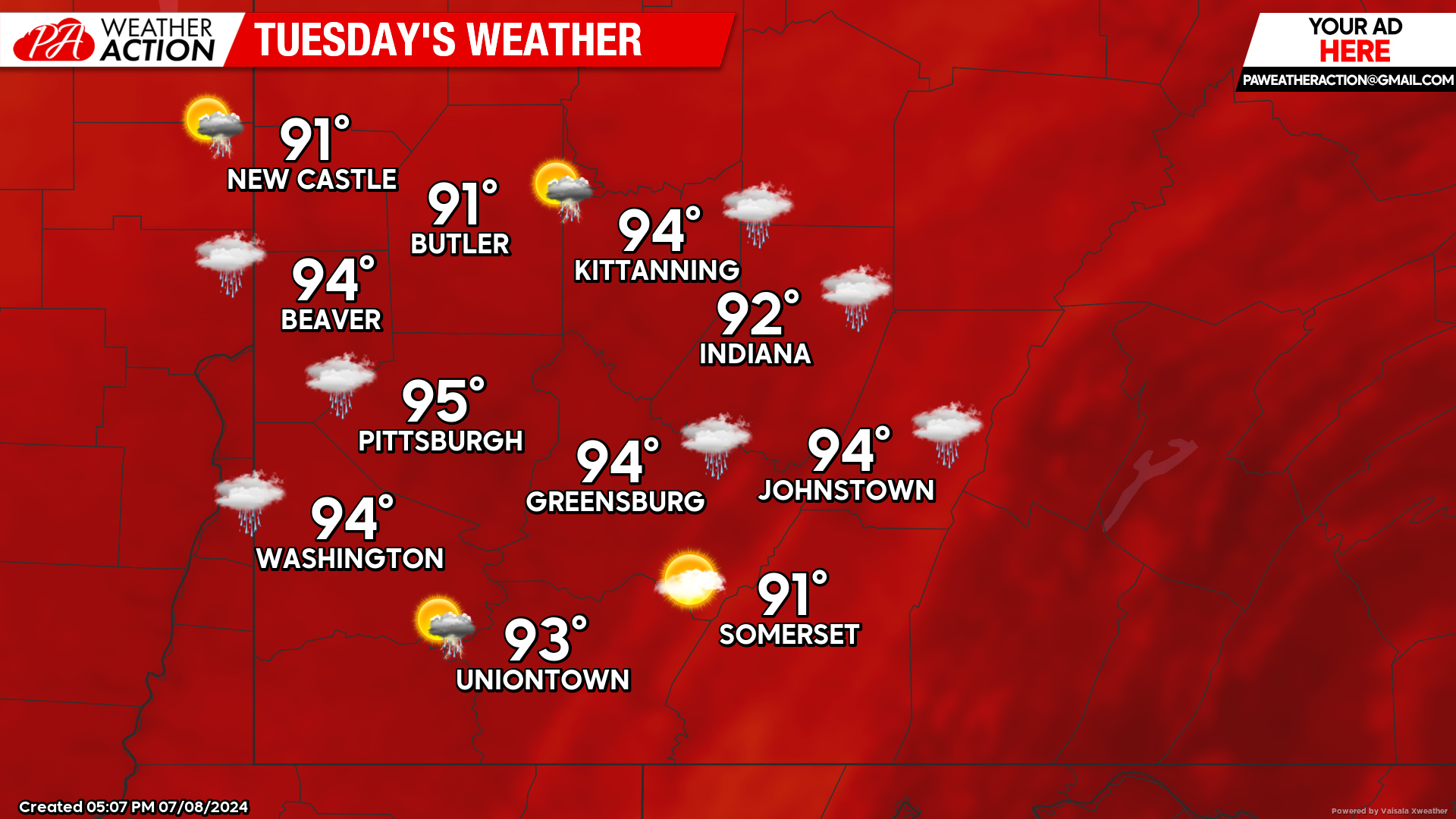
Tuesday
Partly sunny and hot. Highs will be in the mid to low 90s, lows will be in the mid to low 70s. Heat indices may approach 100 degrees in some portions of the region, be weather aware and protect yourself if you are outdoors for an extended period of time. Winds will be out of the southwest around 5 mph in the afternoon hours. Chances for showers and thunderstorms are possible starting Tuesday night.
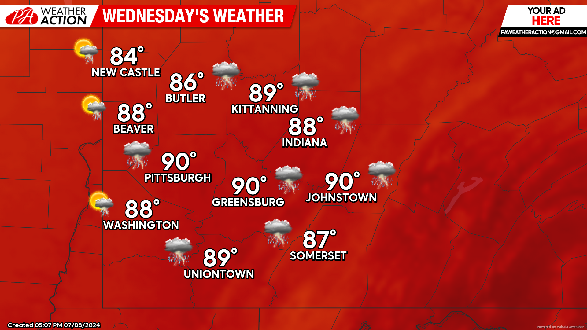
Wednesday
Partly sunny and hot, chance for showers and thunderstorms are possible in the afternoon and evening hours. Highs will be in the low 90s to mid 80s, Lows will be in the high to mid 60s. Heat indices may approach 100 degrees in some portions of the region, be weather aware and protect yourself if you are outdoors for an extended period of time. Winds will be out of the south-southeast at 5-9 mph in the afternoon.
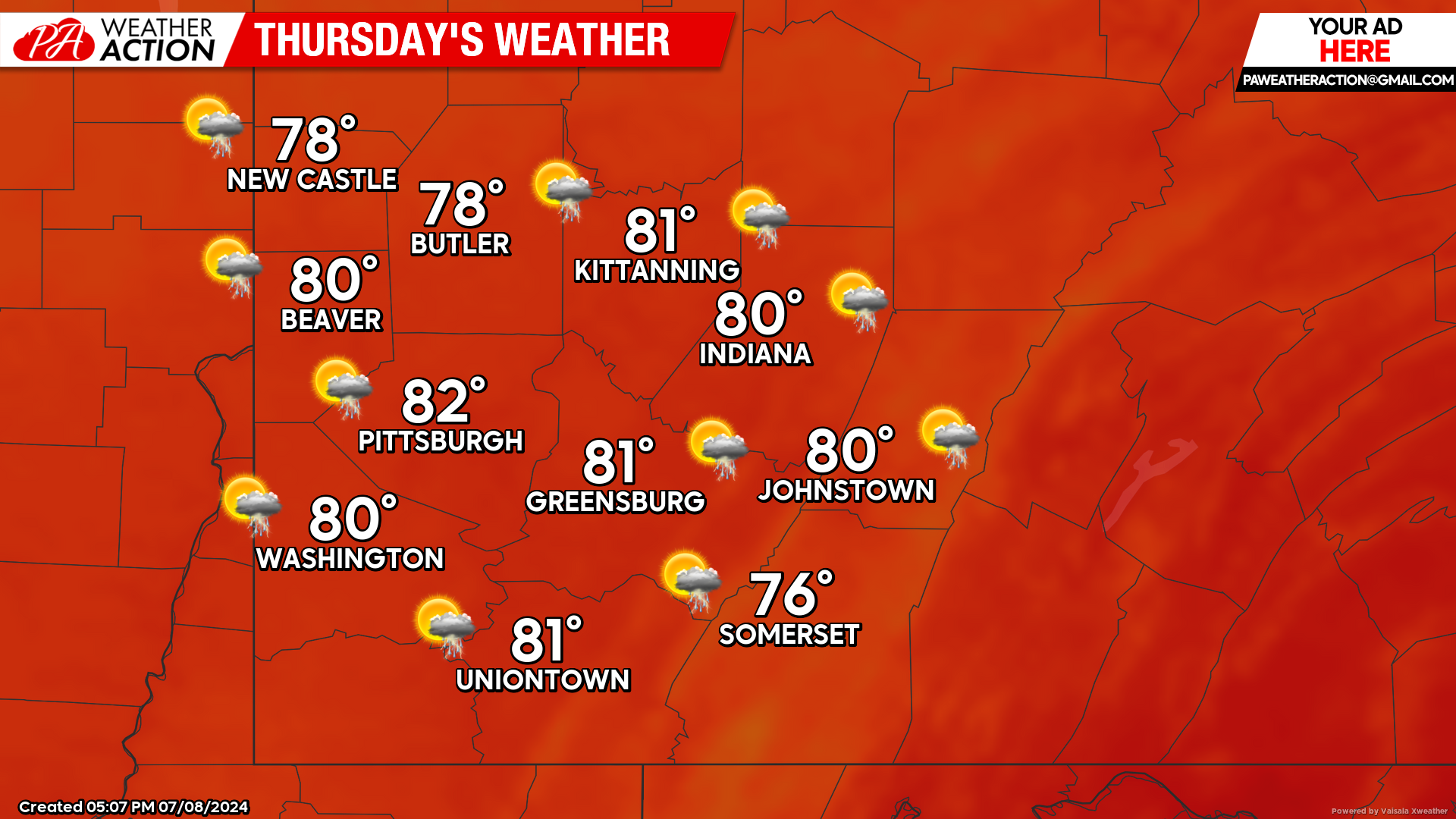
Thursday
Showers and thunderstorms are possible throughout the day and into the evening on Thursday. Highs will be in the low 80s to mid 70s, lows will be in the mid to low 60s.
Clear skies and hot temperatures return at the end of the week and into the weekend. Be sure to follow PA Weather Action for more updates.
You must be logged in to post a comment.