
The well-advertised heat wave is now upon us. Temperatures today soared into the 90s across our area, along with extremely high humidity. This pushed heat indices well over 100 degrees this afternoon. The extreme heat and humidity will last through midweek, with reprieve arriving for the latter part of this week. And if you are looking for a cooler memory in today’s hot weather, there were snow flurries reported in the higher elevations of our area on this date in 1918!
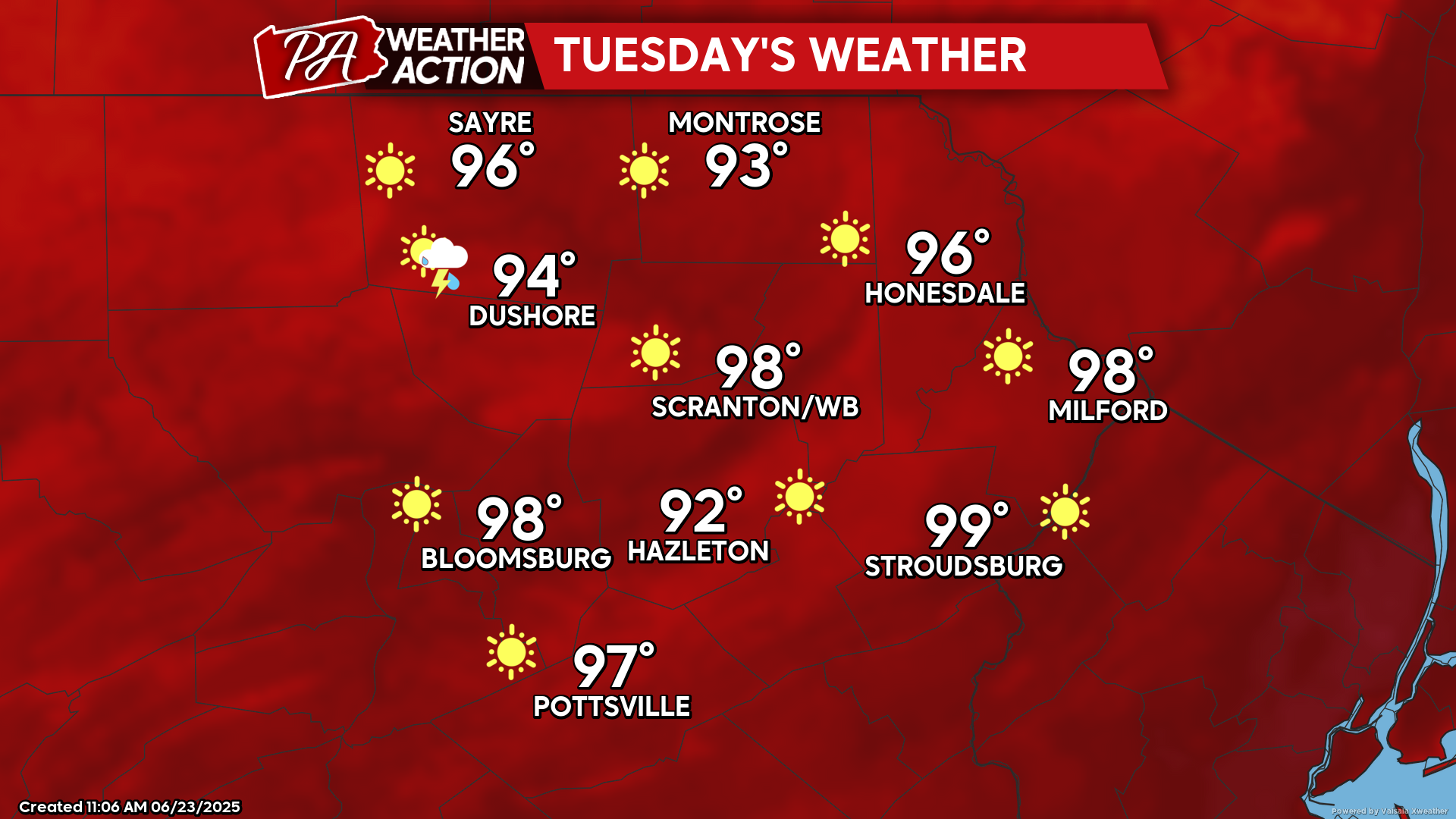
TUESDAY
The extreme humidity will result in overnight temperatures remaining in the 70s for most places tonight and again Tuesday night. Tuesday will be very hot, with some of the valleys and cities teasing with 100 degrees! There could also be a couple isolated thunderstorms popping during the afternoon and evening. Most of us will be hot and dry. But if you are lucky-enough to get one, enjoy!
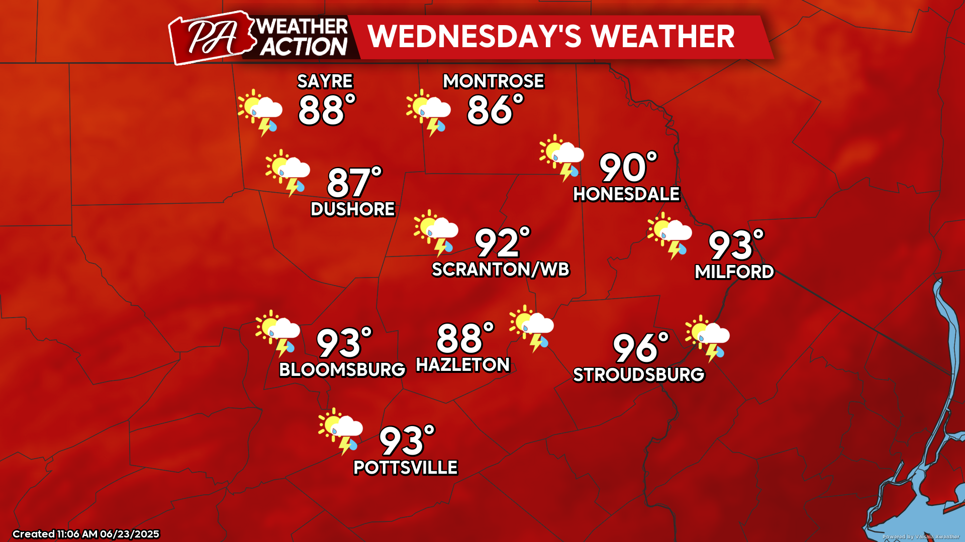
WEDNESDAY
The relentless humidity will continue, rendering Tuesday night and Wednesday night quite steamy with temperatures remaining in the 70s. As the heatwave continues to bake our area Wednesday, isolated thunderstorms will once again pop across the area. While not everyone will get to enjoy a storm, they should be a little more widespread than Tuesday.
THURSDAY
The upper-level ridge responsible for the inferno will start to break down and relinquish control of our weather. A surface cold front crawling southward toward our area will result in lower temperatures and greater thunderstorm activity. That front should push south of our area Thursday night, resulting in a cooler night with lows dropping into the 60s and highs remaining in the 70s Friday.


You must be logged in to post a comment.