
After an absolutely gorgeous week across the commonwealth, those pleasant conditions will come to an abrupt halt as summer bids its final farewell. Temperatures plunge back to average for this time of year, and rain will be present once again. We surely will not see temperatures in the 70s until next spring!
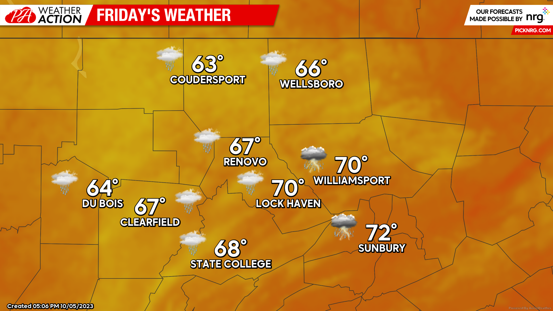
Friday
Patchy fog settles in the region in the morning hours. Fog will give way to partly cloudy skies until the mid afternoon, when cloud cover rapidly increases and develops into rain showers into the late evening and overnight hours. Highs in the mid 60s to low 70s, lows in the mid to upper 50s.
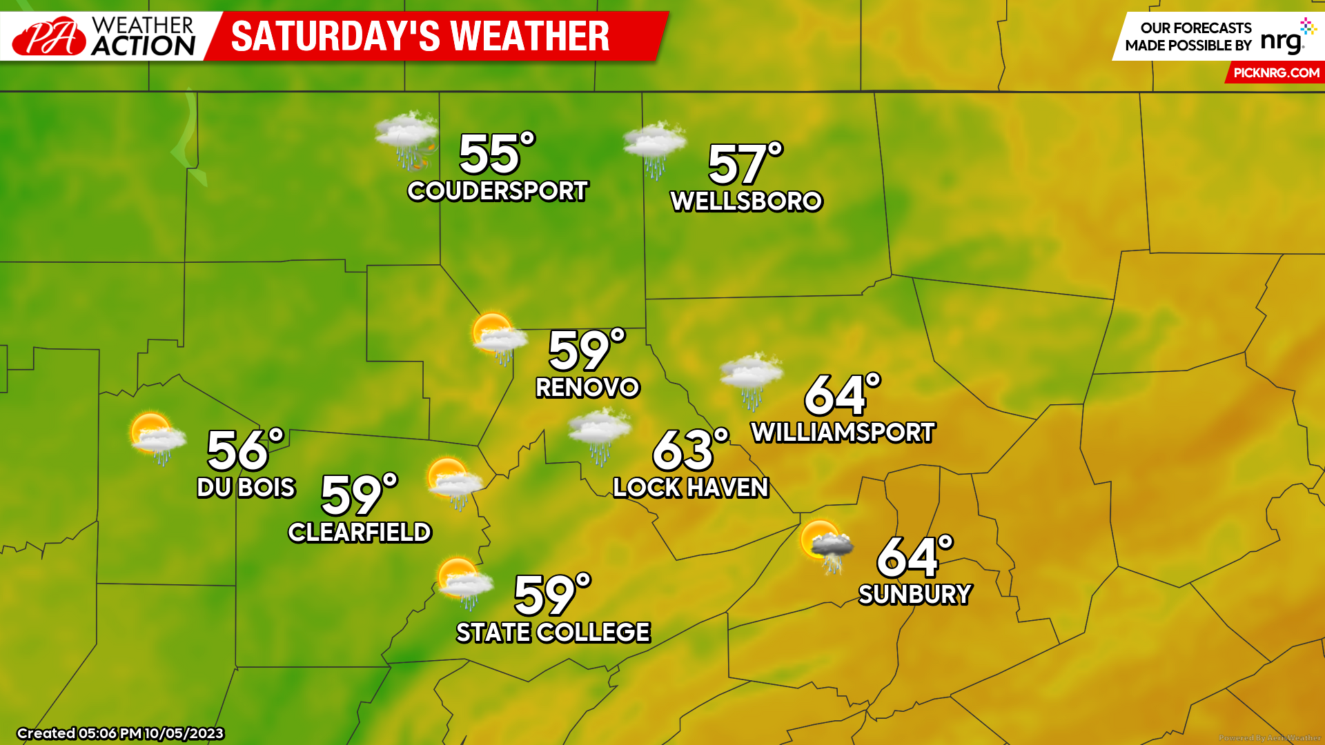
Saturday
Much milder temperatures across the region, with some areas not even getting into the 60s. Scattered showers for most of the day. Highs in the mid 50s to mid 60s, lows in the upper 40s to low 50s.
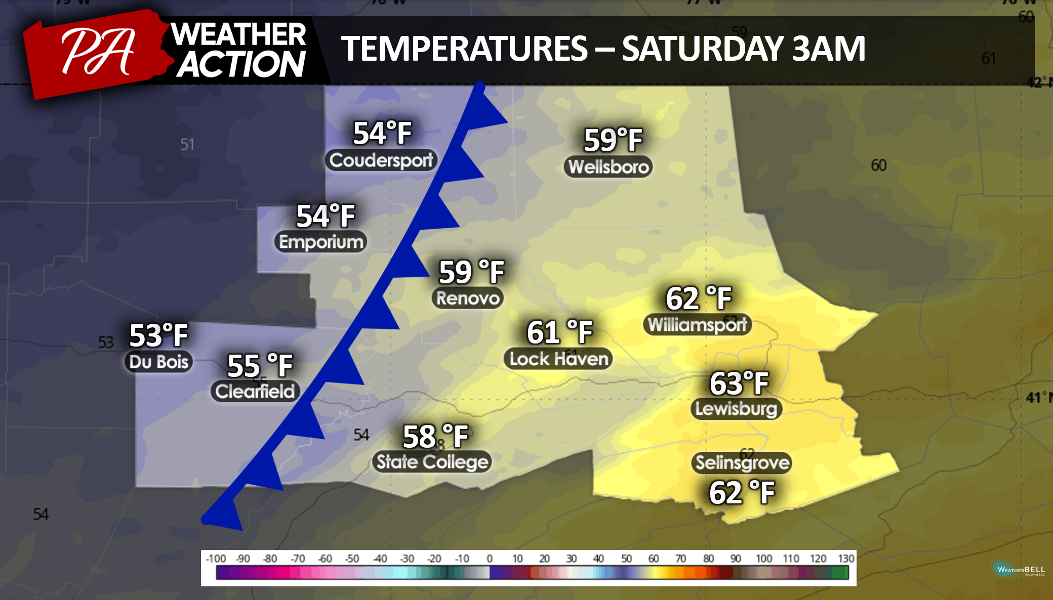
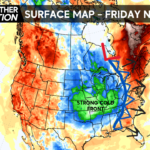
As visualized in the photo below, a cold front will bring in much cooler temperatures overnight Friday into Saturday.
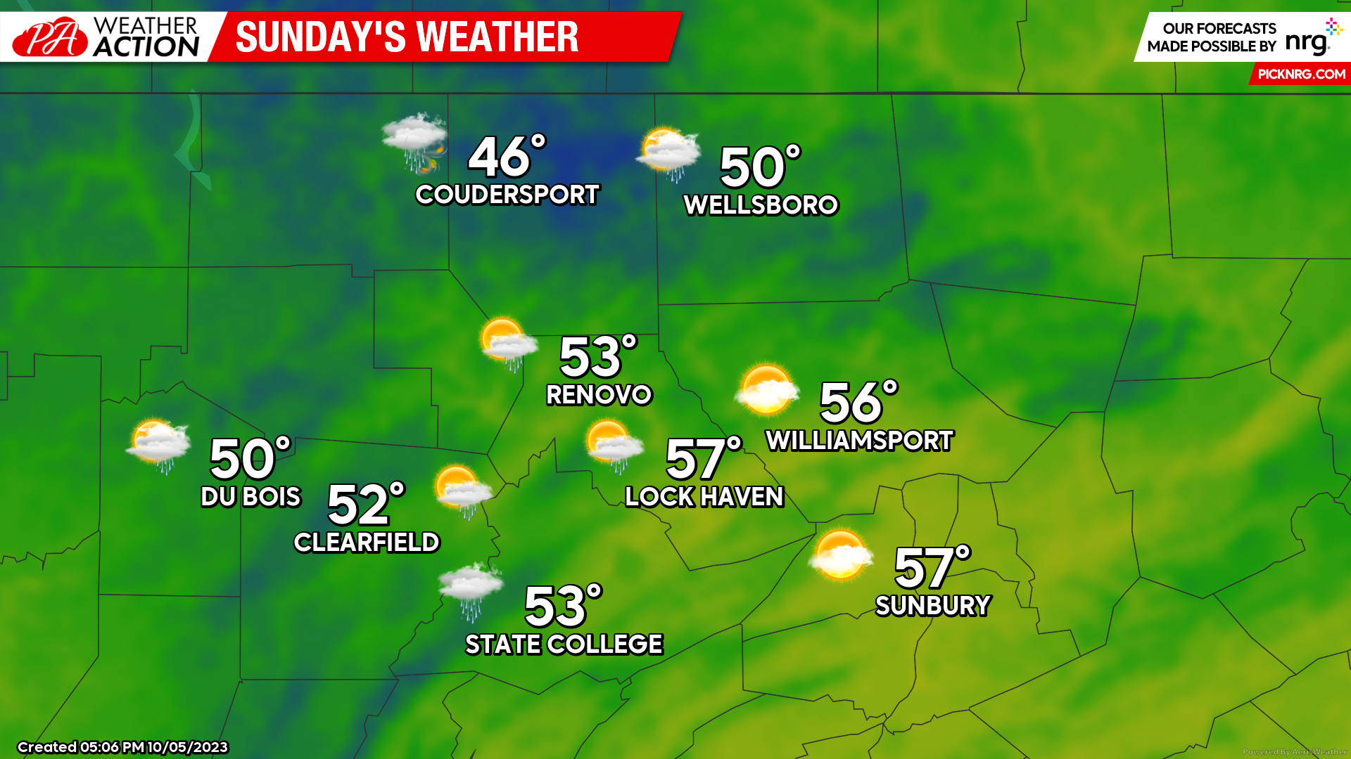
Sunday
The area stays in the 50s- or not even making it into the 50s. You may be stuck in the 40s for the day if you live in the Northern Tier in or near Coudersport. Rain lingers- although much more patchy than Saturday. Highs in the upper 40s to upper 50s, lows getting down into the upper 30s to low 40s.
This weekend, break out your warm raincoat- or stay inside under a warm blanket. Whichever you choose- it is going to be a very brisk weekend compared to what we saw this week. Happy Fall!
Sara Stierly

You must be logged in to post a comment.