

Greetings!
This week featured summery warmth and humidity, with temperatures soaring into the 70s and 80s every day! I hope everyone was able to spend some quality time with the weather, as summer will become a distant memory starting this weekend…
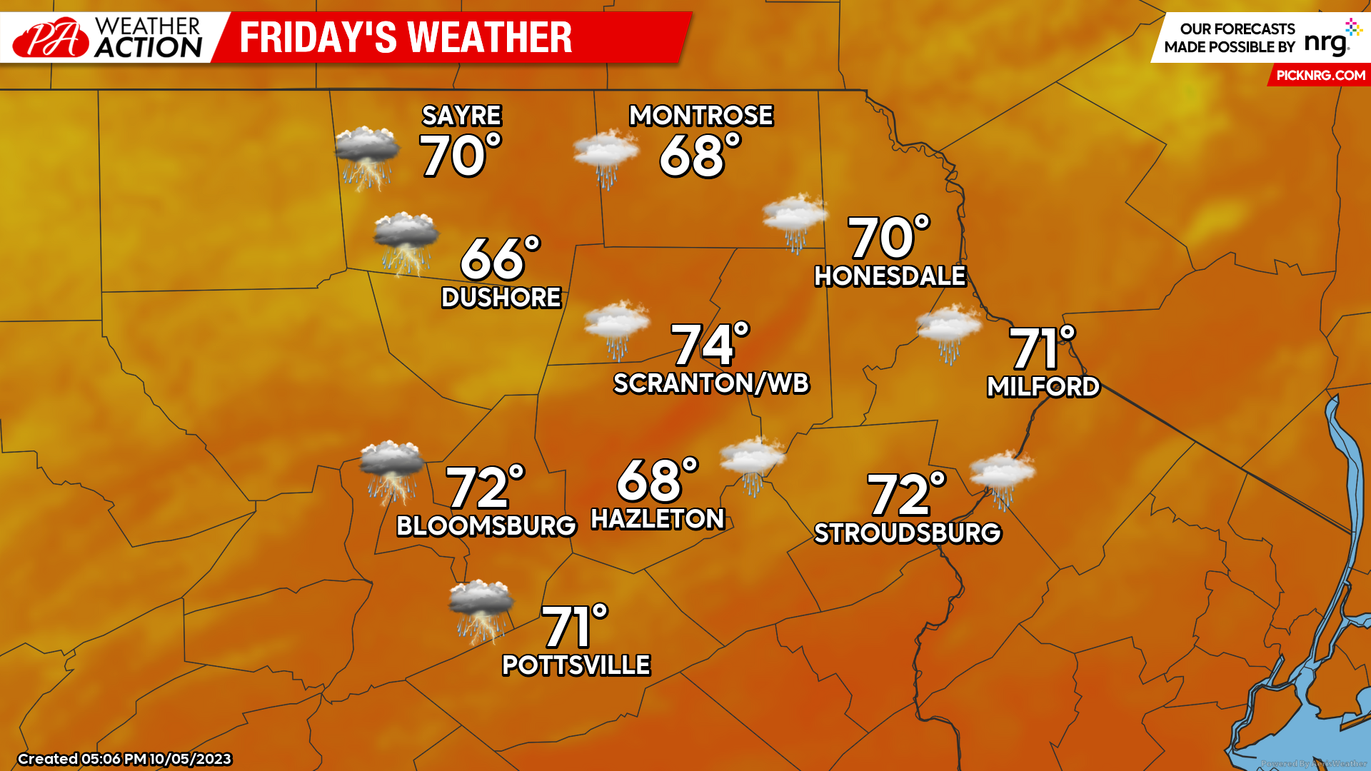
FRIDAY
We will get to enjoy one more day of warmth on Friday, although it will be cloudy with scattered showers as onshore flow develops ahead of an approaching cold front.
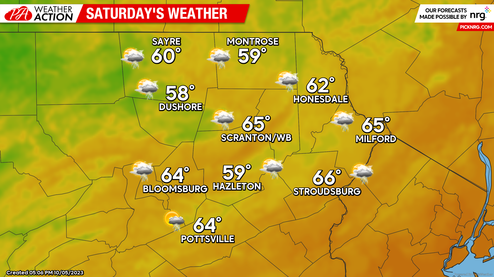
SATURDAY
That cold front will push across the region from west to east during the late morning hours, accompanied by showers and thunderstorms. The heaviest rainfall will end by early afternoon, with only scattered lighter showers the rest of the day. The day will dawn mild with widespread 60s during the morning, but temperatures will remain steady or slowly fall during the afternoon with northwest wind.
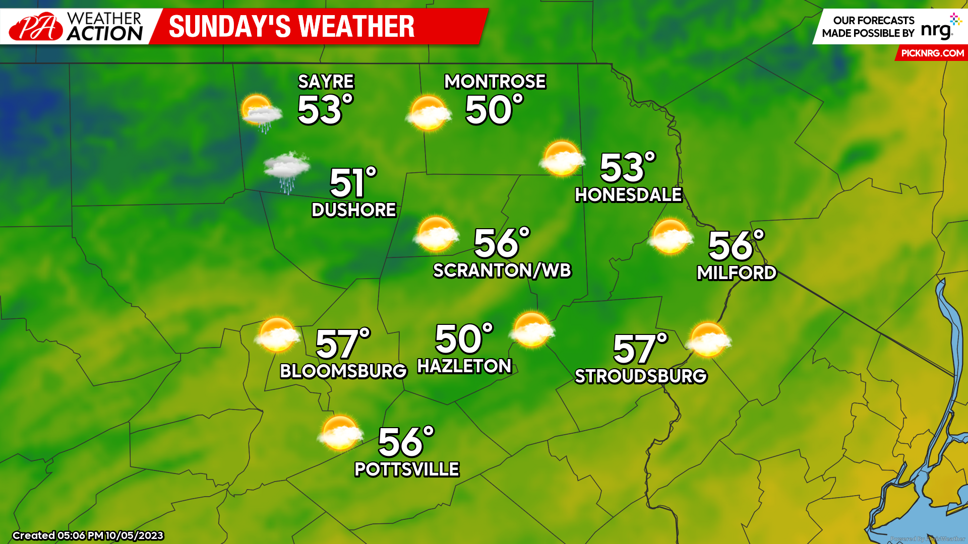
SUNDAY
The hybrid tropical storm Philippe will make landfall in Maine early Sunday to provide some meteorological excitement to northern New England, but it’s main impact on our weather will be that it will merge with a deep upper-level low in southeastern Canada which will help maintain below-normal temperatures through much of next week. Sunday’s weather will be mostly dry in our area, but with temperatures 20-30 degrees lower than what we enjoyed this week. There could be some isolated showers, especially near the New York border. Sunday night will feature widespread lows in the 30s. Enjoy!
This pattern shift into below-normal temperatures will continue into much of next week. In fact, while there could be a brief period of slightly-above-normal temperatures late next week, the longer-term pattern shows signs of a continued colder-than-normal bias even into the 3rd week of October!
And for those of you dreaming about winter, the aforementioned upper-level low will provide the first accumulating snowfall of the season for a large area of eastern Ontario and southern Quebec just north of the Great Lakes Sunday into Monday!

You must be logged in to post a comment.