
A large, messy system will push through the area Wednesday, bringing heavy rain and backend snow to some areas. Strong winds are also expected, so be sure to secure any Christmas decorations! Deep cold air will follow the system, with highs only in the 30s to end the week and wind chills in the single digits and teens Thursday morning.
Storm Timing
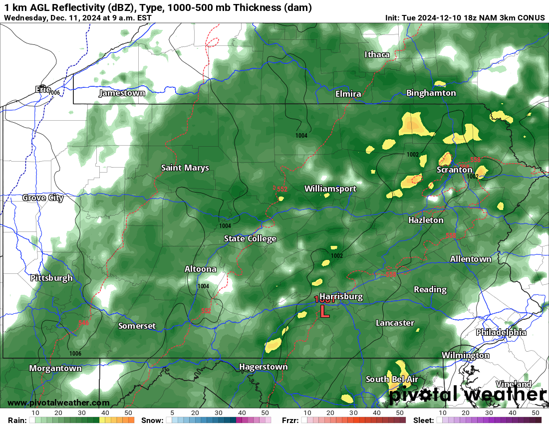
A rainy morning is on tap for Wednesday with moderate rain and gusty conditions making for not the best weather! Below is the Hi-Res NAM model for 9:00 AM Wednesday.
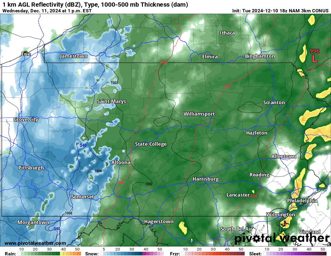
As cold air crashes in behind the system, rain will begin to change to snow in Western PA by around or just after lunchtime Wednesday. Temperatures will still be above freezing, so immediate road condition impacts aren’t expected. Here’s the Hi-Res NAM for 1:00 PM Wednesday.
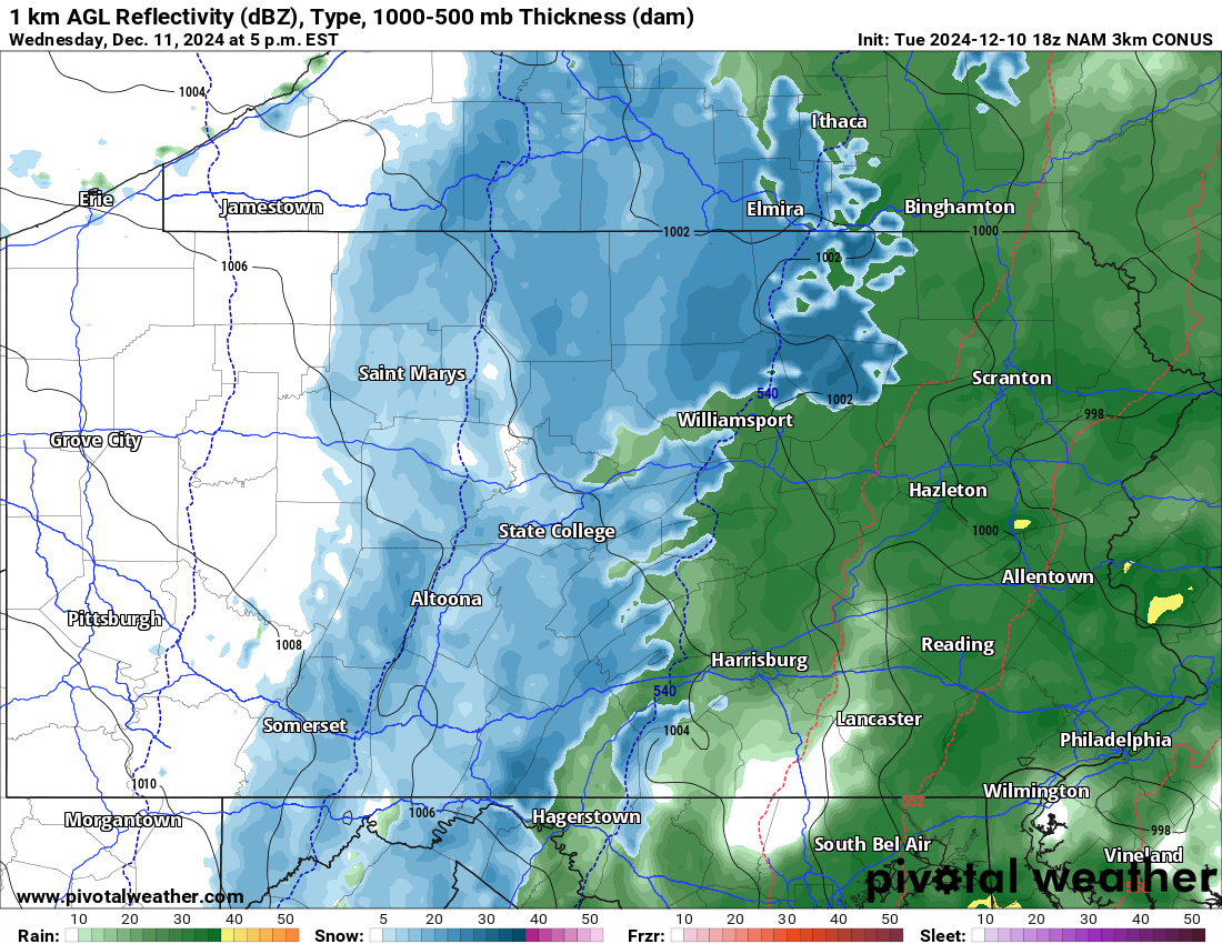
Snow will wrap up in Western PA soon after that, as the changeover line pushes east into Central PA. The cold air is expected to push in just before precipitation ends, especially in Northern PA. But even in Southern PA, some festive flakes are likely.
Below is the Hi-Res NAM model for 5:00 PM Wednesday showing that rain/snow line pushing east.
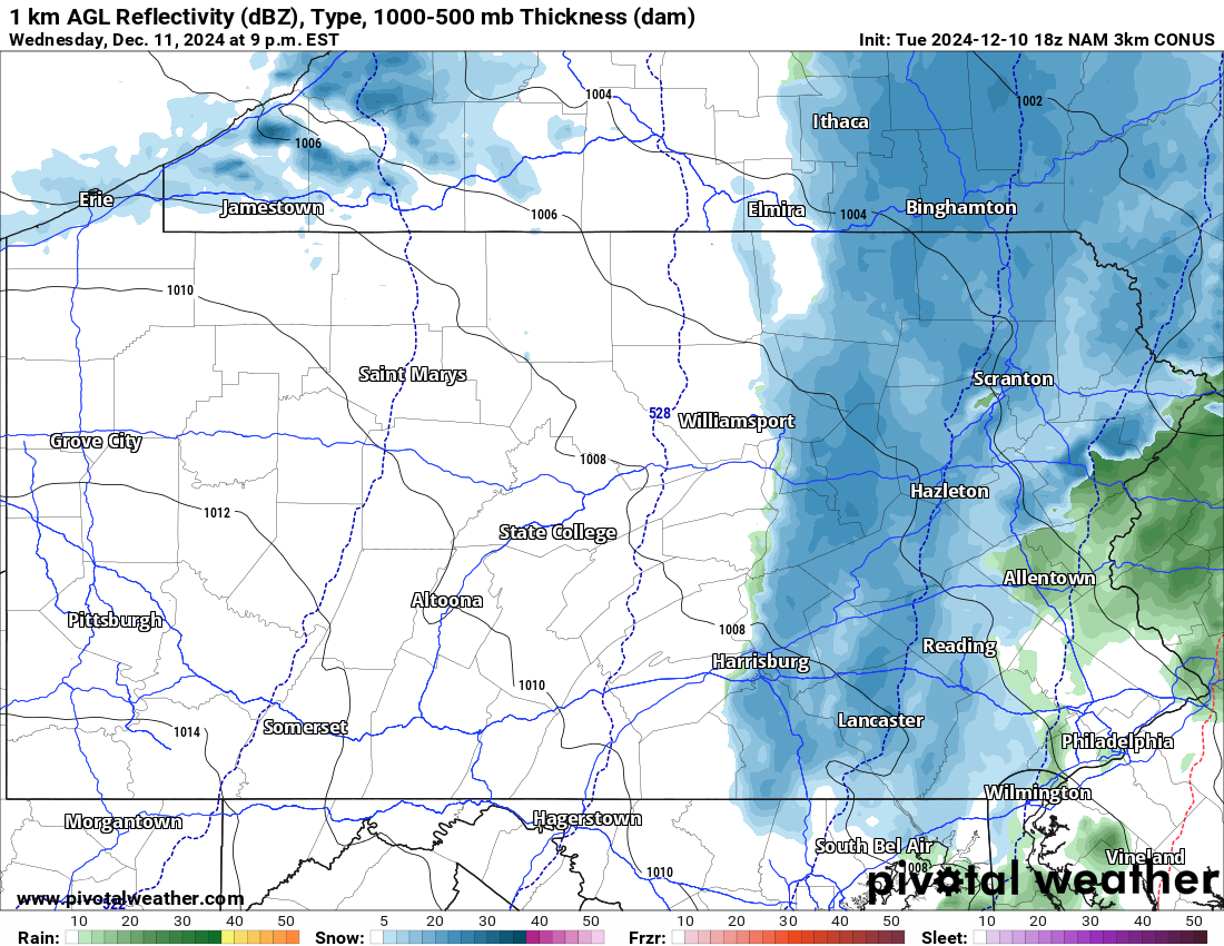
As we head into Wednesday evening, precipitation will exit Central PA, and the rain/snow line will continue its eastward movement into Eastern PA. It’s questionable if snow will fly in Southeast PA, but we’re more confident about the changeover occurring in NEPA. Here is the Hi-Res NAM for Wednesday at 9:00 PM.
NOW – WEDNESDAY RAINFALL FORECAST
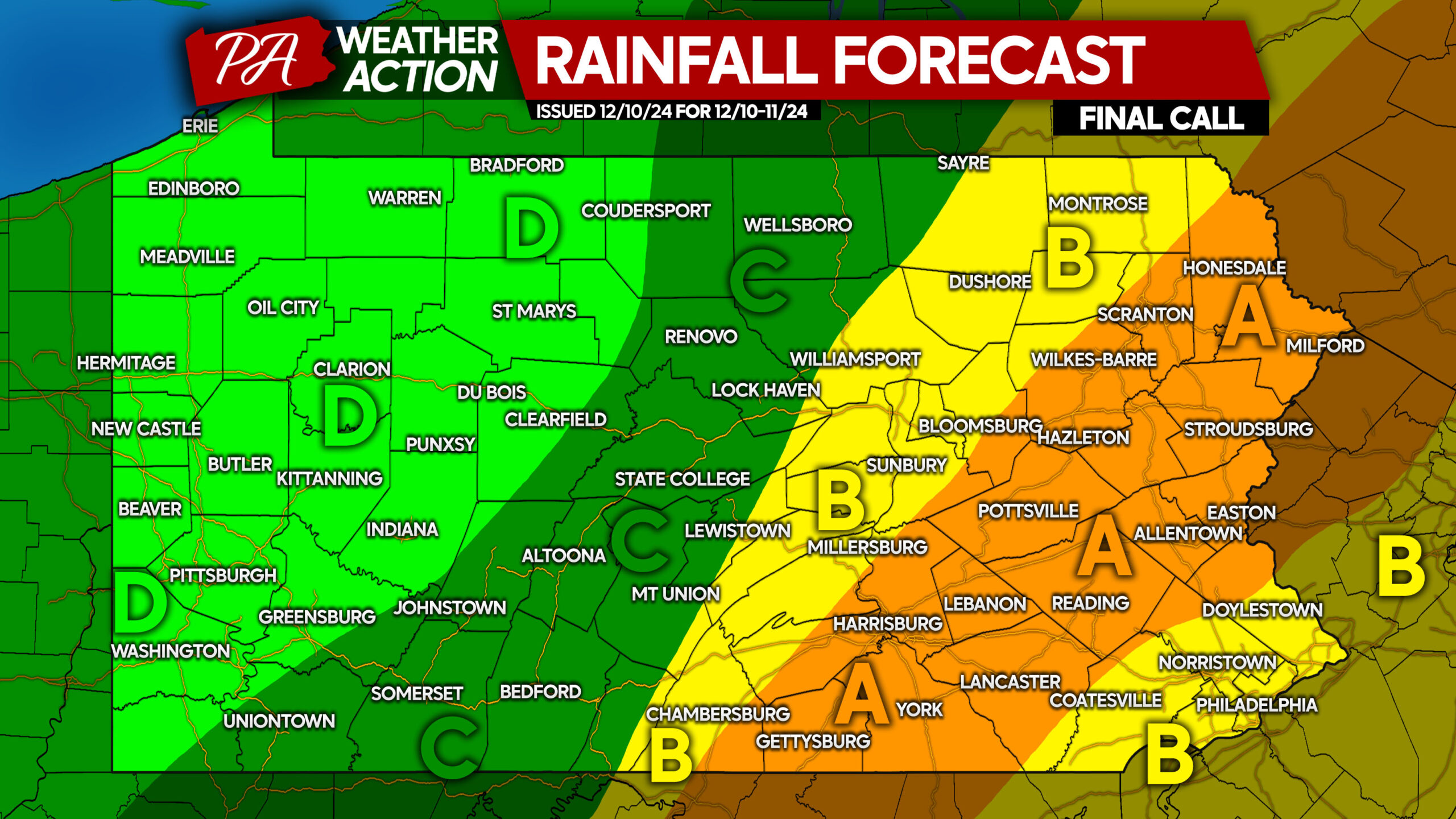
Most precipitation will fall as rain, but a bit will fall as snow. That precipitation is included here as well.
Area A: Rainfall accumulation of 1.5 – 2.0″ anticipated.
Area B: Rainfall accumulation of 1.0 – 1.5″ expected.
Area C: Rainfall accumulation of 0.5 – 1.0″ anticipated.
Area D: Rainfall accumulation of 0.2 – 0.5″ expected.
SNOWFALL FORECAST FOR WEDNESDAY
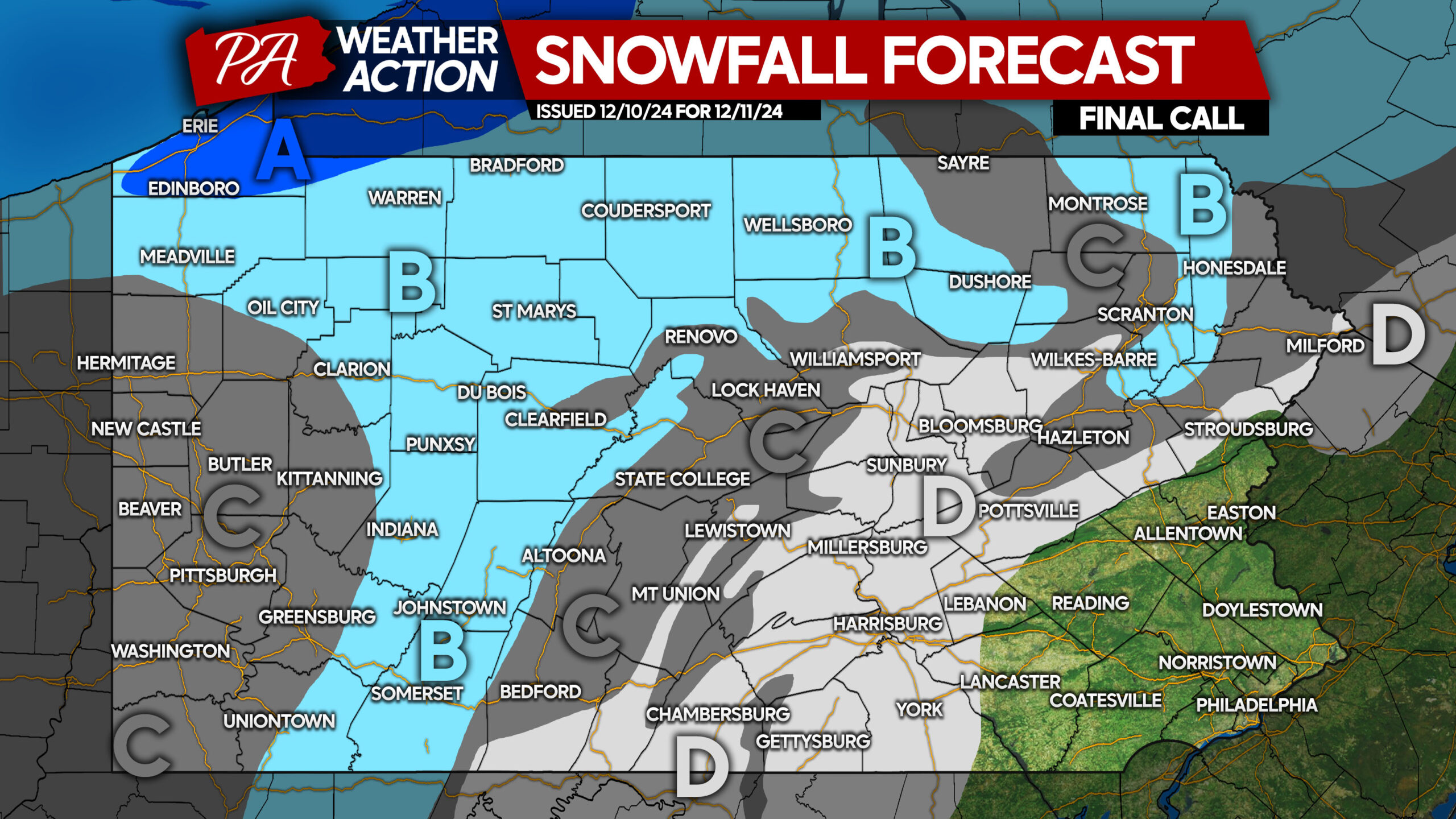
Area A: Snowfall accumulation of 3 – 5″ expected. Road conditions may be deteriorated after multiple hours of snowfall.
Area B: Snowfall accumulation of 1 – 3″ anticipated. Road conditions may become slushy after a few hours of moderate snow.
Area C: Snowfall accumulation of less than 1″ expected. No concerns for roadway impacts.
Area D: Snow showers possible at the tail end of the storm Wednesday, but no accumulations are expected.
You must be logged in to post a comment.