
It seems like it’s been an eternity since we last had a widespread severe thunderstorm threat, with the season assumed all but over at this point. Any rain is desperately needed to save our fall foliage season.
After a promising rainy start to summer and temperatures not too hot, the recent dry conditions may lead to a shorter foliage season and earlier peak. We will have a fall foliage forecast peak article soon!
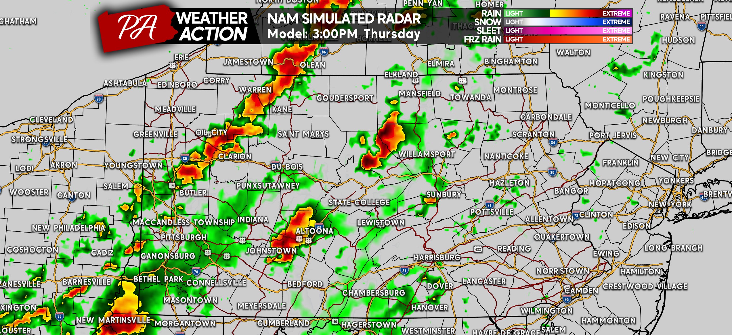
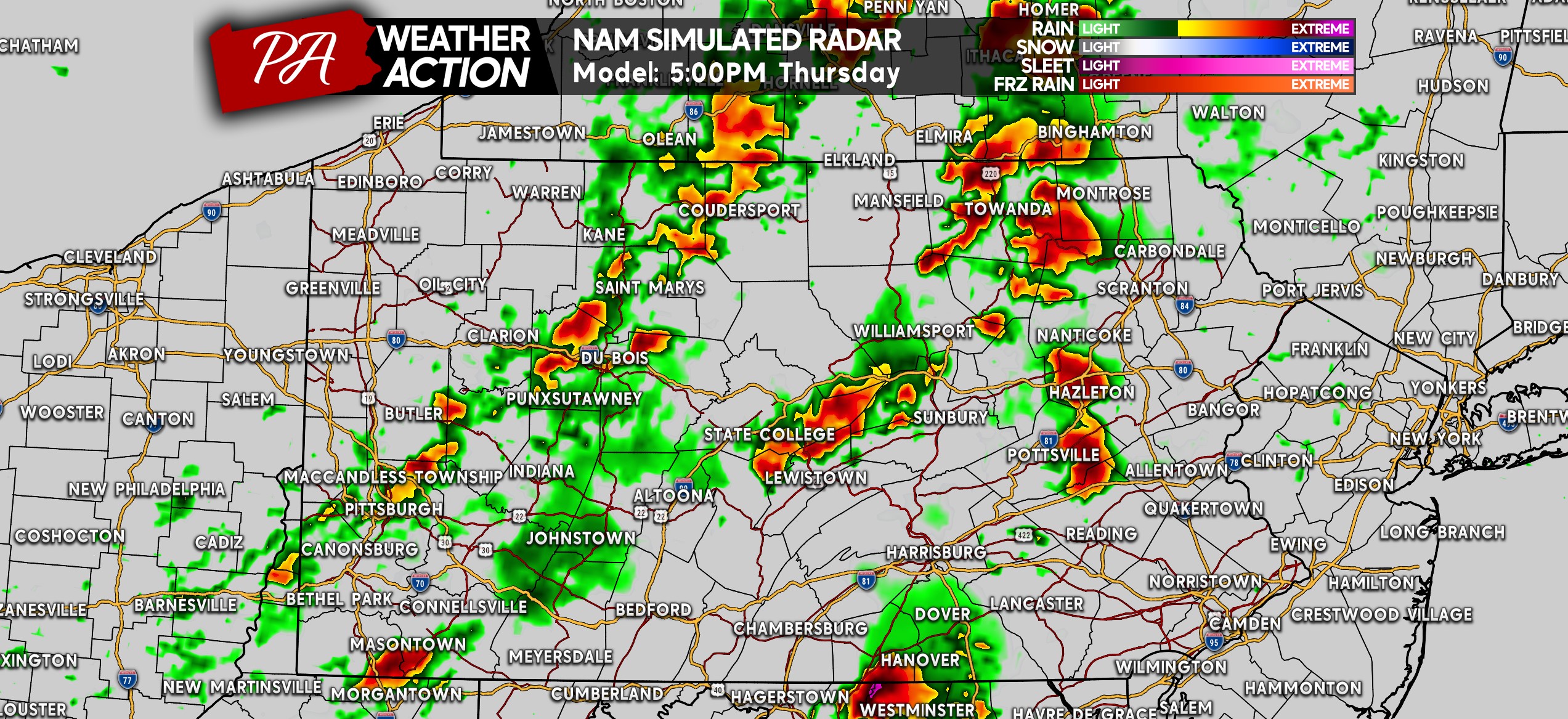
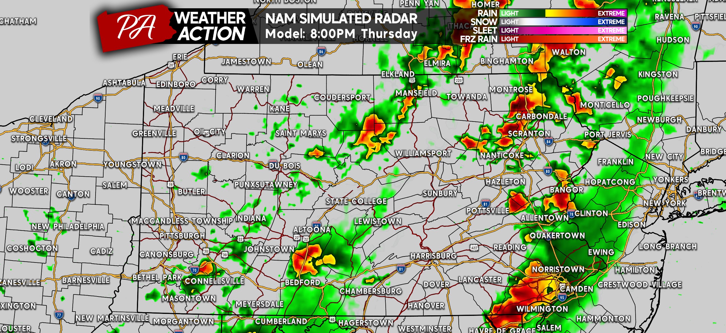
THURSDAY FUTURE RADAR STORM TIMING
A few storms will likely develop by mid-afternoon in Western and Central PA. Most will remain below severe criteria, with the storms in Central PA having the highest potential to produce damaging winds. Below is the Hi-Res NAM model for 3:00 PM Thursday.
As these scattered storms push into the Susquehanna Valley, they will enter the most conducive environment to produce gusty to locally damaging winds. Timing is also most favorable for this area of Central PA, so definitely keep an eye on the radar or minutely forecast if you have outdoor activities around 3-7 PM in Central PA!
As we (unfortunately) head past sunset by 8pm, storms will gradually dissipate as they reach Eastern PA. Still, some may be strong with an isolated severe storm. Here is future radar for 8:00 PM.
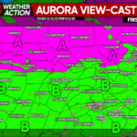
FINAL CALL SEVERE THUNDERSTORM FORECAST FOR THURSDAY 9/4
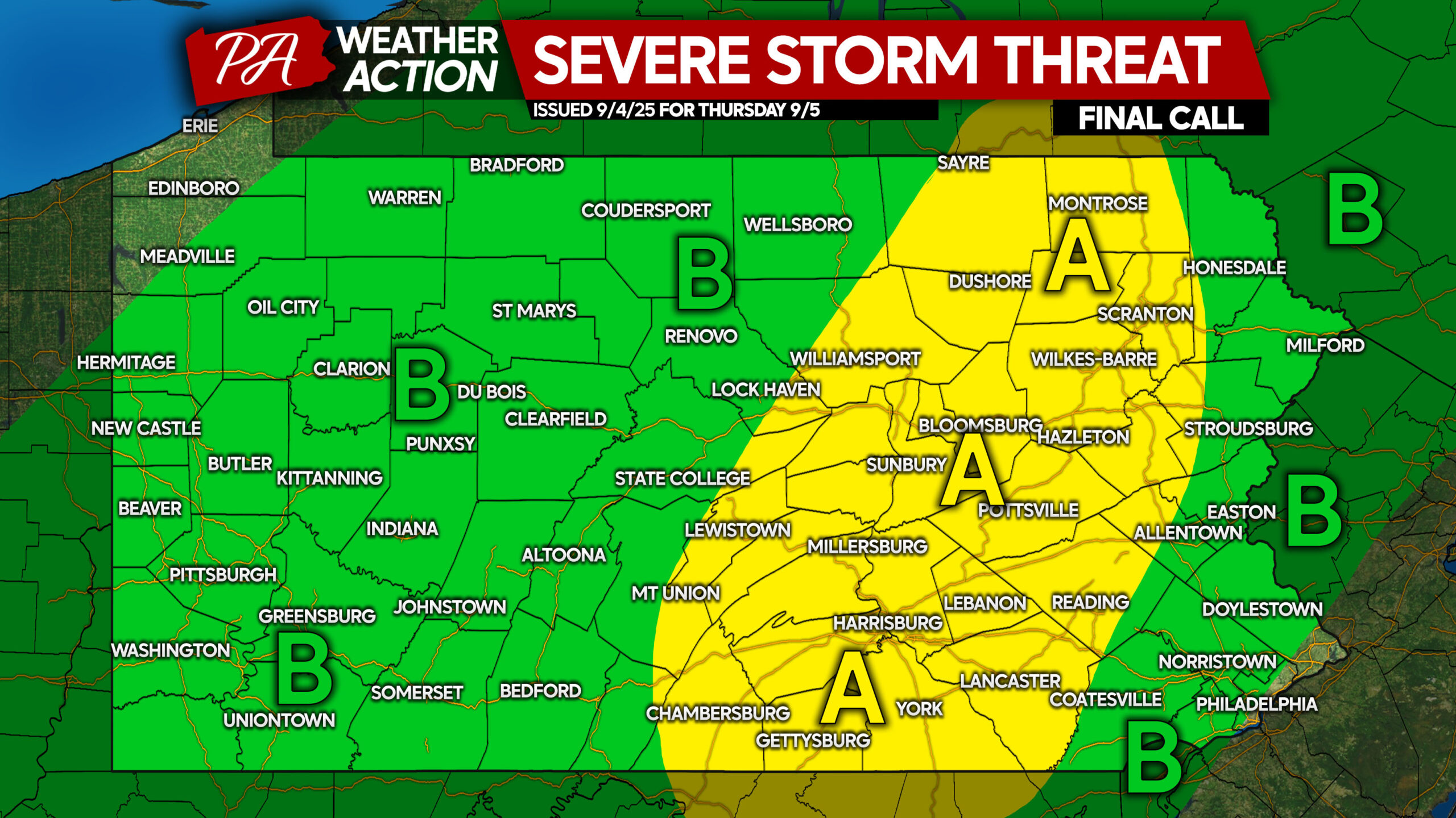
Area A: Scattered thunderstorms likely, with isolated storms going severe. Damaging winds are the main risk, with a slim chance for an isolated tornado.
Area B: Isolated thunderstorms likely, with isolated strong to severe storms possible. Localized gusty to damaging winds are the main concern within stronger storms.
Stay tuned for the latest warnings on our Facebook page!
Don’t forget to share this forecast with friends and family who may have outdoor plans Thursday!
You must be logged in to post a comment.