
In quintessential Pennsylvania late spring format, temperatures well into the 90s with sunny skies to start the week will likely be succeeded by dreary conditions this Memorial Day weekend.
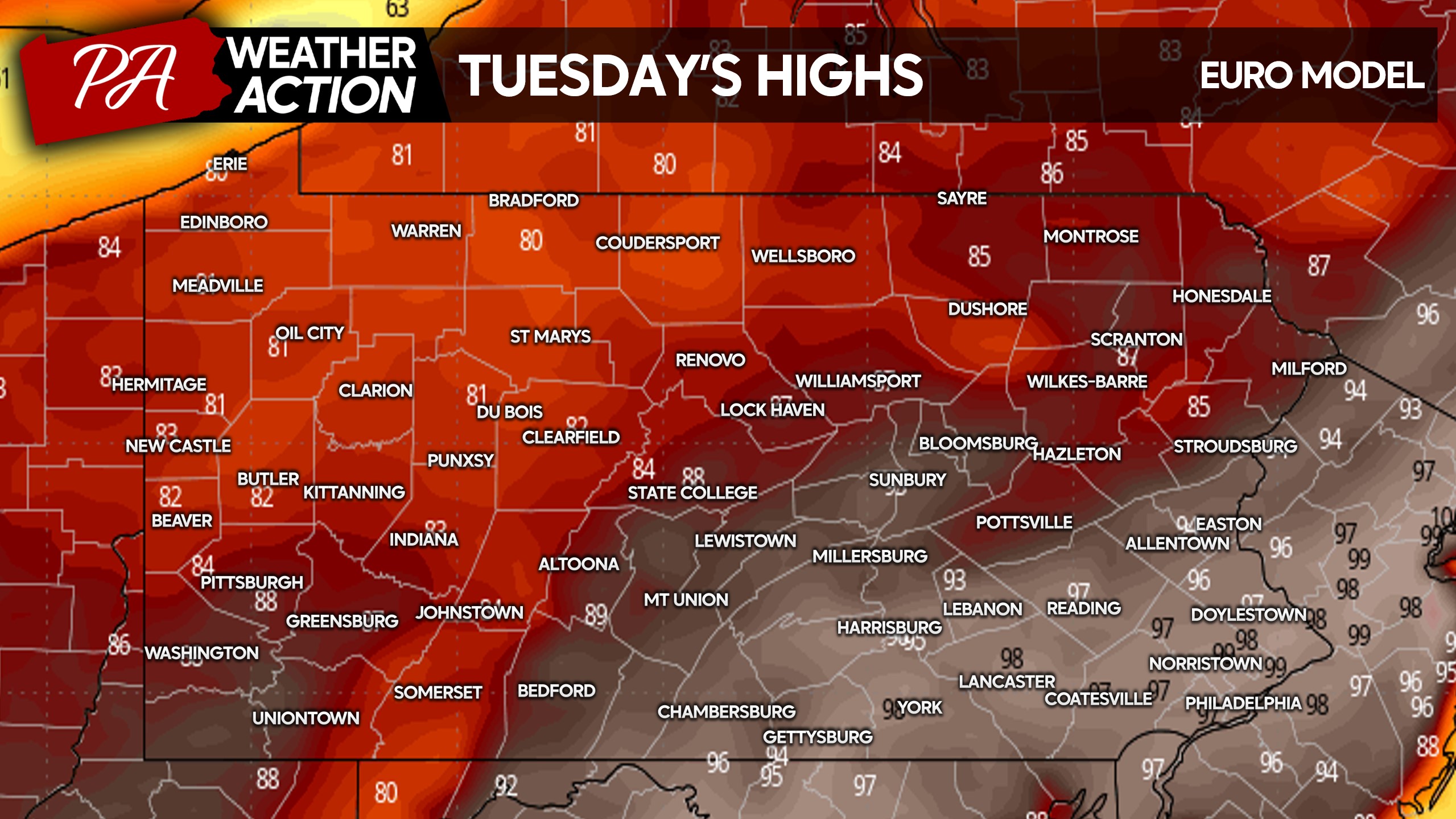
Tuesday will bring temperatures approaching 100° in Southeast and South Central PA, likely shattering Philadelphia’s record high on May 19th of 95°. It’s important to remember heat safety tips like not leaving any humans or animals in locked areas! Below are Tuesday’s highs.
Temperatures will come crashing down Wednesday as a strong cold front pushes through, perhaps preceded by rare strong to severe thunderstorms in a severe season that has seemingly yet to begin in PA.
Now onto the opposite side of this forecast – being the rain and cold temperatures. Not everywhere will be cold, but the more typical areas.
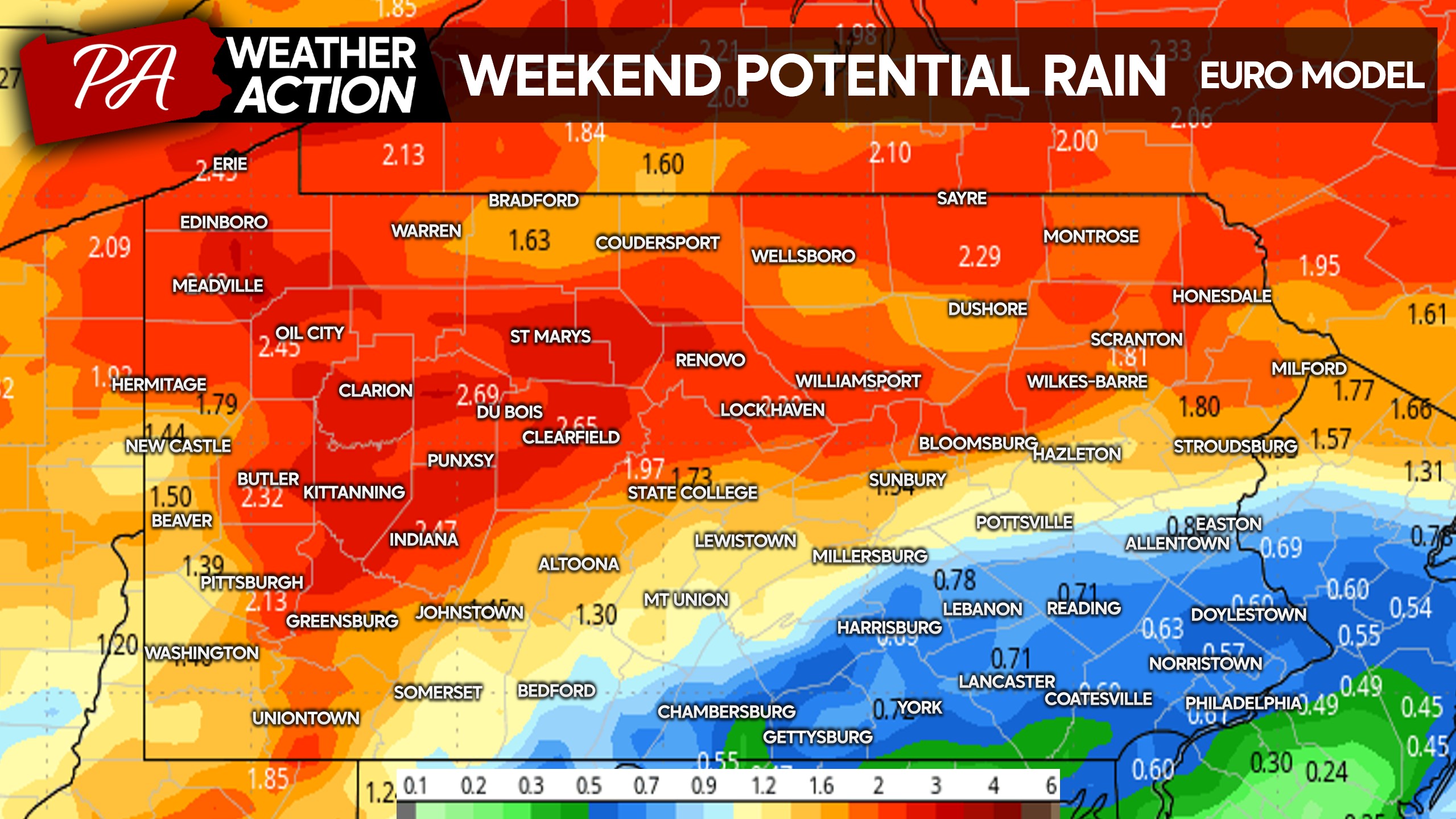
Persistent rain is currently forecast from Friday evening to Sunday morning across the state with the European model placing highest rainfall totals of 2″ or more across Northern PA.
With the rainy system looming overhead will come a complete reversal in temperature anomalies, going from 20-25° above normal to start this week to 20-25° normal to end.
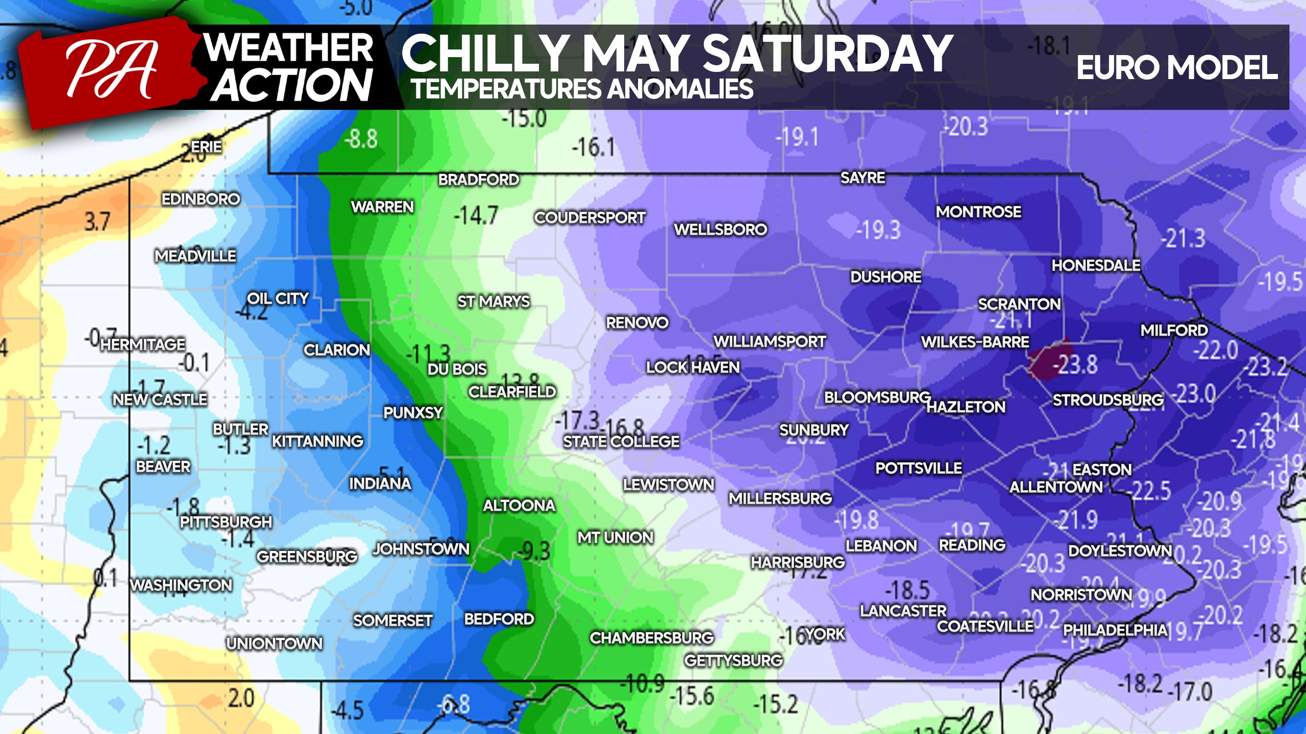
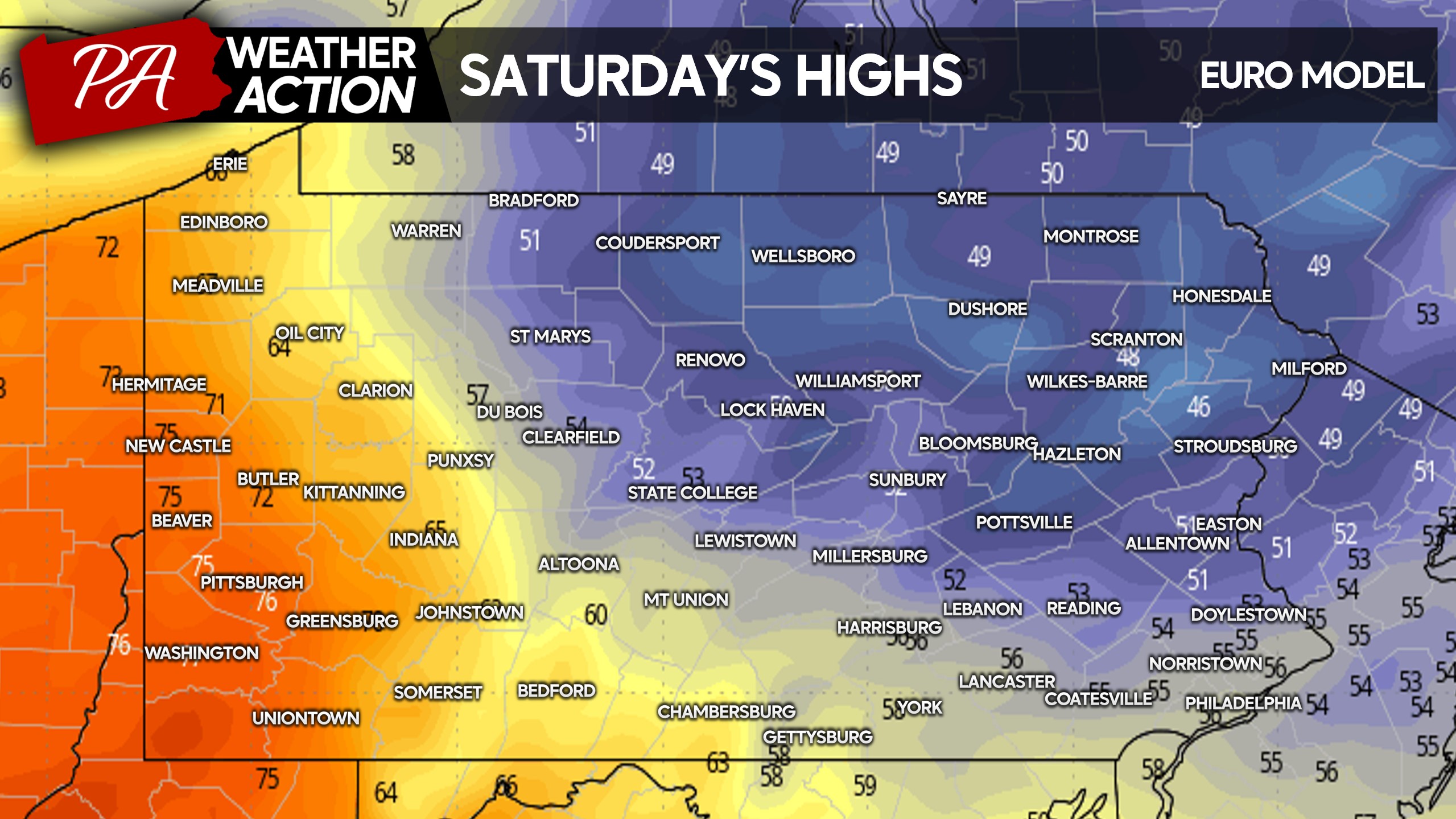
Practically, this looks like high temperatures in the 40s and 50s in the eastern-two thirds of Pennsylvania. Western PA looks to really luck out with very pleasant temperatures this weekend. Meanwhile in the Poconos, it’s going to be a toss another log on the wood stove type ordeal.
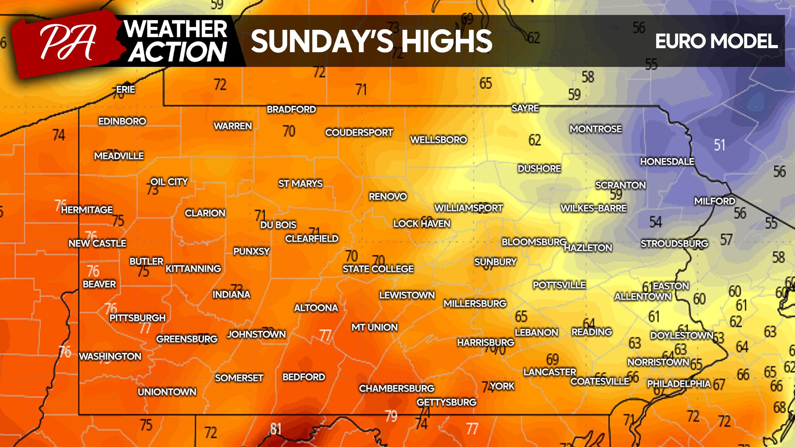
For some hope, Sunday is looking better with a mainly dry afternoon and temperatures in the 60s and 70s most places. The Poconos would be the typical area to see this sort of thing on Memorial Day Weekend. Below is a look at Sunday’s highs.
There’s still time for change, but models are in unfortunately strong agreement about this forecast. It’s going to be a roller coaster of a week!
Don’t forget to share the heat safety reminder with friends and family!
You must be logged in to post a comment.