
A messy winter storm will soon begin across the state. All areas will begin as rain Thursday morning, while extreme NWPA starts as snow. That snow line will gradually make its way south in NWPA (north of Hermitage), and in Northcentral PA (north of Route 6, west of Wellsboro), Thursday afternoon. Meanwhile, freezing rain is expected in SWPA within 20 miles of the Ohio border.
By Thursday evening, temperatures will begin to drop and the snow line will start to make its way south. This southward progression will continue through the night and into Friday morning. By the Friday morning, ice will become an issue in Southcentral PA to the Southern Poconos. This may cause school delays in those areas. All locations north and west of those areas can expect delays, if not closings.
To get a better idea of what you can expect, below is the latest Hi-Res NAM Future Radar.
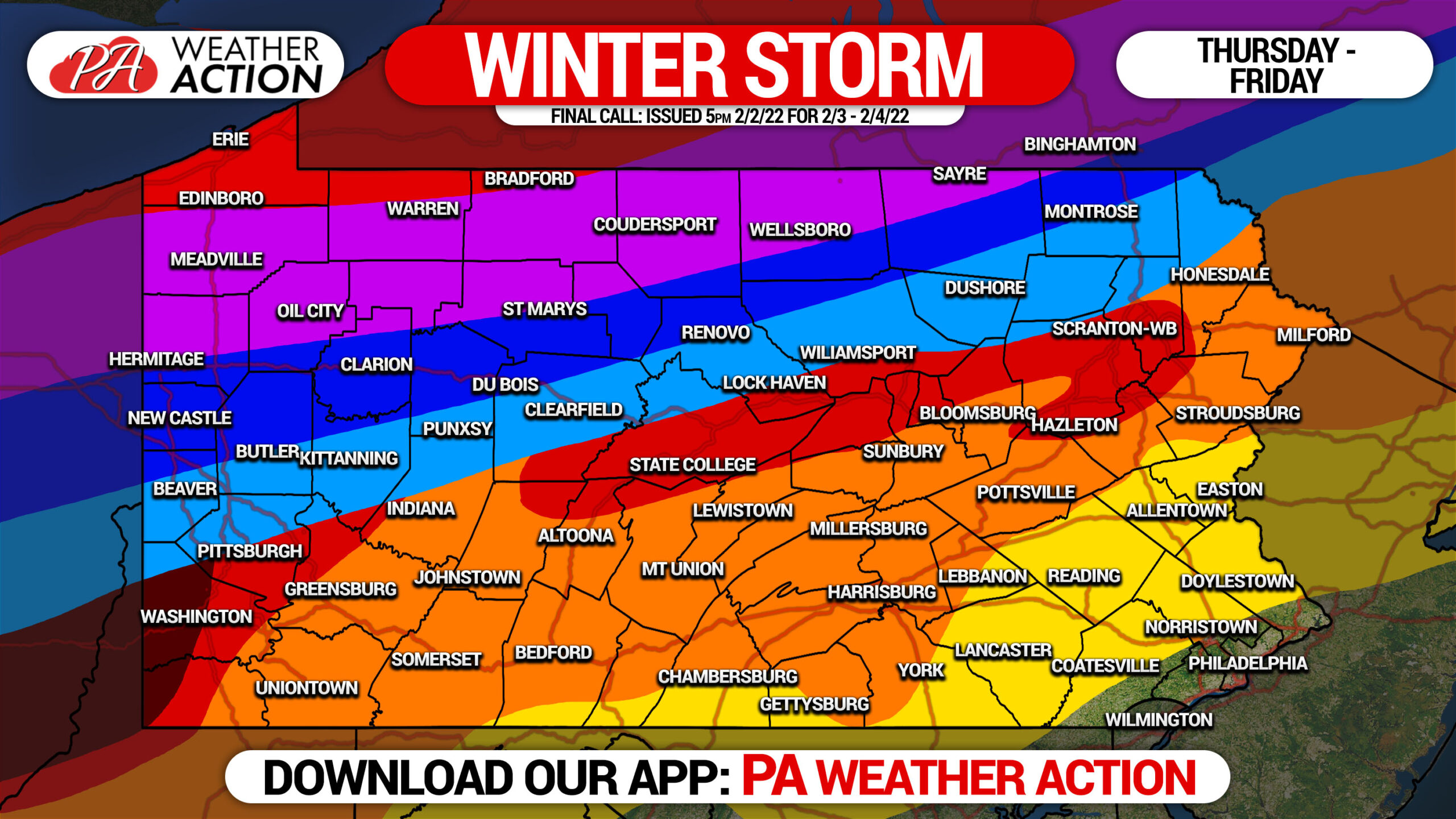
FINAL CALL SNOWFALL FORECAST THURS – FRI

Area A: Snowfall accumulation of 8 – 12″ expected.
Area B: Snowfall accumulation of 6 – 8″ expected.
Area C: Snowfall accumulation of 4 – 6″ expected.
Area D: Snowfall accumulation of 2 – 4″ expected.
Area E: Snowfall accumulation of 1 – 2″ expected.
FINAL CALL ICE FORECAST THURS – FRI
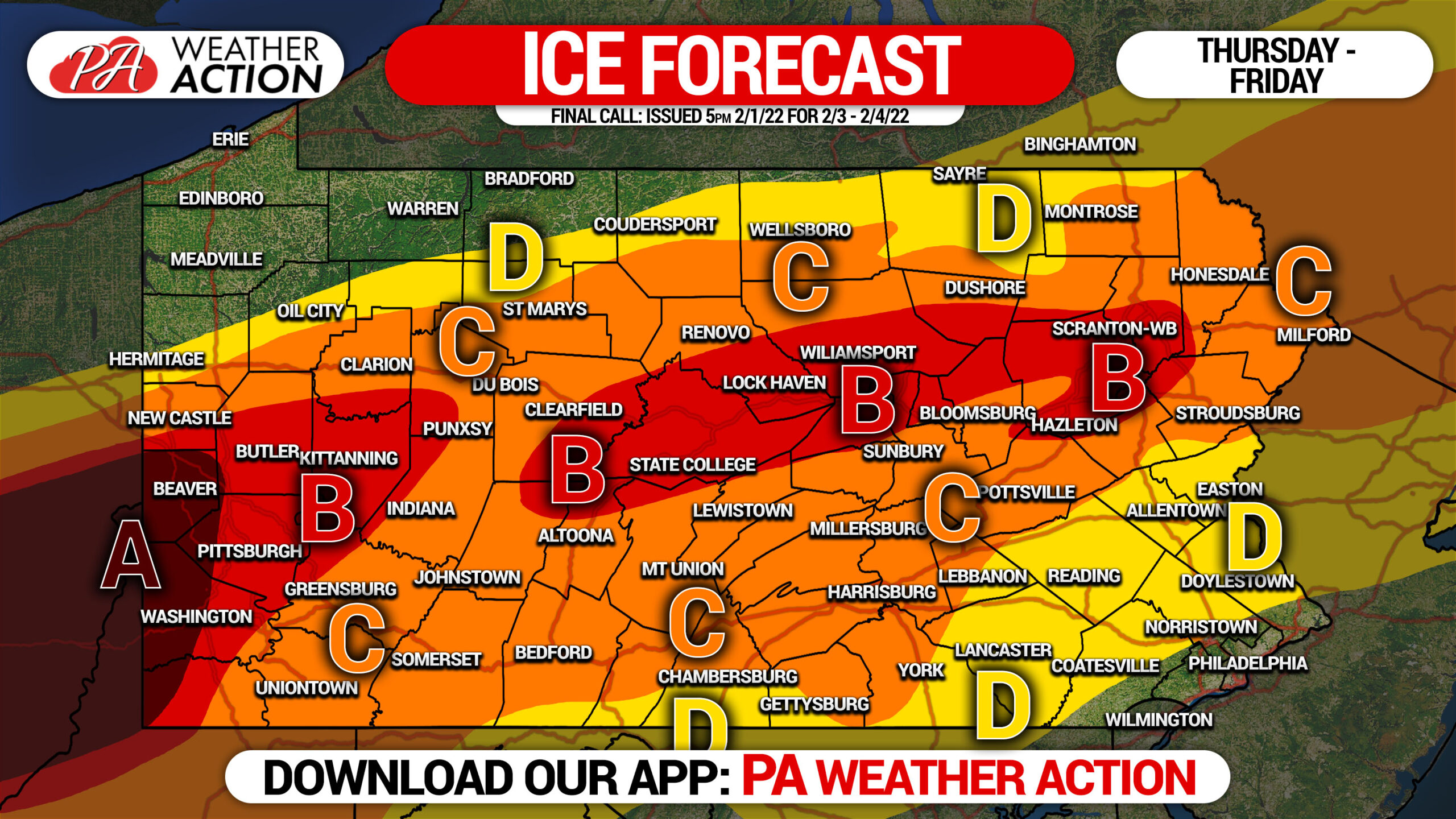
Area A: Ice accumulation of .30 – .40″ expected. Widespread power outages expected.
Area B: Ice accumulation of .20 – .30″ expected. Widespread power outages possible.
Area C: Ice accumulation of .10 – .20″ expected. Scattered power outages possible.
Area D: Ice accumulation of .01 – .10″ expected.
Ice should be taken seriously. Power may be out for a long duration, especially in rural areas. Take precautions for that possibility immediately.
Temperatures will not rise above freezing on Friday, which may result in roads becoming slick even in areas that receive mostly rain.
Be sure to share this important forecast with family and friends.
[social_warfare]
Track your latest alerts, hourly forecast, radar, road conditions, and much more with our free app on Apple & Android. Tap the banner below to get it.

You must be logged in to post a comment.