
OUR FINAL CALL FORECAST HAS BEEN ISSUED (POSTED 6 PM THURSDAY):
Final Call Forecast for Significant Snow & Ice Storm Thursday into Friday
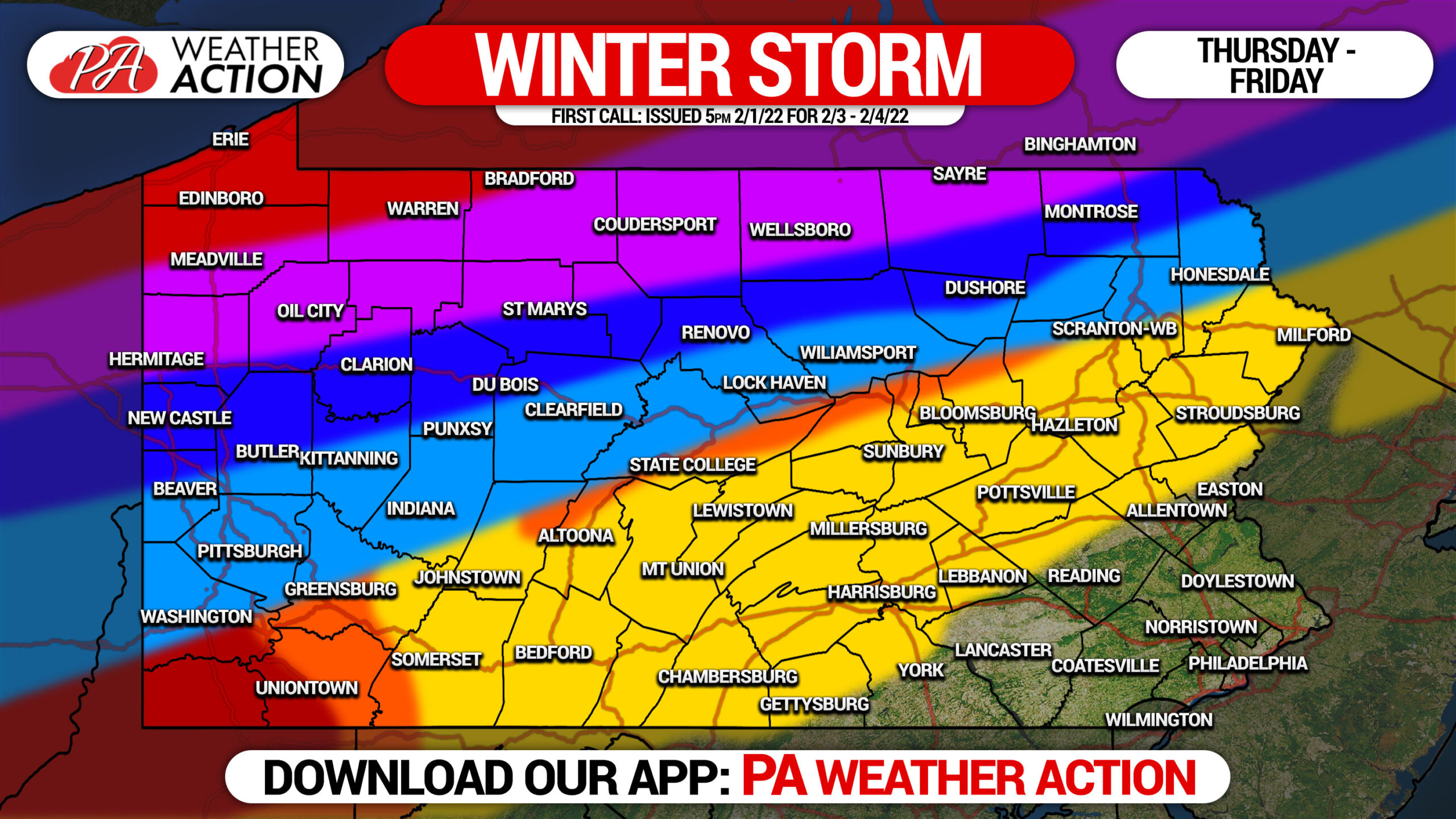
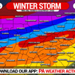
Yet another large winter storm is on the way, and once again we will be looking at a plethora of different impacts on Pennsylvania. However this storm will be much warmer than the last, due to trough tilting negative out west, sending this storm right into the Ohio Valley and our area. As a result, the heaviest snow will be in Northwest PA, with a wintry mess in between and rain southeast.
There is an ongoing battle on the models between two high pressure systems. One over the Northern Plains, another to our east. This continues to alter the storm track, which of course will make a big difference on what we see. As a result, this is a medium confidence forecast. Shifts to the north or south are very possible, but it’s unlikely the heaviest snow will be any farther south than I-80 regardless. Where the ice sets up will also depend on that. Be sure to return Wednesday afternoon for our final call forecast.
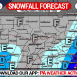
FIRST CALL SNOWFALL FORECAST FOR THURS – FRI
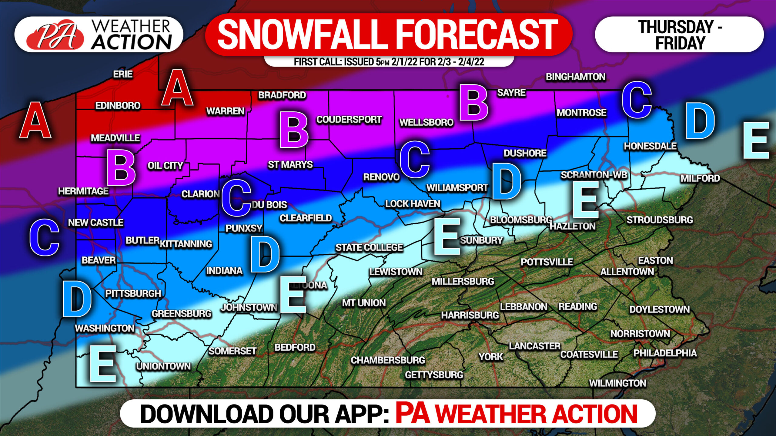
Area A: Snowfall accumulation of 8 – 14″ expected.
Area B: Snowfall accumulation of 5 – 8″ expected.
Area C: Snowfall accumulation of 3 – 5″ expected.
Area D: Snowfall accumulation of 1 – 3″ expected.
Area E: Snowfall accumulation of less than 1″ expected.
FIRST CALL ICE FORECAST FOR THURS – FRI
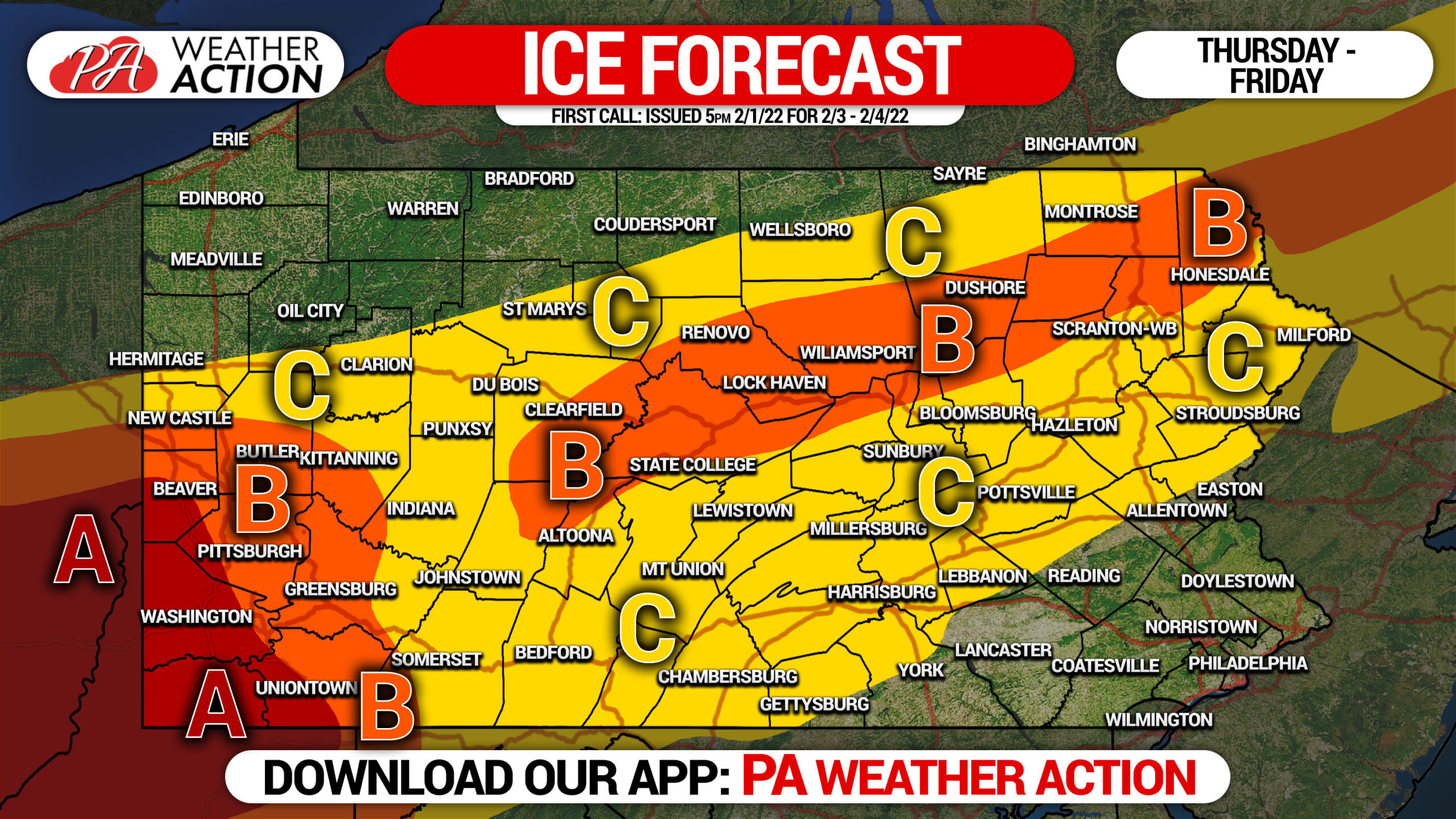
Area A: Ice accumulation of a quarter inch to half inch expected. Scattered power outages expected.
Area B: Ice accumulation of a tenth inch to a quarter inch expected. Scattered power outages possible.
Area C: Ice accumulation of a hundredth inch to a tenth inch expected.
This is not a high confidence forecast yet, and adjustments will probably be needed in tomorrow’s final call forecast.
[social_warfare]
You can track our latest articles, hourly forecasts, road conditions and more with our app on Apple & Android. Tap the banner below to get it!
You must be logged in to post a comment.