
While temperatures are warming up this week, we are still in the heart of winter and colder areas of PA will find a way to see wintry precipitation. Freezing rain is the primary concern this time around, and high elevations are most at risk for ice accrual.
We are unable to do timing charts for this event, as it will come in the form of three different waves of precipitation over a 36 hour period. The first, and most notable round of hazardous weather will push into the northern half of the state from west to east between 3 – 6 AM Tuesday, continuing through late Tuesday morning. There is the possibility that areas near and north of Route 6 may change to snow, which is much more ideal than ice.
That exits, and then another round of precipitation arrives late Tuesday evening, in the form of plain rain in most areas except in elevations above around 1600′, where temperatures will be below freezing and freezing rain is likely into the early hours of Wednesday morning before moving out.
Finally, another, more expansive wave of rain moves in late Wednesday morning continuing all the way through Wednesday evening. This will be plain rain except in areas above 2000′ elevation.
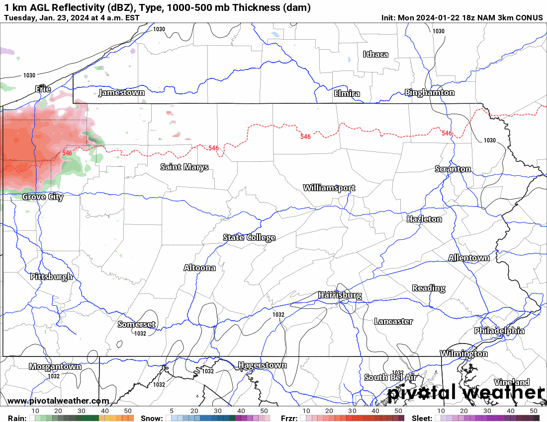
Below is Hi-Res NAM Future Simulated Radar for the entire event. The timestamp is in the top left, and the color key is at the bottom. Frzr means freezing rain!
TOTAL ICE ACCRUAL TUESDAY – WEDNESDAY
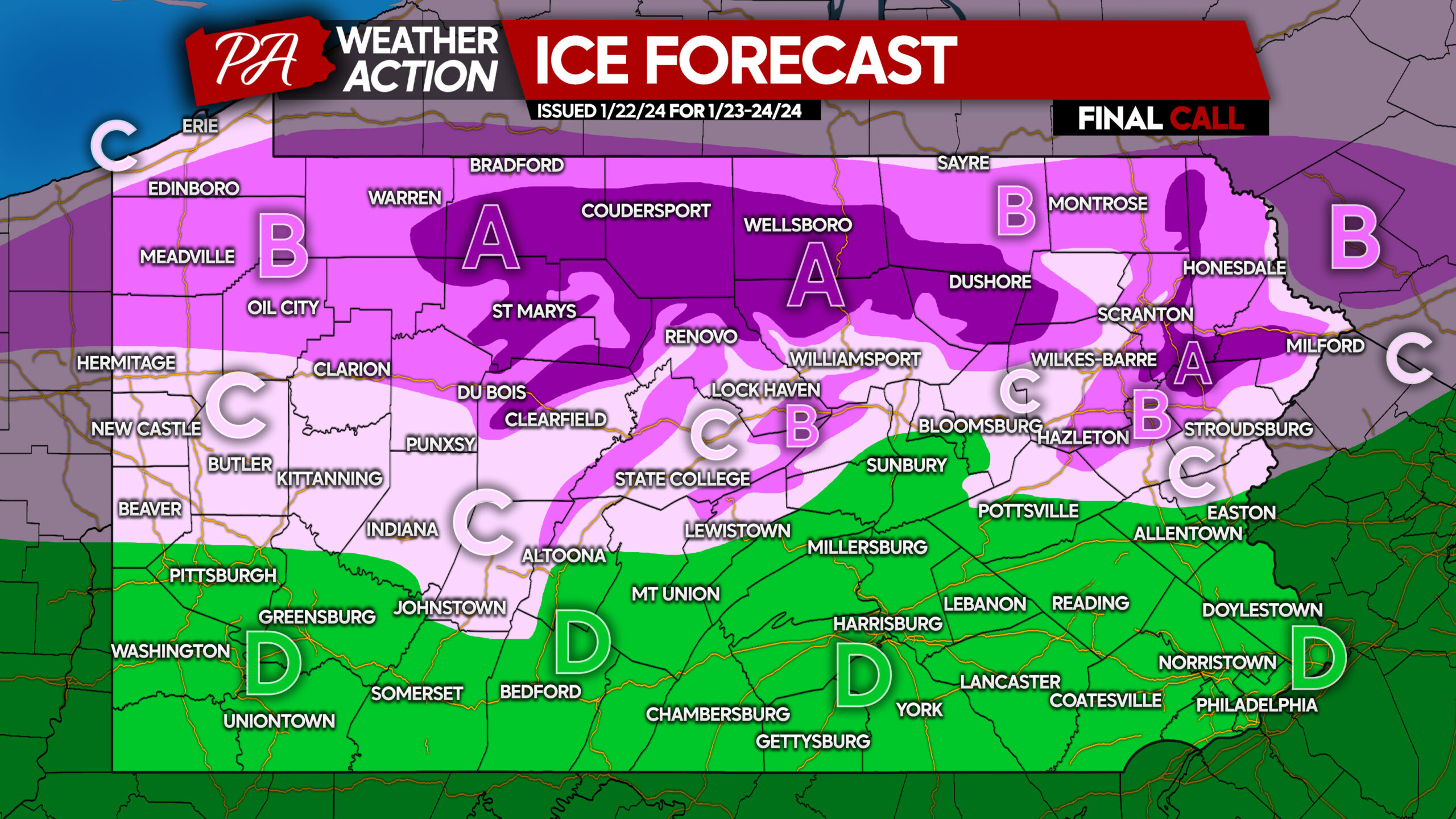
Area A: Ice accrual of .10 – .15″ expected. Hazardous travel certain due to icy roadways. View impact timing above.
Area B: Ice accrual of .05 – .10″ expected. Hazardous travel likely due to icy roadways especially on ridges. View impact timing above.
Area C: Ice accrual of .01 – .05″ possible. Hazardous travel likely if freezing rain occurs, view impact timing above.
Area D: Plain rain expected, with no ice concerns!
If surfaces are slippery, take it very slow when driving. We’ve already seen hundreds of accidents in the Midwest due to this ice, and we advise not driving on icy roads unless you must. Ice is much more hazardous than snow.
Be sure to share this forecast & info with friends and family!
We have had millions of Pennsylvanians utilize our forecasts this month! However, the majority of you reading this do not follow us. If you use Facebook, that’s where we post our updates immediately! Please consider following us on Facebook below!

You must be logged in to post a comment.