
As winter seems to be on its way out with the reality of 70s and 7pm sunsets being six days away, we have one last wintry threat to discuss. This likely won’t be it for the season especially across the Appalachians, as something will probably hit in late March.
But we are truly in for a treat the end of this week into next week in what will feel like a massive reversal for those with SAD especially. High temperatures well into the 70s, a few thunderstorms, and sunsets around 7pm by this Sunday.
Back to the topic at hand. Freezing rain is likely in the Appalachians by pre-dawn hours of Tuesday. Starting around 2am Tuesday in the Laurel Highlands, reaching I-80 in the western half of PA by 5:00 AM as shown below on the Hi-Res NAM.
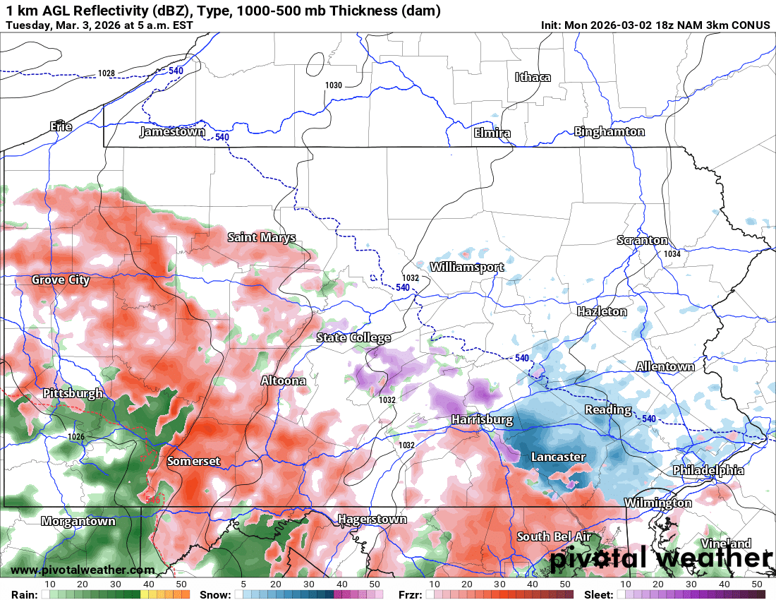
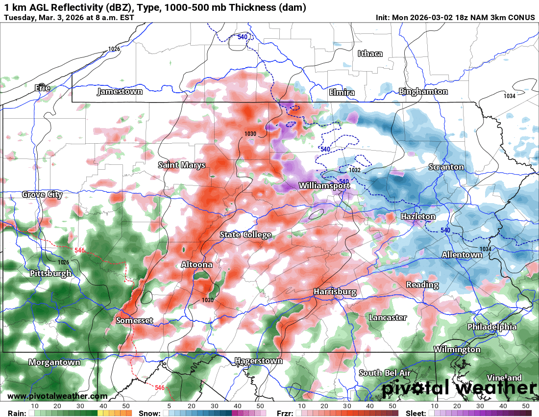
This freezing rain is coming at a horrible time for the Tuesday morning commute, which may result in school delays due to slippery travel in many areas between 6-9am. By 8:00 AM, freezing rain is likely everywhere in Central PA along and north of the PA Turnpike. Elevations above 1000′ feet will hold onto it longer as well.
There is the chance it could start as snow in Northeast PA, which would be rather unimpactful and more ideal.
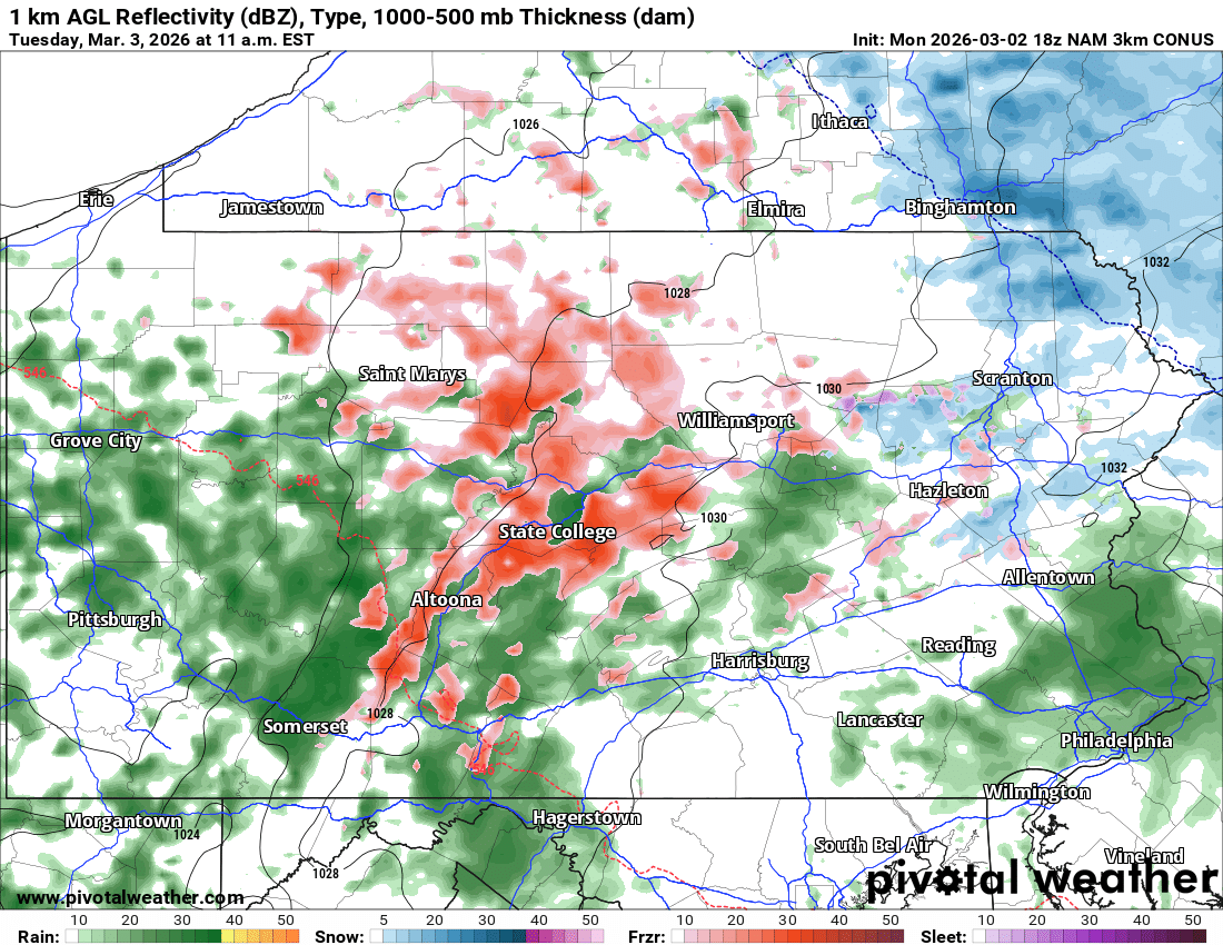
And by 11:00 AM Tuesday, temperatures will rise above freezing below 1800′ elevation in Central and Northwest PA. This will mean plain rain that doesn’t freeze on contact. However on the mountaintops, freezing rain will continue into early Tuesday afternoon.
FINAL CALL FREEZING RAIN FORECAST FOR TUESDAY

Area A: Ice accumulation of 0.2 – 0.3″ expected. Very hazardous road conditions will be a risk Tuesday morning and early afternoon.
Area B: Ice accumulation of 0.1 – 0.2″ expected. Treacherous road conditions are likely Tuesday morning.
Area C: Ice accumulation of 0.01 – 0.1″ expected. Road conditions may be slippery especially around the Tuesday morning commute.
School delays are possible in all areas due to slippery conditions. Cancellations are possible in districts with ridgetops.
Be sure to share this forecast with family and friends below! Stay safe!
You must be logged in to post a comment.