Scattered heavy rain has already begun in parts of the state as this 24-36 hour deluge is just about to get going. Moderate to major flooding is now projected for many creeks in southern PA, and we will be monitoring the larger rivers for rises into minor flood stage. In addition, many of the usual roads you take to go to work or the store may be underwater. To identify flood zones in your area, view this tool >>> Pennsylvania Flood Plain Map
Moderate rain, with pockets of heavy rain, will continue Tuesday night before widespread heavy rain pushes in Wednesday morning along I-81 over to the Laurel Highlands. This is when we expect to see rainfall rates of 1″ to even 2″ per hour locally. Heavy rain will continue into Wednesday afternoon in central PA before shifting into much of eastern PA by Wednesday evening. Finally by Thursday morning, the rain will abruptly end from west to east. Below is a future radar video that you can stop and start.
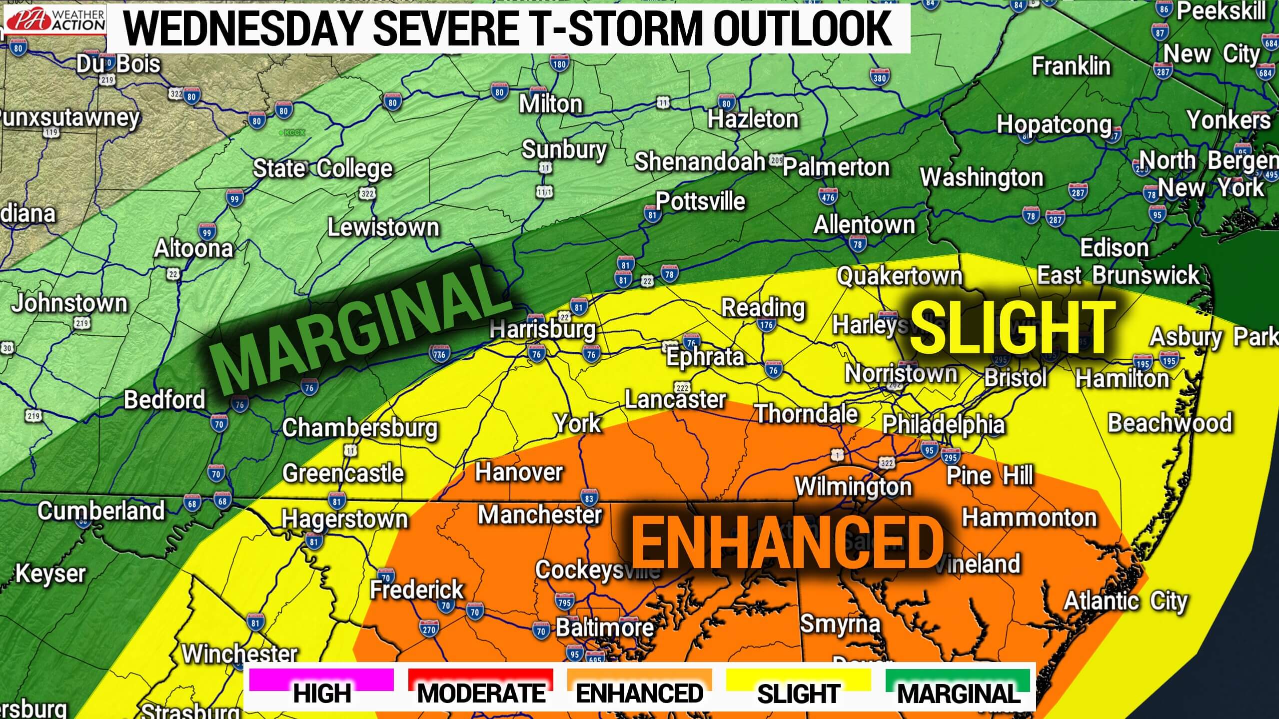
Due to the low pressure system now modeled to track a bit farther north, parts of southeast PA now have a tornado concern. The SPC has posted an Enhanced Risk for Wednesday, with a high 10% tornado risk in far SEPA.
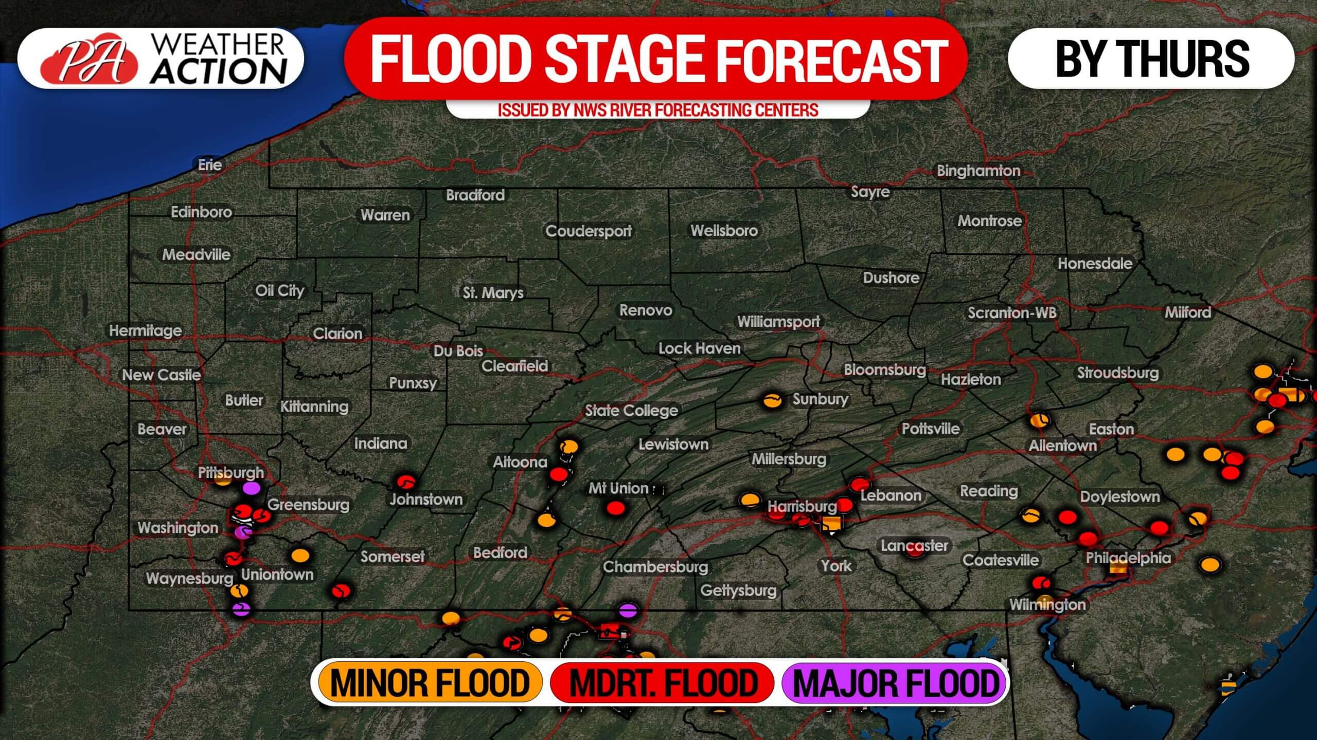
 CREEK AND RIVER FLOODING FORECAST
This map shows creeks and rivers that are expected to reach flood stage. Not that each dot represents a measuring location on a creek or river. If you live along that creek or river within 10 miles of the dot, this forecast applies to your location as well. For more details, visit this link >>> NWS River Forecasts Website
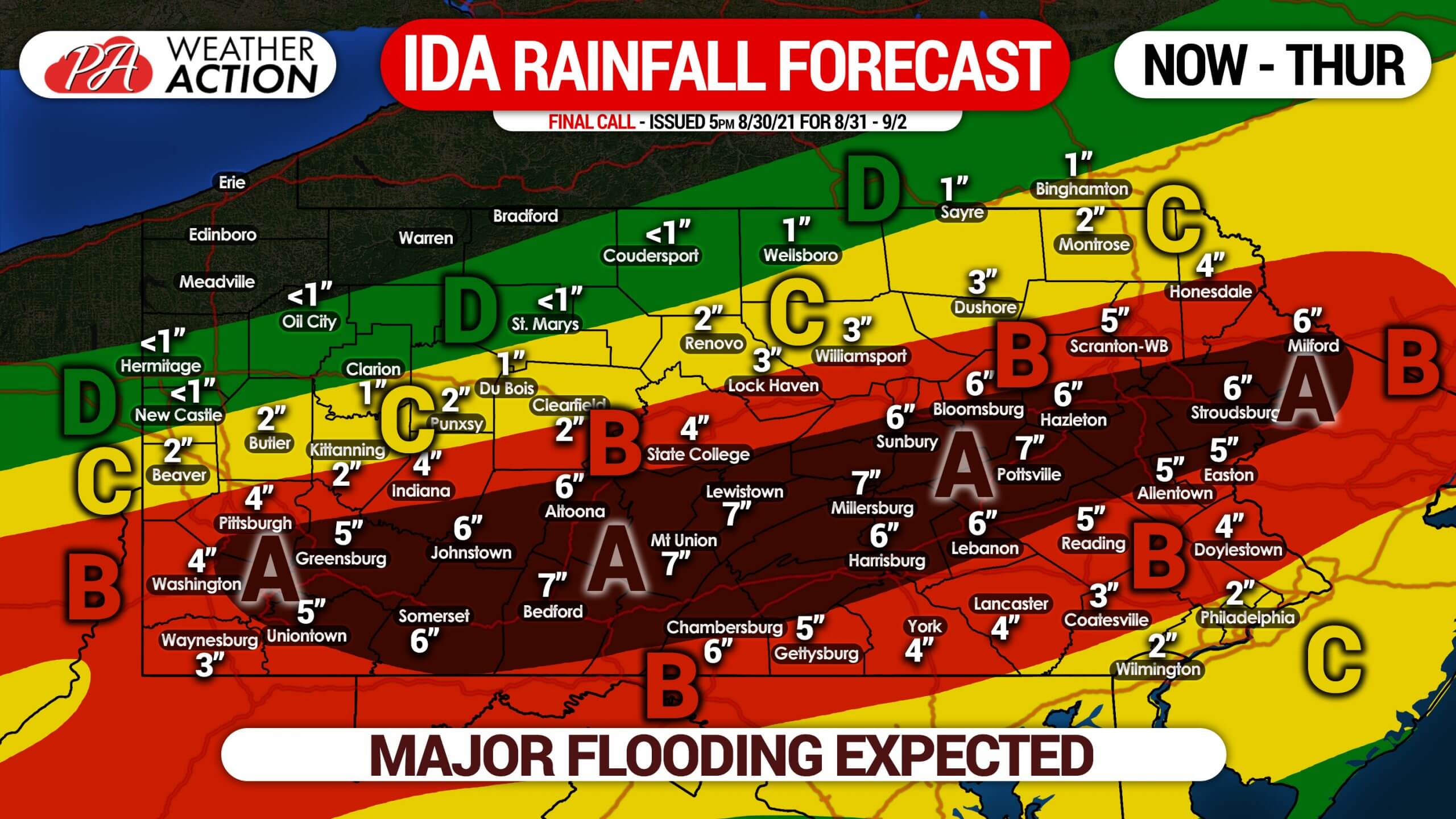
FINAL CALL RAINFALL FORECAST FOR NOW – THURSDAY AM
Area A: Rainfall totals of 5 – 8″ expected. Significant to major flooding expected in all areas with poor drainage and flood plains, take precautions immediately. SMany creeks are likely to flood, and large rivers may reach flood stage.
Area B: Rainfall totals of 3 – 5″ expected. Moderate to significant flooding is expected in areas with poor drainage and flood plains. Some creeks and streams may experience minor to moderate flooding. Large rivers may reach flood stage in the southern portion of this area.
Area C: Rainfall totals of 1 – 3″ expected. Minor to moderate flooding is expected in some areas with poor drainage and flood plains.
Area D: Rainfall totals of up to 1″ expected. Flooding is not a concern.
Have all your preparations made by Tuesday night in case you cannot get to work or the store. Find alternative routes that are not flooded. This is the type of flooding that may cause roads to completely wash out, meaning if you proceed through flood waters, there may be no road to drive on, and your vehicle will float.
Share this information with your family and friends, this will be a once in a decade flood.


You must be logged in to post a comment.