
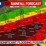
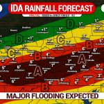
OUR FINAL CALL FORECAST HAS BEEN POSTED:
As Ida moves closer to the region, our confidence that widespread flooding will occur continues to increase. The state has not seen this kind of event since Tropical Storm Lee in 2011, and while it’s unlikely Ida will bring similar impacts as Lee, significant impacts are still expected. If you live in a flood-prone area in the South Central PA or the Laurel Highlands, now is the time to make preparations for flooding. This is not an article where you just skip to amounts. Other very important information such as expected creek and river flooding is included.
TIMING:
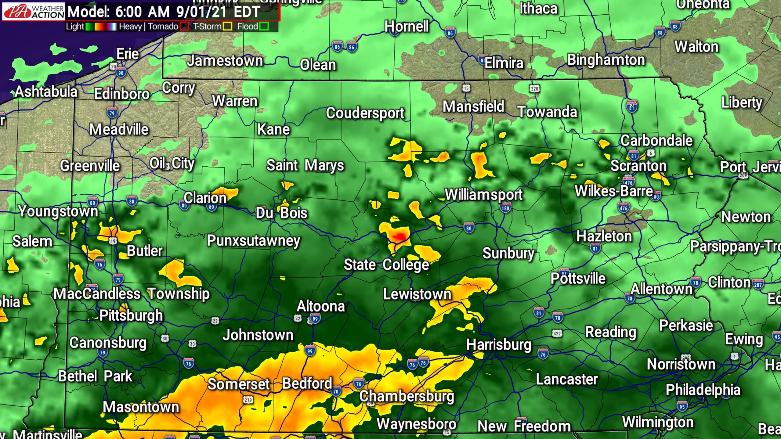
Moderate rain will push into much of southern PA from the southwest during Wednesday morning. No flooding is expected by Wednesday morning. Below is future radar for 6:00 AM Wednesday.
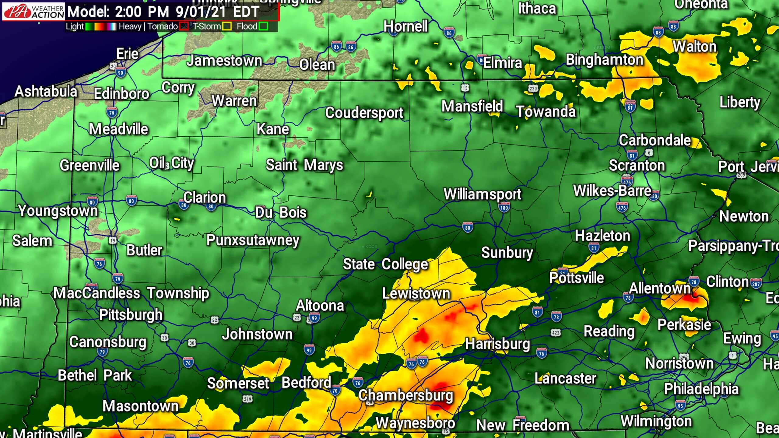
As we progress into Wednesday afternoon, rainfall rates will continue to increase in parts of Southern PA. Localized flooding in areas with poor drainage will begin to occur in South Central PA and the Laurel Highlands. Below is future radar for 2:00 PM Wednesday.
Heavy rain will then setup late Wednesday afternoon and early eveniung across much of central and eastern PA, south of I-80. Rates of 1″/hour are possible in heaviest rain bands, rapidly leading to widespread flooding in much of South Central and parts of Southeastern Pennsylvania. Below is future radar for 10:00 PM Wednesday.
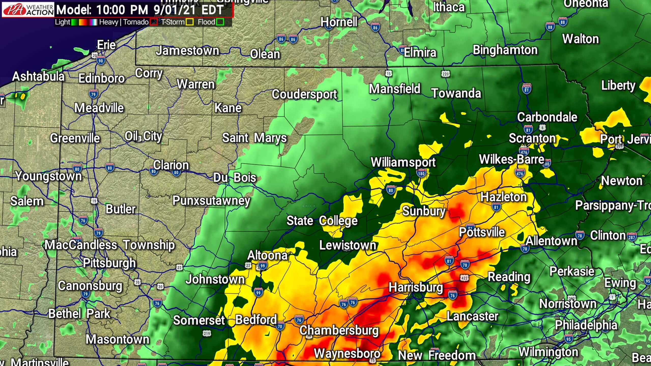
Wind gusts of 30 – 45 MPH are possible near the Maryland border Wednesday evening as the swath of very heavy rain slowly pushes east. Rain will end from west to east Thursday morning, but keep in-mind creeks and rivers will still be rising into Thursday.
RIVER & CREEK FLOOD INFORMATION
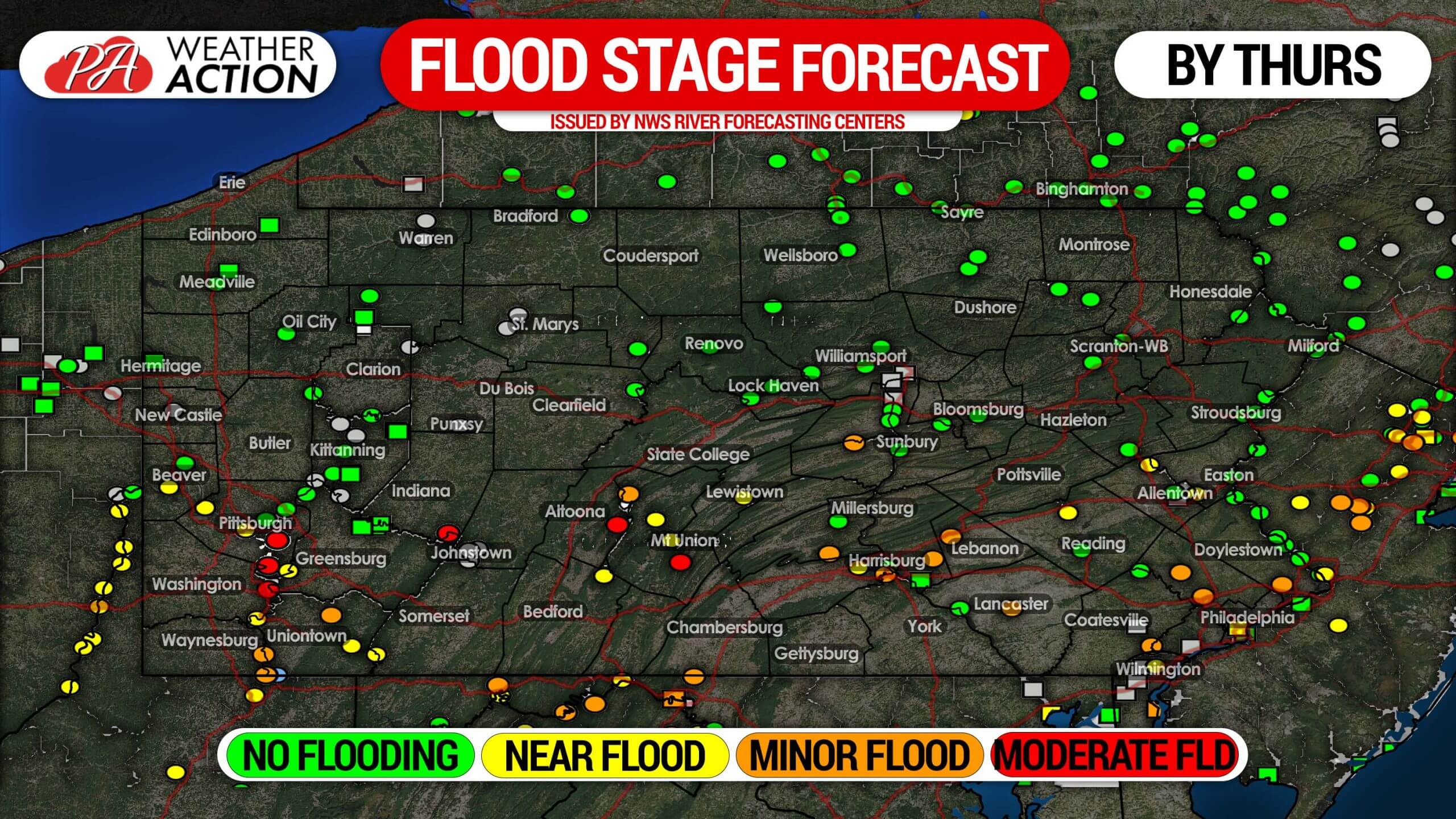
Each dot represents a measuring location along a creek or river, and this is a flood stage forecast. If you live along a creek or river, please take appropriate precautions based on the latest NWS forecast. For a more detailed forecast, visit the National Weather Service river flooding forecast website >>> NWS River Flooding Forecast Link
IDA RAINFALL FORECAST: SECOND CALL (WED-THUR)
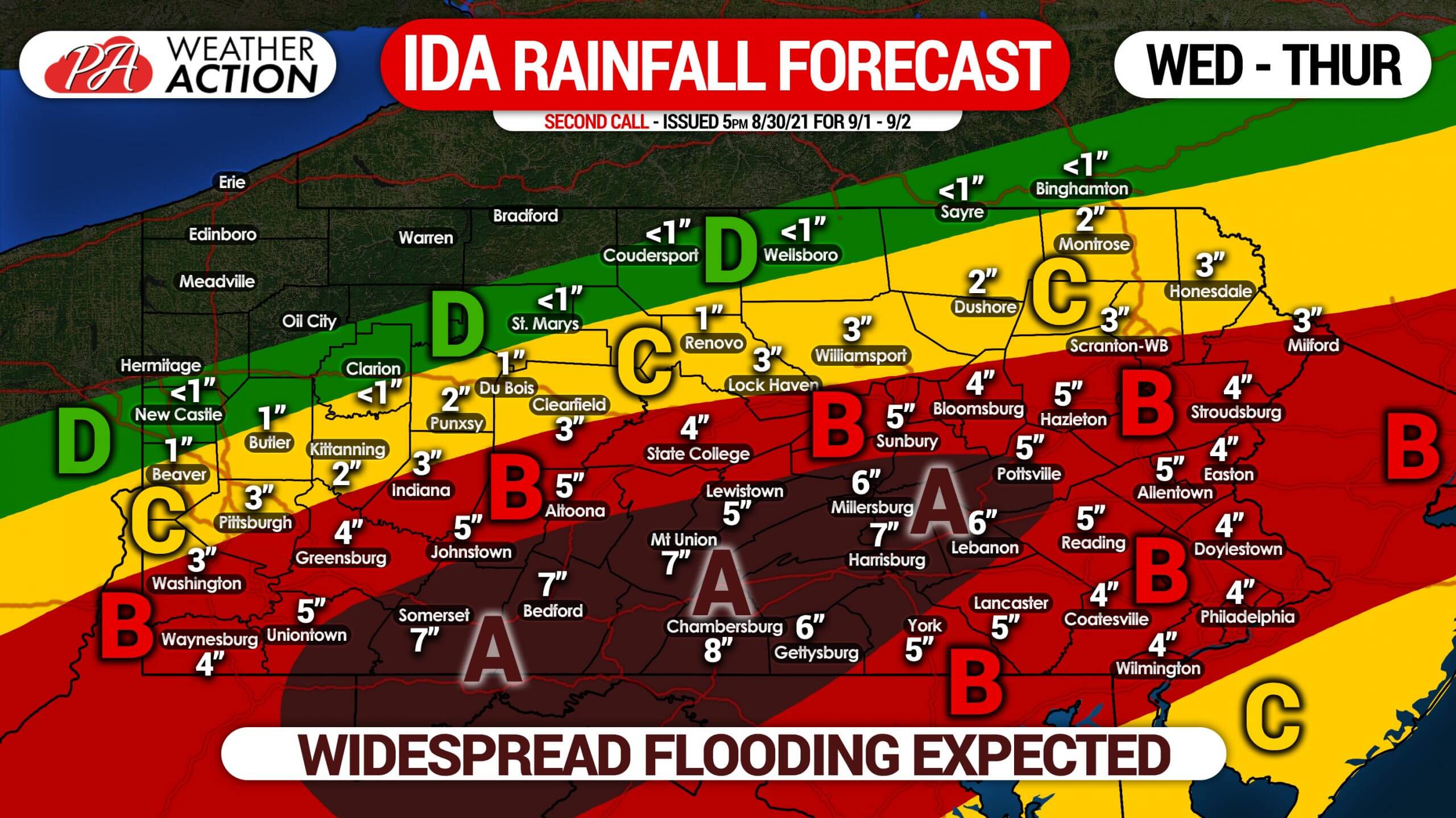
Area A: Rainfall totals of 5 – 8″ expected. Significant flooding expected in all areas with poor drainage, take precautions now. Some creeks are likely to flood, but large rivers are not projected to reach flood stage.
Area B: Rainfall totals of 3 – 5″ expected. Moderate flooding is expected in areas with poor drainage. Some creeks and streams may experience minor flooding, but river flooding is not currently projected.
Area C: Rainfall totals of 1 – 3″ expected. Flooding is possible in some areas with poor drainage.
Area D: Rainfall totals of up to 1″ expected. Flooding is not a concern.
Take precautions now if you live in an area that flood-prone area. Many roadways may become underwater. if you approach a flooded roadway, TURN AROUND. It’s not worth all the risks involved.
Please share this crucial information with your family and friends using the blue button below!
You must be logged in to post a comment.