Wednesday 3:30 PM Update:
Timing for storms today is going to be anytime between now until midnight in Central & Western PA, and 6 PM – 2 AM in Eastern PA.
We are seeing a cluster of hail-producing storms in the northern tier, and scattered storms developing in Central PA as of 3:30pm. But short range models bring the main line through this evening and the early overnight hours.
That line will be most probable to produce scattered damaging winds across a more widespread area.
After a slow start to severe storm season in most of Pennsylvania, a considerable threat exists Wednesday. A low pressure system will move near I-80 Wednesday, with hot and humid conditions with dew points in the low 70s creating a ripe environment for severe thunderstorms in the southern two-thirds of the state. Latest modeling indicates the potential for clusters of storms and a few bow echoes, which commonly produce damaging winds.
Damaging winds will be the primary concern Wednesday, so be sure to bring in anything in the garden or by the pool that may blow around in high winds. A few tornadoes are also possible, mainly in South Central and Southwest PA late Wednesday afternoon. Isolated large hail is also possible. Let’s get into timing.
WEDNESDAY THUNDERSTORM TIMING
Models are having a very hard time agreeing on timing for these storms. This future radar will not be perfect, and may not even be close to perfect. Sometimes what we are saying below may not line up with what the future radar has, and that is us factoring in other guidance.
By around 2-3 PM Wednesday, we expect scattered thunderstorms to begin developing across Western PA and in parts of Northern PA. The storms in Northern PA may be strong, but they’ll be embedded within heavy rain as the cold pool north of the low pressure will be sweeping in behind it as it moves east.
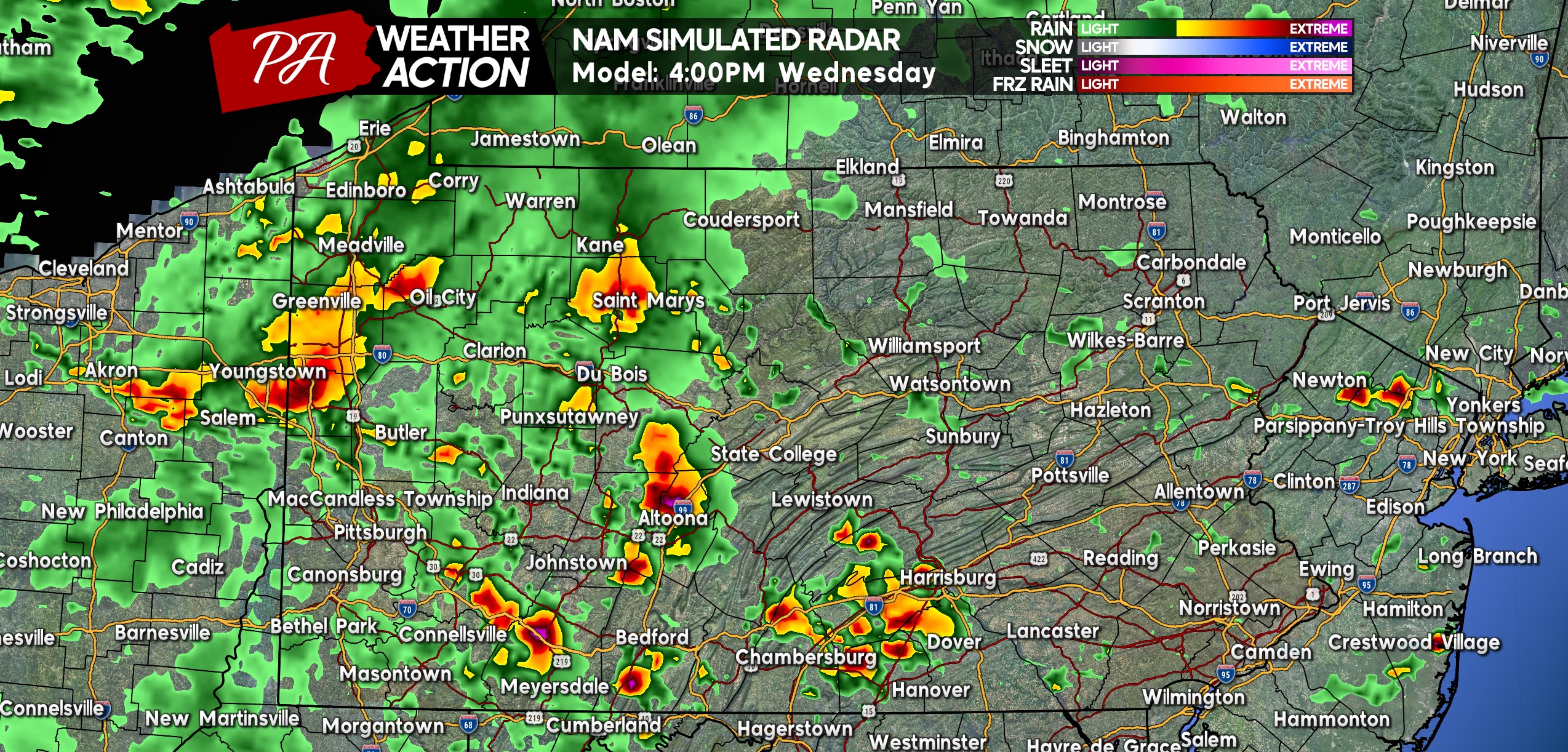
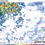
Southwest PA has been red hot in terms of tornadoes so far this year, so we can’t rule out one or two Wednesday afternoon in that area. Below is Hi-Res NAM Future Simulated Radar for 4:00 PM Wednesday. As you can see by then, some storms will likely be pushing into Central PA.
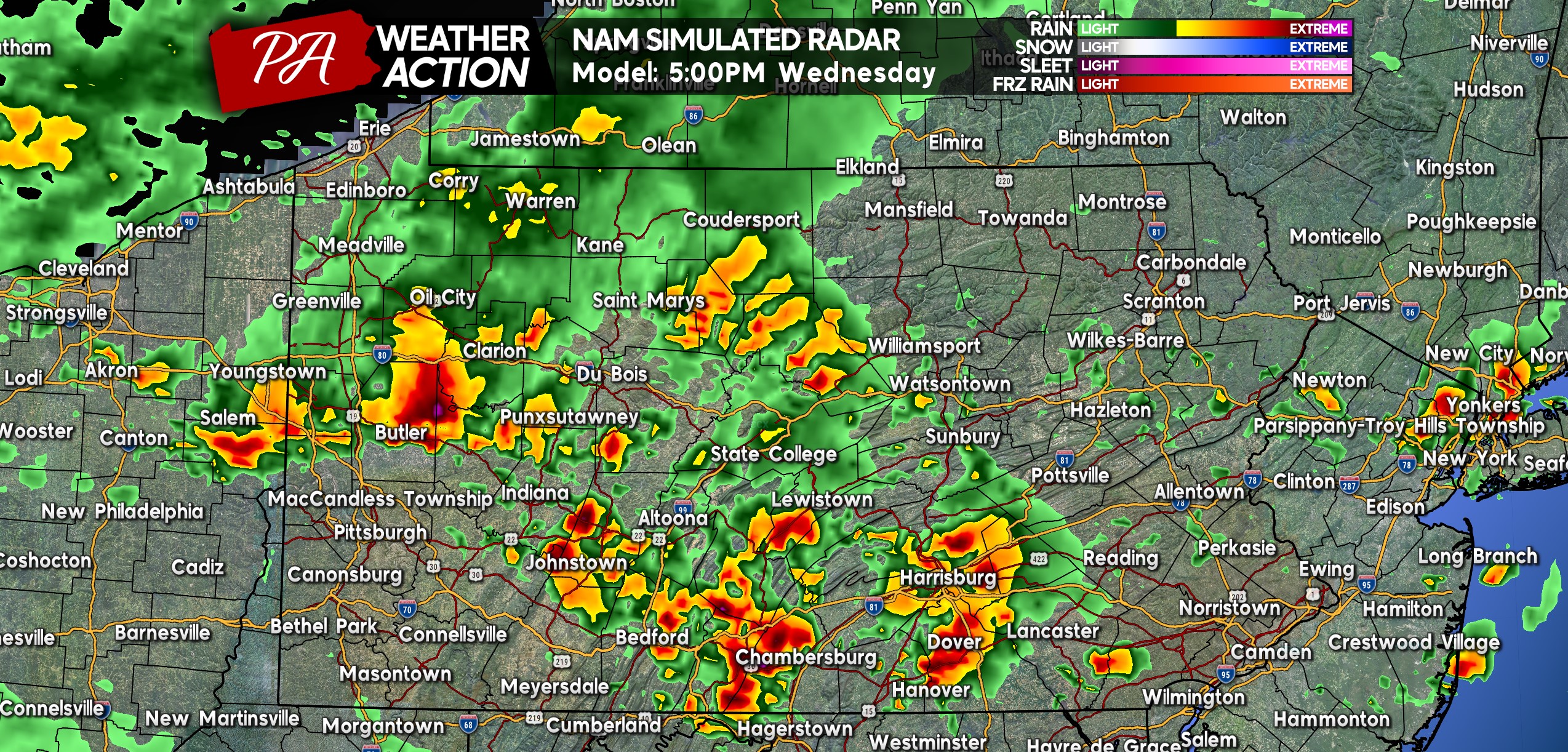
By 5:00 PM, we expect to have several severe-warned storms in Central and Western PA Pennsylvania as a few small bow echoes may form. South Central PA has the highest chance to see a small bow echo, which may come right around the Wednesday PM commute. So watch out for downed trees and even power lines if driving around. Here is future radar for 5:00 PM Wednesday.
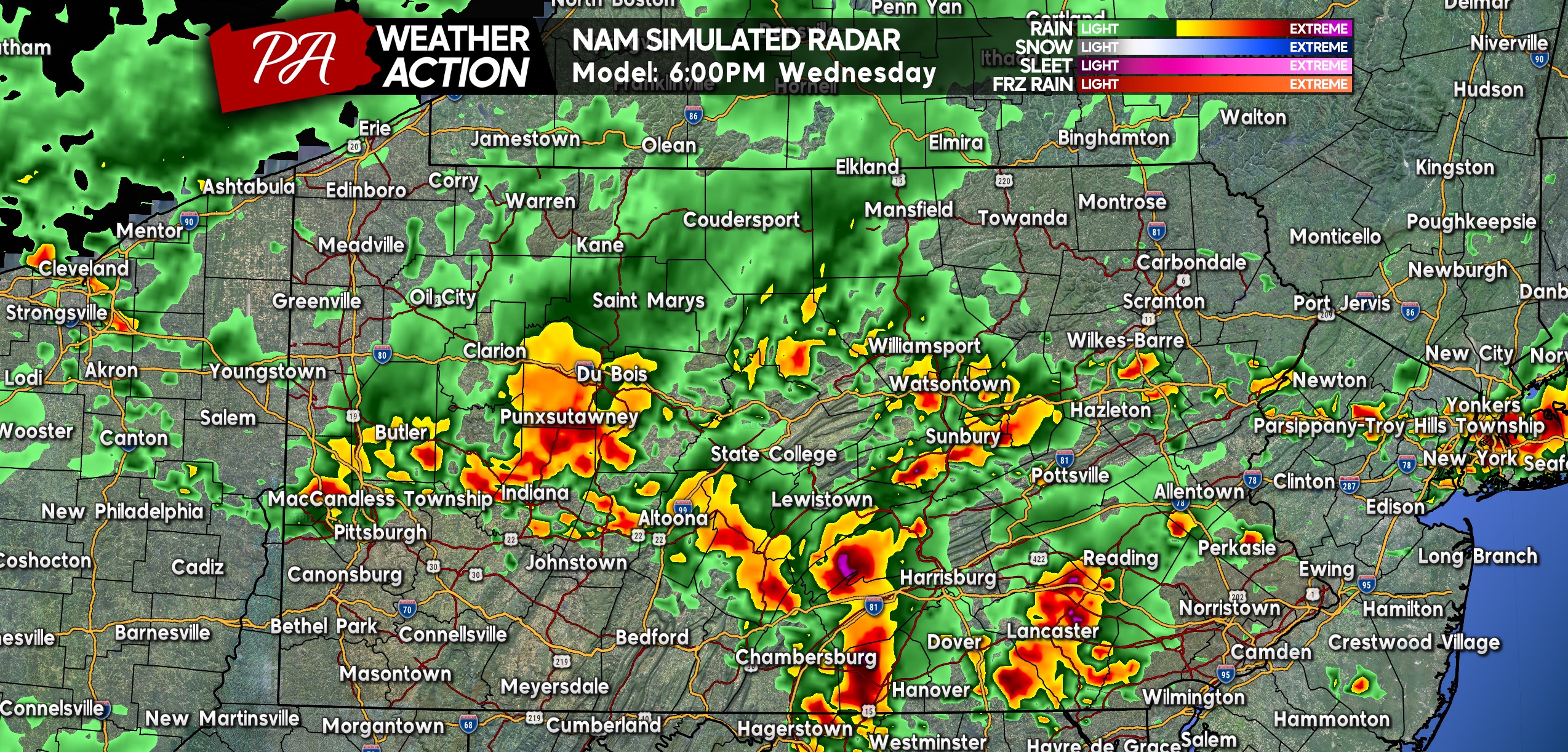
By 6:00 PM Wednesday, the focus for severe weather will shift a bit east. Areas like Lancaster, Reading, and Pottsville may be next in line for potent thunderstorms by this point. Scattered thunderstorms are also likely around dinnertime near between I-76 and I-80, some of which could be strong.
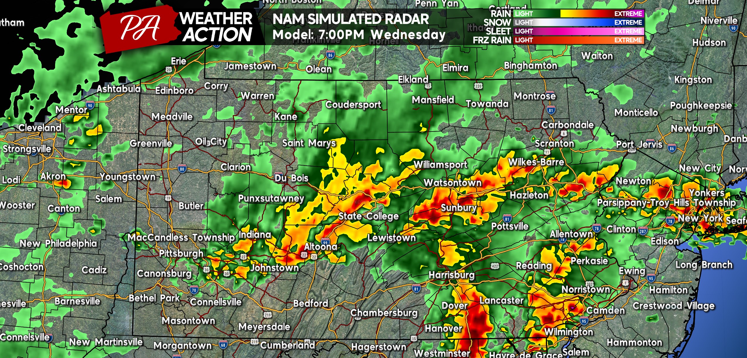
As we head into Wednesday evening, Southeast PA and potentially as far north as the Southern Poconos will be the focal point for severe weather. Timing for strong winds in SEPA looks to be between 6-9 PM Wednesday. Heavy rain is projected across the I-80 corridor around 7:00 PM as well, as modeled below.
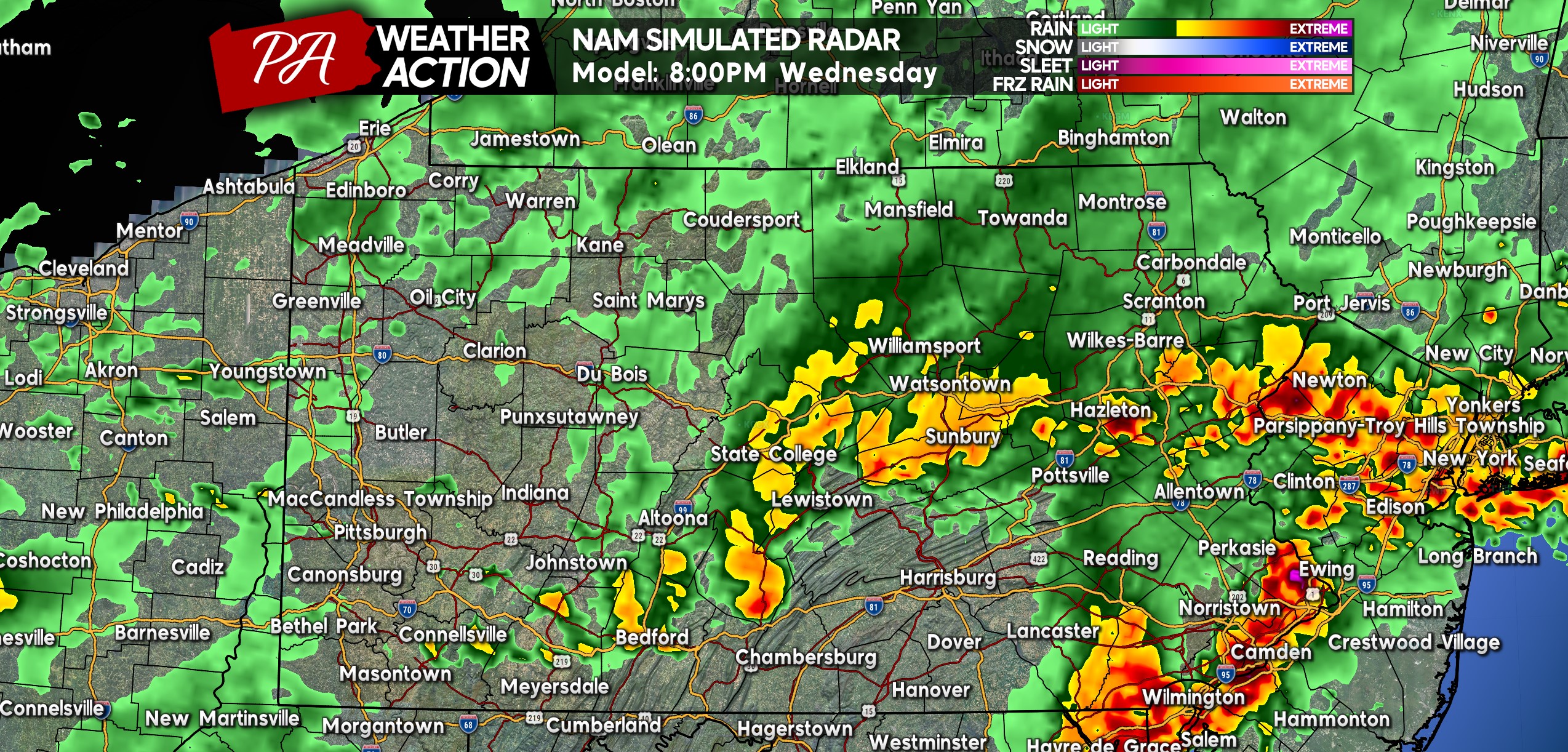
Severe thunderstorms are most probable in the Philadelphia Metro area between 7-9 PM, so outdoor activities Wednesday evening should be rescheduled. A small flash flood concern exists in the Southern Poconos around this time as well, with several hours of heavy rain modeled to train over the area. Here is future radar for 8:00 PM Wednesday.
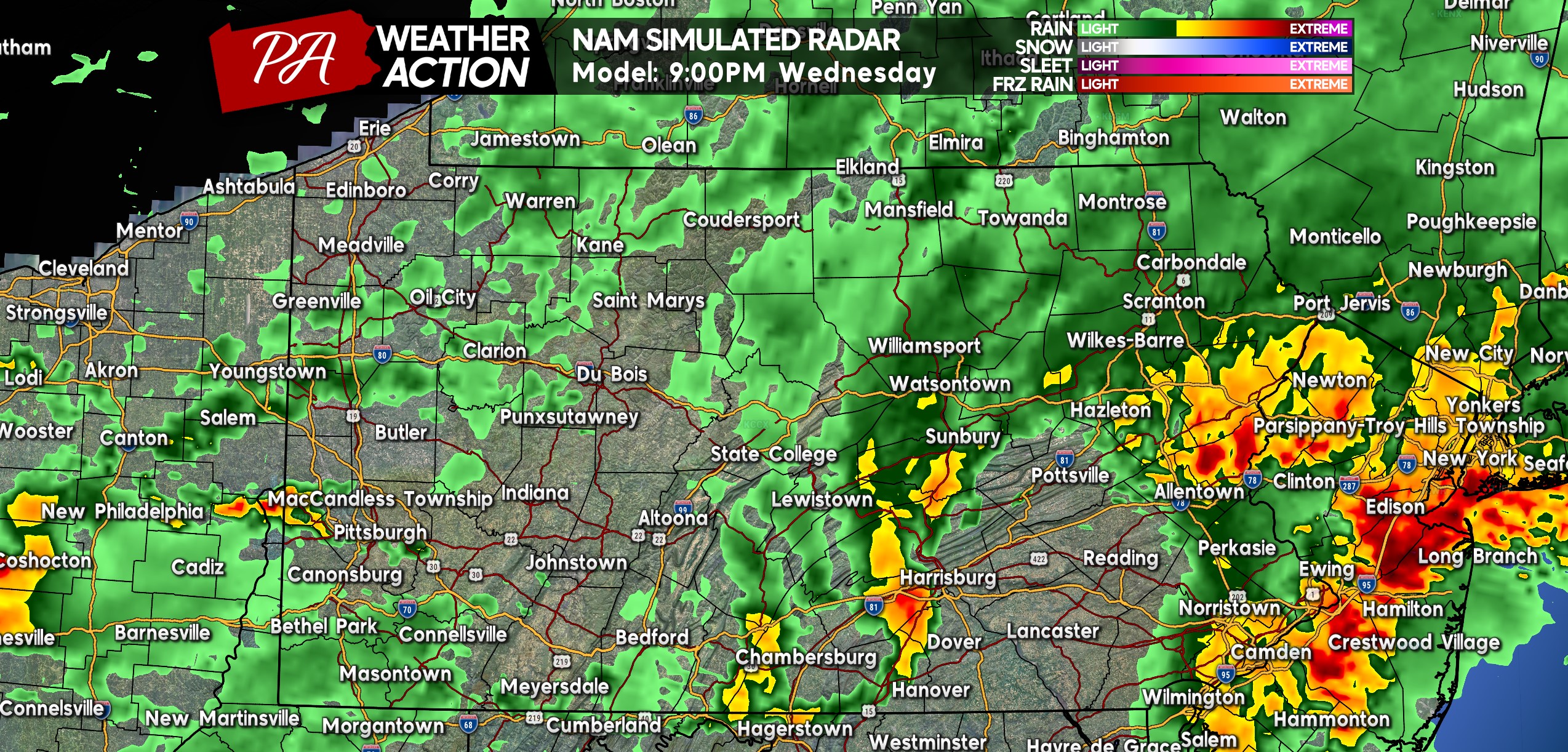
Finally by 9:00 PM, our problems will become New Jersey’s problems, with most thunderstorms pushing east of the Delaware by then. Between 9 PM and midnight, a strong line of storms may push southeast through Southwest PA. These storms will be loud, but should be below severe limits. Below is future radar for 9:00 PM Wednesday.
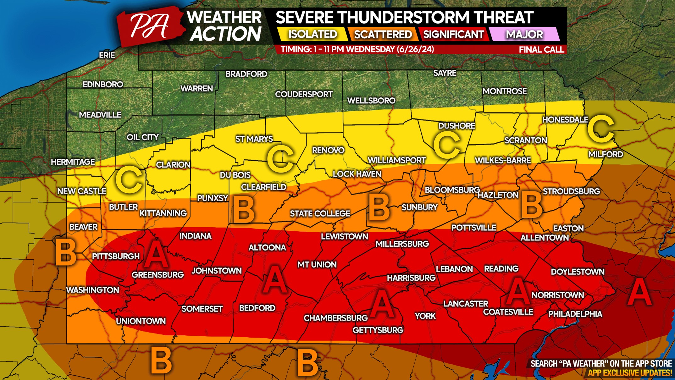
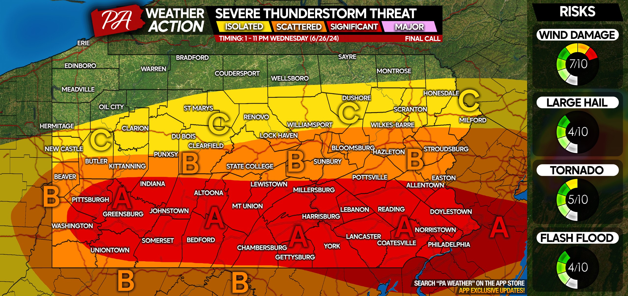
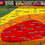
WEDNESDAY 6/26 SEVERE THUNDERSTORM RISK MAP
Area A: A significant threat for severe thunderstorms. Most areas will at least see a strong storm or two, while others will see greater impacts. Damaging wind gusts of 60 MPH and large hail are the main concerns with strongest storms, with a few tornadoes also possible across the entirety of this area.
Area B: Scattered strong to severe thunderstorms possible amidst heavy rain and embedded storms. Isolated damaging wind gusts of 60 MPH and large hail are the main threats in strongest cells, with a very isolated tornado possible.
Area C: Isolated strong to severe thunderstorms possible, with damaging winds as the primary concern.
Don’t forget to share this article with family and friends who have outdoor plans Wednesday!
If you don’t follow PA Weather Action on Facebook, you can easily do so below!

You must be logged in to post a comment.