
A winter storm will bring a mix of snow, sleet, freezing rain and plain rain to the region beginning late tonight for western pa and lasting through the first half of Tuesday. The storm system will arrive in two waves. Wave one will deliver snow from west to east for our southern tier counties beginning late tonight and lasting through Monday morning. There will likely be a lull period Monday afternoon before wave two arrives. Wave two will be stronger and bring snow, sleet, freezing rain and rain to the region Monday evening from south to north and lasting through the first half of Tuesday.
TIMING:
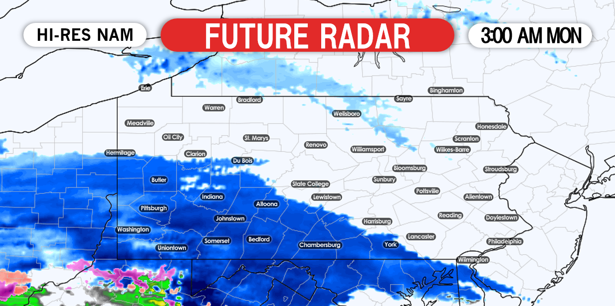
Wave one will arrive by midnight tonight for our southwestern counties and will overspread the southern half of PA from west to east. Snowfall rates will likely remain light to moderate, however the snow may fall heavy at times. Below is a look at 3:00 AM Monday morning:
It is without question, southern PA will see greater impacts with wave one. If you are reading this from northern PA, do not be fooled. We expect that area to receive greater impacts with wave two. Below is a look at 9:00 AM Monday Morning: 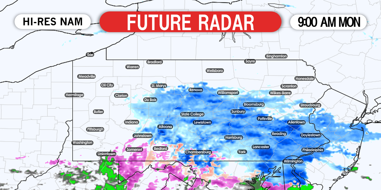
The snow will continue to fall lightly across central and eastern PA through the late morning hours. We expect there to be a lull in the action Monday afternoon before wave two arrives. By Monday evening, wave two will arrive from south to north delivering a wintry mix to the region. Below is a look at 5:00 PM Monday: 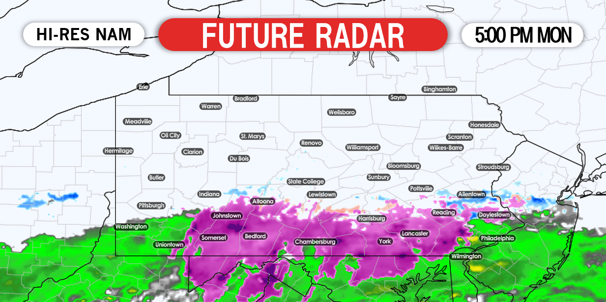

Monday evening through early Tuesday morning will be the worst of the freezing rain. We strongly recommend to avoid traveling during this time. Below is a look at midnight Tuesday: 
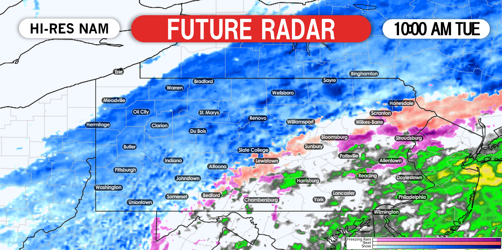
For southern PA, a change to plain rainfall will occur early Tuesday morning. For central and northern PA, precipitation will remain either a wintry mix or a plain snowfall through Tuesday morning. We do not anticipate the precipitation to completely dissipate until early Tuesday afternoon. Below is a look at 10:00 AM Tuesday:
 This will be a long duration event and we do anticipate significant travel delays Monday morning and evening, as well as Tuesday morning.
FINAL CALL SNOWFALL FORECAST FOR MONDAY INTO TUESDAY

Area A: Snow accumulation of 3 – 5″ expected. This will fall Monday night into Tuesday morning, so plan for difficult travel Tuesday morning.
Area B: Snow accumulation of 2 – 3″ expected. Slushy roads expected Monday for the southern part of this area, and Tuesday morning for the northern section.
Area C: Snow accumulation of 1 – 2″ expected.
Area D: Snow accumulation of a coating to 1″ expected.
FINAL CALL ICE FORECAST FOR MONDAY INTO TUESDAY
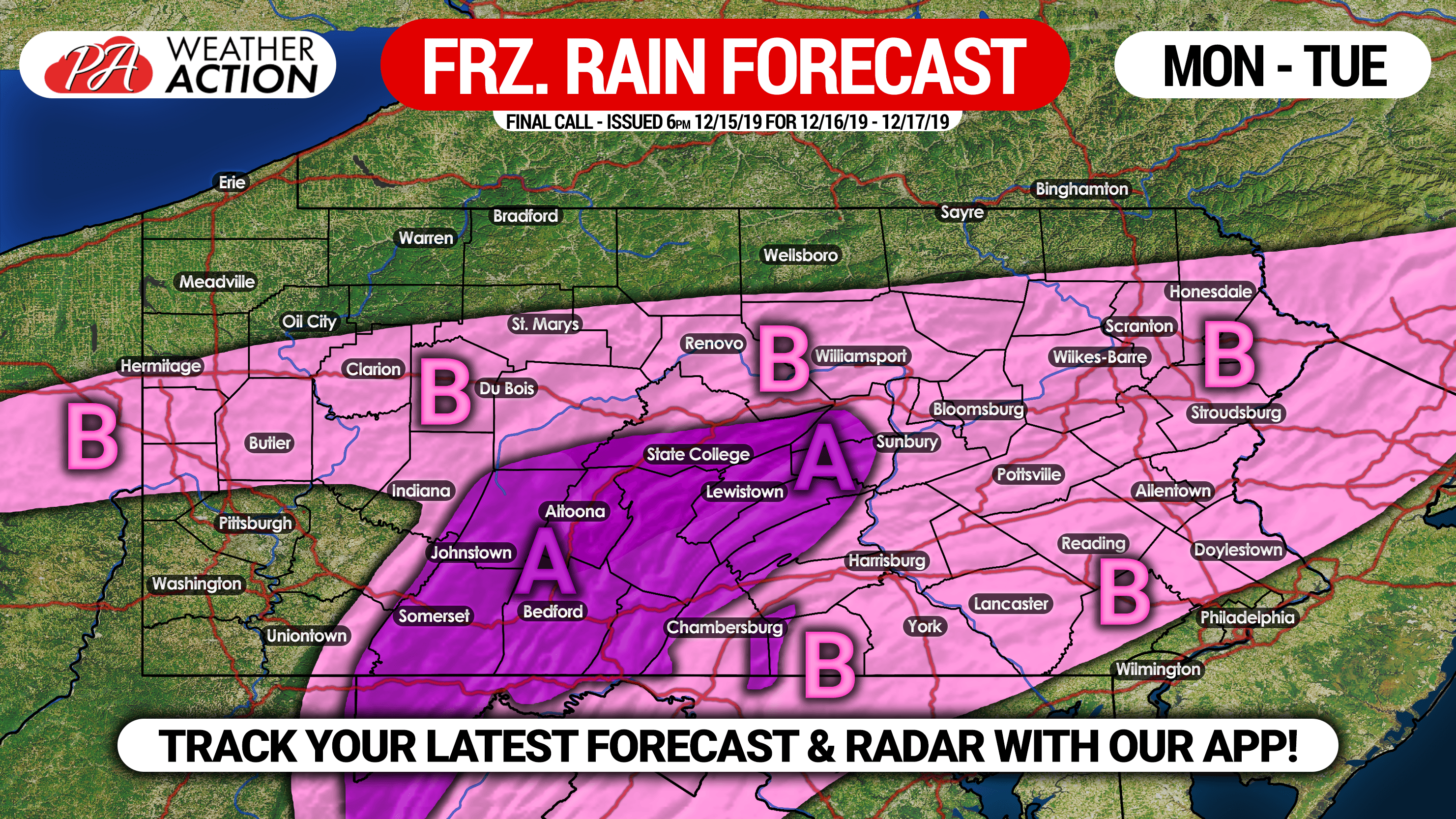
Area A: Ice accrual of .10 – .20″ expected on top of the snow. Hazardous travel likely all of Monday, through late Tuesday morning.
Area B: Ice accrual of .01 – .10″ expected on top of the snow. Untreated surfaces will become ice Monday afternoon into mid-morning Tuesday.
Be sure to share this update with your friends and family, as school delays/closings will occur due to hazardous travel.
For precise hour-by-hour timing, snowfall rates, and total amounts, download our free app! To download it, tap this link >>> Weather Action App
You must be logged in to post a comment.