
Overall no major changes in our forecast, only minor tweaks. A complex storm system is still expected to bring a wintry mix to the state tomorrow. All areas will start off as a period of snow at the onset before transitioning to a period of sleet and then some freezing rain. There is potential for some areas to change back to snow towards the end of storm.
The model data that we like to use for our future radar is in a disagreement with other model data currently. However, we will still use it for the timing which has been rather consistent over the past few days.
Snow will begin to fall across western Pennsylvania after 5:00 AM Saturday. The snow will quickly expand eastward, below is a look at 7:00 AM Saturday: 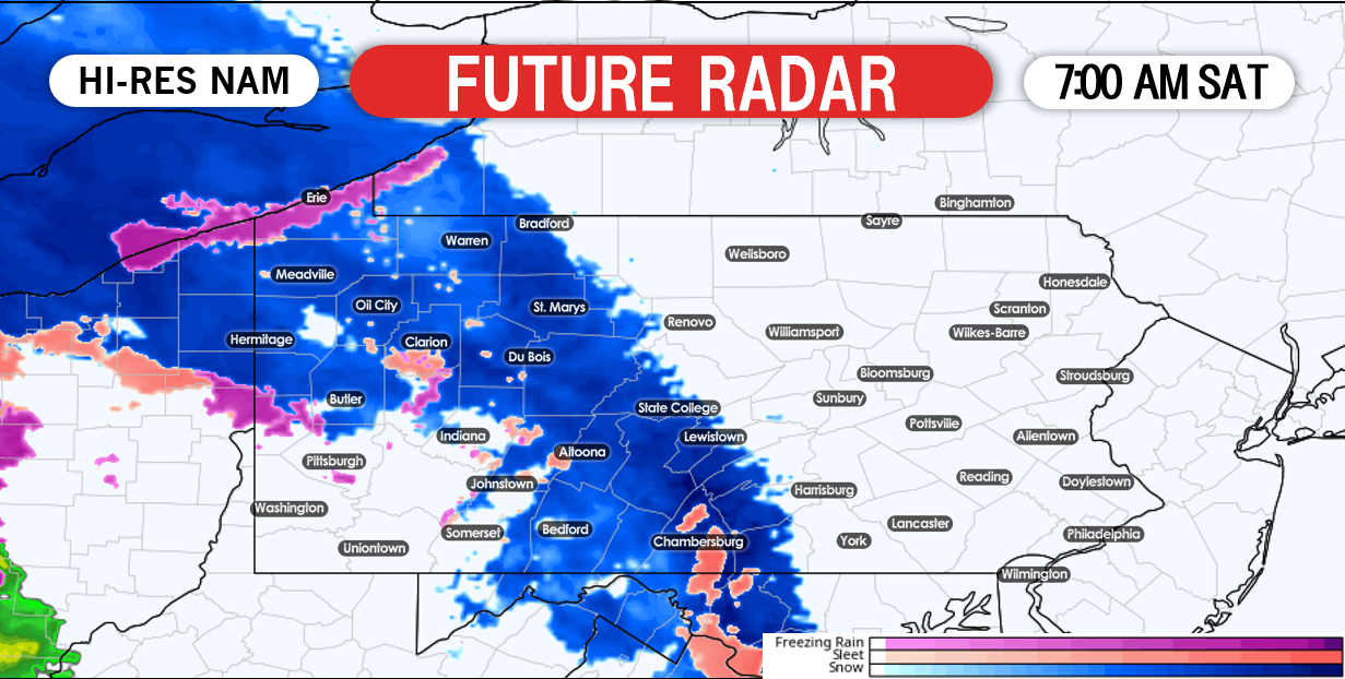
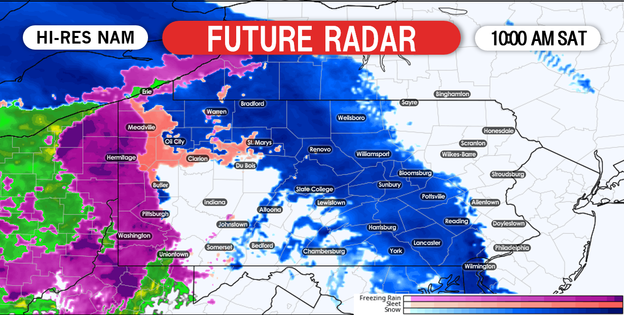
Again, we anticipate that the lull shown here in western and parts of central Pennsylvania will be more filled in reality. This will allow for areas to reach our projected snow totals shown at the end of this article. The snow, sleet and freezing rain will be widespread across the state by the afternoon hours. Below is a look at 1:00 PM Saturday: 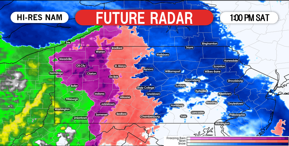
Other model data as well ourselves disagree with our future radar model. Most locations north of interstate 80 in central and eastern Pennsylvania will remain all snow tomorrow. Even in this scenario, a transition back to snow would be likely as the system begins to pull away by Saturday evening. Below is a look at 6:00 PM Saturday: 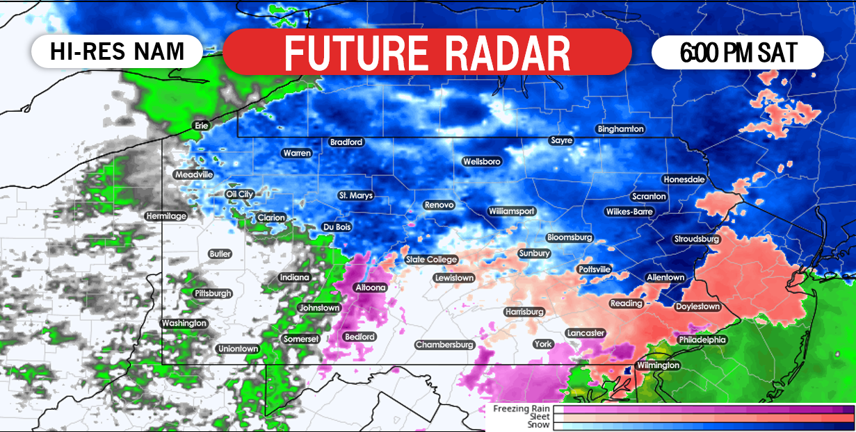
We highly suggest to avoid traveling tomorrow as much as possible. We expect significant traffic delays and treacherous road conditions across the state tomorrow.
FINAL CALL ICE FORECAST FOR SATURDAY
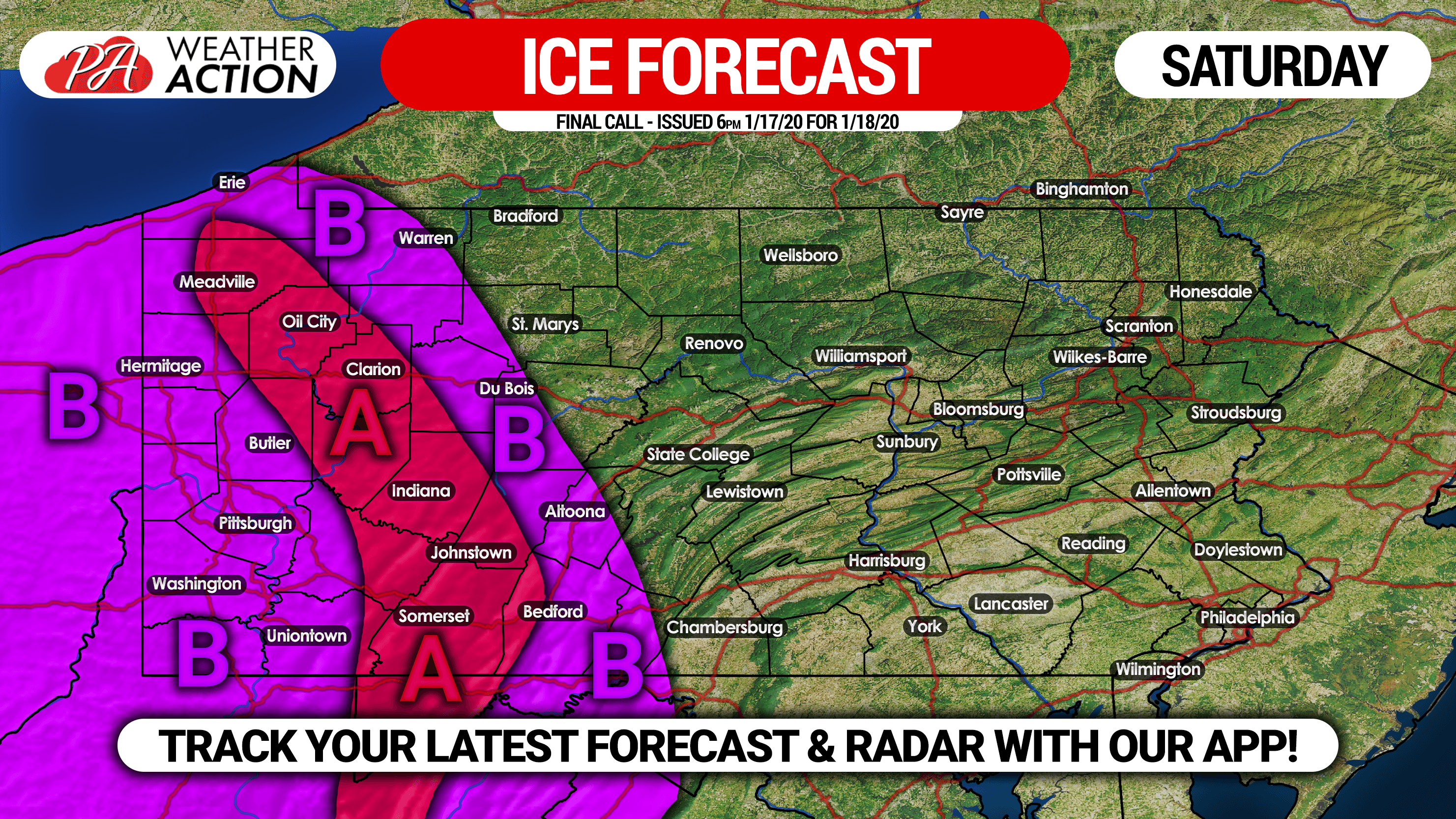
Area A: Ice accrual of .05 to .15″ expected, causing isolated power outages due to windy conditions.
Area B: Ice accrual of a thin glaze to .05″ expected.
FINAL CALL SNOWFALL FORECAST FOR SATURDAY

Area A: Snow/sleet accumulation of 4 – 7″ expected. Snowpacked roads will make for hazardous and difficult travel.
Area B: Snow/sleet accumulation of 2 – 4″ expected. Roads will become treacherous, especially during the heavy snow burst Saturday morning.
Area C: Snow/sleet accumulation of a coating – 2″ expected. Travel will be difficult during the burst of snow Saturday morning.
Be sure to share this final forecast with your family and friends.
For more precise timing and amounts for your location, interactive radar and more, download our free app! >>> Weather Action App Link
You must be logged in to post a comment.