
We are tracking an Upper Level Low system that will bring plenty of moisture to the state late Friday night through Saturday. Earlier in the workweek, it looked like this storm system had the potential to produce a significant snowfall across the interior part of the state, however that does not appear to be the case this time around. Most locations will see rain from this storm, with a few locations receiving some snow and icy conditions. As the system pulls away, wrap around snow showers are expected across the state Sunday.
Rain will reach western areas first, like after 8:00 PM Friday night. The rain will be steady and heavy at times. Below is a look at 10:00 PM Friday night: 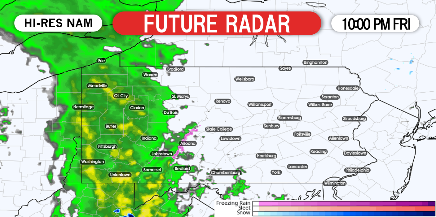
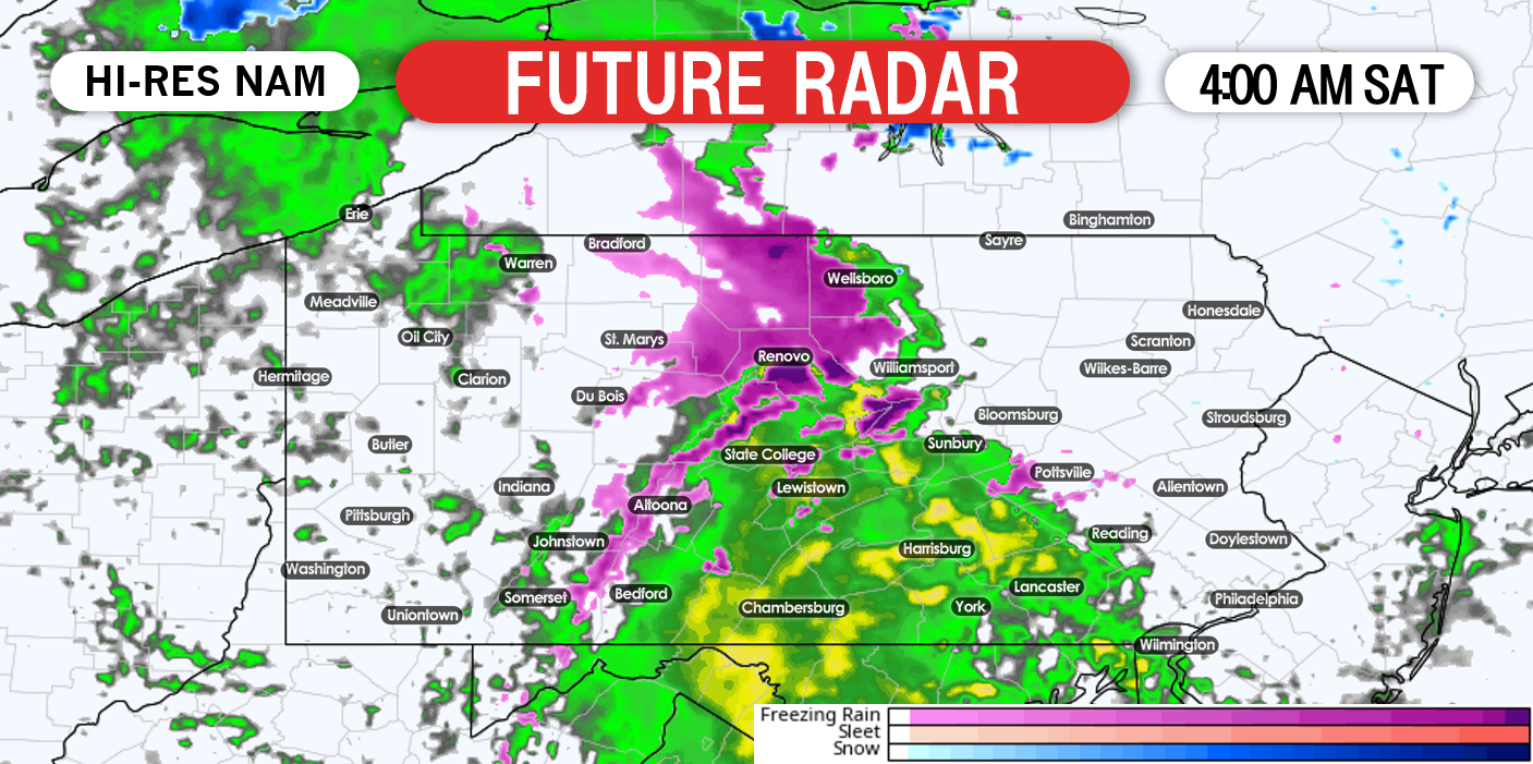
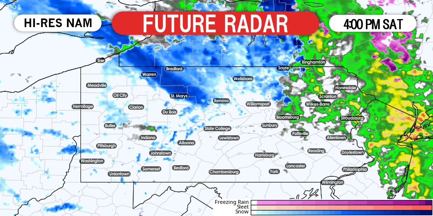
Northeast Pennsylvania will likely experience the longest duration of freezing rain Saturday morning. It does not appear to be a major icing event. In fact, even these areas will only see upwards of 3 to 4 hours of freezing rain. With that being said, it does not take much ice to create significant issues. A small pocket of snow will breakout across parts of northern Pennsylvania Saturday morning. These areas will stand the best chance to see some accumulating wet snow: 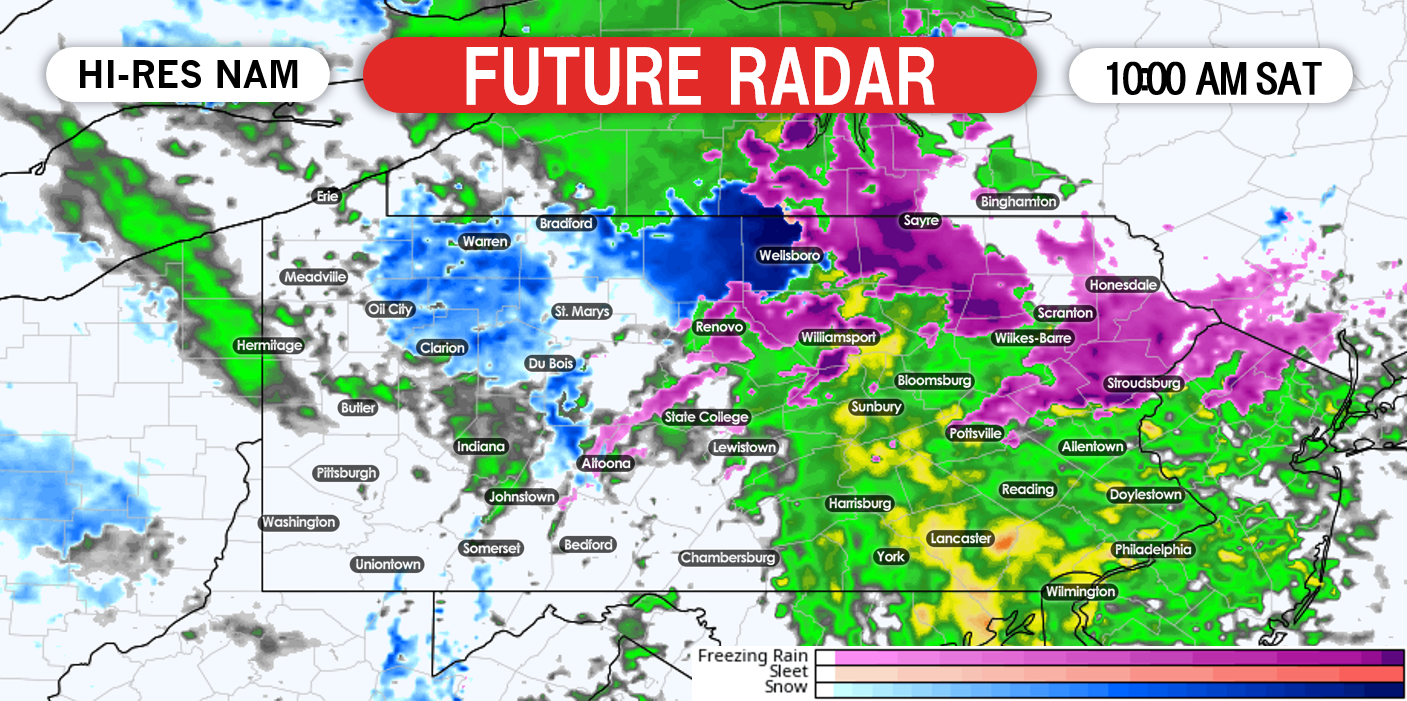
As the system begins to pull away Saturday night, northwest winds will allow for wrap around snow showers during the day Sunday across many areas. Below is a look at 10:00 AM Sunday: 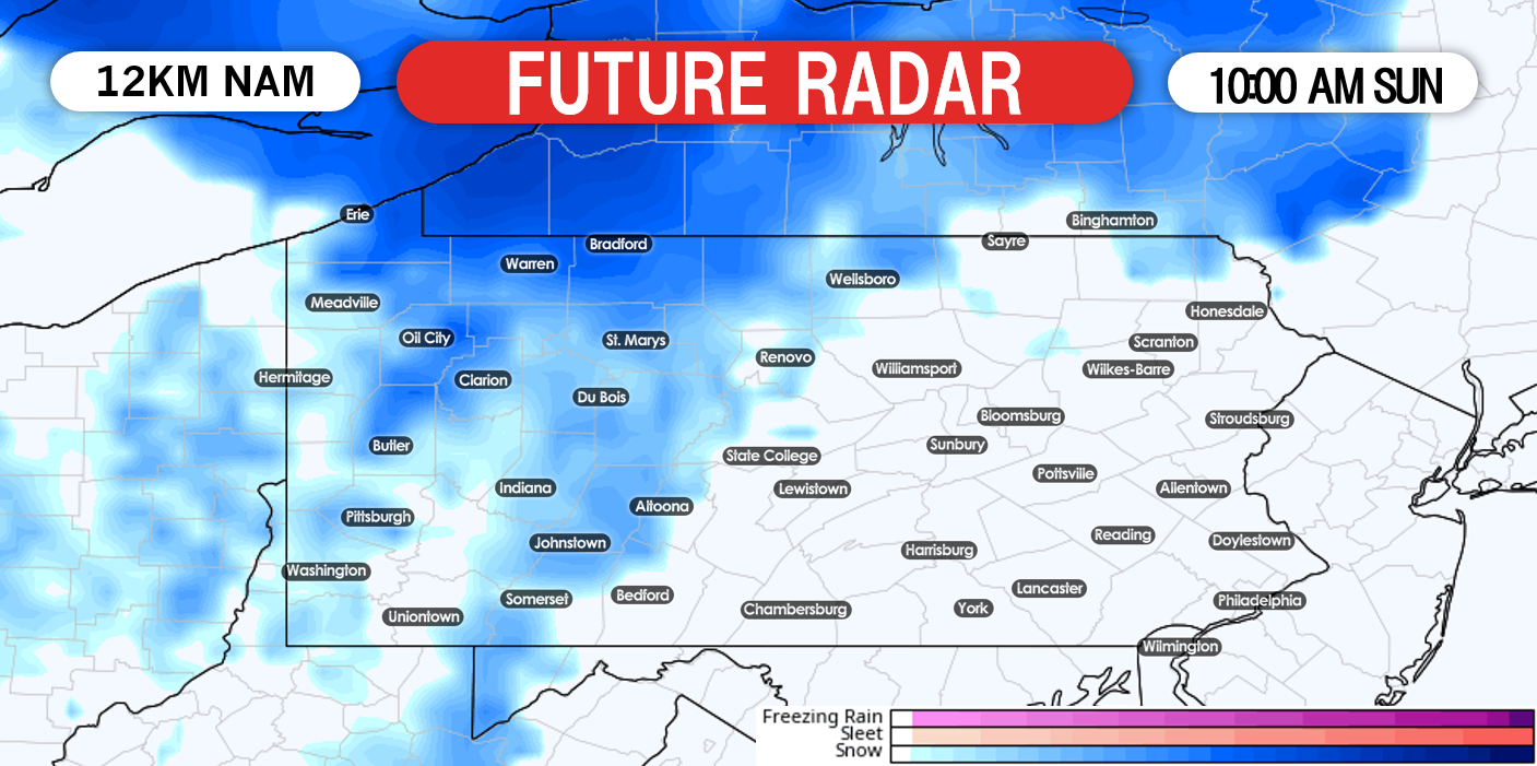
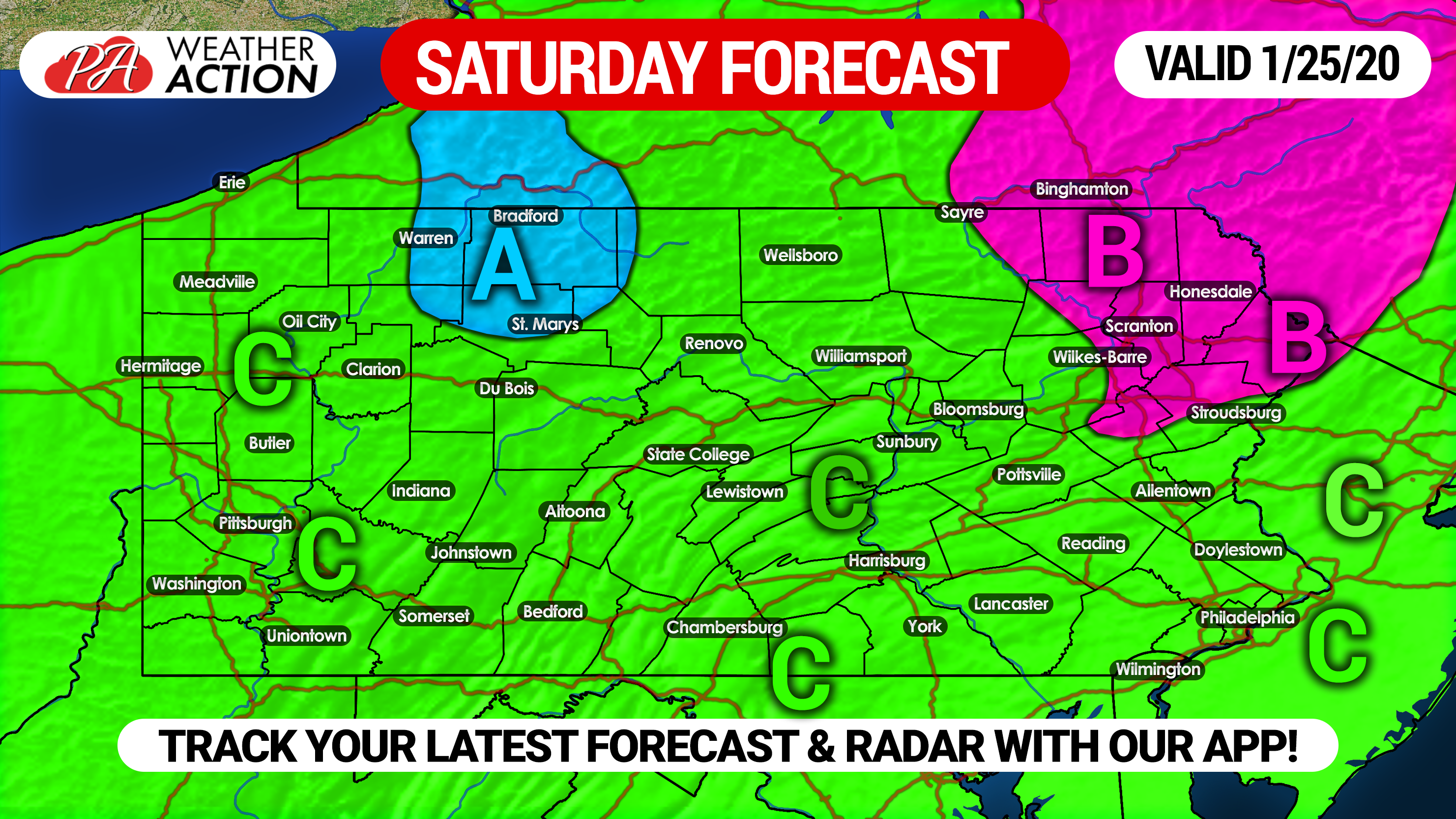
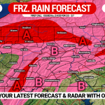
SATURDAY’S FORECAST:
Area A: A mix of rain and snow is expected Saturday. Snowfall accumulations of a coating to 2 inches of wet snow, with isolated higher amounts possible.
Area B: This is the area that we are most concerned with. These locations will start off a period of freezing rain Saturday morning before transitioning to plain rain. Up to a tenth of an inch of ice possible, with isolated areas receiving higher amounts. Hazardous travel is likely Saturday morning.
Area C: All rain is expected from this storm, primarily during the first half of Saturday.
SUNDAY’S FORECAST:
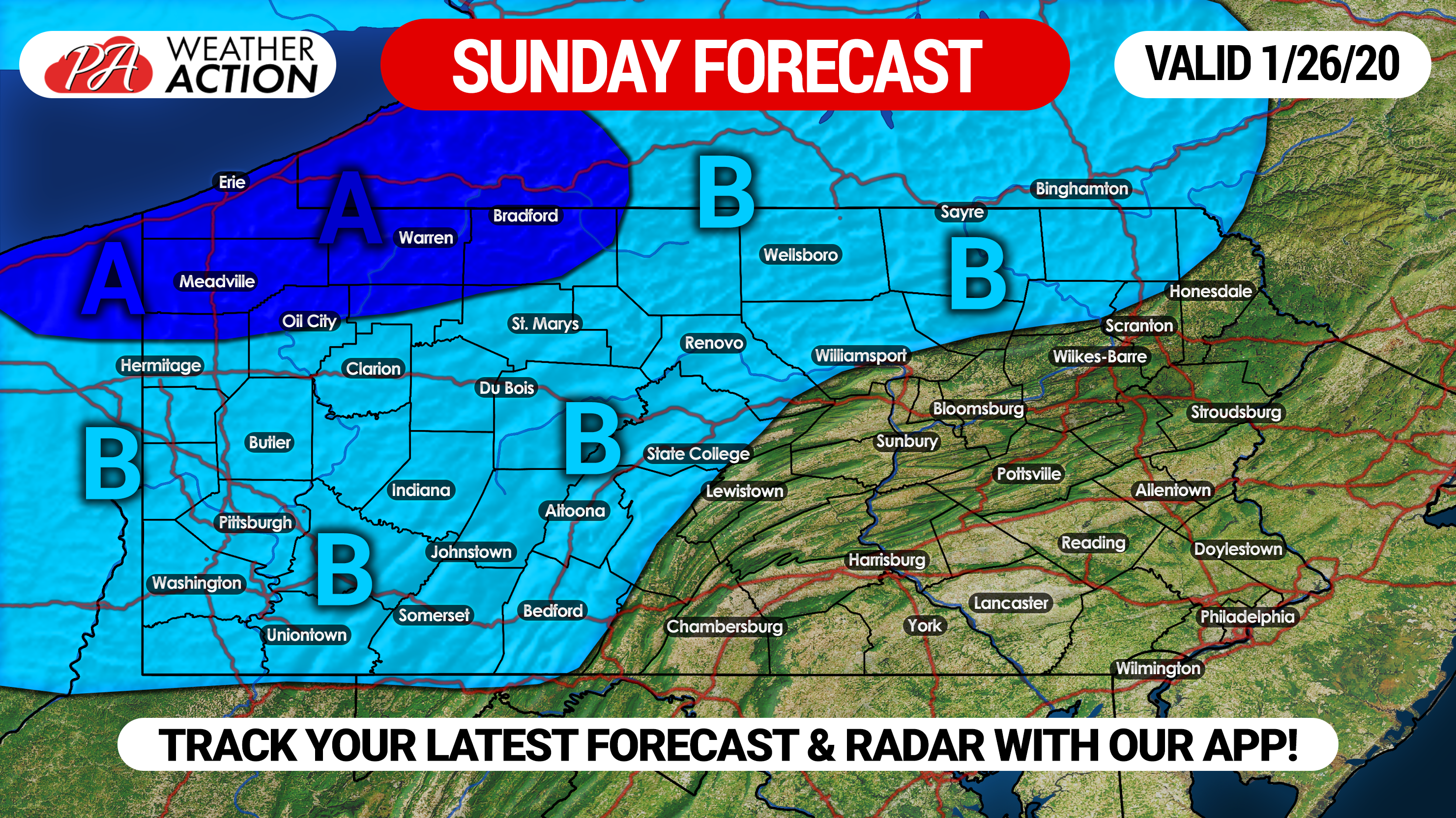
Area A: Sunday’s snow showers will not produce significant snow, however these locations have the best chance to receive anywhere from 1 to 3 inches of snow, with isolated higher amounts possible.
Area B: On and off snow showers are expected. A coating to one inch of snow is likely.
Do not forget to share this article with your family and friends to keep them ahead of the action!
Download our free app today to keep you head of the latest weather alerts and traffic conditions, click this link:Download Here!
You must be logged in to post a comment.