
Winter will be delivering a 1-2 punch to the state over the next 48 hours, with the first punch being the weaker of the two. Light snow is already pushing into Western PA associated with our first snow event. The first event will be all snow. The second and more potent system continues to look like a snow to wintry mix to rain for many areas. However, recent trends suggest there will be less plain rain to end the storm. We will get into that shortly.
First off, tonight’s system will push from west to east over the next several hours. Most areas will see a coating to two inches, with isolated areas seeing upwards of 3 inches of snow. Below is a look at 1:00 AM Monday morning: 
Travel disruptions are possible Monday morning from the result of snow covered roads.
The first event will be wrapped up by 7:00 AM Monday morning for everyone. There will then be a several hour lull period from our first system and our second. Precipitation will then develop from the southwest by Monday afternoon, mainly in the form of snow. Below is a look at our future radar valid for 4:00 PM Monday afternoon: 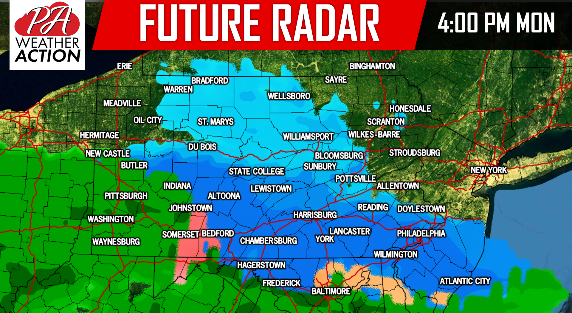
Guidance and observations continue to suggest Southwest PA will see mainly rain from this system. But everyone else will at the very least start off as a period of moderate to heavy snow before changing over to sleet and freezing rain. Below is a look at our future radar valid for 10:00 PM Monday night: 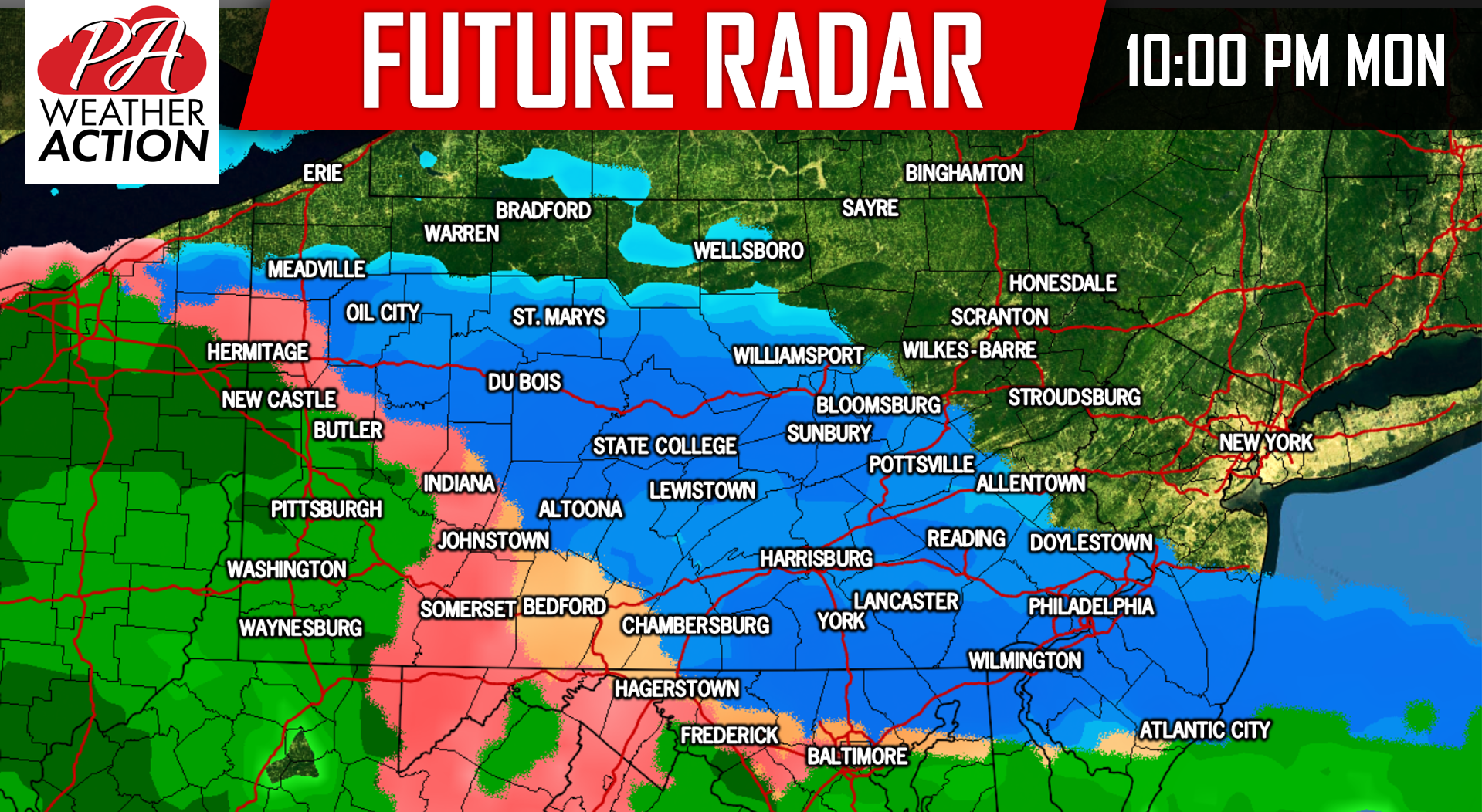
Looking at our future radar, you can see the changeover to sleet and freezing rain is already taking place over the Laurel Highlands. This will continue to push northeast as we head into the early morning hours Tuesday. Below is a look at 4:00 AM Tuesday: 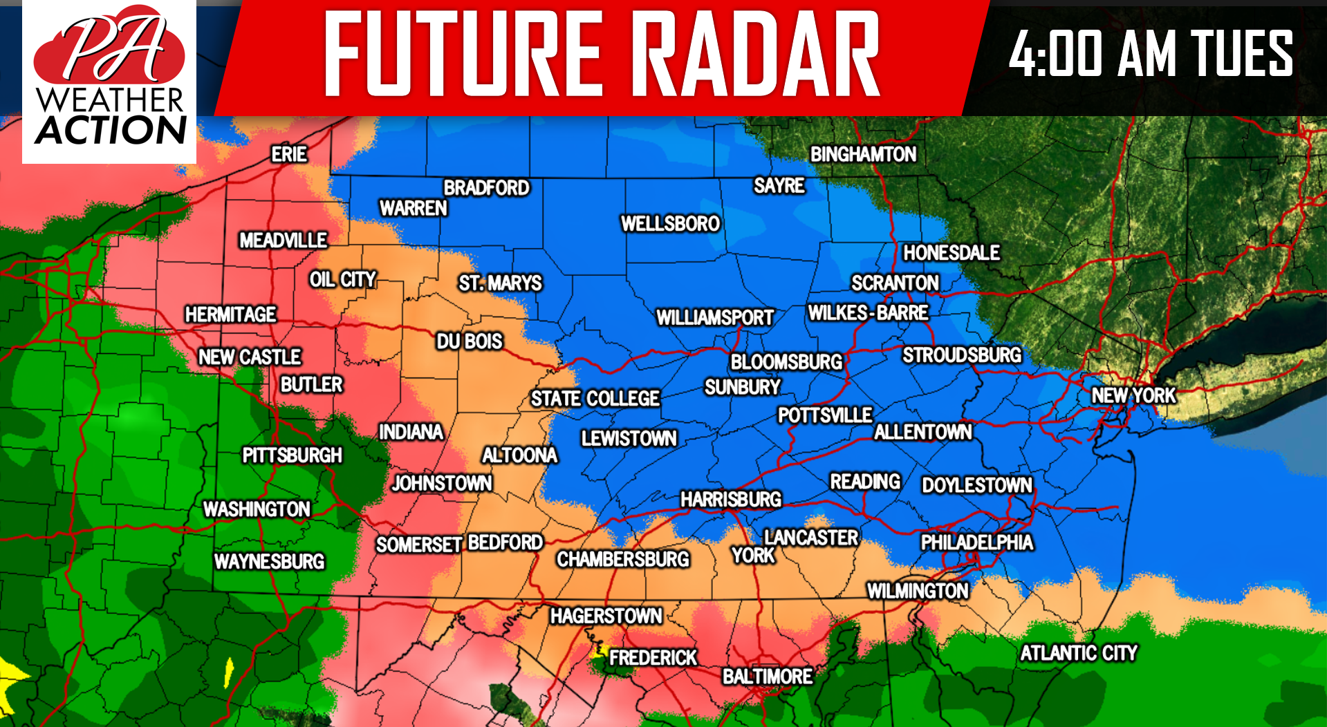
Most areas throughout the state will see severe impacts to travel Tuesday morning. There will be many delays and cancellations. In fact, we recommend to avoid driving Tuesday, especially during the first half of Tuesday. By 10:00 AM Tuesday morning, many of us have changed over to sleet and freezing rain: 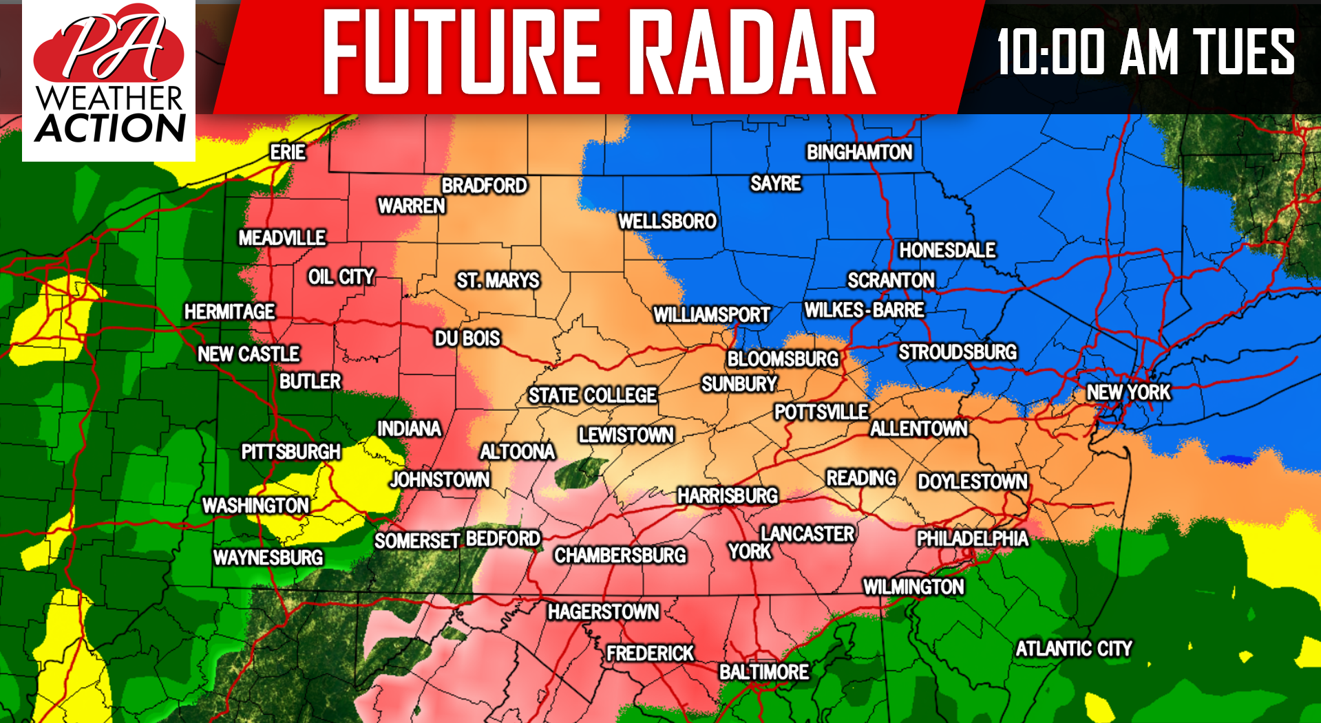
There is the potential for significant sleet and freezing rain Tuesday morning into the afternoon. Latest guidance suggests that many of us struggle to reach 32 degrees Tuesday. This means we expect to see more sleet and freezing rain vs plain rain Tuesday. However, we do still expect that the precipitation will end as a brief period of plain rain late Tuesday afternoon and evening. Below is a look at 4:00 PM Tuesday afternoon: 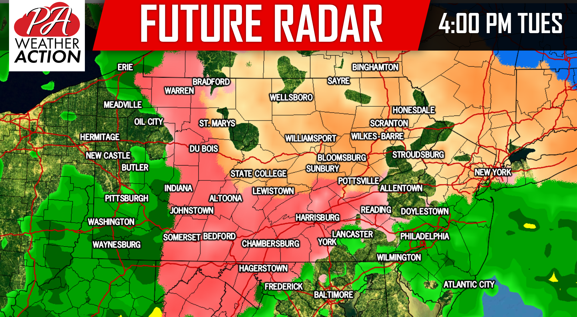
All precipitation will taper off by Tuesday evening. Again, we recommend to avoid traveling Tuesday. Some of us will see a half a foot of snow, followed by significant icing. This will cause major disruptions to travel and may even lead to scattered power outages.
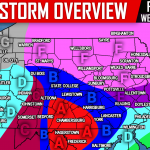
FINAL CALL SNOWFALL FORECAST (NOW – TUESDAY)
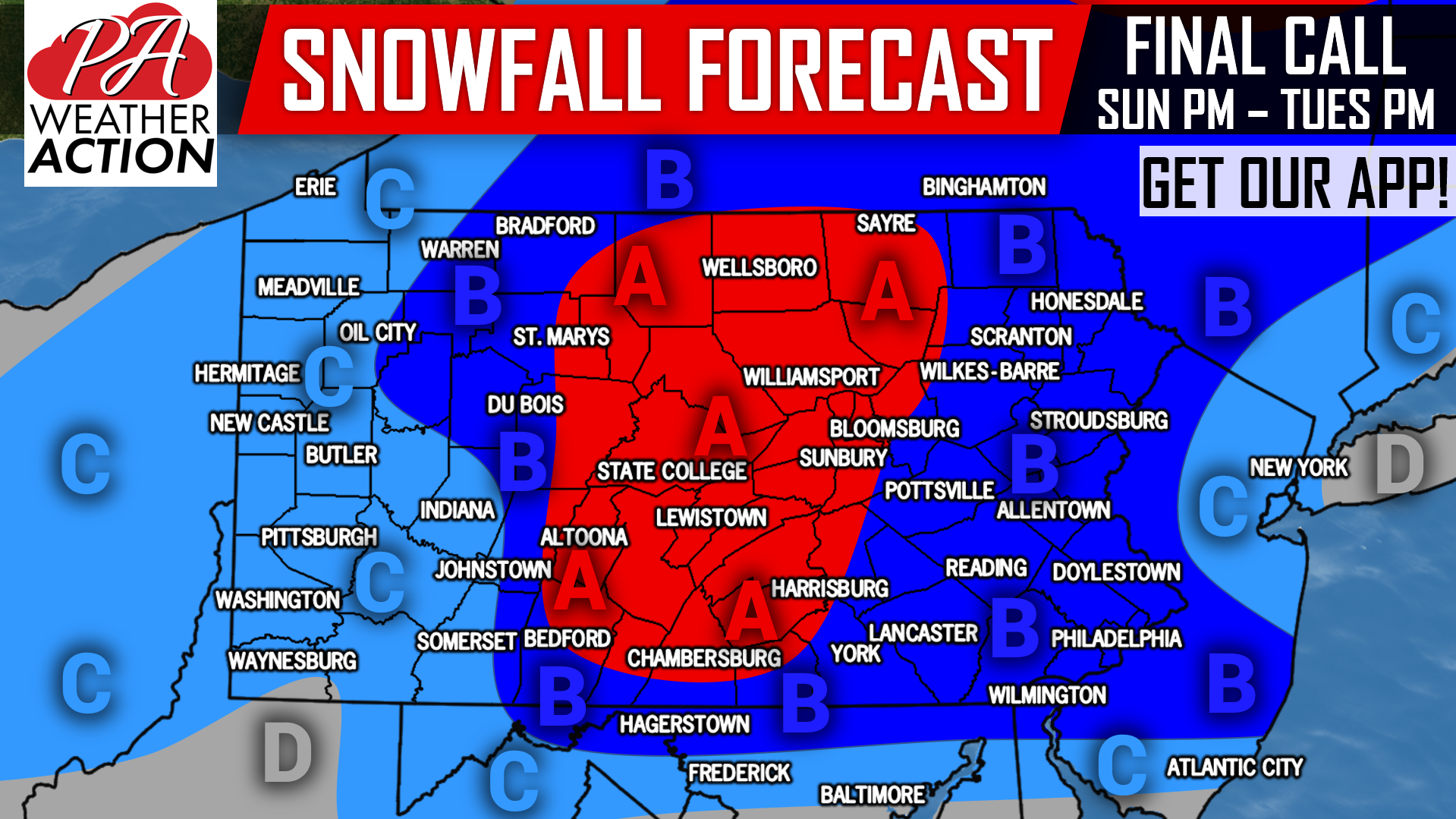
Area A: Total snow accumulation of 6 – 9″, before turning to sleet and freezing rain and possibly just plain rain at the end. School cancellations are expected Tuesday as roads will be dangerous from the late evening hours of Monday, through Tuesday Night. Also watch out for slick roads tonight (Sunday Night).
Area B: Total snow accumulation of 3 – 6″, then sleet and freezing rain, and finally rain. School cancellations are likely Tuesday as roads will be hazardous from the late evening hours of Monday through Tuesday Evening. Also watch out for slick roads tonight (Sunday Night).
Area C: Total snow accumulation of 1 – 3″ tonight in Western PA, however this area will be mainly rain for Tuesday’s storm.
Area D: Total snow accumulation of less than 1″ expected.
FINAL CALL SNOWFALL FORECAST (NOW – TUESDAY)
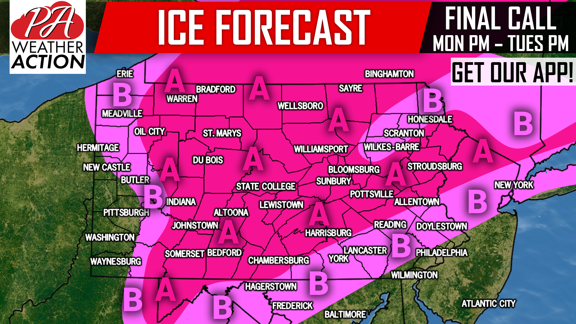
Area A: Ice accretion of .10 – .25″ anticipated. Scattered power outages possible.
Area B: ice accretion of .01 – .10″ expected.
View your latest hourly & daily forecast, to alerts and radar with our free app >>> PA Weather App Link
Be sure to like us on Facebook for future updates if you haven’t already >>> PA Weather Action Facebook Page
Share this important final forecast with your friends and family using the button below!
You must be logged in to post a comment.