
Temperatures are crashing from west to east ahead of a strong cold front coming in! Gusty northwest winds of 20-40mph and heavy lake effect snow bands are likely Monday and Tuesday, making it feel awfully wintry.
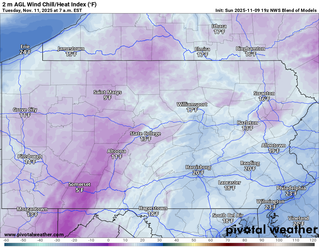
Wind chills as you walk out the door Tuesday morning will be downright frigid, with most places in the single-digits and teens. Here’s a look at feels like temperatures at 7 AM Tuesday. Safe to say you will need your heavy winter coat all day!
And looking forward into the rest of this week and even next week, there’s a lot of wind and a lot of days struggling to reach 50°. Your winter coat is here to stay!
FUTURE RADAR TIMING
Rain will change over to light snow in parts of Western PA late evening into early Monday morning. This snow will initially have a hard time accumulating, as temperatures will still be at or above freezing.
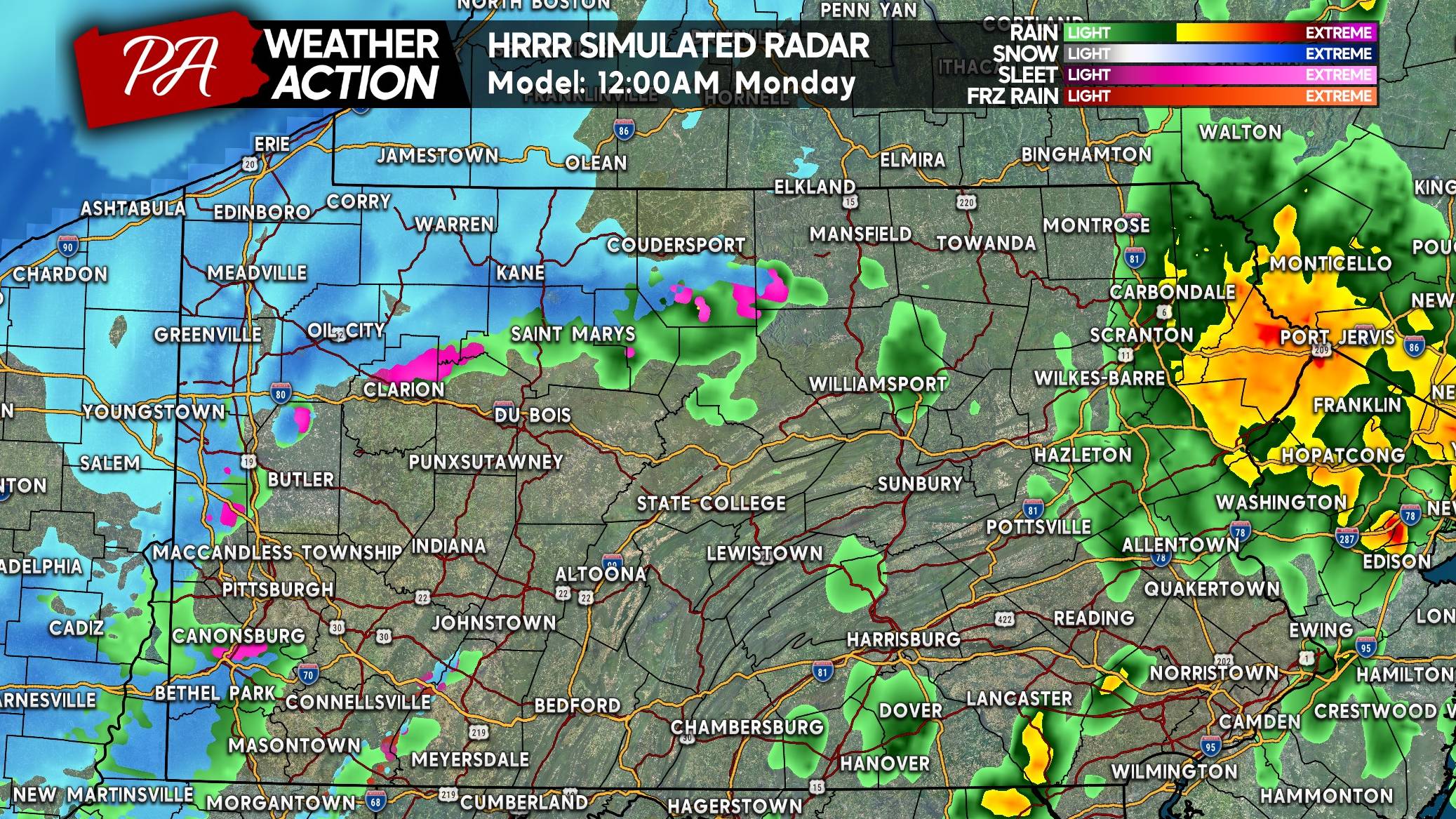
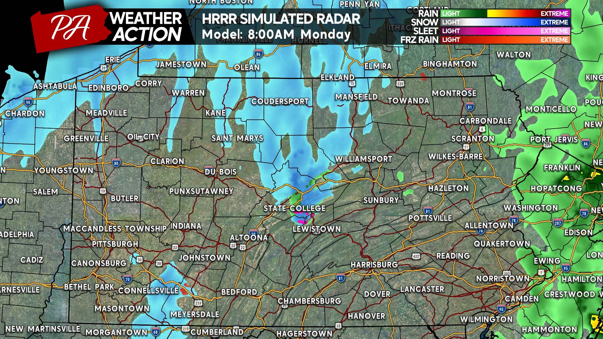
Come Monday morning, scattered snow showers are projected across Northwest PA and the Laurel Highlands. Below is the HRRR model for 8:00 AM Monday.
Lake effect snow squalls will really start to get going late Monday afternoon into the evening commute. Temperatures will be deep into the 20s where snow is falling, and there’s no question snow will be able to accumulate. Here’s the model for 6:00 PM Monday.

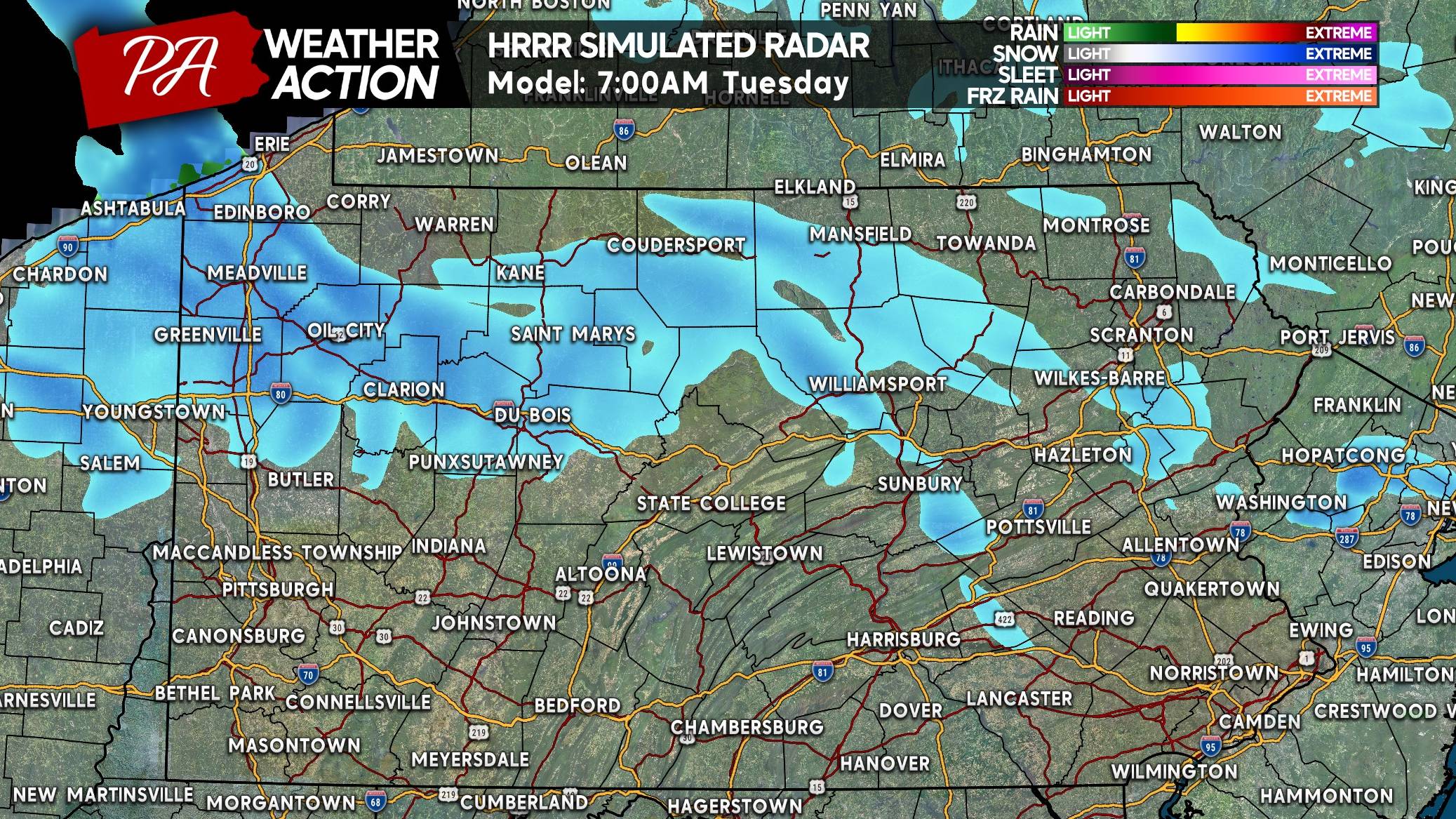
Lake effect snow will be most intense Monday evening through Tuesday morning. By the Tuesday morning commute, snow showers may reach Northeast PA.
Back in Northwest PA, scattered heavy snow squalls will be ongoing. Below is a look at the future radar for 7:00 AM Tuesday.
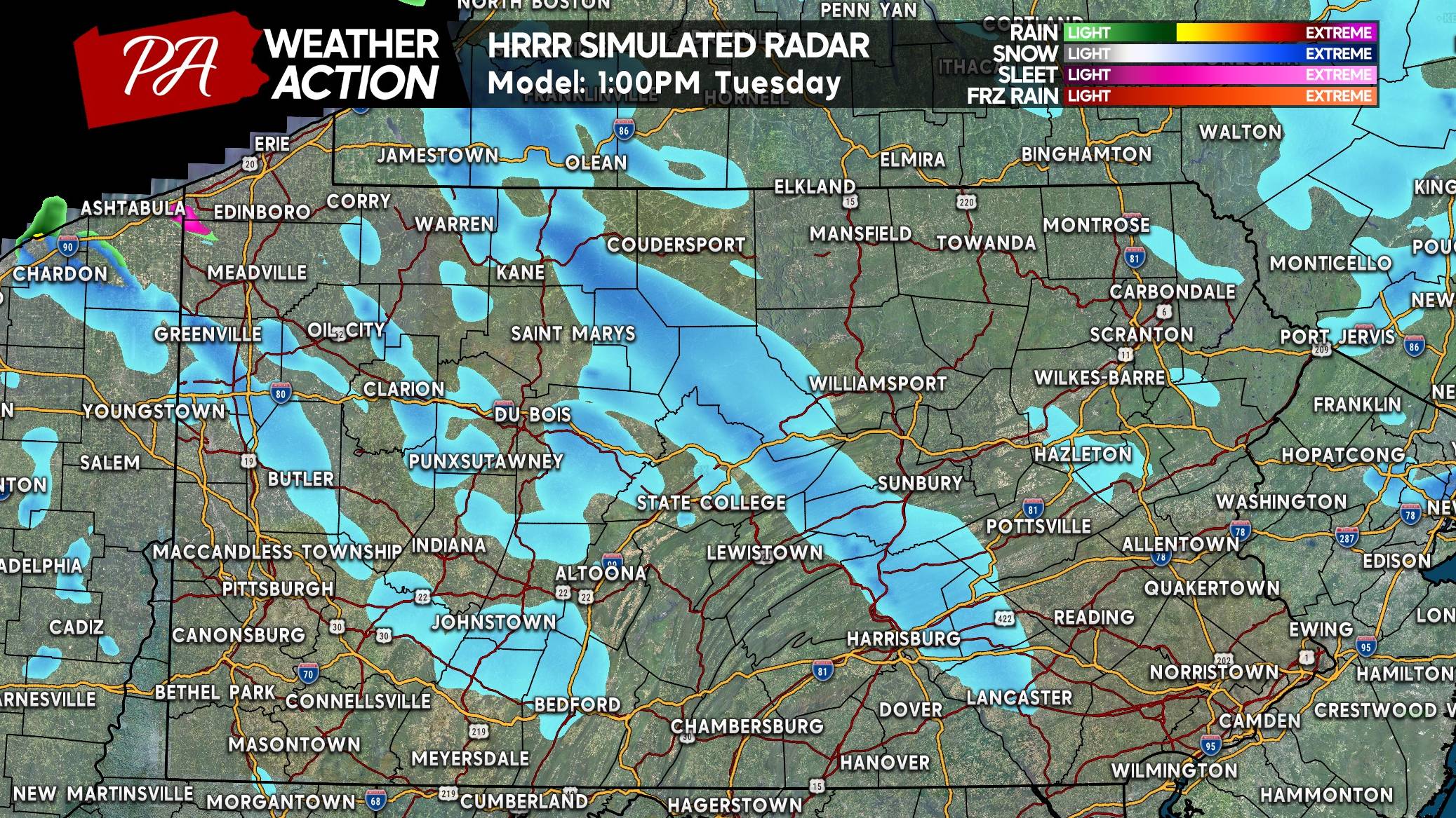
As the lake effect snow machine begins to calm Tuesday afternoon, some snow showers may reach all the way over the mountains. This is illustrated by the HRRR model below, showing its best guess for 1:00 PM Tuesday.
Scattered lake effect snow showers are likely Wednesday and Thursday as well in the snow belts.
FINAL CALL SNOWFALL FORECAST FOR MONDAY – TUESDAY
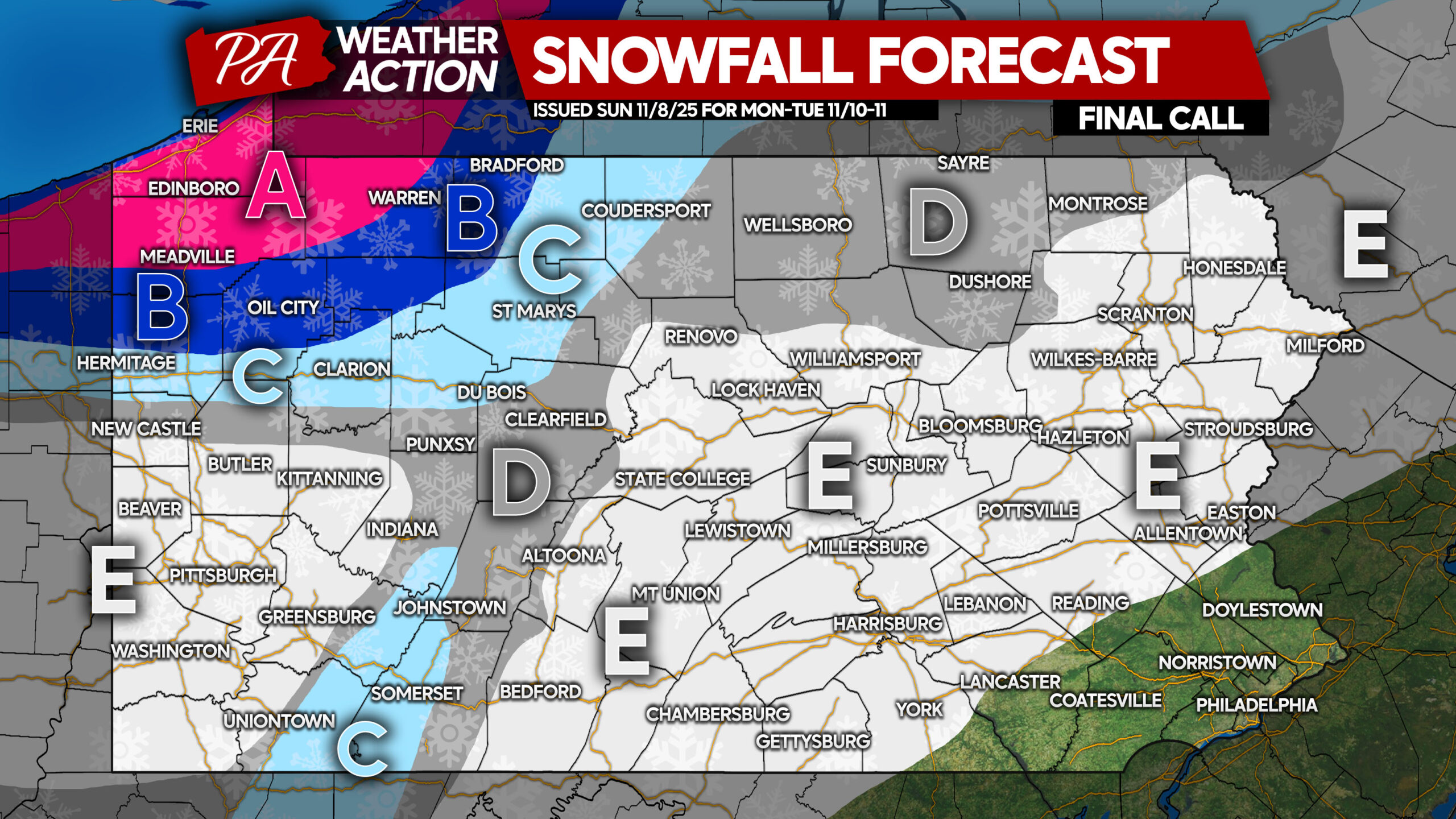
Area A: Snowfall accumulation of 6 – 12″ expected. Roads will become snow-covered and dangerous during squalls.
Area B: Snowfall accumulation of 3 – 6″ anticipated. Road conditions will be snow-covered and slippery during squalls.
Area C: Snowfall accumulation of 1 – 3″ expected. Roads may be covered as snow falls Monday evening into Tuesday morning.
Area D: Snowfall accumulation of less than 1″ anticipated. Slick roads are likely if a squall pushes through.
Area E: The first scattered snow showers of the season are likely, but no accumulation is expected..
Share this final forecast and good info with friends and family!
You must be logged in to post a comment.