Another round of light snow is expected Friday into Saturday across Pennsylvania, and it’ll be largely a case of festive flakes. A clipper system swinging through the Midwest will be weakening on approach, as a coastal storm develops too far offshore for widespread impacts in the northeast.
The European model suggests there may be an inverted trough, which is a thin band of moderate snow that can drop a few inches quick. It places the inverted trough across Eastern PA. Because of the lack of other model support, we are not on board with that idea.
Future Radar Timing
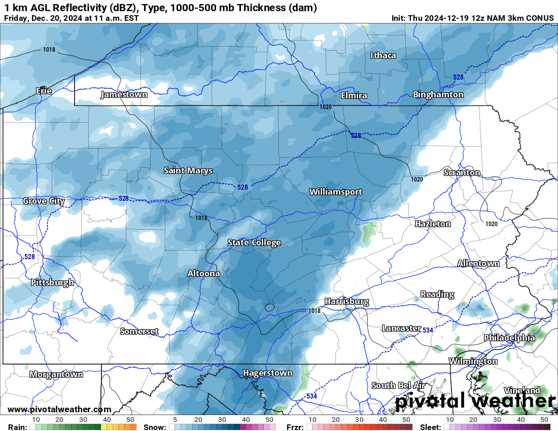
Light to moderate snow will develop in Western and Central PA late Friday morning, with temperatures below freezing in most areas. Untreated surfaces may become slippery, especially on ridge tops. Below is Hi-Res NAM Future Radar for 11:00 AM Friday.
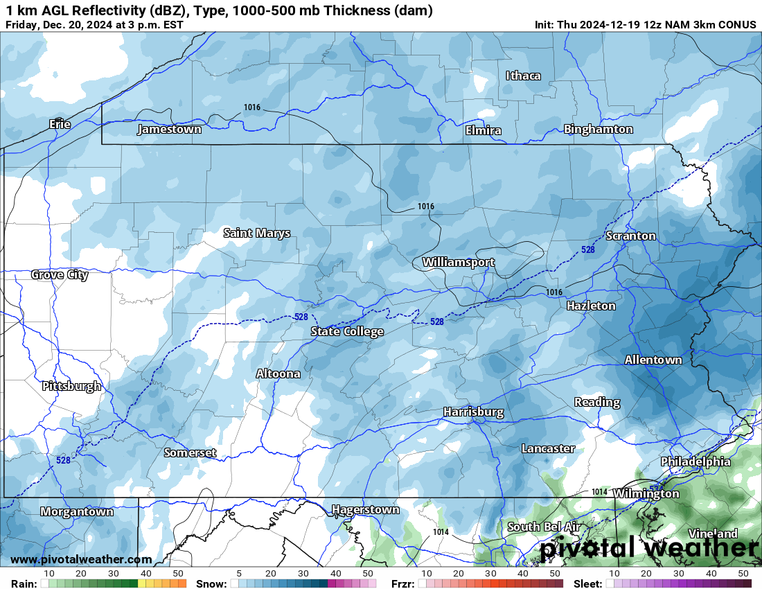
That light snow will quickly push into Eastern PA as we progress through Friday afternoon. Very light snow, or as we like to say, festive flakes, will continue falling sporadically in Central and Western PA. Here is Hi-Res NAM Future Radar for 3:00 PM Friday.
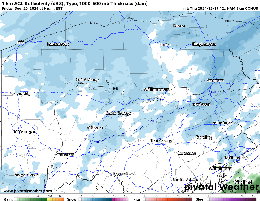
And by dinnertime Friday, or for those outdoor Christmas events, scattered festive flakes will continue falling. This is the time when the European model indicates the inverted trough will setup in Eastern PA, but currently we don’t expect that to happen. Below is Hi-Res NAM Future Radar for 6:00 PM Friday.
Occasional light snow will continue into Friday night and Saturday morning, especially in the form of lake effect streamers. Some pockets of light snow may also occur in Southeast PA just before sunrise Saturday.
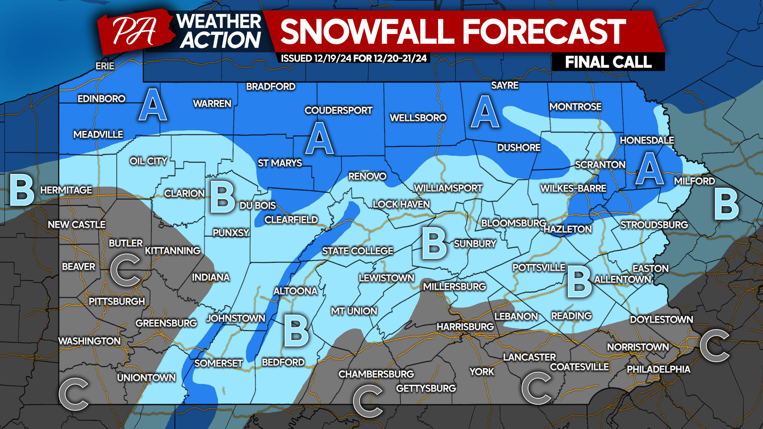
FINAL CALL SNOWFALL FORECAST FOR FRIDAY – SATURDAY
Area A: Snowfall accumulation of 2 – 4″ expected. Snow will come and go throughout the forecast period, with snow-coated roads likely much of Friday and Saturday.
Area B: Snowfall accumulation of 1 – 2″ anticipated. A period of light to brief moderate snow will occur at the onset, followed by occasional snow showers. Road impacts likely during times of snow.
Area C: Snowfall accumulation of a coating to 1″ expected.
In the unlikely event the inverted trough sets up in Eastern PA, amounts will be higher by a few inches.
Don’t forget to share this forecast with friends and family who may be interested!


You must be logged in to post a comment.