
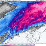
Our long-awaited snowstorm is nearly here, and in the last 24 hours since our second call, there have been some changes to increase expected snowfall in much of Central and Western PA. As usual, the most complicated, high stakes area is where rain and sleet will mix in, which is across South Central and Southeast PA. There will almost certainly be a few surprises in those areas, in the form of a bit more or less snow than anticipated. Both areas where 6-8″ and 8-12″ are expected have dramatically increased in size, which you will see below. Timing has also moved up a fair amount, so please view the latest time tables below.
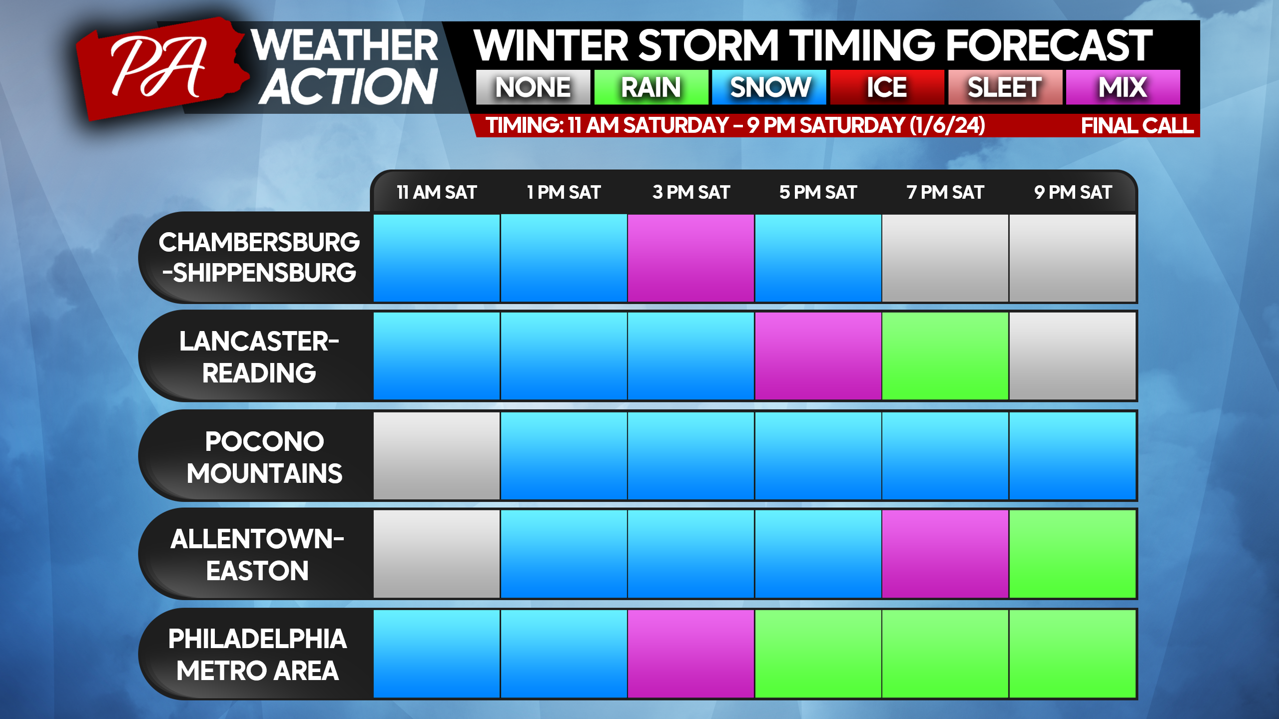
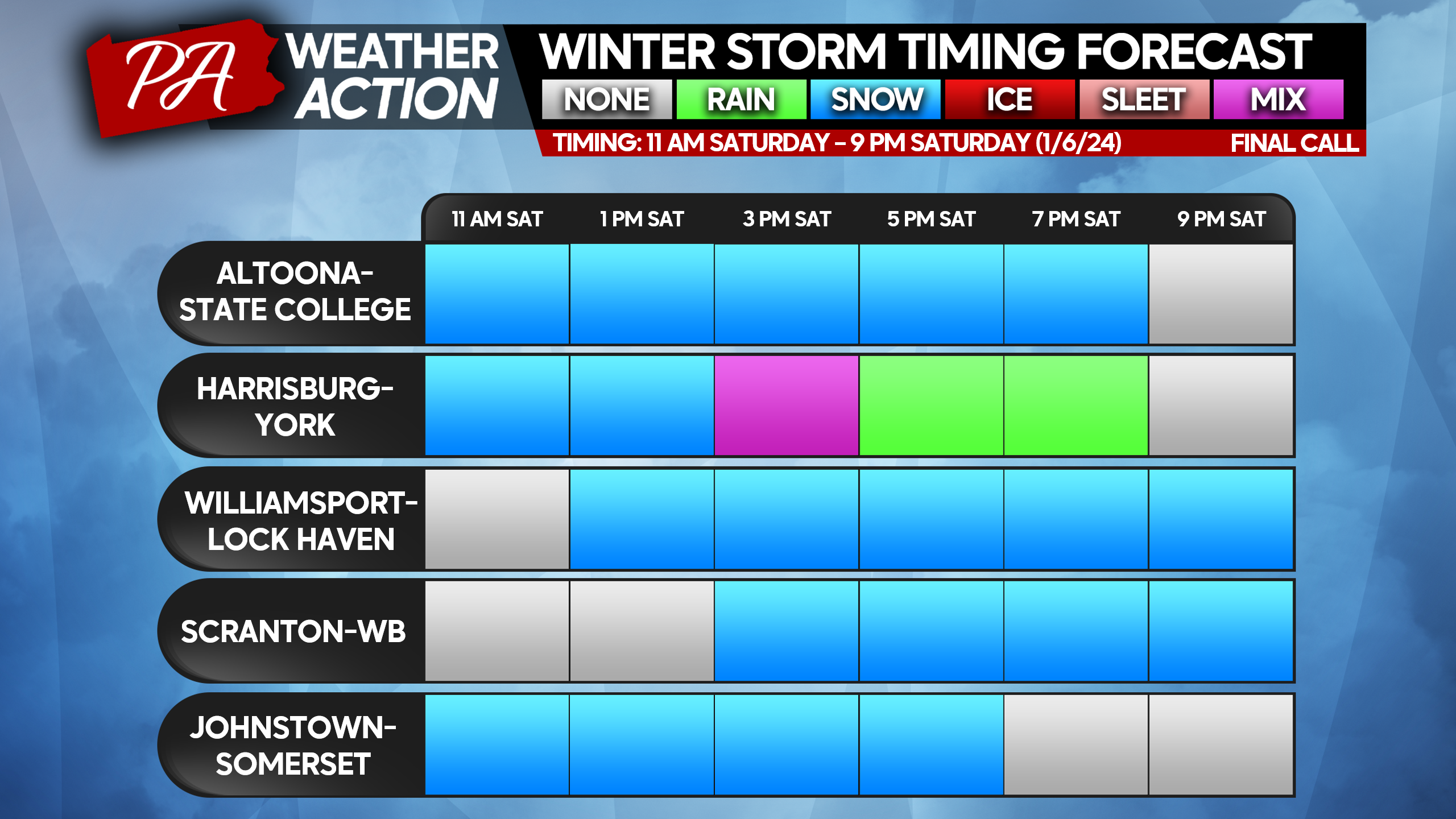
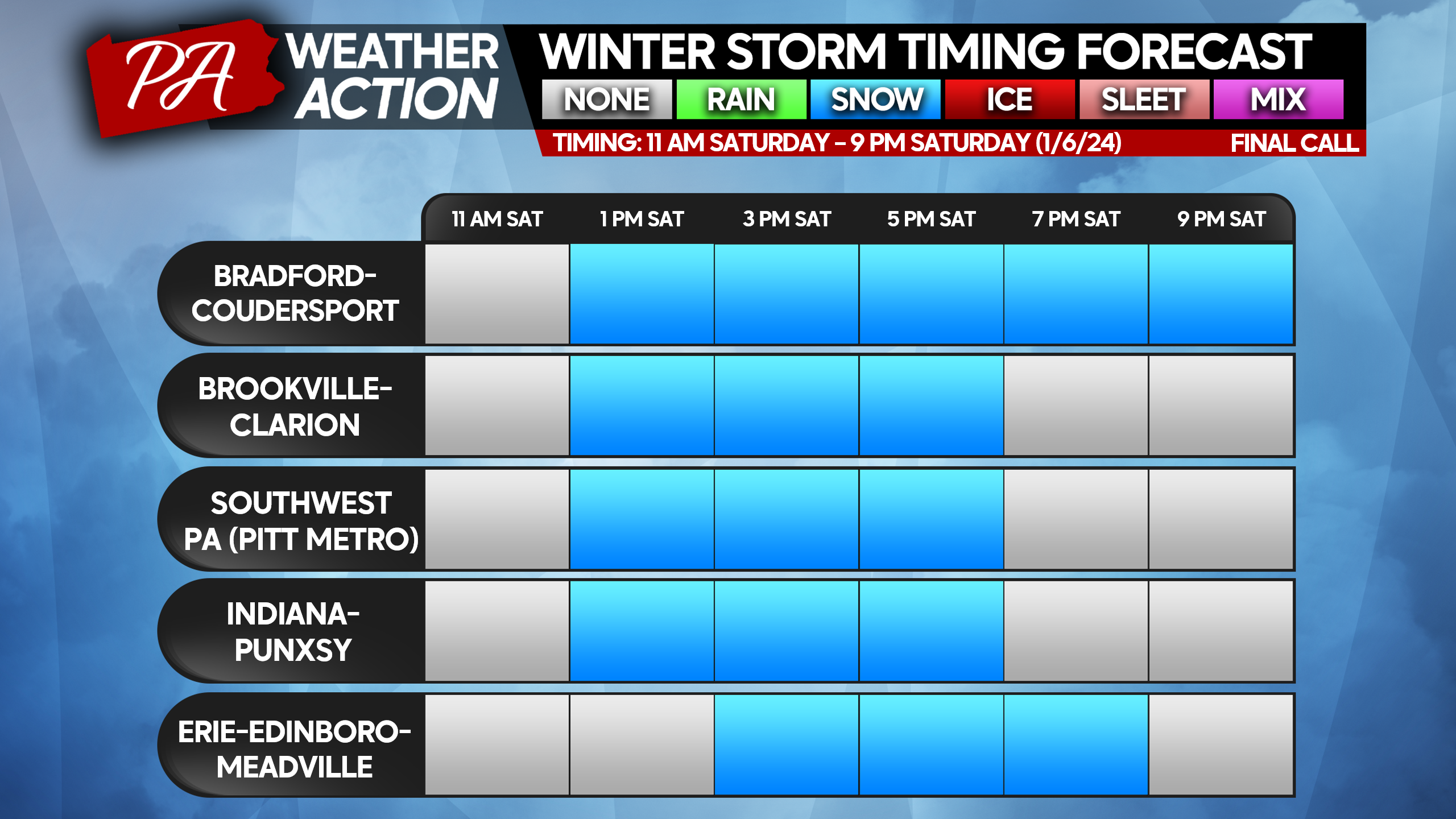
STORM IMPACT TIME TABLES
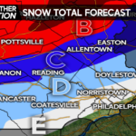
FINAL CALL SNOWFALL FORECAST FOR SATURDAY’S SIGNIFICANT SNOWSTORM
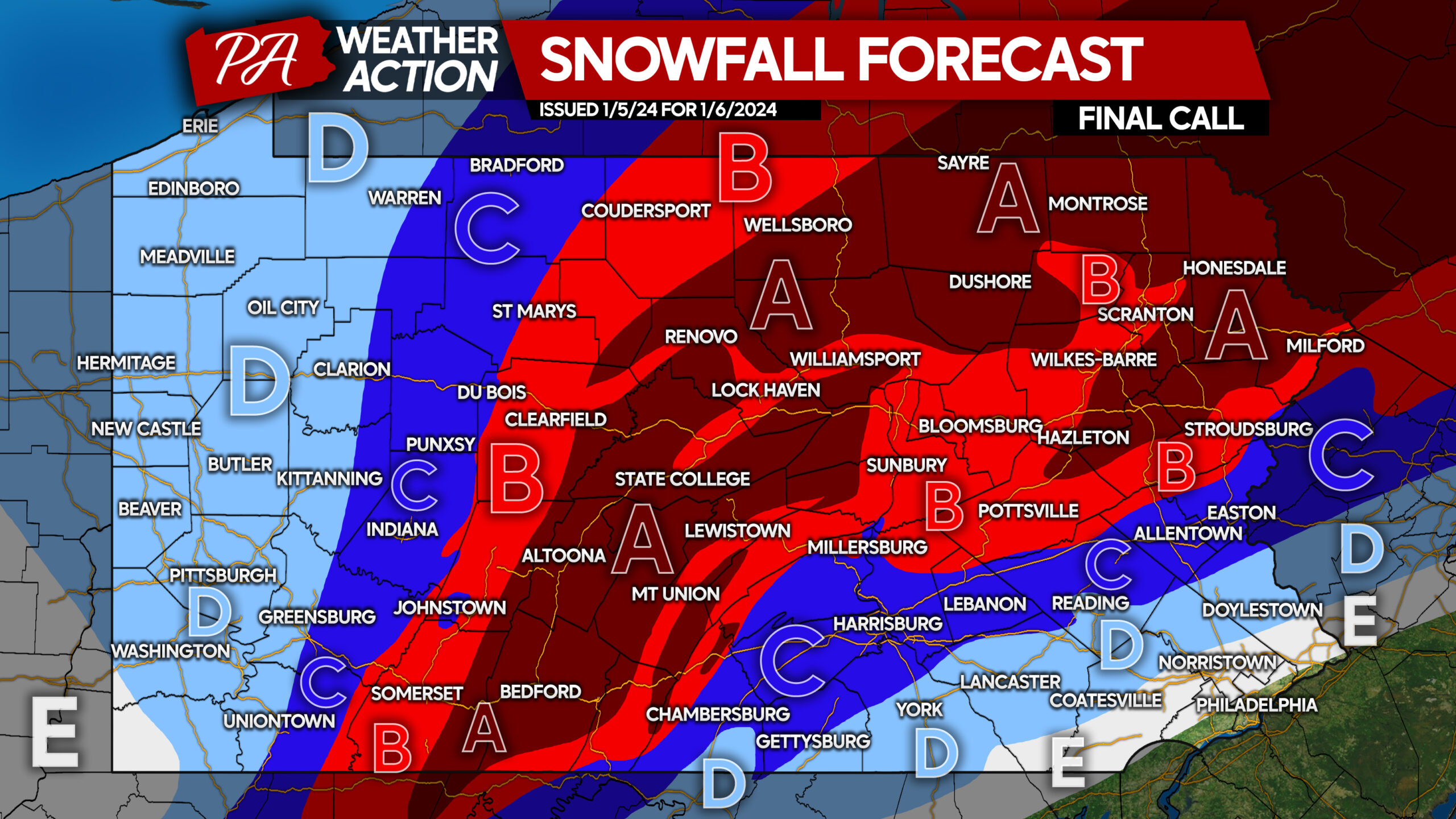
Area A: Snowfall accumulation of 8 – 12″ expected. All snow expected, with rates often above 1″ per hour. Do not travel during storm.
Area B: Snowfall accumulation of 6 – 8″ expected. All snow expected, with rates often above 1″ per hour. Do not travel during storm.
Area C: Snowfall accumulation of 4 – 6″ expected. Southern areas near I-81 and I-78 will begin as snow, followed by a brief wintry mix before ending as snow. Snowfall rates at onset above 1″ per hour, no not travel during that period.
Area D: Snowfall accumulation of 2 – 4″ expected. Southern areas will begin as snow before changing to a long period of wintry mix and rain. Snowfall rates above 1″ per hour at onset, limit travel during that period.
Area E: Snowfall accumulation of 1 – 2″ expected. Southern areas will briefly begin as snow before changing to rain.
Don’t forget to share this forecast with family and friends below!
Don’t forget to download the PA Weather Action App here ~> PWA App Link
You must be logged in to post a comment.