
A tale of two stories thus far with above average snowfall to start the season across the Midwest and Great Lakes. The infamous snow hole has found its way into our area again. Much of Virginia is off to roaring start in terms of snowfall, meanwhile Southeast PA has nothing to show for.
This weekend’s snow opportunities are trending downward as well, with a warm-up likely coming by the end of next week. From there, we look to see more swings before what looks to be a warm period around the holidays. I am right there with you in frustration, snow lovers.
But onto the task at hand, which is snow for those who are all too familiar. To be fair, these mountainous areas of Northern PA average more snow than anyone. But then again, parts of Southern Virginia are already near their entire seasonal average. I digress.
A strong clipper coming across the Great Lakes will bring snow to parts of Pennsylvania with northwest winds behind it, leading to lake effect snow following the clipper, mainly in Northwest PA.
Future Radar Timing
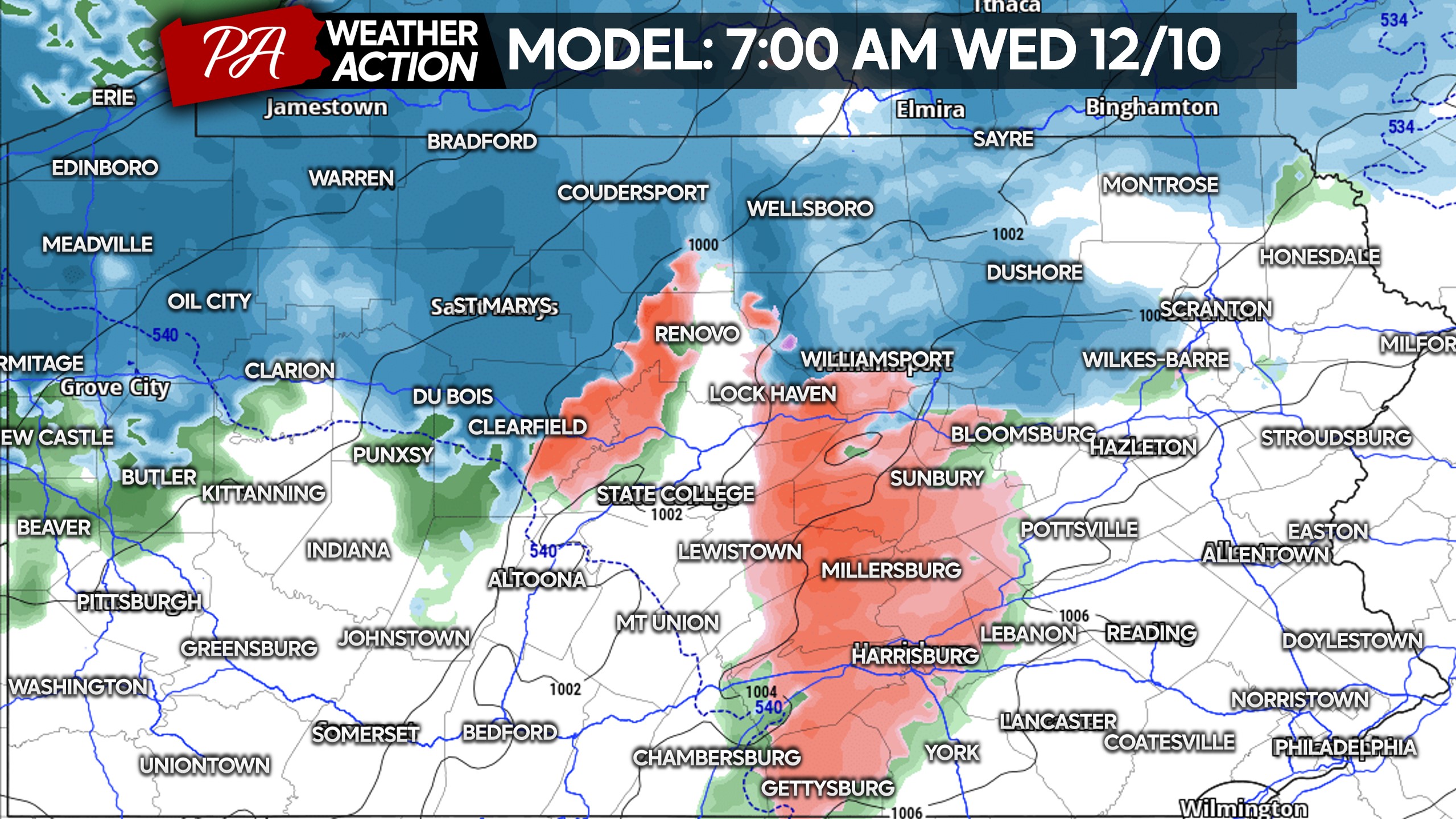
Light to moderate snow will fill the radar in Northern PA by the Wednesday morning commute. Roads may be slippery by this point in Northwest PA. Below is future radar for 7 AM Wednesday.
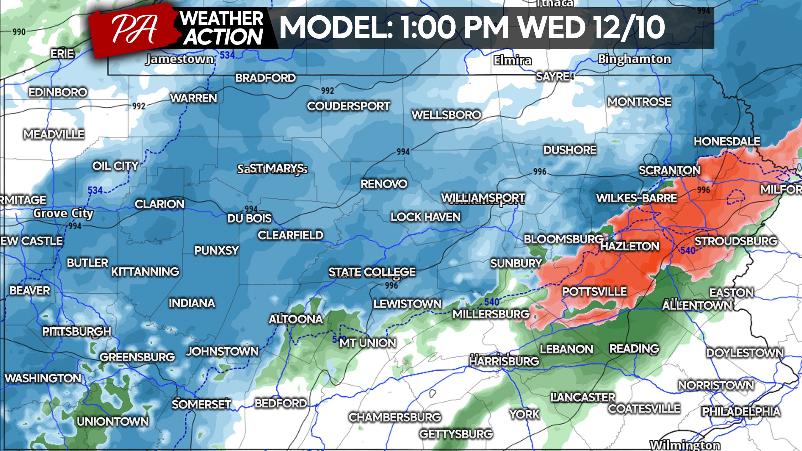
As we hit lunchtime Wednesday, snow will be falling across most of Western and Northern PA. The Poconos will likely start as freezing rain before switching to snow early afternoon. Even northern areas of the Lehigh Valley may switch to snow by the late afternoon.
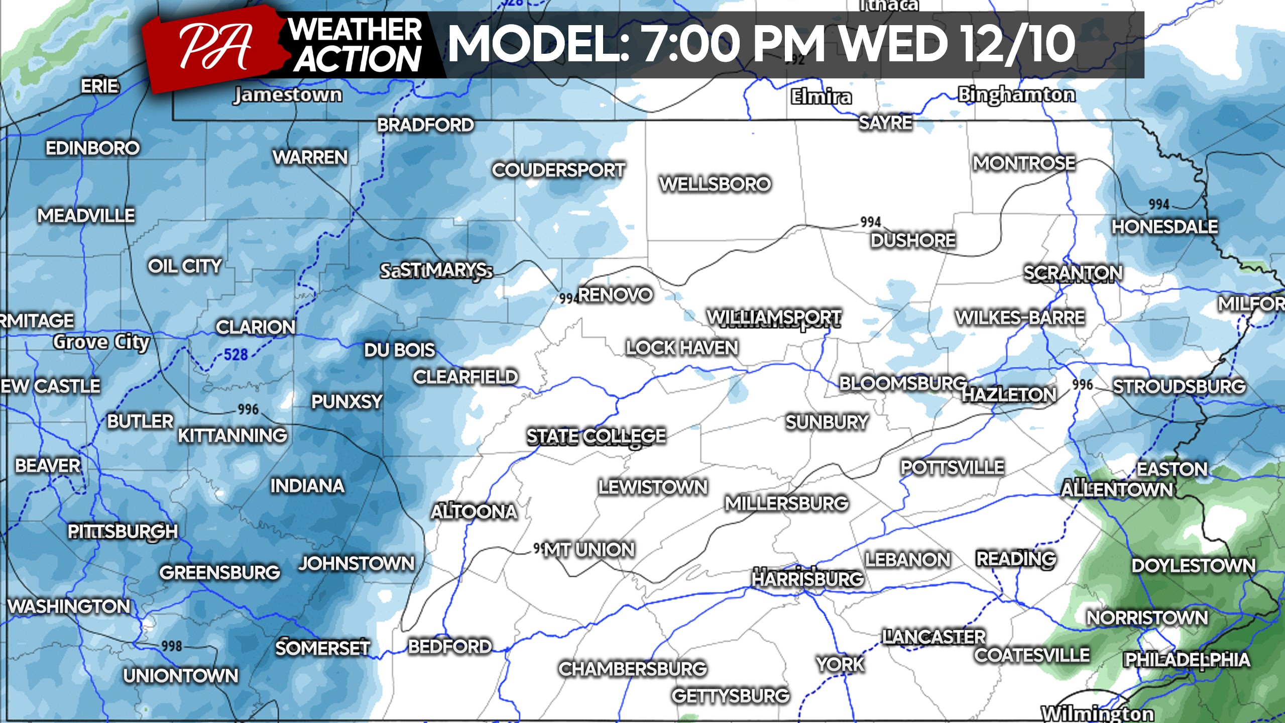
By dinnertime Wednesday, widespread light snow will fill the map in Western PA as lake effect takes over. Temperatures will be falling, so roads may be slick especially later Wednesday evening. Here is the Hi-Res NAM model for 7 PM Wednesday.
Those widespread snow showers will dissipate early Thursday morning as we switch to lake effect snow squall model. Snow squalls will rage all day across the northwest quarter of the state, occasionally causing issues on I-80 in the usual areas of Central PA.

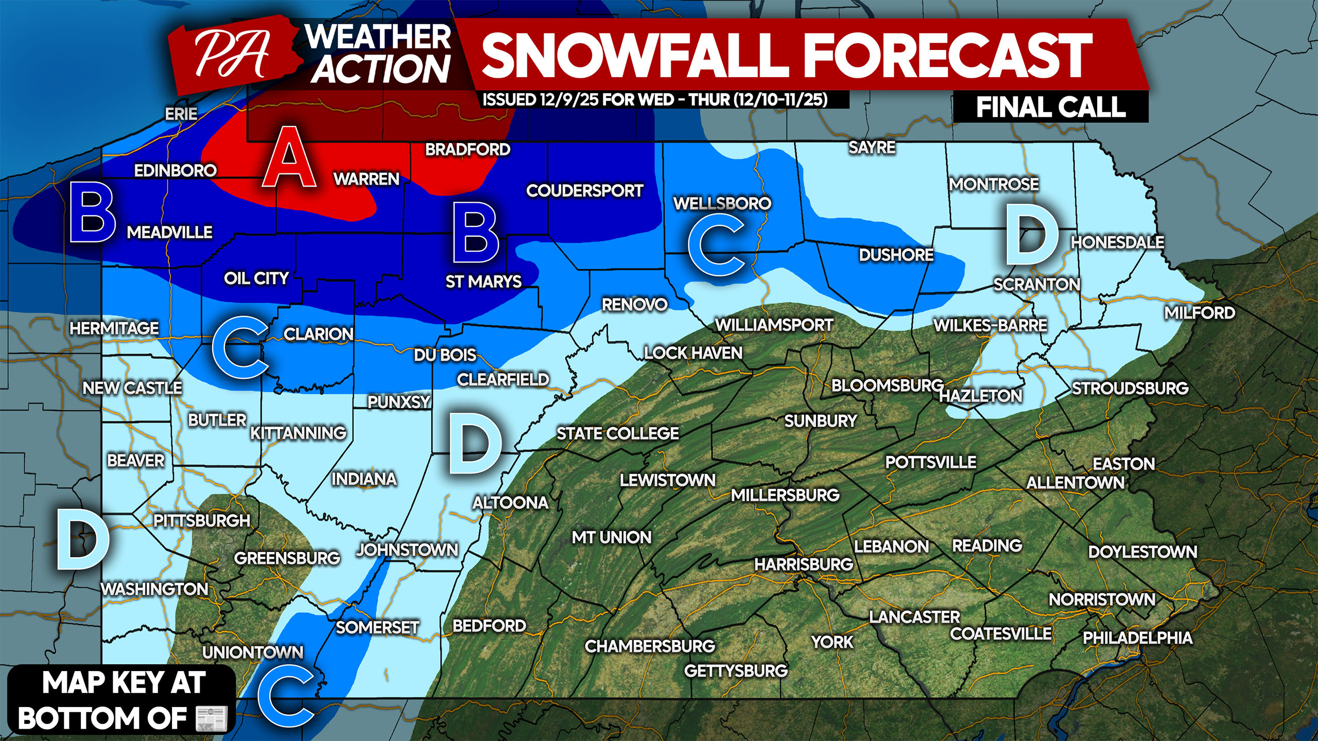
FINAL CALL SNOWFALL FORECAST FOR WEDNESDAY INTO THURSDAY IN PA
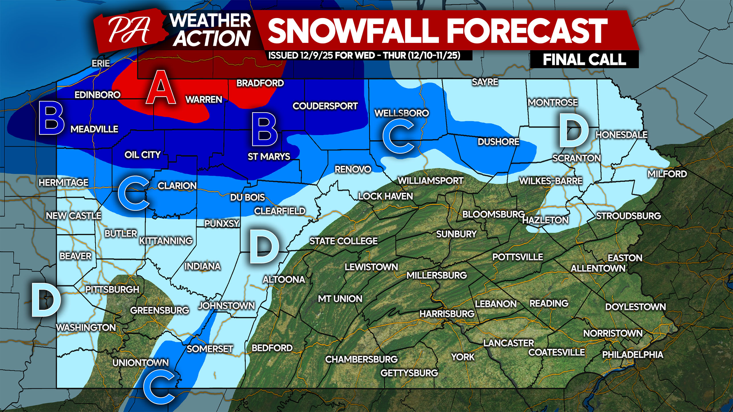
Area A: Snowfall accumulation of 8-14″ expected. Roads will be snow-covered from Wednesday morning through Thursday night. Use caution when traveling!
Area B: Snowfall accumulation of 5-8″ anticipated. Snow-covered roads will cause very difficult travel especially on mountain roads.
Area C: Snowfall accumulation of 3-5″ expected. Roads will be snow-covered or slushy much of the day Wednesday into Thursday.
Area D: Snowfall accumulation of 1-3″ anticipated. Roads may be slushy during times of snow, mainly from the clipper system.
Don’t forget to share this information with friends and family in impacted regions! Stay safe and warm!
You must be logged in to post a comment.