
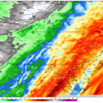
A soggy and foggy Sunday it has been in much of the state – but this is what Decembers have become the last decade it seems. Now this evening, temperatures are crashing from west to east across the state as a cold front moves in. However, there’s more precipitation to come and that will fall as rain in the valleys and snow in the mountains generally, however even the valleys may get some snow at the end. Models have been a roller coaster ride more intense than anything at Hersheypark.
The change from rain to snow will be extremely elevation-dependent, to the point our snowfall forecast is practically an elevation map in much of Central PA. Snow may accumulate on roadways in areas where more than an inch of snow is expected, especially in areas above 1000′ elevation. This is a good tool to find your elevation.
There is even a slim chance you may hear some thunder this evening into early Monday morning in Central and Eastern PA. Jim Cantore is reportedly in the area (just kidding).
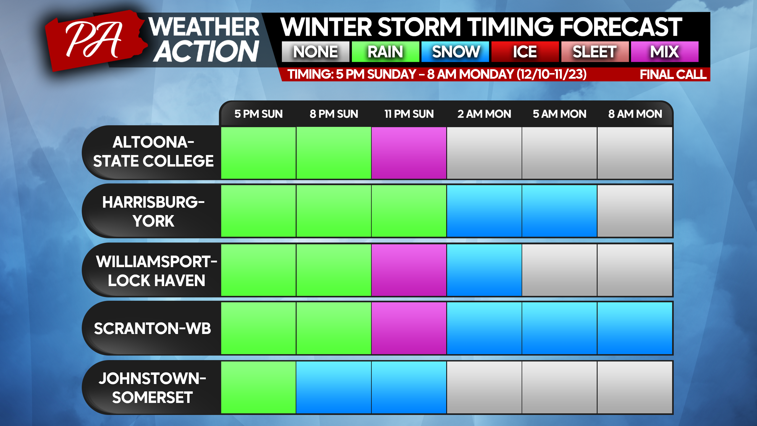
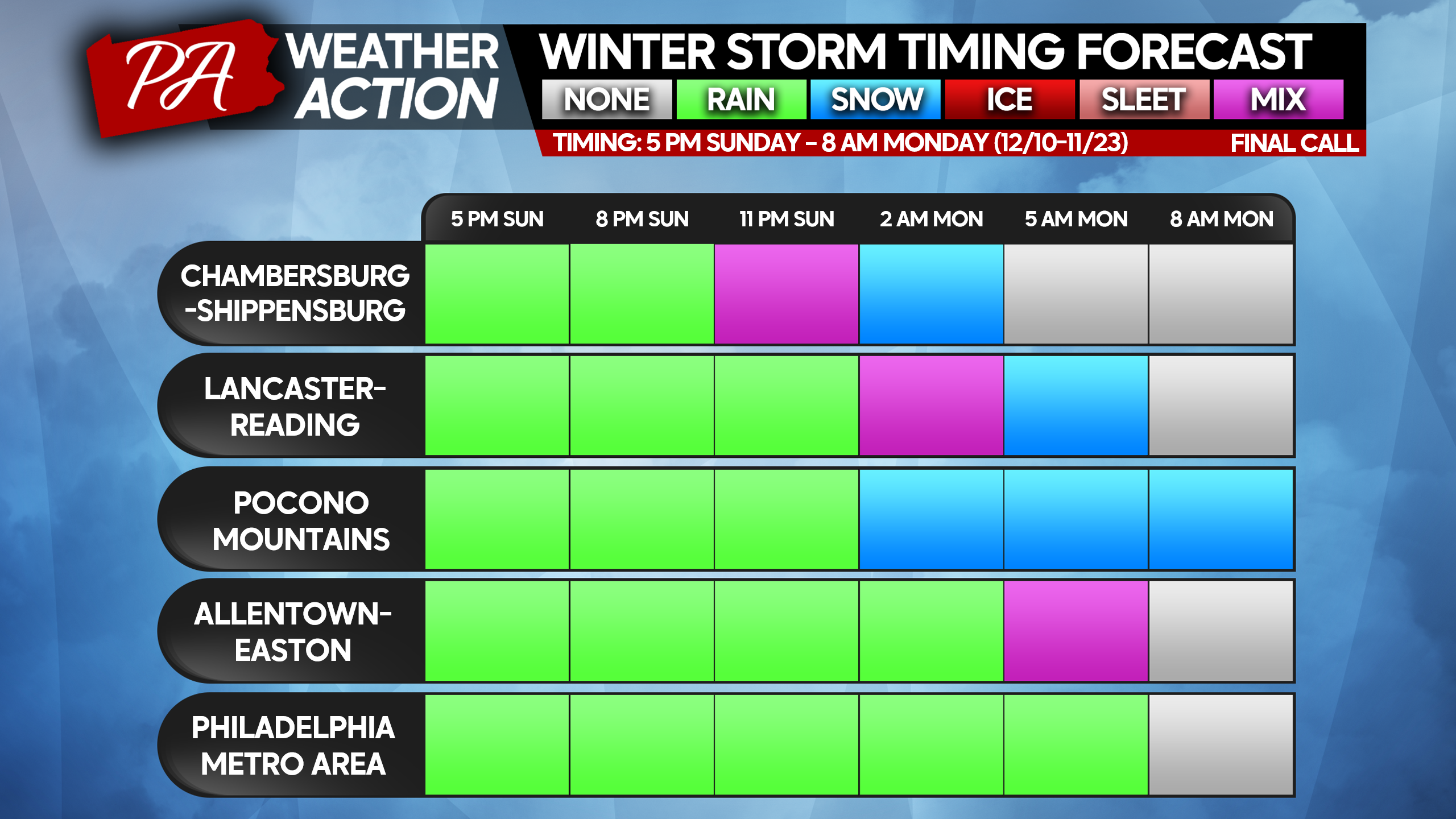
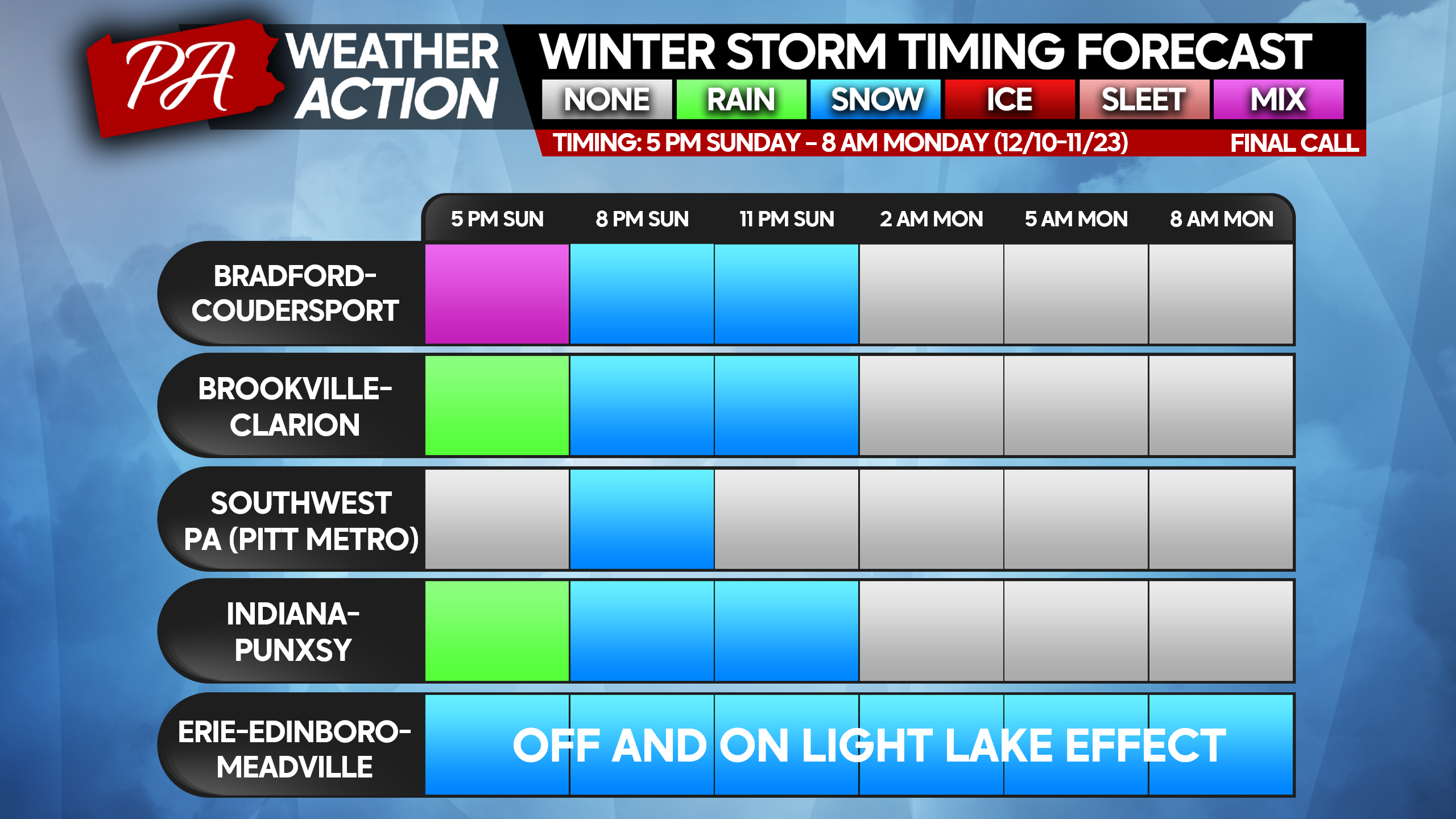
STORM TIME TABLES
FINAL CALL SNOWFALL FORECAST FOR SUNDAY EVENING – MONDAY MORNING
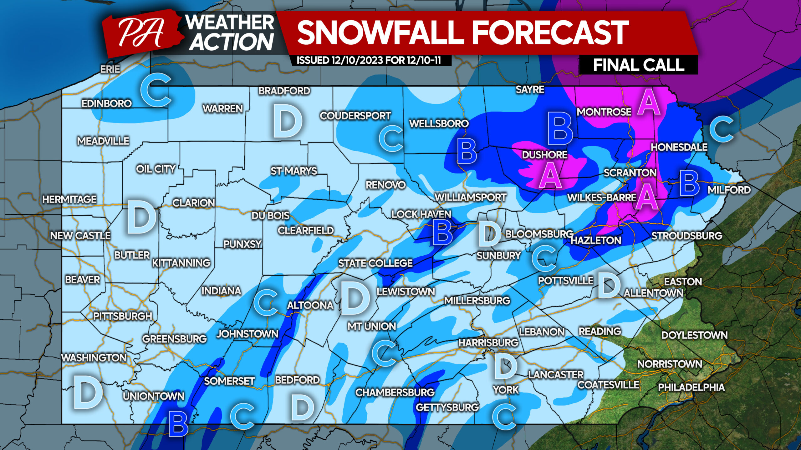
Area A: Snow accumulation of 4 – 7″ expected, with highest amounts above 2000′ elevation. Snow-covered roads expected during and after the storm.
Area B: Snow accumulation of 2 – 4″ expected, with highest amounts above 2000′ elevation. Slushy road conditions expected during and shortly after the storm.
Area C: Snow accumulation of 1 – 2″ expected. Slippery travel conditions possible when snow is falling.
Area D: Snow accumulation less than 1″ expected. Eastern portions of this area may experience slippery travel briefly when snow is falling.
Be sure to share this final forecast with family and friends! Could be some slow Monday morning commutes depending on your area!
You must be logged in to post a comment.