
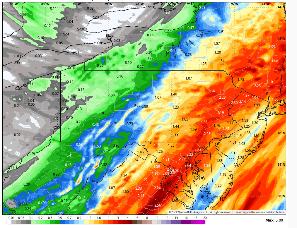
RAINFALL POTENTIAL
A strong cold front is slowly pushing eastward across the region, undercutting strong south wind aloft that is transporting tropical moisture all the way from the equatorial Pacific! Batches of heavy rain will stream northward across the area to inundate our area with widespread 1-3″, with the heaviest amounts focused on the Delaware River watershed. The NWS issued a flood watch for much of the area.
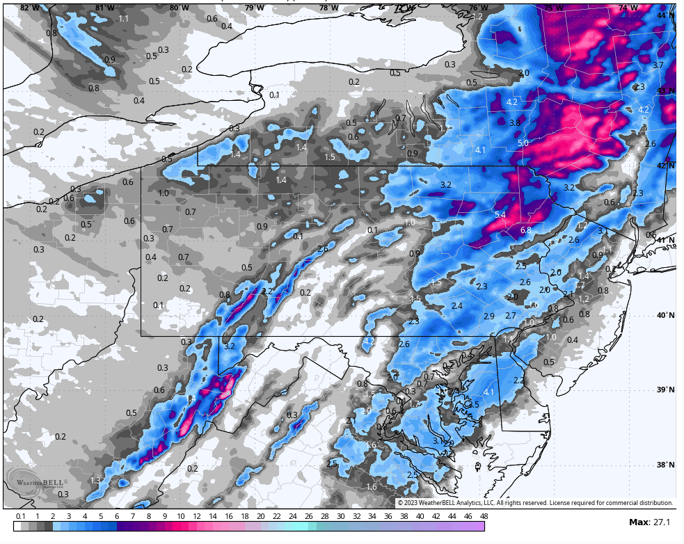
SNOWFALL POTENTIAL
As colder air continues to push eastward into our area tonight, the rain will change to snow from NW to SE. Timing of changeover looks to be around 8pm in Bradford-Sullivan-Susquehanna counties, eventually reaching all but the lower elevations of the southern Poconos by midnight. A disturbance will ripple northward along the front just off the NJ coast tonight, prolonging the precipitation in the form of snow for much of the night. Most areas will enjoy 1-3″ snow. Elevations above 1500 ft could get as much as 6″ accumulation. However, those of you in the southeastern part of the area below 1000 ft elevation might struggle a bit to get cold-enough for accumulation, but it cannot be ruled out just yet. The snow will exit the area Monday morning. Strong NW wind gusting to 40 mph will supply cold air and snow showers for Monday afternoon.

You must be logged in to post a comment.