
Often times we have seen models overdo confluence this year and storms have trended northwest in the final one or two days before the storm. But this time, that will not be the case. Model guidance has lowered snow amounts somewhat. With a brutal supply of cold air to our northwest, it’s no surprise this storm will produce highest snowfall amounts to our south and on the immediate NJ Coast, as well as Cape Cod.
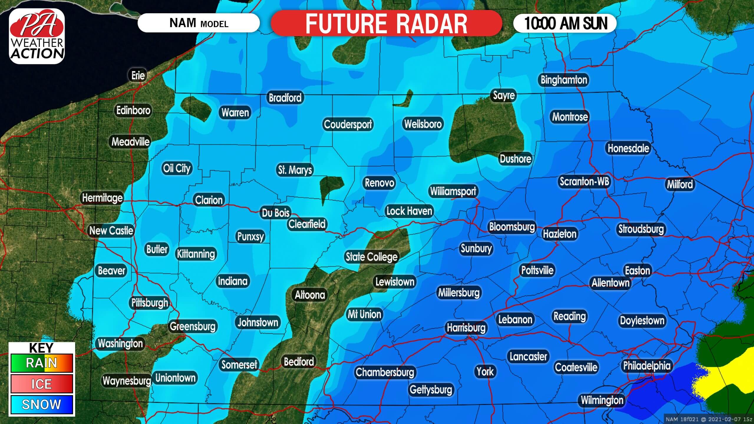
Most of the eastern half of Pennsylvania will be seeing moderate snow by dawn Sunday, with highest radar coverage likely around 9-10 AM. Snowfall rates of an inch per hour will be possible near Philadelphia. Below is future radar for 10:00 AM Sunday.
FINAL CALL SNOWFALL FORECAST FOR SUNDAY’S COASTAL
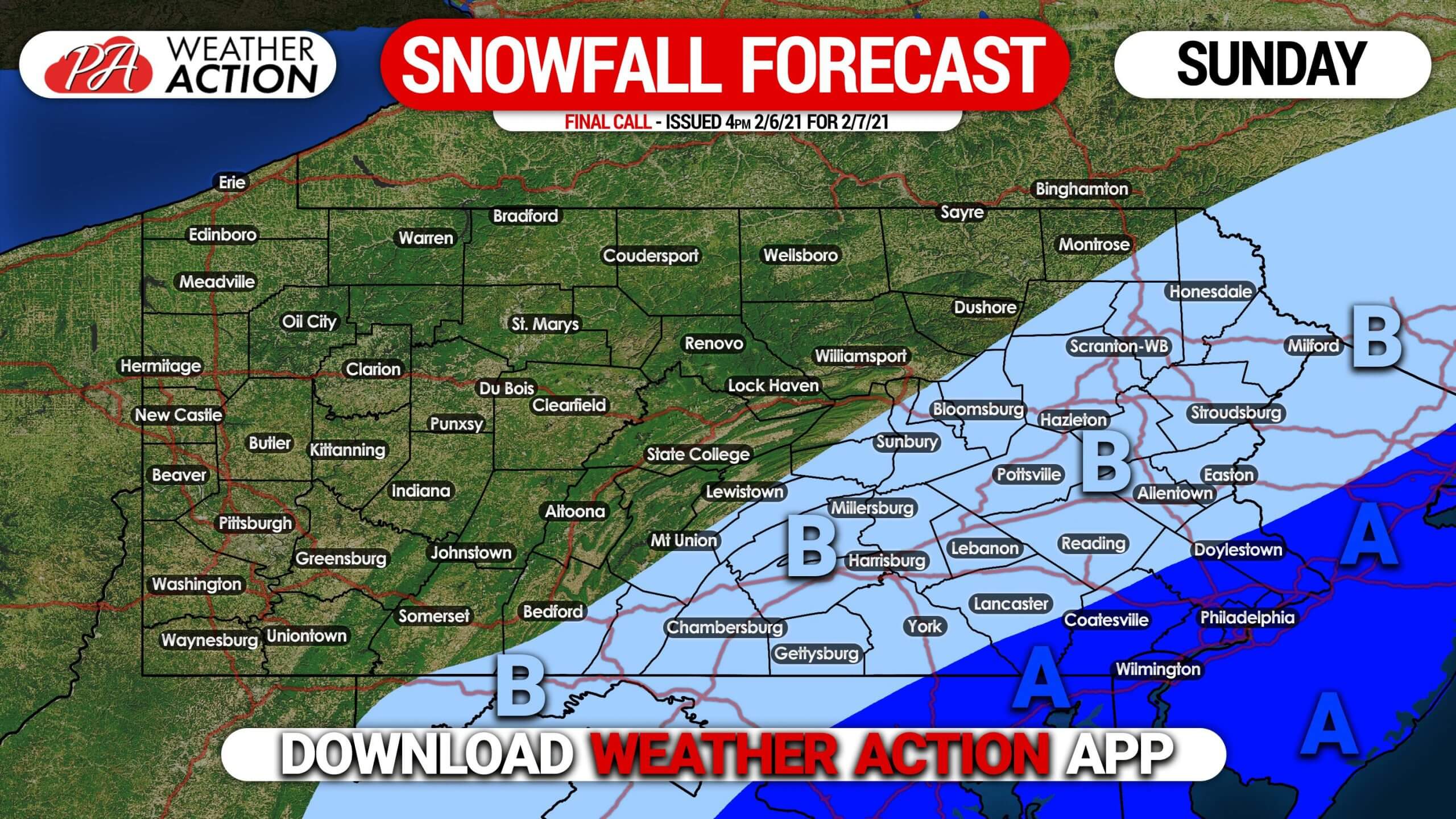
Area A: Snowfall accumulation of 3 – 5″. Moderate will begin early Sunday morning, ending by around noon from southwest to northeast. Slushy roadways expected.
Area B: Snowfall accumulation of 1 – 3″ expected.
Get the latest forecast with our app! Download it on the App Store here >>> Weather Action App
Be sure to share this forecast with friends and family using the blue button. Stay safe!


You must be logged in to post a comment.