
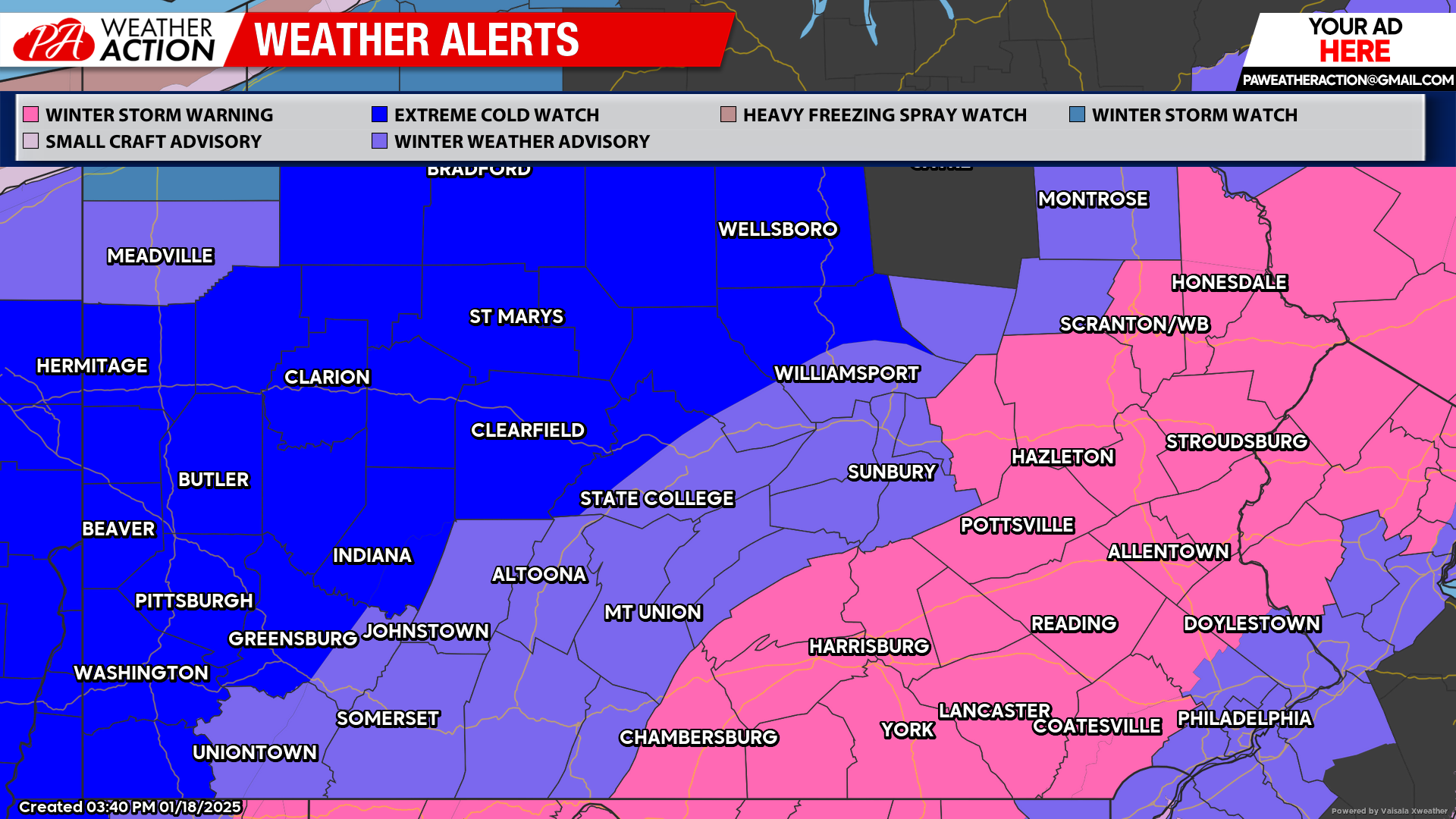
Winter Storm Warnings and Winter Weather Advisories have been issued by the NWS ahead of our short, but potent snowstorm that is on tap for Sunday. Travel will be dangerous Sunday afternoon and evening in most of the state, and it’ll be one of those days to stay inside and watch a snowy Eagles playoff game.
On the graphic below, you will also see Extreme Cold Watches in Western and Northern PA, issued for Monday to Thursday. There is a strong chance schools will be closed for multiple days this coming week due to the threat of frostbite. We will have those details on Sunday!
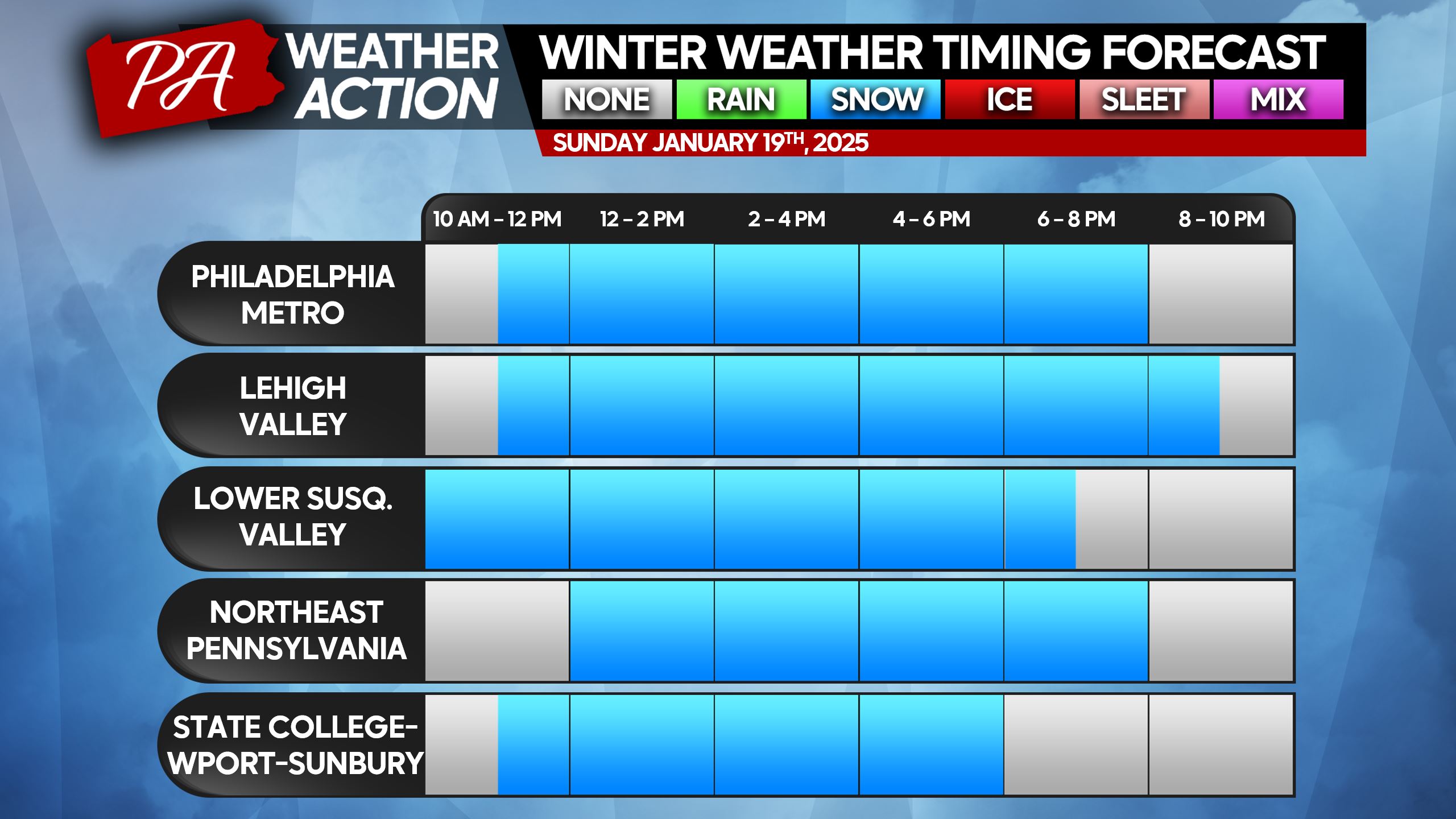
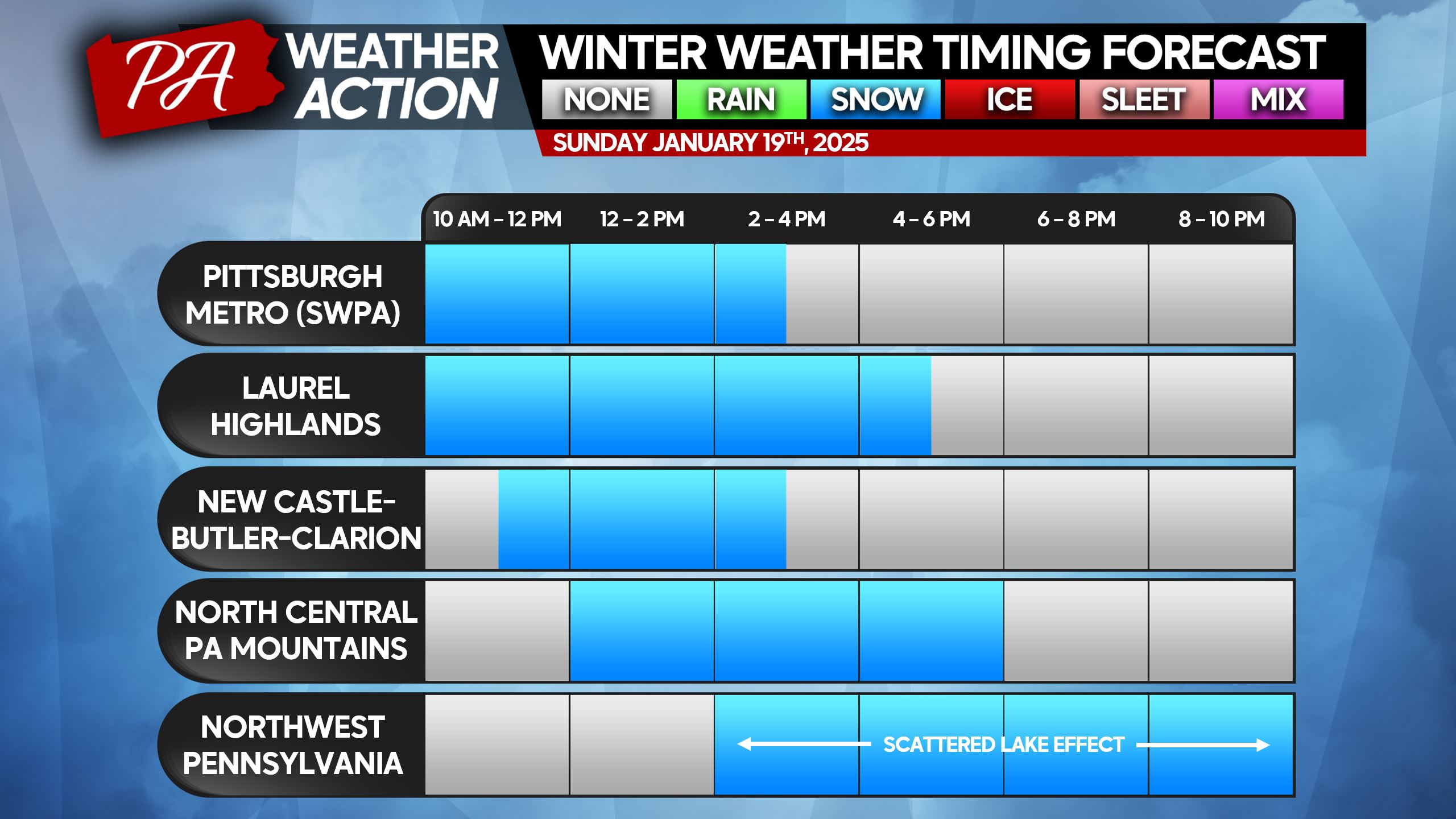
Snowstorm Timing
Light snow will move into Southern PA from SW to NE on Sunday morning between 9 – 11 AM. The leading edge of snow will push northeast towards I-80 around lunchtime, meanwhile snow will become heavy in Southern and Eastern Pennsylvania.
Heavy snow will continue generally along and east of the I-81 corridor through Sunday afternoon, while light to moderate snow falls near I-99 and Route 15 in Northern PA. As we head into the evening, snow will lighten up from SW to NE and begin to move out.
This will be a fluffy snow, which means it won’t be too exhausting to shovel. However it also means as winds kick up behind the storm for the next few days, snow drifts over roadways will be a concern along with the life-threatening cold temperatures.
Below are timing charts for this storm. If you do not see your location, please find the nearest city or area.
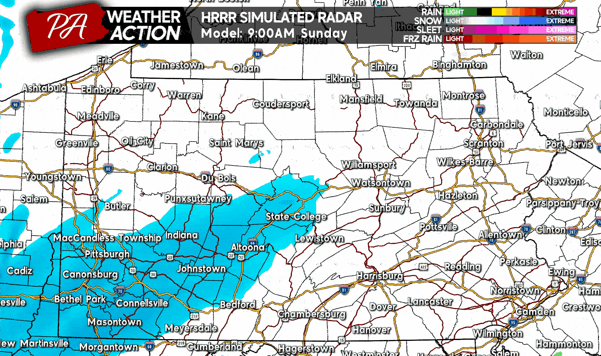
Below is the latest future radar from the Hi-Res Rapid Refresh Model as of Saturday evening, lining up with the timing shown above. You will also notice a small chance of mixing in Philadelphia, as well as lake effect snow in NWPA.
FINAL CALL SNOWFALL FORECAST FOR SUNDAY
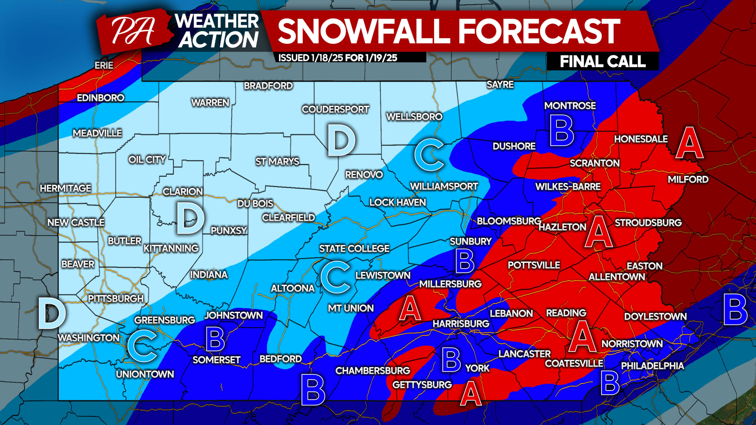
Area A: Snowfall accumulation of 6 – 8″ expected. Snow-covered roads will cause dangerous travel conditions soon after snow begins through early Monday morning.
Area B: Snowfall accumulation of 4 – 6″ anticipated. Roads will become snow-covered, making travel inadvisable after snow starts into early Monday AM.
Area C: Snowfall accumulation of 2 – 4″ expected. Snow-covered roads will lead to very poor travel conditions.
Area D: Snowfall accumulation of 1 – 2″ anticipated. Secondary roads may be covered by snow, causing slippery travel.
Be sure to share this forecast with friends and family!
More details on the harsh cold next week will be posted Sunday.

You must be logged in to post a comment.