
A March daytime snow event with marginal temperatures and a warm ground is the perfect recipe for elevation-dependent snowfall here in Pennsylvania. As a result, higher elevations are likely to see twice the amount of snow as neighboring valleys. This is not our last shot, as we are watching Saturday for probably some interior snowfall. For now, let’s get into timing and amounts for Wednesday’s event.
TIMING
Precipitation will move in to the area in the pre-dawn hours from southwest to northeast. In many valleys, it may begin as rain before evaporation cooling takes place as heavier precipitation occurs, changing the rain to snow. However, all of the Pittsburgh Area and much of the Philadelphia Area will be all rain. Moderate snow will continue through the morning, especially in the higher elevations. Low elevations (below 700′) in the southern tier may have a tough time changing to accumulating snowfall. Precipitation will continue into the early afternoon before lifting out in the mid to late afternoon. Overall, roads should be mainly wet below 1000′ elevation. Below is future radar from the Hi-Res NAM for this event.
FINAL CALL SNOWFALL FORECAST FOR WEDNESDAY
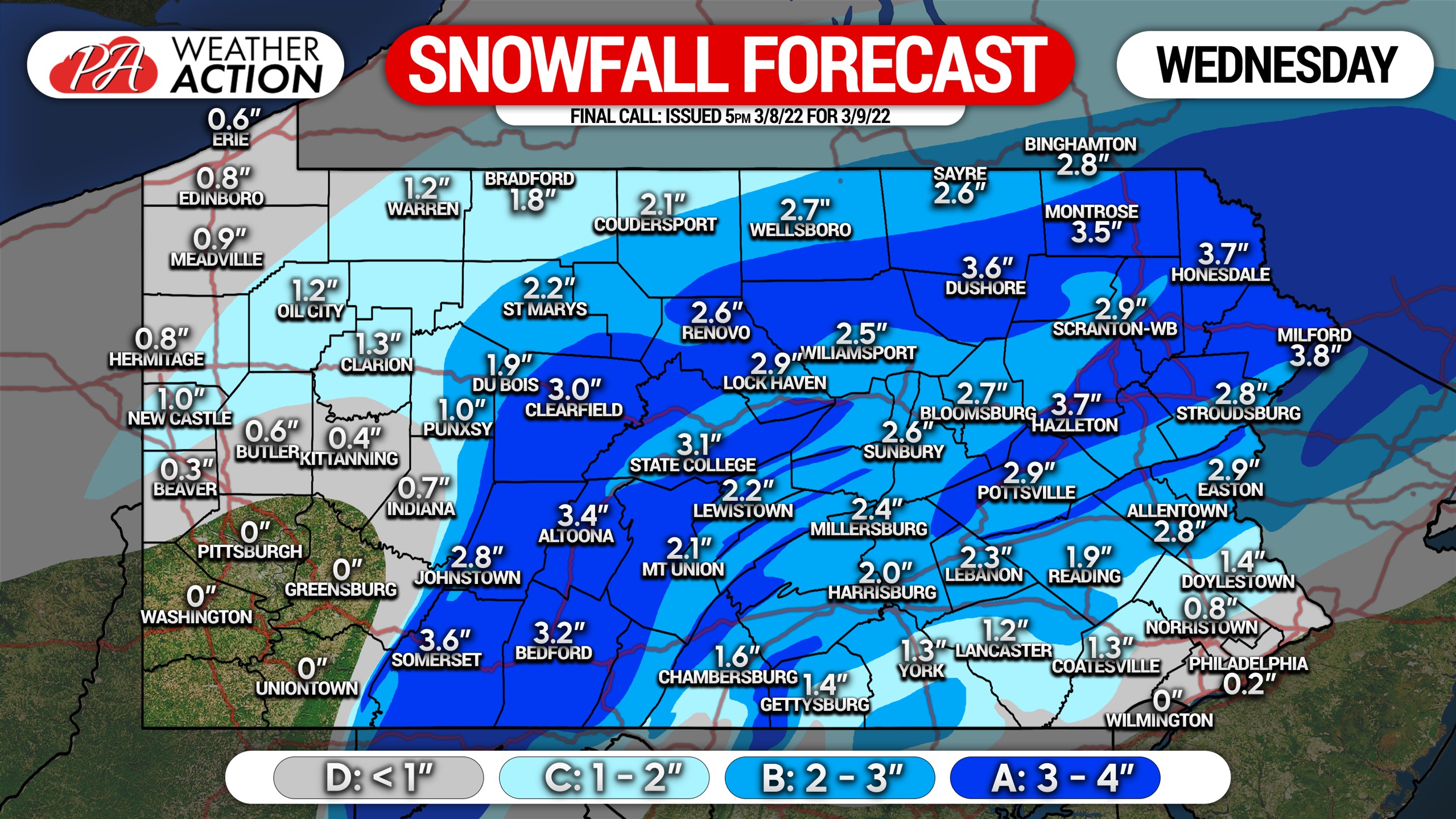 Area A: Snowfall accumulation of 3 – 4″ on unpaved surfaces, 1 – 2″ on untreated paved surfaces.
Area B: Snowfall accumulation of 2 – 3″ on unpaved surfaces, coating to 1″ on untreated paved surfaces.
Area C: Snowfall accumulation of 1 – 2″ on unpaved surfaces, coating on untreated paved surfaces.
Area D: Snowfall accumulation of less than 1″ on unpaved surfaces.
Be aware of changing road conditions with elevation increase.
Be sure to share the forecast with family and friends below! Stay safe!
[social_warfare]
We continue to make upgrades to our app and have many new things on tap this year. Get it on your phone’s app store by tapping the banner below!


You must be logged in to post a comment.