
Busy times may be ahead in the weather department, but for now let’s focus on this weekend. A strong system will move into the area Saturday into Sunday, dropping feet of snow to our north. We will see a bout of wintry precipitation on the front-end of this storm, followed by a changeover to plain rain.
Cold air damming will play a role, especially when it comes to ice accumulation in the Appalachians. Snow will be more latitude-based, as temperatures in the upper levels aren’t affected as much by topography this time. We have adjusted our snowfall forecast slightly south with the recent trends.
We will be the first to keep you informed on realistic thoughts and expectations for the potential winter storm next Thursday. There is a long way to go, but the one thing we are confident about is that if there is a coastal storm, Pennsylvania will see mainly snow. No wintry mix or rain nonsense.
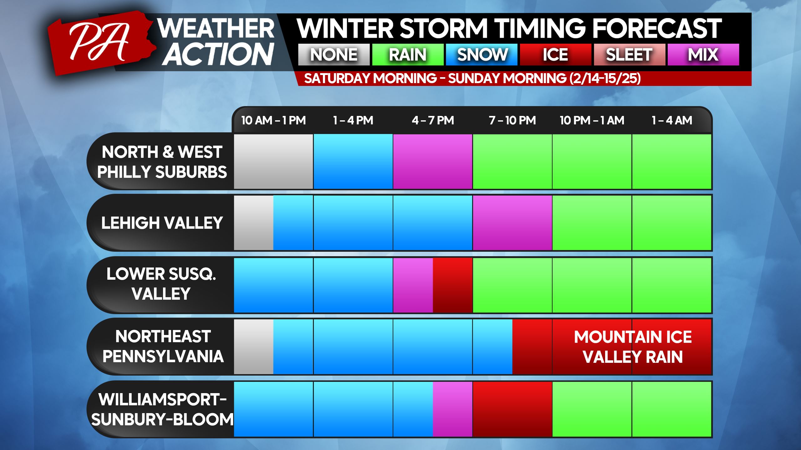
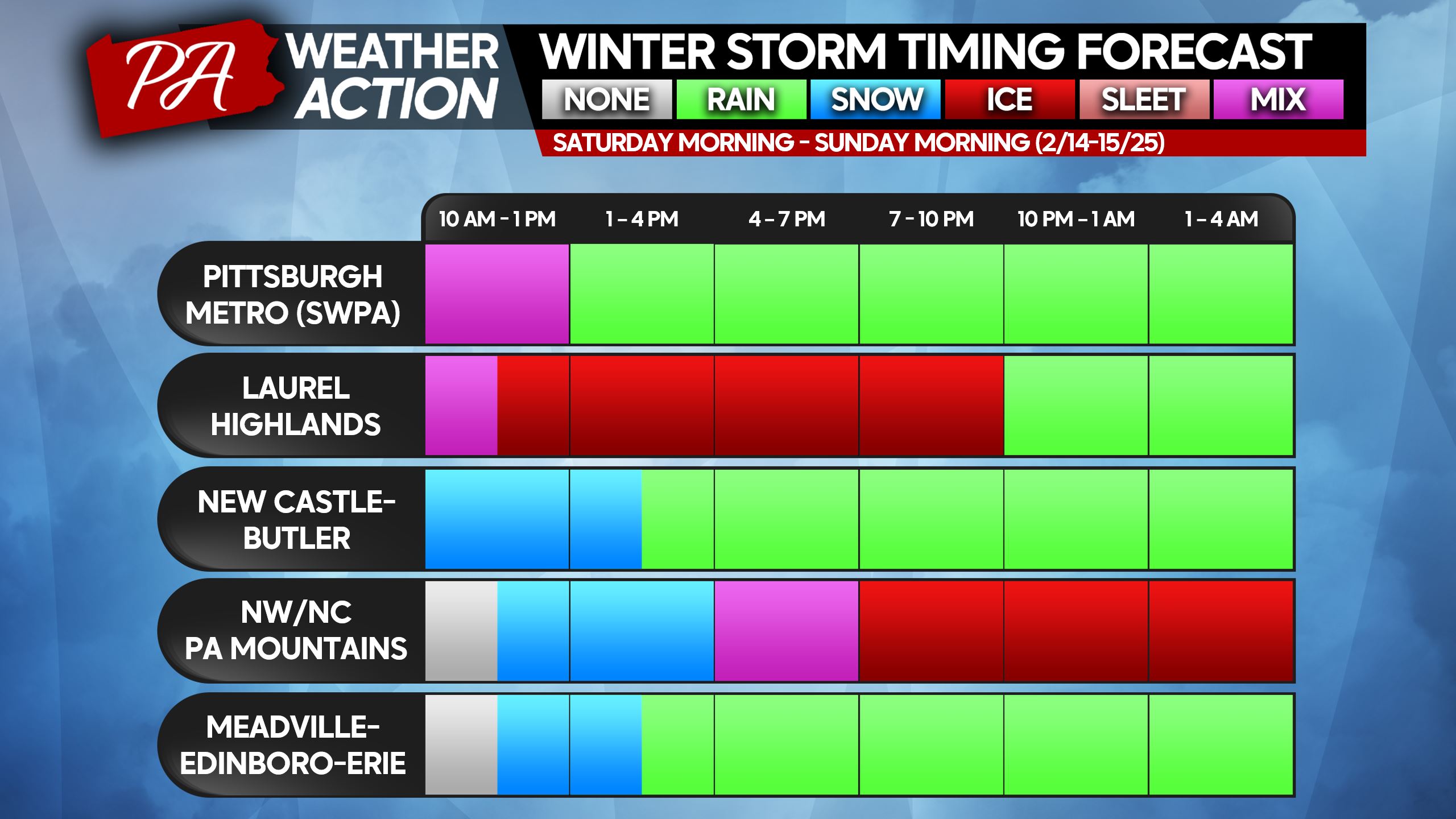
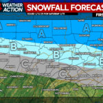
WINTER STORM TIMING FORECAST
Precipitation will move into Western PA just after sunrise Saturday as mainly snow, except in far SWPA. As the morning progresses, the rain/snow line will push north through the Pittsburgh Metro.
By 9-10 AM, snow will make its way into Central PA and by lunchtime, it will hit Eastern PA. The rain/snow line will push north as the afternoon progresses, meaning those north of I-80, east of State College will hang onto snow the longest.
The issue is that after the changeover to rain happens, many areas will still be below freezing. This means freezing rain (ice) will begin to accumulate, especially in the higher elevations above 1000′. Places like the Allegheny Front and higher areas of the Poconos will see an extended period of freezing rain.
Please find your nearest city/area on the timing charts below.
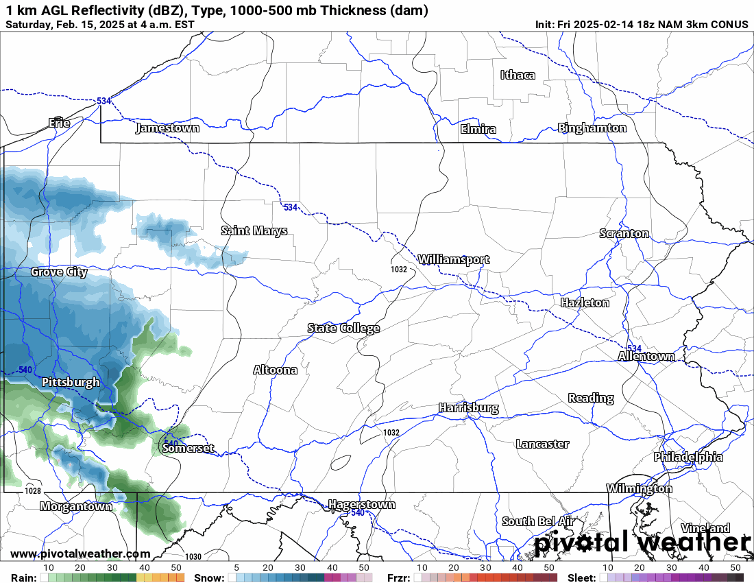
Below is the latest Hi-Res NAM Future Radar for the duration of the wintry portion of this storm.
FINAL CALL ICE FORECAST FOR SATURDAY – SUNDAY
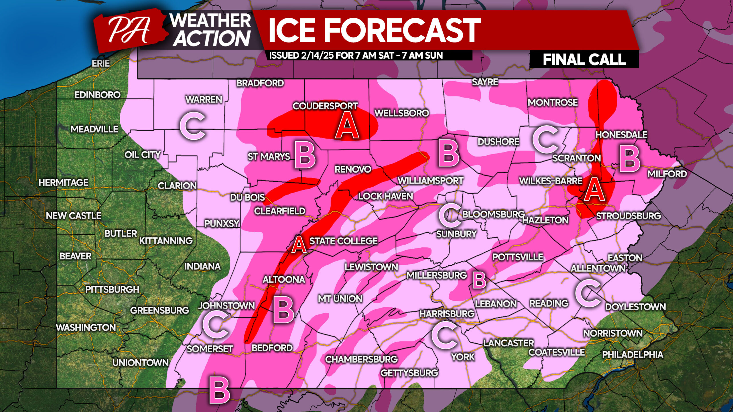
Area A: Ice accumulation between a fifth and a quarter-inch expected. Roadways will become extremely hazardous, and travel is not advised.
Area B: Ice accumulation between a tenth and a fifth-inch anticipated. Roadways, especially secondary roads, will likely be very slippery.
Area C: Ice accumulation between a hundredth and a tenth-inch expected. Ice will mainly accumulate on elevated surfaces, but hilltop roads may be slick.
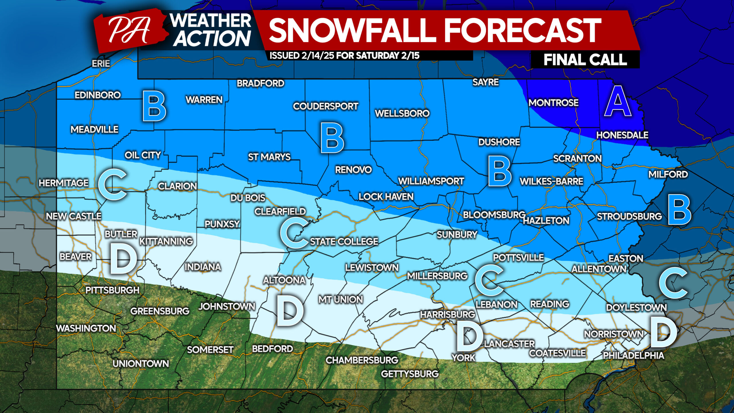
FINAL CALL SNOWFALL FORECAST FOR SATURDAY
10 AM Sat Live Update: Snow is overachieving north and east of Pittsburgh to South Central PA. Expect a few inches of snow near the PA Turnpike to the Southern PA border before changing to rain.
The forecast remains on track elsewhere.
Area A: Snowfall accumulation of 4 – 6″ expected. Snow-covered roads will cause treacherous travel, especially when ice accumulates on top.
Area B: Snowfall accumulation of 2 – 4″ anticipated. Snow-covered and slushy roads will lead to difficult travel conditions.
Area C: Snowfall accumulation of 1 – 2″ expected. Roads will be slushy during times of heavier snow.
Area D: Snowfall accumulation of less than 1″ anticipated. Roads should be just wet.
Be sure to share this forecast with family and friends!
You must be logged in to post a comment.