
Since December 1st, Pennsylvania has experienced the coldest temperature anomalies of any state in the Lower 48. The second half of winter will likely continue that, meaning a snowy March is on the table unlike previous seasons.
With a weak to moderate El Niño looking possible next winter, there’s a decent chance of a third consecutive colder than normal winter. But for now, let’s focus on the near-term.
SNOW TIMING
Light to moderate snow will start falling in Western PA around sunrise Friday or shortly after, with the morning commute probably being OK. Scattered snow showers will push into Central PA early Friday afternoon, reaching Eastern PA by the early evening hours around dinnertime.
Although the snow will fall lightly, temperatures in the 20s will enable it to accumulate on all surfaces. Roads often aren’t treated for relatively minor snow events like this one, especially after what we’ve dealt with recently.
Snow will conclude in Central PA Friday evening, but will persist until the early hours of Saturday morning in Western and Eastern PA. We are watching for very intense snow squalls in Western PA Friday evening along the Arctic front.
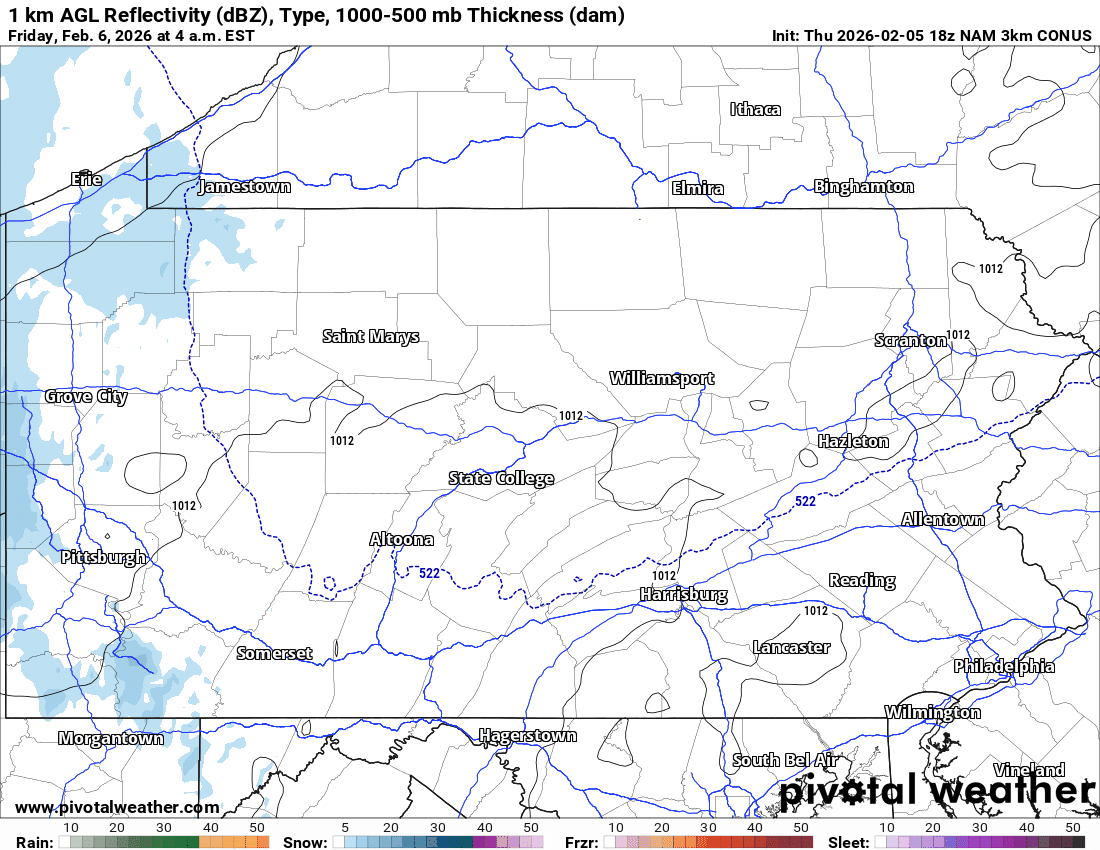
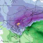
Below is the most recent High Resolution NAM model simulation for this clipper.
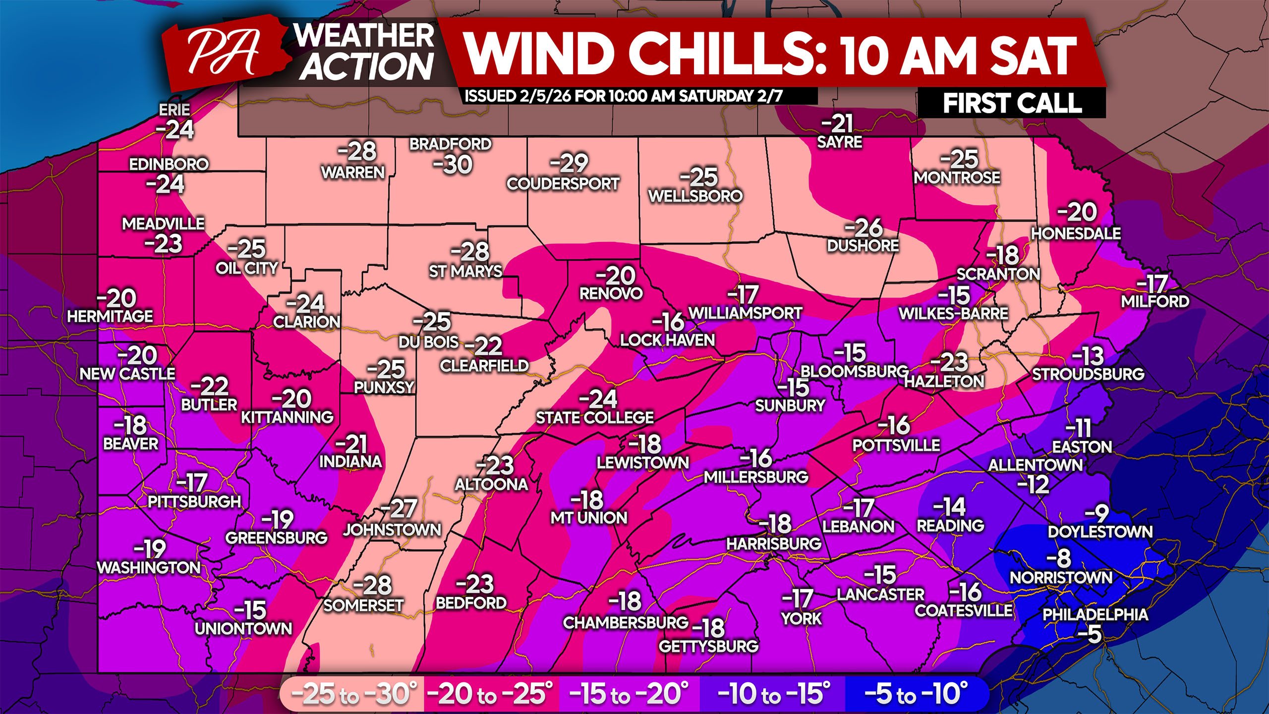
The coldest wind chills of the season will blow in Saturday morning with wind gusts of 35-55 MPH and temperatures on either side of zero. These winds will whip up the loose snow that falls from this clipper, creating ground blizzards which cause very low visibilities and snow drifts on roads.
If you must be outside, dress in multiple insulating layers under a winter coat and cover as much exposed skin as possible! Limit time outdoors, take frequent warm-up breaks, and watch for signs of frostbite (numbness, pale or hard skin). And don’t forget to bring pets inside! Below are wind chills for 10:00 AM Saturday.
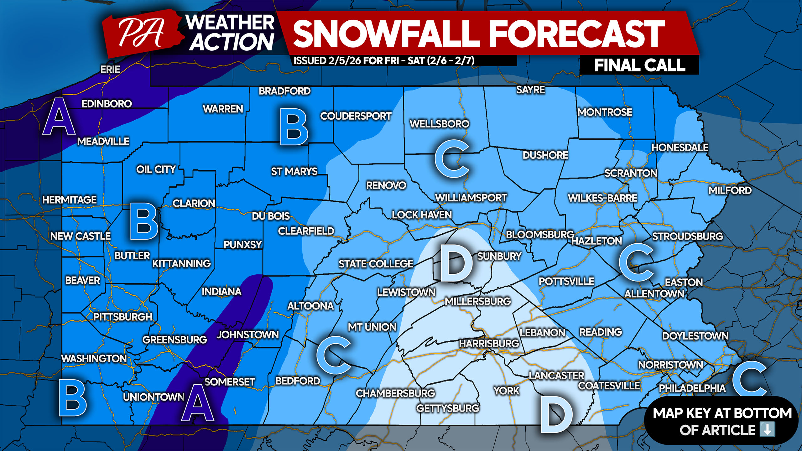
FINAL CALL SNOWFALL FORECAST FOR EARLY WEEKEND CLIPPER
Area A: Snowfall accumulation of 3 – 6″ expected. Wind gusts of 35-50 MPH will cause ground blizzards with very low visibility late Friday night and Saturday.
Area B: Snowfall accumulation of 2 – 3″ expected. Wind gusts of 35-50 MPH will create ground localized blizzard conditions late Friday night and Saturday.
Area C: Snowfall accumulation of 1 – 2″ expected. High wind gusts of 40-55 MPH may create localized ground blizzards on Saturday if enough snow falls.
Area D: Snowfall accumulation of less than 1″ expected.
Share this forecast with friends and family who may have plans Friday or Saturday!
You must be logged in to post a comment.