
Thunderstorms were localized Tuesday across Southeast PA, while Upstate NY was hit very hard by tornadoes and widespread damaging winds that created an absolute mess up there. Meanwhile, Harrisburg hit 103° and parts of the Cumberland Valley in South Central PA reached 105°. As many areas plunge into drought conditions, it’s safe to say we are in desperate need of a pattern change.
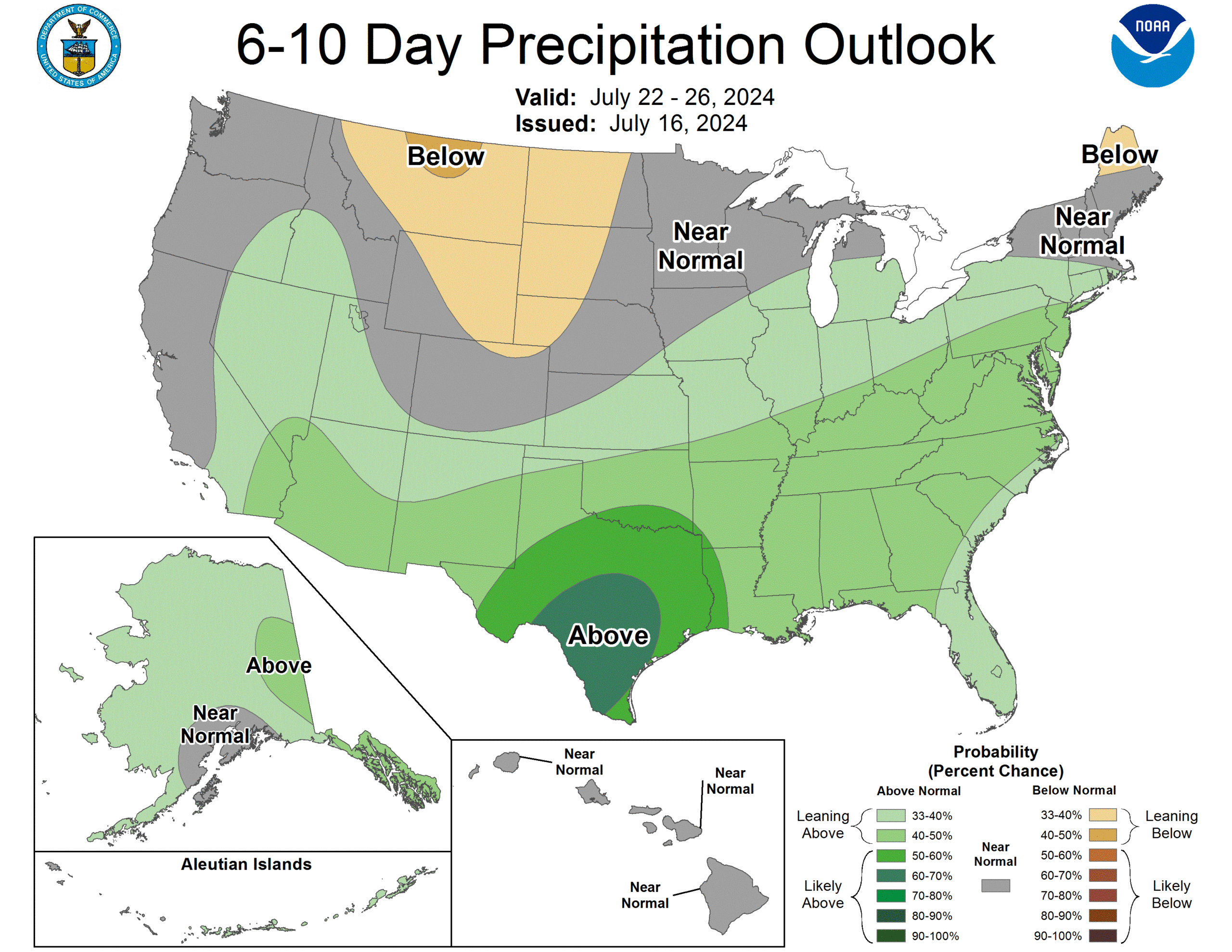
And a pattern change is exactly what we are getting, starting Wednesday! In fact, the Climate Prediction Center has all of Pennsylvania in probabilities leaning toward above average rainfall in the 6-10 day period, which is next week.
In addition, we will return to average temperatures for the middle of summer, as opposed to the torch we have received recently. Since June 1, Harrisburg is having their hottest summer on record! Now let’s get into Wednesday’s thunderstorm chances.
WEDNESDAY FUTURE RADAR
It’s safe to say Monday evening’s future radar for Tuesday did not work out. We mentioned other model guidance had much less thunderstorm development, and that other guidance was in fact correct (except for Southeast PA). Tonight, models are all on the same page for how they expect Wednesday to go.
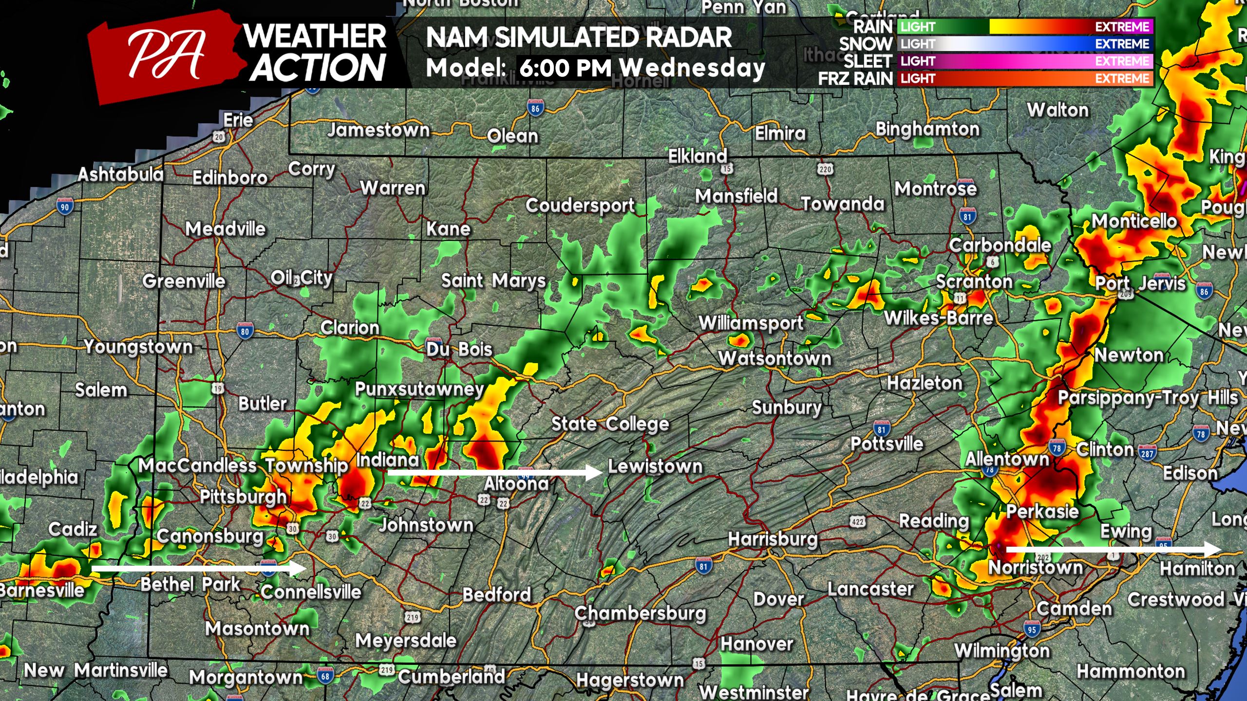
Starting at 2:00 PM Wednesday, scattered thunderstorms are expected to pop-up in the Susquehanna Valley, Northern Poconos, and maybe an isolated cell in Southwest PA. Below is the Hi-Res NAM model for that time. We have added arrows to indicate storm direction, but try not to take the exact placement of cells verbatim.
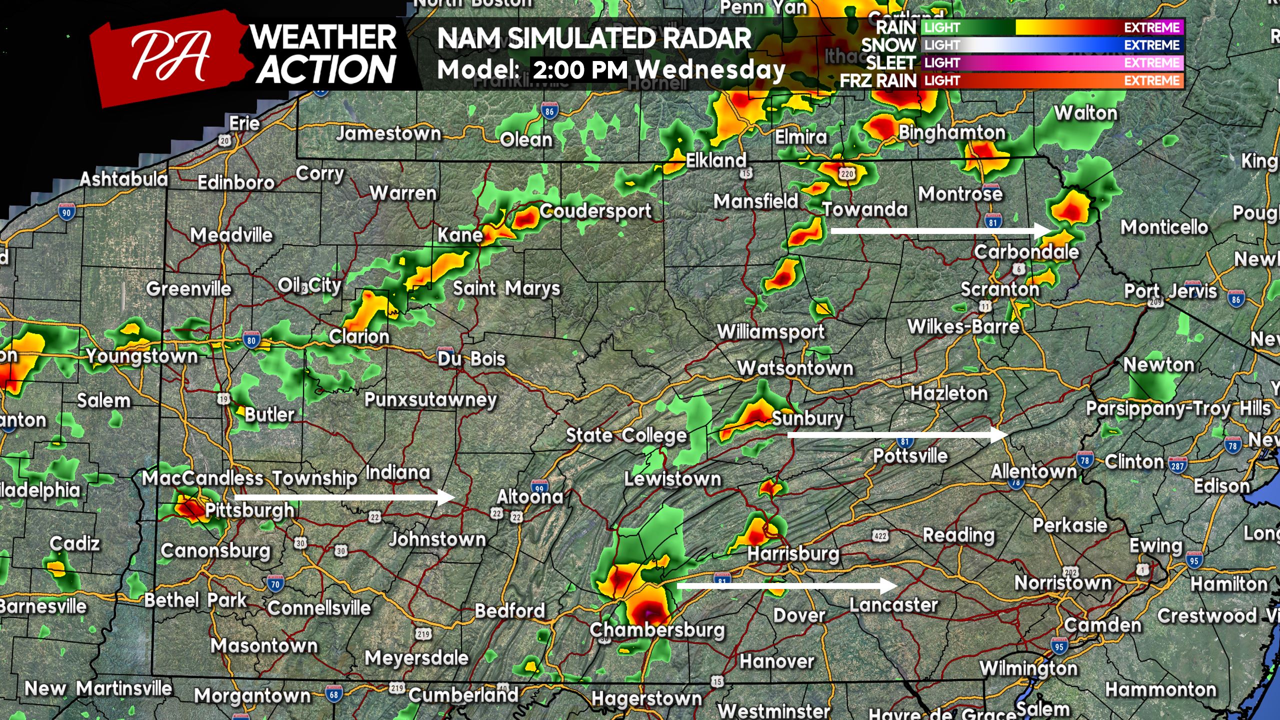
By around 4:00 PM, strong thunderstorms are modeled to be near the I-81 corridor northeast of Harrisburg. There may also be storms around the Pittsburgh Metro, although those have a lower chance of being severe. The main concern with these storms will be damaging winds and frequent lightning.
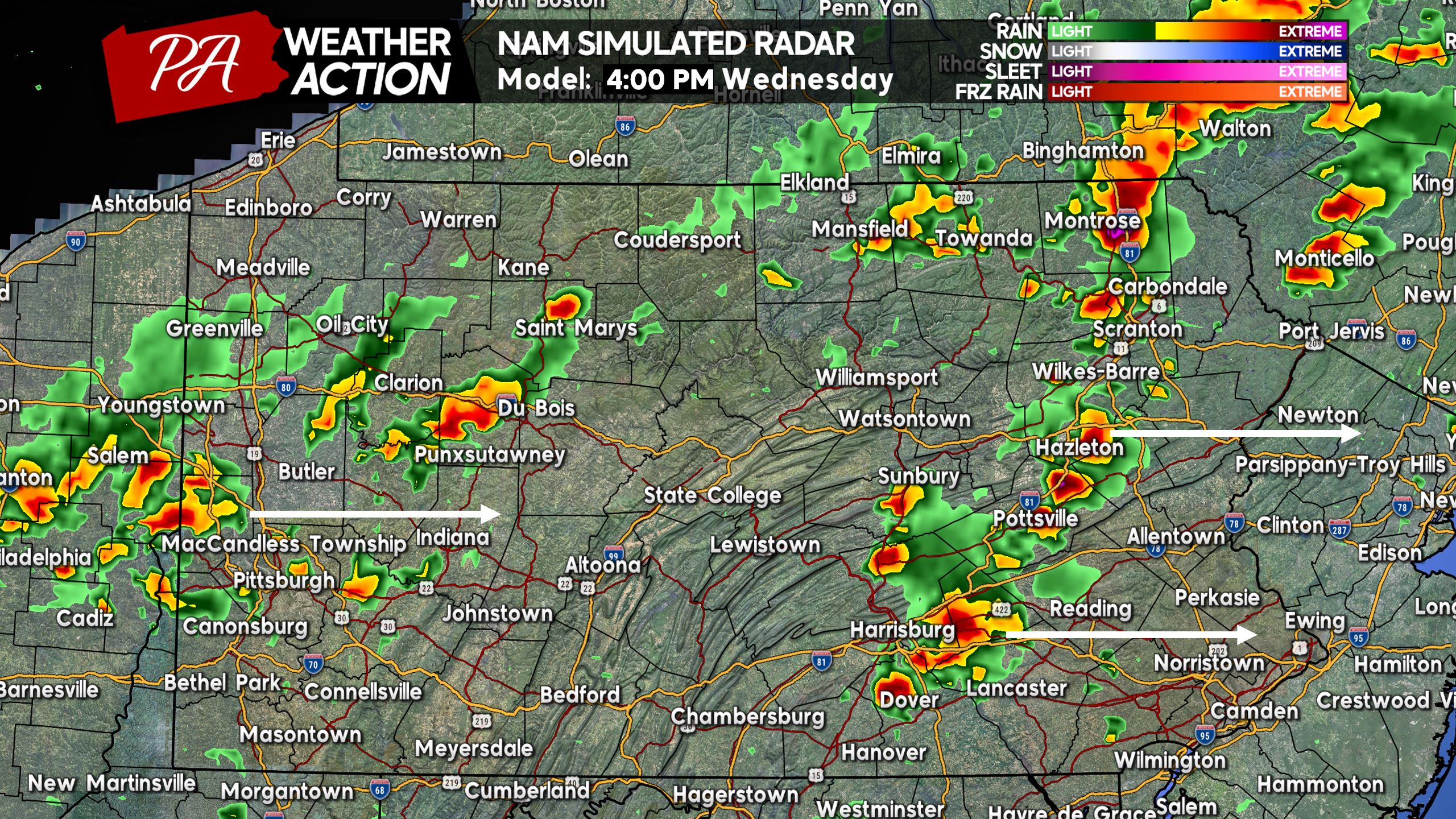
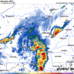
Heading into the dinnertime hour, storms are likely to be nearing the Poconos, Lehigh Valley, and north Philadelphia suburbs. Not a good look for outdoor events Wednesday evening in these areas! Below is future radar for 6:00 PM Wednesday. Also seen are some storms in Southwest PA, some of which may be strong.
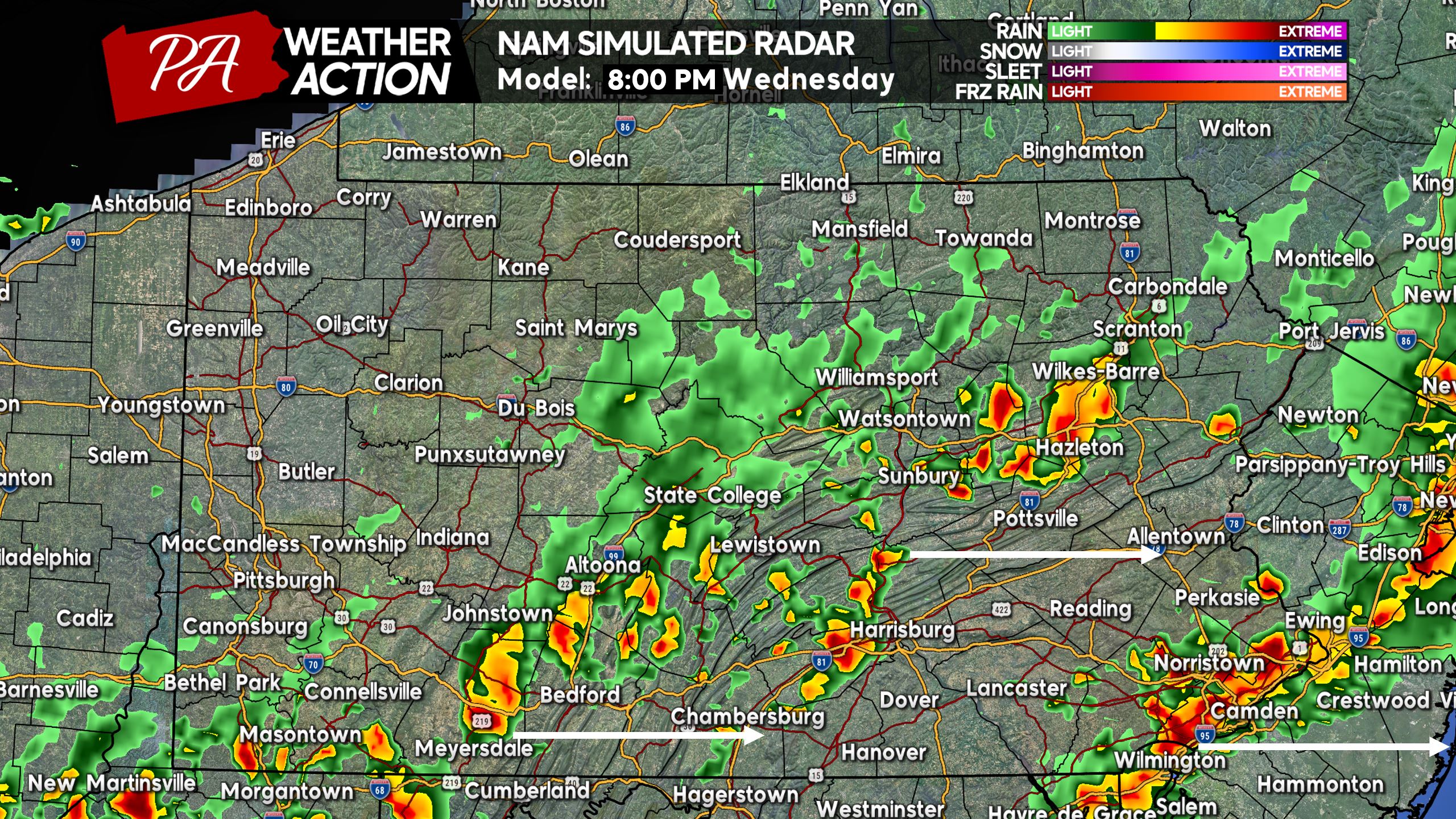
And by 8:00 PM Wednesday, thunderstorms are anticipated to move through Philadelphia, along with some activity back north and west. Again, the activity behind the main line is less likely to be severe. Here is future radar for 8:00 PM Wednesday.
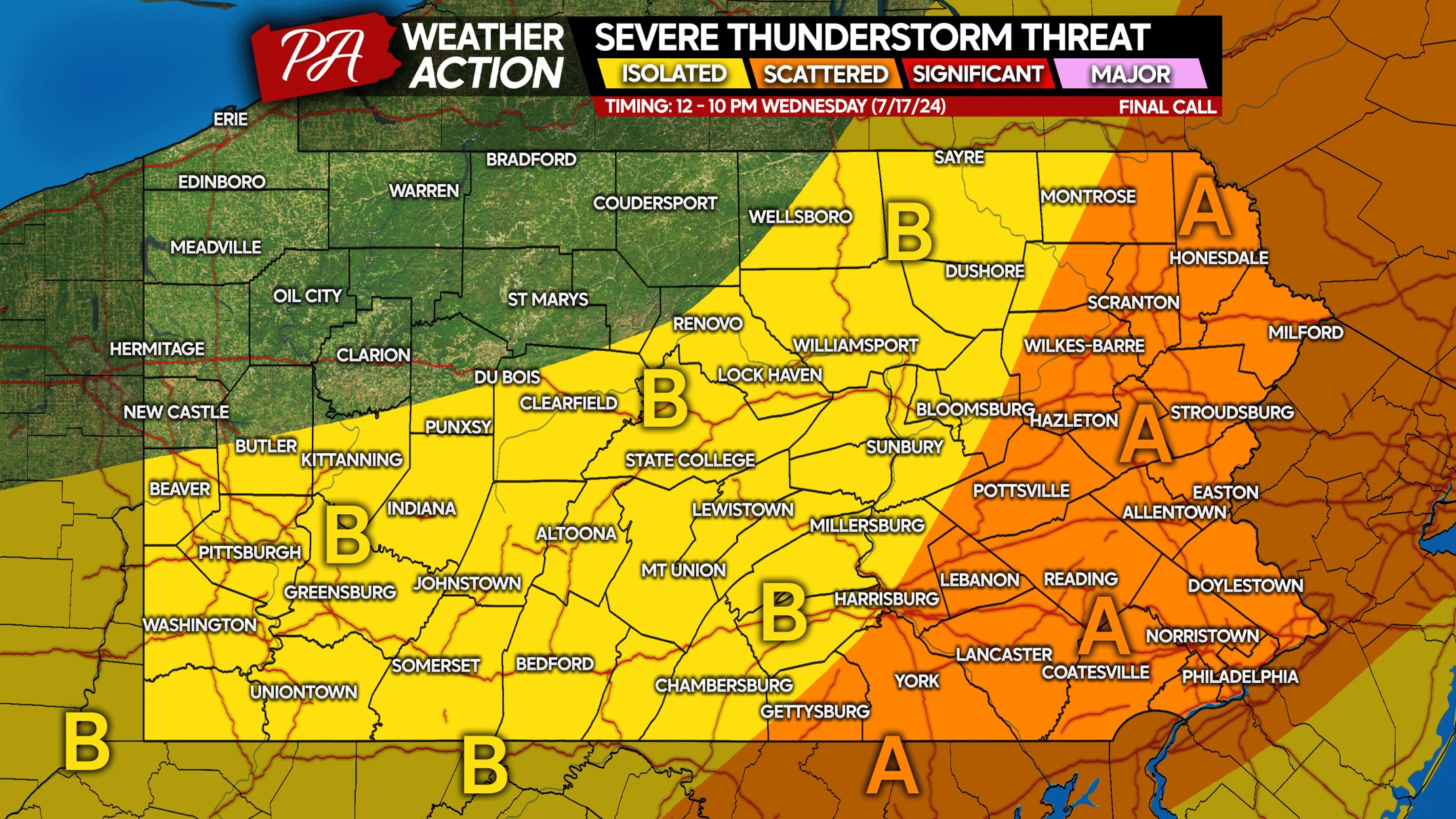
WEDNESDAY 7/17 SEVERE THUNDERSTORM RISK MAP
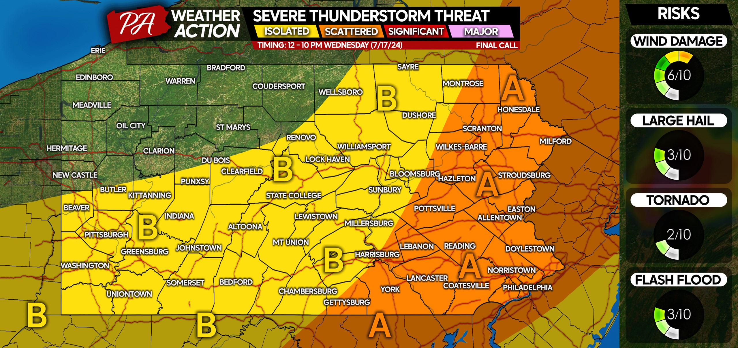
Area A: Scattered severe thunderstorms are possible Wednesday afternoon and evening. Damaging winds of 50-70 MPH that may bring down trees and power lines are the primary concern, with isolated hail and a very isolated tornado possible as well.
Area B: Isolated severe thunderstorms are possible Wednesday. Gusty winds of 40-60 MPH are the main concern.
You must be logged in to post a comment.