
Concerning trends have taken place over the last 24 hours, with Tuesday’s severe thunderstorm threat gaining steam especially in the Great Lakes. All modes of severe weather are possible!
A low pressure system tracking through the Northern Plains will likely cause a tornado outbreak in the Upper Midwest on Monday, before the system pushes into Canada. But the threat doesn’t end there, with another threat of severe weather on Tuesday.
And that’s where our area comes into play, notably with a somewhat abnormal risk for late April. The Storm Prediction Center specifically mentions the threat of very large hail in the Eastern Great Lakes region, including Western Pennsylvania.
SEVERE WEATHER FUTURE RADAR
There are still large timing discrepancies between the modeling, so hopefully we will have a better idea in Monday’s update. We have modified the Hi-Res NAM’s timing to better match that of most other guidance.
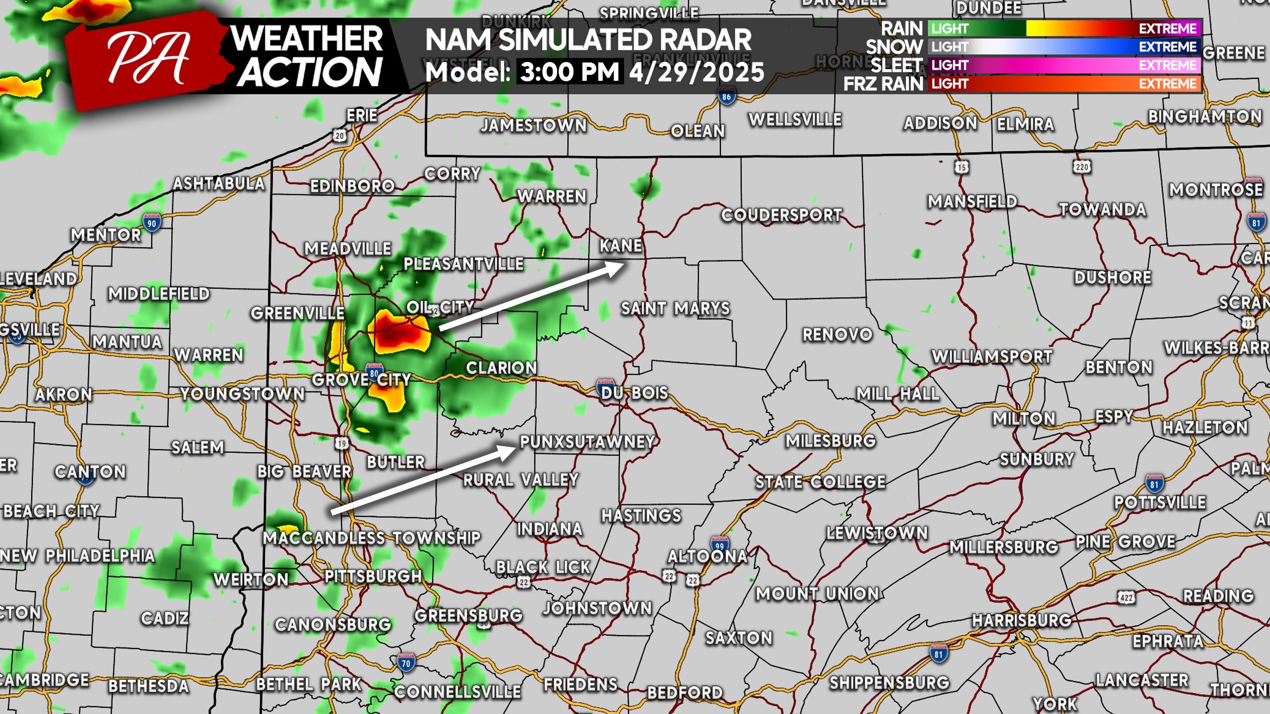
A few thunderstorms will likely develop Tuesday afternoon in Northwest PA. These cells will have the potential to quickly turn severe, with the possibility of large hail and isolated tornadoes. Here is the Hi-Res NAM Future Radar for 3 PM Tuesday.
Focus will then shift to a more organized line of severe thunderstorms pushing into Northwest PA around dinnertime Tuesday. These storms will carry the threat of damaging winds, along with embedded large hail and rotation signatures.
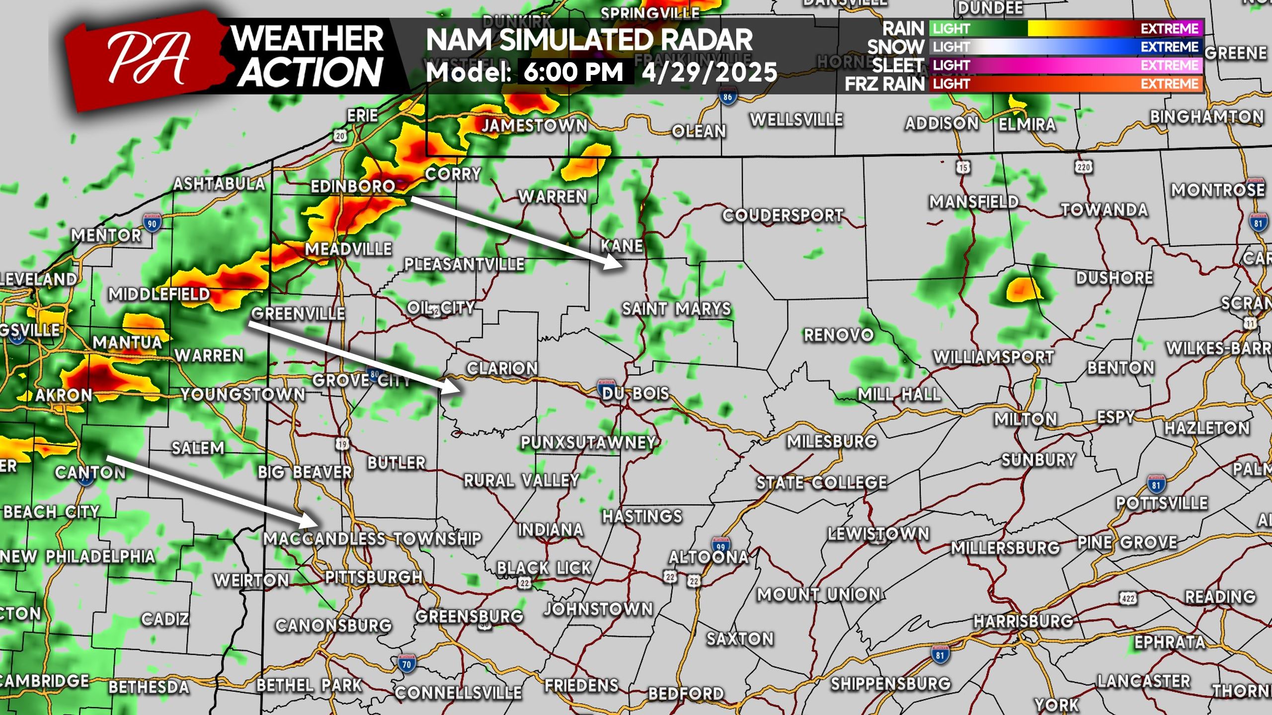
This line will likely move pretty fast, entering West Central PA up to the Alleghenies by around 7 PM Tuesday. Emphasis on around, because at this point I’d give or take an hour.
Since we modified the timing of this model by 4 hours, it may be showing something weaker than reality. Because daytime heating and peak instability will still be at play.
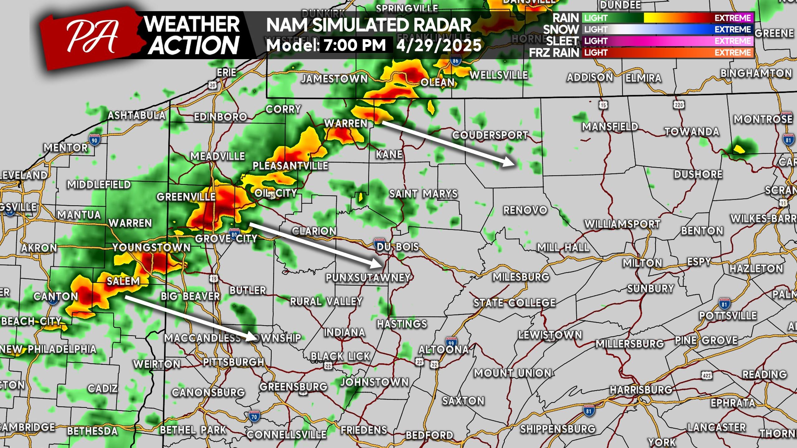
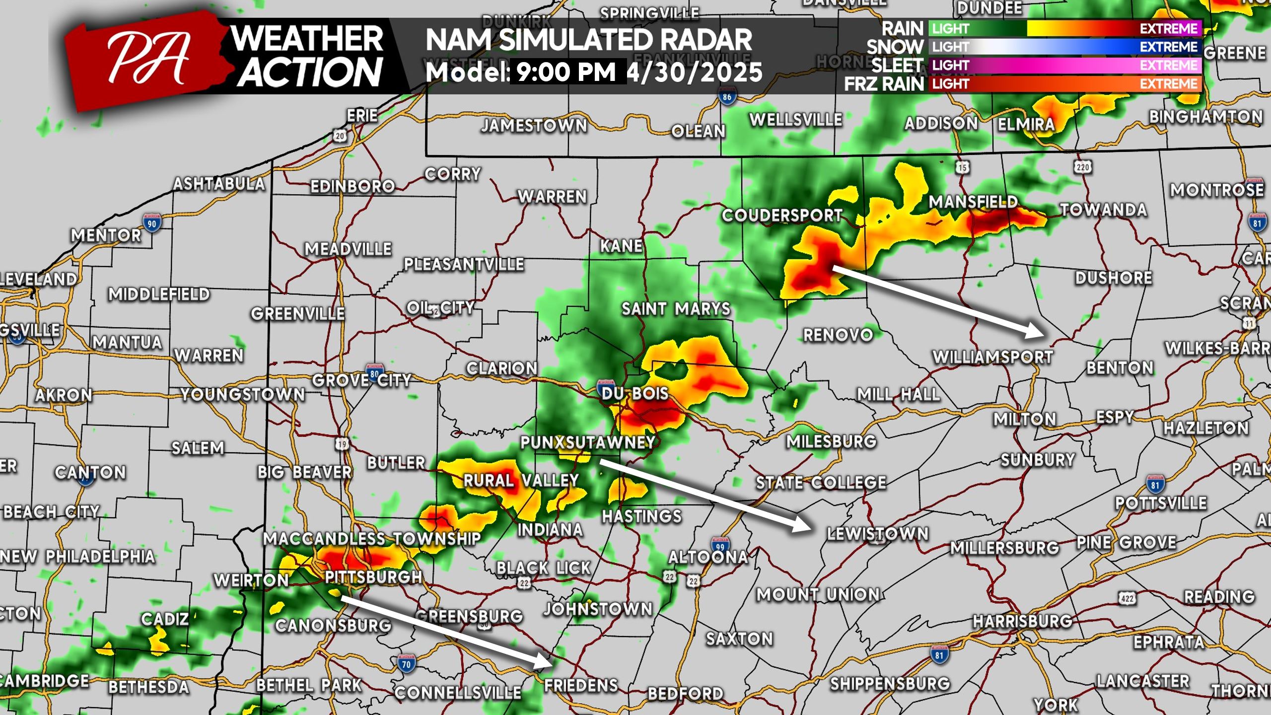
By around 8 PM Tuesday, the line of strong to severe storms will be entering the Pittsburgh Area and pushing through the Pennsylvania Wilds. We anticipate the line to be more impressive than shown below in Southwest PA, given the aforementioned info above.
Large hail, damaging winds, and isolated tornadoes will continue to be a concern around sunset Tuesday.
As we begin to lose daytime heating and instability, the line will likely have another hour or two before weakening significantly. With that said, by 9 PM Tuesday the storms will be approaching the eastern edge of supportive dynamics.
The Pittsburgh Area to Clearfield and Mansfield will be there area of concern shortly after sunset Tuesday. This may change, and if it does we will let you know tomorrow! Here is Hi-Res NAM Future Radar for 9 PM Tuesday.
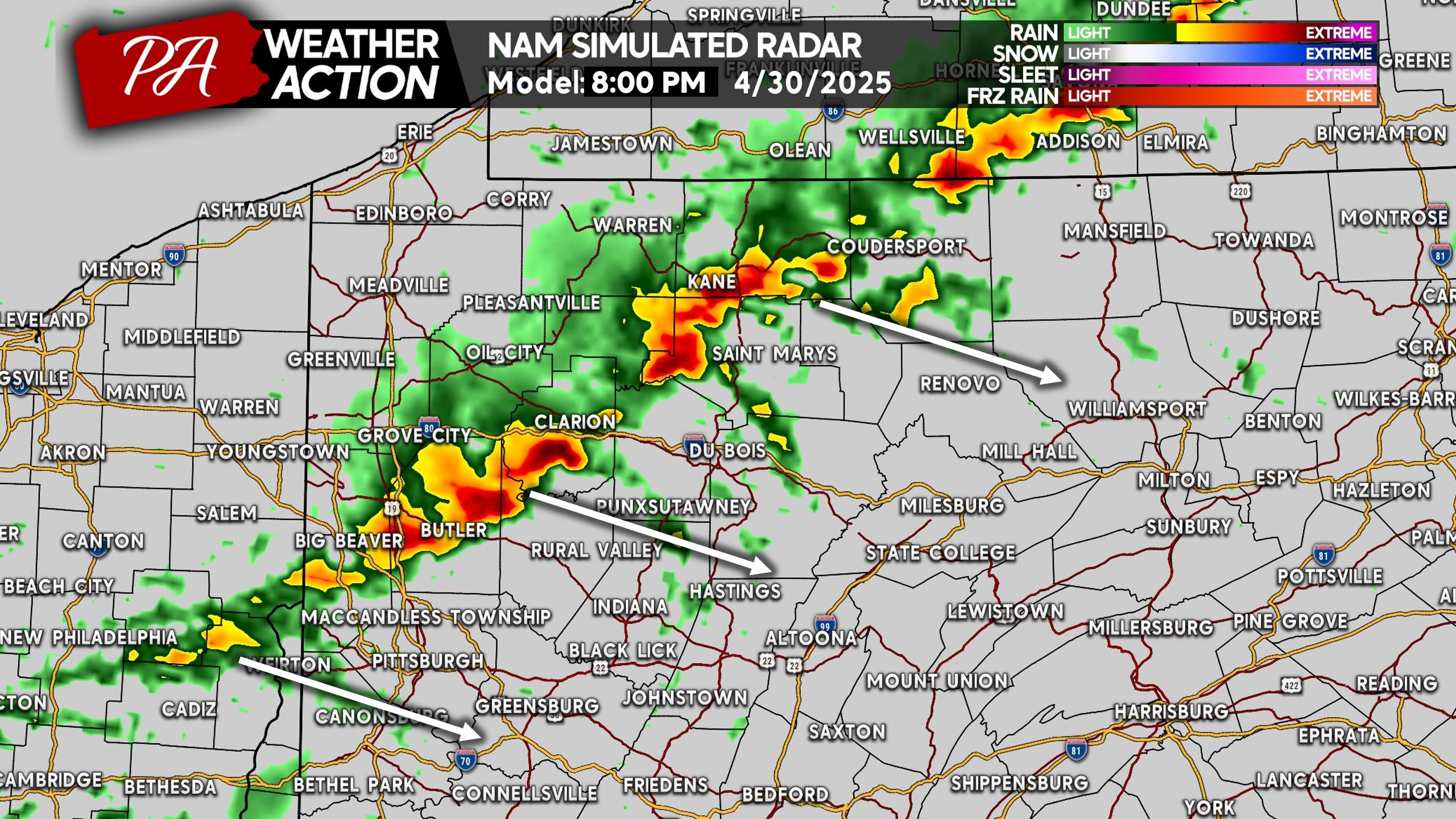
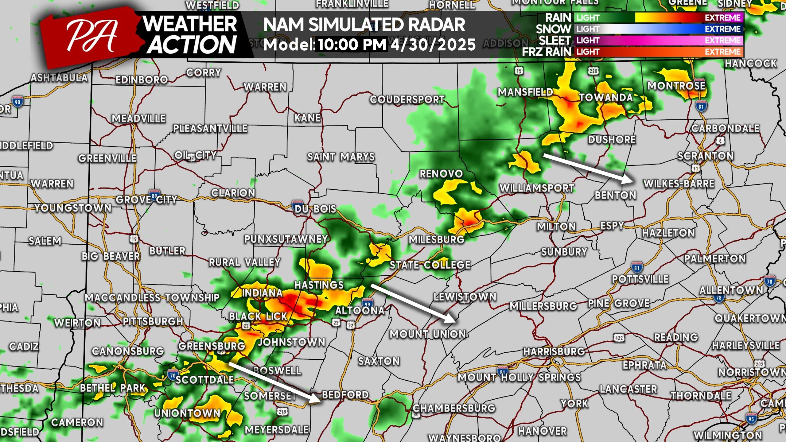
And finally by late Tuesday evening, we expect a weakening and broken line of strong thunderstorms to be pushing through the Laurel Highlands and Northern PA mountains.
There are models that suggest the line will make it slightly farther east, which is definitely possible still at this hour. Typically threats like the one we will see Tuesday do not completely fizzle out until about 12 – 1 AM the following morning.
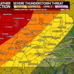
FIRST CALL SEVERE THUNDERSTORM THREAT FORECAST FOR TUESDAY
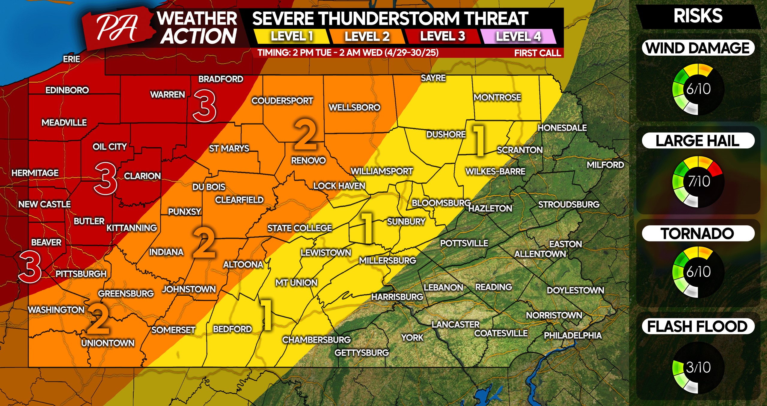
Level 3 Area: Widespread severe thunderstorms are likely. Very large hail, scattered wind damage due to 55-70mph winds, and isolated tornadoes possible!
Level 2 Area: Scattered severe thunderstorms are likely. This area will likely see a gradually weakening, but still strong to severe line of thunderstorms Tuesday evening. Large hail, scattered wind damage, and isolated tornadoes possible.
Level 1 Area: Isolated severe thunderstorms are possible, with most locations in this area more likely to see strong storms just under severe criteria. A weakened and broken line of storms will push in late Tuesday evening, producing an isolated wind damage and hail threat. A very brief tornado can’t be ruled out but is unlikely.
Don’t forget to share this important forecast with friends and family! Stay tuned.
You must be logged in to post a comment.