
While many of us are enjoying temperatures today in the 60s and even 70s, we are tracking a winter storm for Saturday evening lasting through early Sunday morning. A storm system will take shape over the Tennessee Valley early on Saturday, will quickly strengthen and track northeast from there.
By Saturday evening, snow will begin to spread across the area from southwest to northeast as the low pressure system starts to transfer to the coast. Depending where this transfer takes place, will determine exactly how much snow we will see.
We expect snow to begin falling across southwest areas as early as 4:00 PM Saturday. The snow will overspread to Central and Eastern Pennsylvania by Saturday evening. Below is the future radar valid for 7:00 PM Saturday evening: 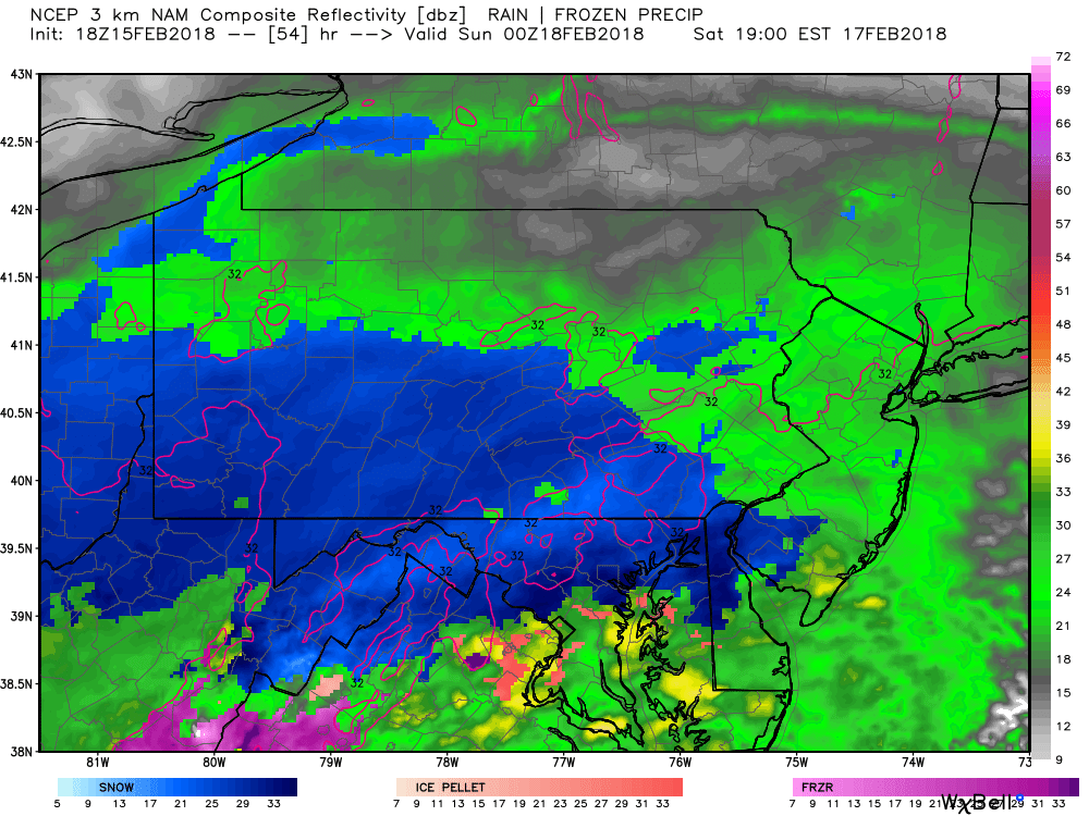
Any greens you see in Pennsylvania and the northern half of New Jersey are actually snow. The only areas that we are concerned for mixing issues would be south of the PA/Maryland line.
By 9:00 PM Saturday night, we are in the height of the storm. The low pressure has transferred right of the coast of Delaware, enhancing the precipitation. This will be a quick hitting storm. However, because of the transfer to a coastal low, this will lead to a period of heavy snow. 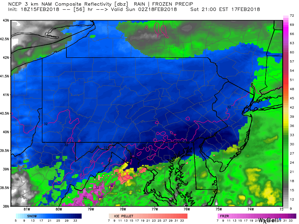
For snow lovers, the timing of this storm could not be anymore perfect. Snow will be heavy and wet, but will pile up fast due to the sun being down and the intense precipitation rates.
Taking the future radar out to 11:00 PM Saturday night, the snow is still falling heavily, but notice the back edge is approaching from the south and southwest: 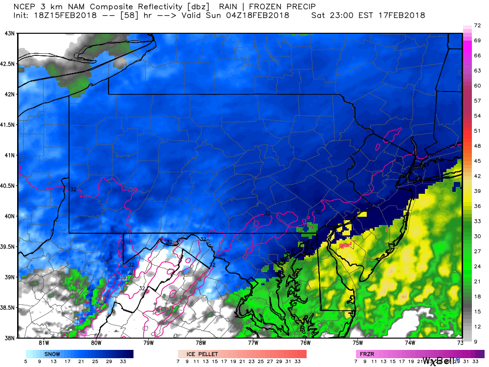
Because of the strengthening coastal low, Eastern Pennsylvania will hang onto the snowfall the longest and is why we expect these areas to receive the most snow out of this system. By 1:00 AM Sunday morning, snow has shut off across the Southwestern third of Pennsylvania, but still snowing at a good clip for Central and Eastern Pennsylvania: 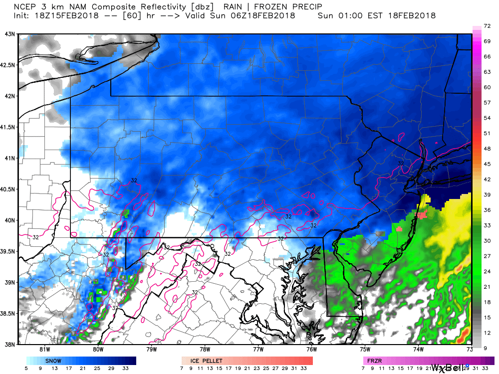
The snow will clear out by 4:00 AM for everyone Sunday morning. Significant travel impacts are expected all of Saturday night as well as the Sunday morning commute as we all begin to clean up. However, by Sunday afternoon, temperatures will warm up into the upper 30s and 40s helping with the snow melt.
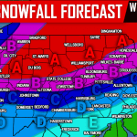
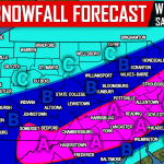
FIRST CALL SNOW FORECAST SATURDAY EVENING INTO SUNDAY MORNING
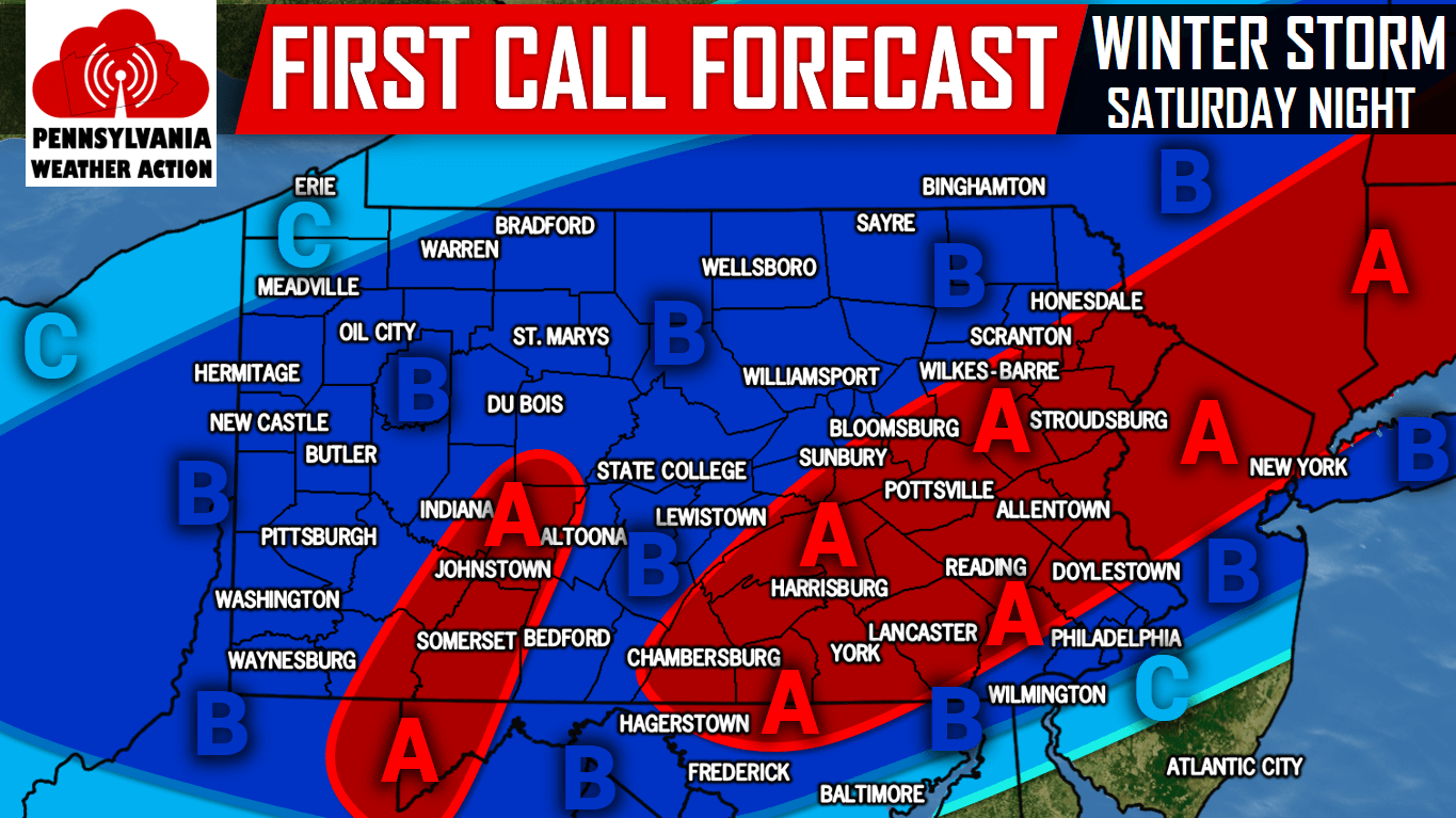
Area A: 3-5″ of snow is expected. Hazardous travel expected Saturday Night into Sunday Morning.
Area B: 1-3″ of snow is expected. Hazardous travel expected Saturday Night into Sunday Morning especially in the mountains of Central and Northeast PA.
Area C: <1″ of snow is expected. untreated roads will be slick at times Saturday Night.
For updates on the storm, like us on Facebook by clicking here>>>Pennsylvania Weather Action’s Facebook Page You can also download our free app for interactive radar, your latest forecast, alerts, and more by tapping here >>> PA Weather App
Share this winter storm first call forecast with your family and friends using the button below!
You must be logged in to post a comment.