
A winter storm is expected to deliver snow, sleet, freezing rain, and rain for our area on Superbowl Sunday. The northern low pressure over the Great Lakes that we mentioned yesterday is expected to be more dominant than the southern low pressure allowing for warmer air to get involved. However, enough cold air will be in place to allow for many areas to at least begin as snow. The good news is, the storm system has sped up a tad. Enough that the bulk of the precipitation will be over by the start time of the Superbowl.
Most areas will start off as a period of snow Sunday morning. Precipitation will begin in Western Pennsylvania after 2:00 AM Sunday morning and will overspread into Central Pennsylvania by 5:00 AM. Below is a look at the future radar for 5:00 AM Sunday morning: 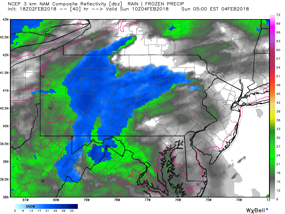
Snow will continue to fall and overspread into parts of Eastern Pennsylvania by the mid-morning hours. Below is a look at 8:00 AM: 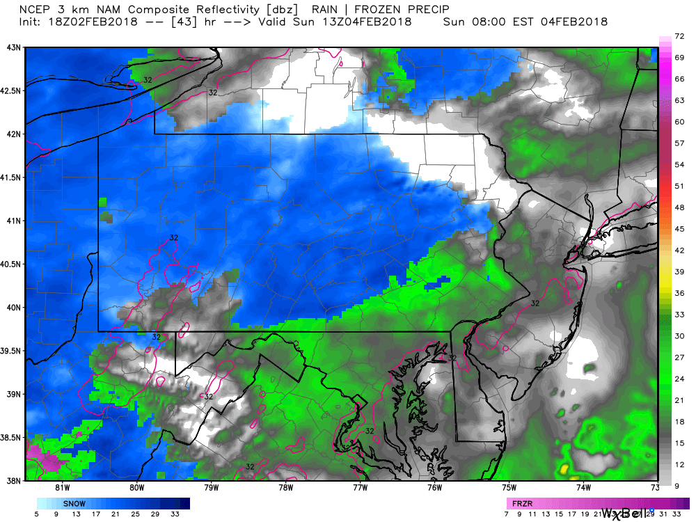
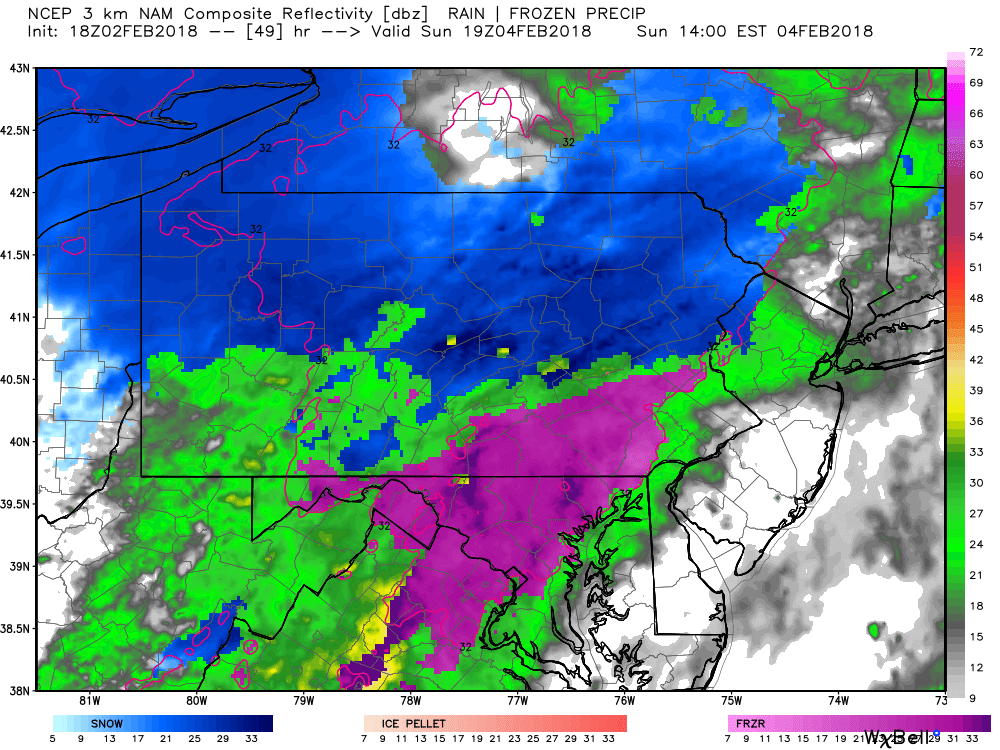
While this is just one model, we are confident much of Southeastern Pennsylvania will remain all rain. The closer you are to I-95 with this system, the more likely it is you see more rain than snow.
There is the potential for the snow to change over to a brief period of sleet and freeing rain early Sunday afternoon for some areas. This particular model shows a colder solution, allowing for many areas in South Central Pennsylvania to change over to a frozen mix. However, many other models suggest this to occur farther north. Below is valid for 2:00 PM Sunday afternoon:
Like we stated in the beginning of this article, the good news is, most of precipitation will have tapered off by game time Sunday for this year’s Superbowl game. Far Eastern Pennsylvania is the only exception where the rain and snow will not taper until 8:00 PM Sunday night. Below is a look at 6:00 PM Sunday night: 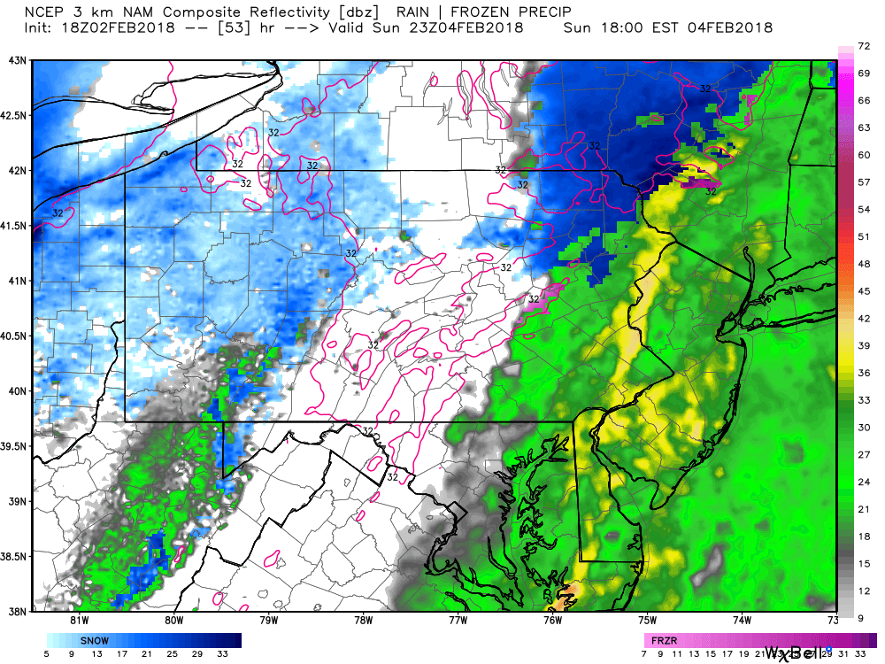
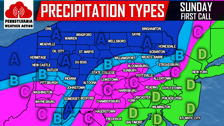
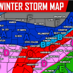
PRECIPITATION TYPES FOR SUNDAY:
The map above is for precipitation types only.
Area A: All snow. Travel impacts likely.
Area B: Mostly snow, with mixing of sleet possible. Travel impacts likely.
Area C: A period of snow, possibly changing to a period of a mix between sleet and freezing rain, changing to rain. Travel impacts likely.
Area D: All rain.
FIRST CALL SNOW AMOUNTS FOR SUNDAY: 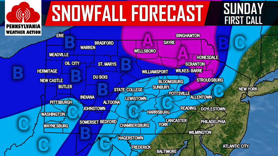
Area A: This area has the best chance of receiving more than 4 inches of snow.
Area B: 2 to 4 inches of snowfall is expected.
Area C: A coating to 2 inches of snowfall is expected.
For snow lovers out there, root for the storm to trend colder. If this does occur, not only will we shift our zones southeast, we would also increase our numbers. For now, this is how we see it playing out.
For updates on Sunday’s storm system, like us on Facebook by clicking here>>>Pennsylvania Weather Action’s Facebook Page
Do not forget to share the wintry mess that is on the way with your family and friends using our icon below!
You must be logged in to post a comment.