
We are tracking yet another winter storm to impact the area for Wednesday. Similar to Sunday, many areas will receive a period of snow before transitioning to a wintry mix of sleet and freezing rain and then to plain rain for some areas. This upcoming storm however, will pack a bigger punch. The combination of a high pressure sitting to our northwest and more precipitation to work with, will lead to higher snow and ice totals for many locations.
Another similarity with this upcoming storm and Sunday’s storm is the timing. Snow will begin to overspread Southwest Pennsylvania after 5:00 AM and will work its way northeast throughout the morning hours. Below is a look at the future radar for 7:00 AM Monday: 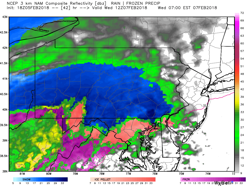
While some areas will change over to a mix or rain later Wednesday, the initial burst of snow will be heavy for everyone. And for those areas that do not change over to a mix or rain, will receive a significant amount of snow. For some areas it will likely be the biggest snowfall of the season. Taking the future radar out to 10:00 AM Wednesday, the heavy snow has overspread the state, with some mixing going on in Southwest Pennsylvania: 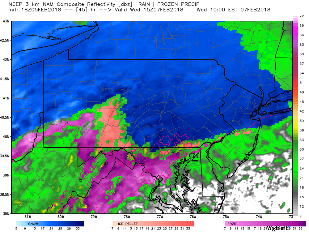
Areas North of Interstate 80 will have the best chance of remaining all snow. The future radar shows this pretty well at 1:00 PM Wednesday afternoon: 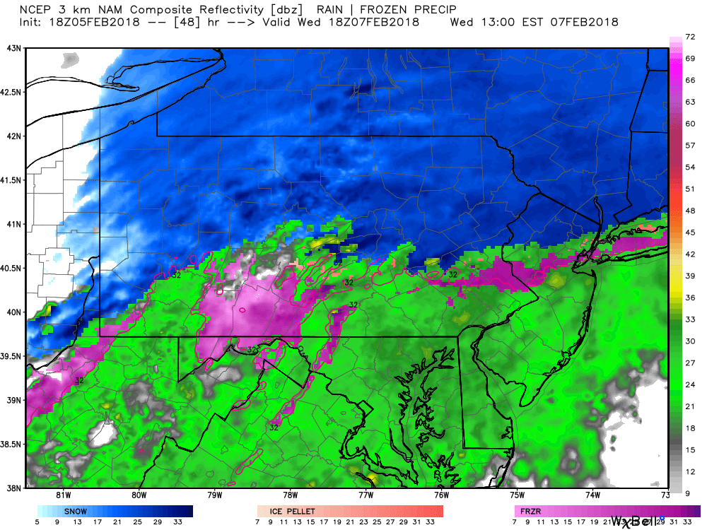
The precipitation will then begin to taper from southwest to northeast, likely after 4:00 PM Wednesday afternoon: 
We do recommend avoiding to travel as much as possible Wednesday. Roads will likely be worse than Sunday’s with colder air in place.
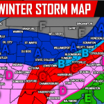
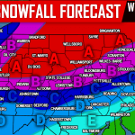
WEDNESDAY’S FIRST CALL FORECAST MAP
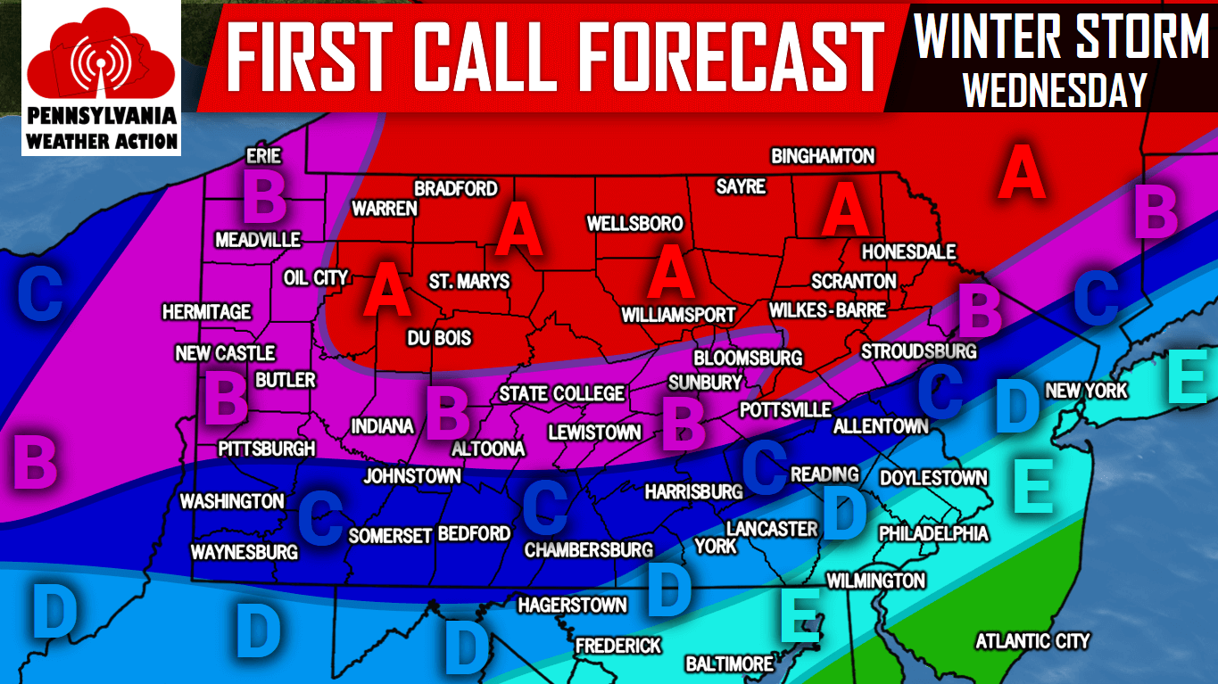
Area A: 6-10″ of snow is expected. Snow covered roads will cause hazardous travel conditions all day Wednesday.
Area B: 4-6″ of snow is expected. This area will start as snow and likely end as sleet or freezing rain. Snow covered roads will cause hazardous travel conditions all day Wednesday.
Area C: 2-4″ of snow is expected. This area will start with a heavy burst of snow for several hours, followed by sleet or freezing rain, the ending as rain. The worst travel conditions will be during Wednesday Morning into the early afternoon.
Area D: 1-2″ of snow is expected. A burst of snow will last a few hours before changing over to sleet, then rain. Travel will be most difficult Wednesday Morning, until about noon.
Area E: <1″ of snow is expected. Snow will quickly transition to rain Wednesday Morning. Untreated roads may be slick as the snow falls.
For updates during the storm, like us on Facebook by clicking here>>>Pennsylvania Weather Action’s Facebook Page You can also download our free app for interactive radar, your latest forecast, alerts, and more by tapping here >>> PA Weather App
Share this winter storm first call forecast with your family and friends using the button below!
You must be logged in to post a comment.