
NORTH TREND CONTINUES, SECOND CALL POSTED:
A major to crippling winter storm will impact the entirety of Pennsylvania early Sunday morning through Monday morning, bringing up to 20″ of snow. This large of a storm comes around once or twice a decade, and we are now just 2-3 days away depending on when you’re reading this.
Do not travel Sunday, anywhere or anytime. If you absolutely must, bring an emergency kit in your car and a shovel. Schools and many businesses will be closed Monday as well, with school closings perhaps spilling into Tuesday and Wednesday. For those with kids, it’s important to check if your district will be doing virtual days.
WINTER STORM TIMING
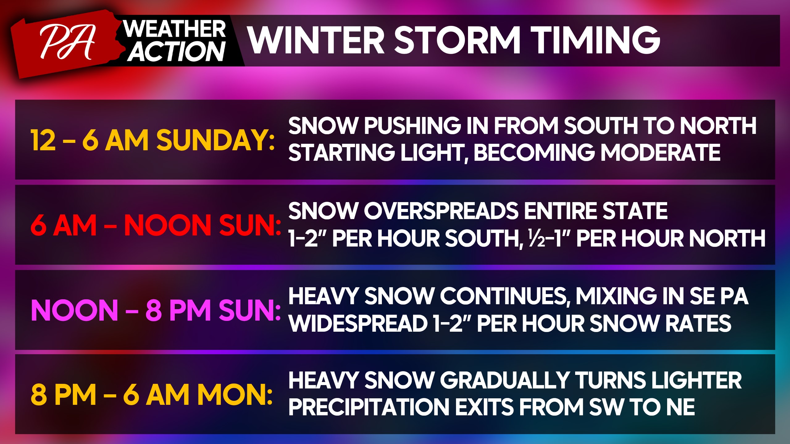
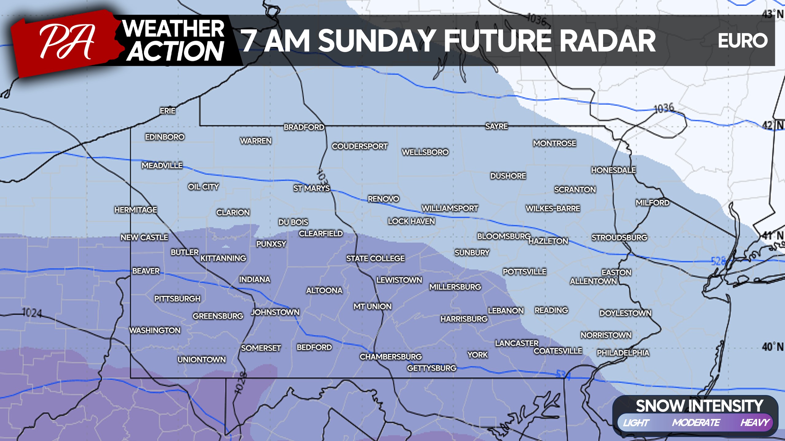
Light snow will begin moving into the state from south to north early Sunday morning. By sunrise, moderate snow will be falling in the southern half of the state. Temperatures will be 4-14°, meaning snow will stick to all surfaces instantly. Below is the European model for 7:00 AM Sunday.
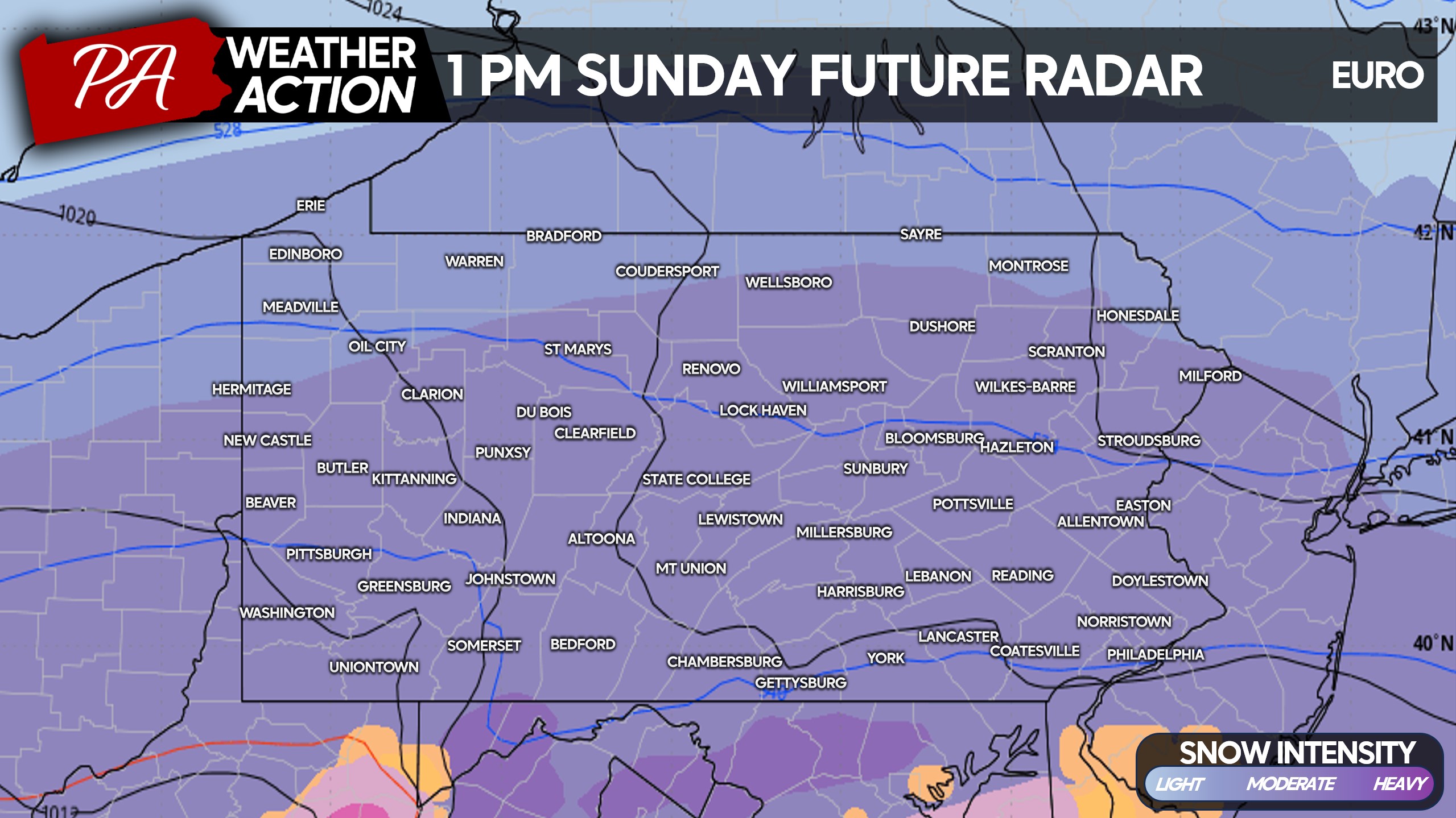
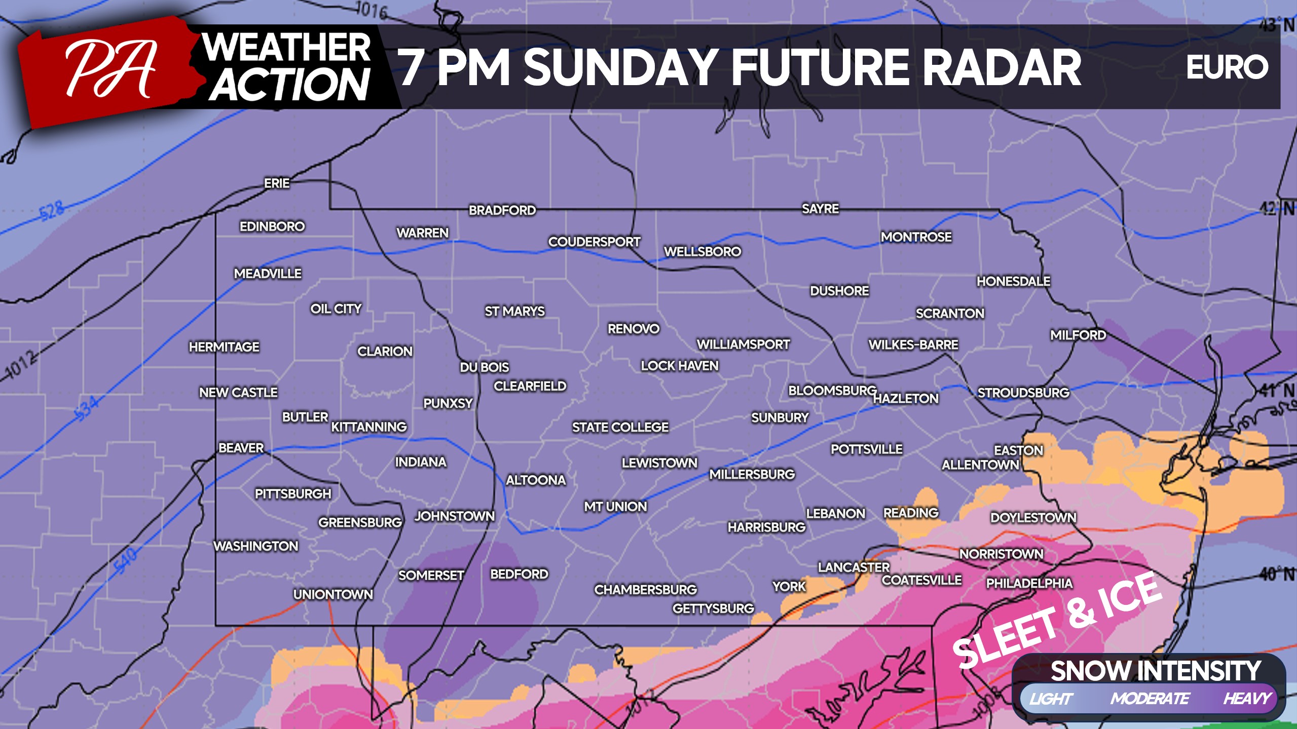
As late Sunday morning rolls on, snow will get heavier and heavier. Snowfall rates of 1-2″ per hour will be occurring everywhere, with this being a fluffy snow that accumulates fast. Here is a look at Euro future radar for 1:00 PM Sunday.
Heavy snow will continue falling through Sunday afternoon and evening. Traveling for any distance will be nearly impossible for 90% of vehicles, with road crews being overwhelmed by snowfall rates. Avoid the interstates, as its these types of storms we often hear of a situation where people are stranded for a day or two after a backup.
We also see sleet and ice creeping into the picture in Southeast PA. That will make things even more slippery, but will cut down on snowfall accusations.
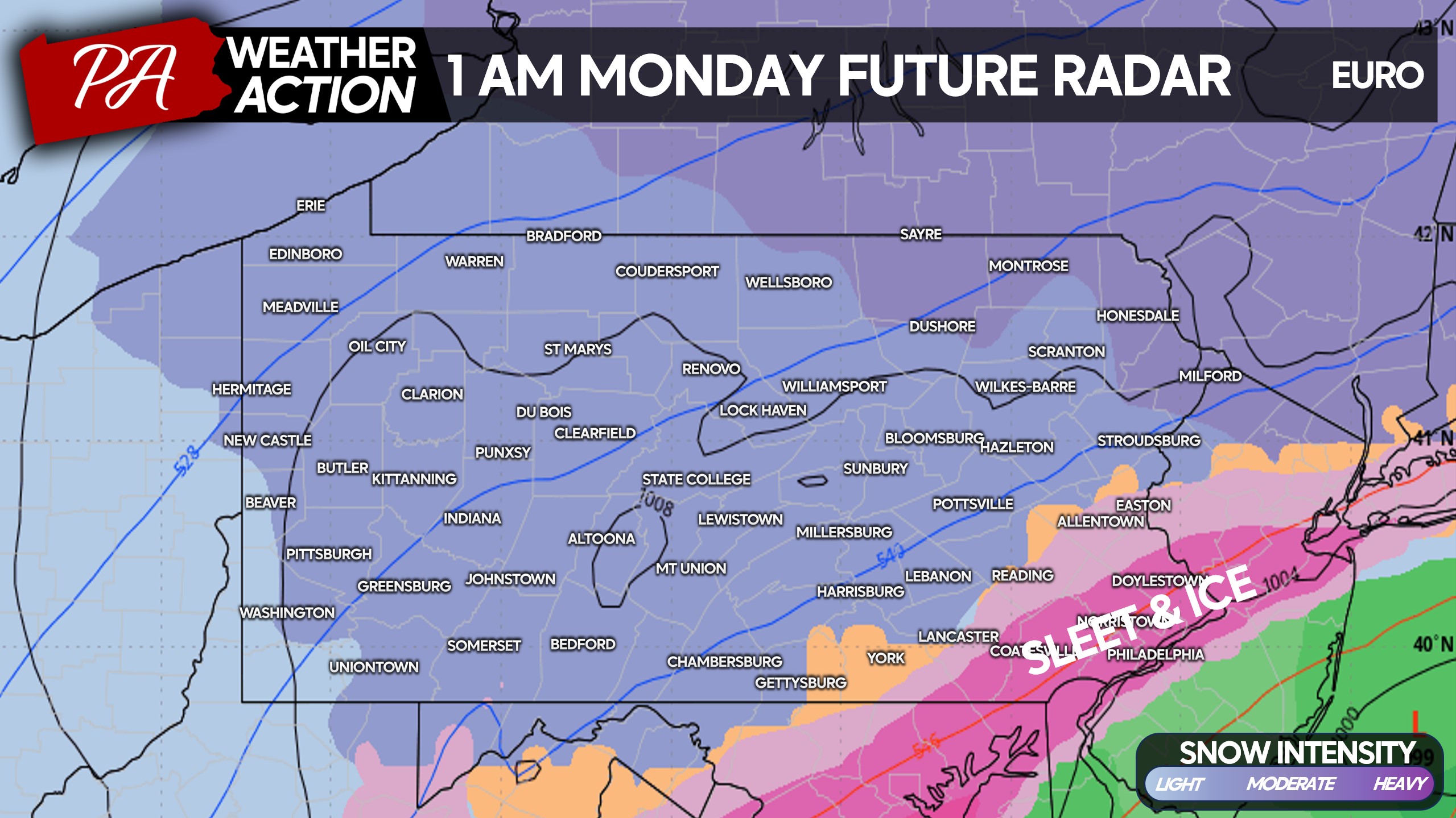
By early Monday morning, we will see snowfall rates drop from south to north, with a wintry mix persisting along I-95. Heavy snow will continue in the northern tier of PA, with snow becoming light in Southern PA. Below is the Euro model for 1:00 AM Monday.
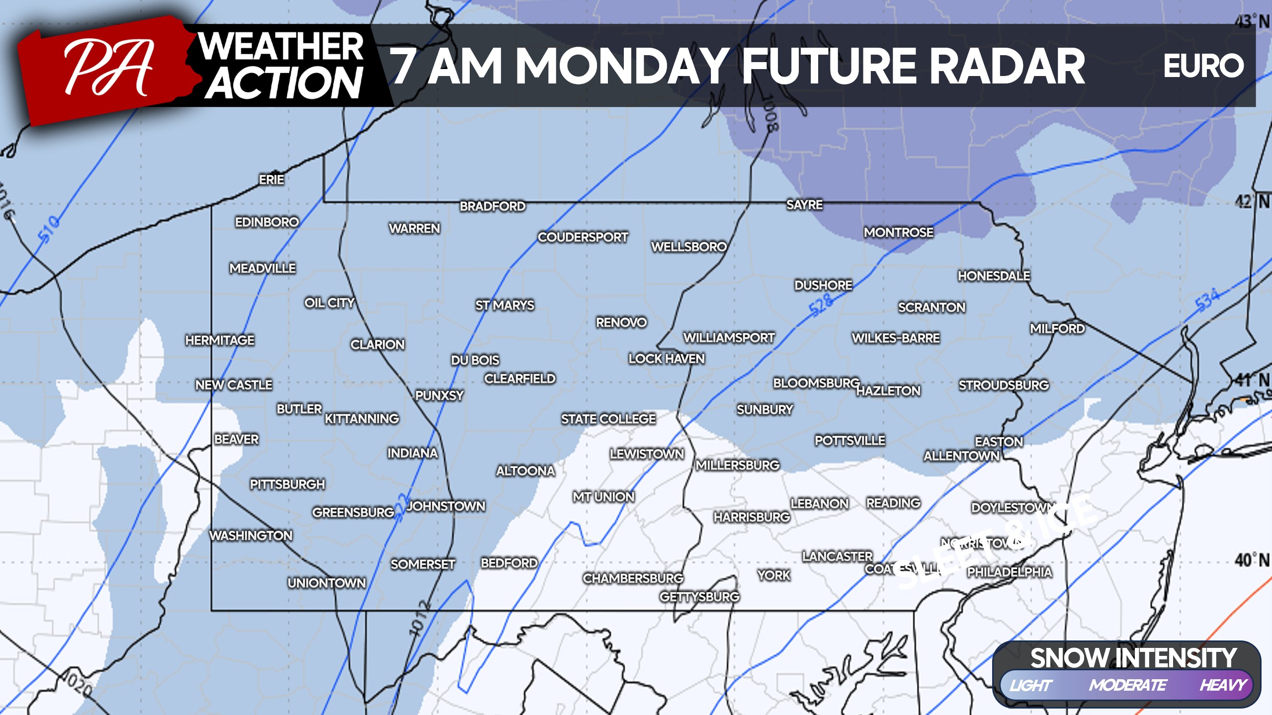
And finally as we wake up on Monday, the storm should be all but over with only a few snow showers leftover in Northern PA and the Alleghenies. This is when many of us will begin digging out!
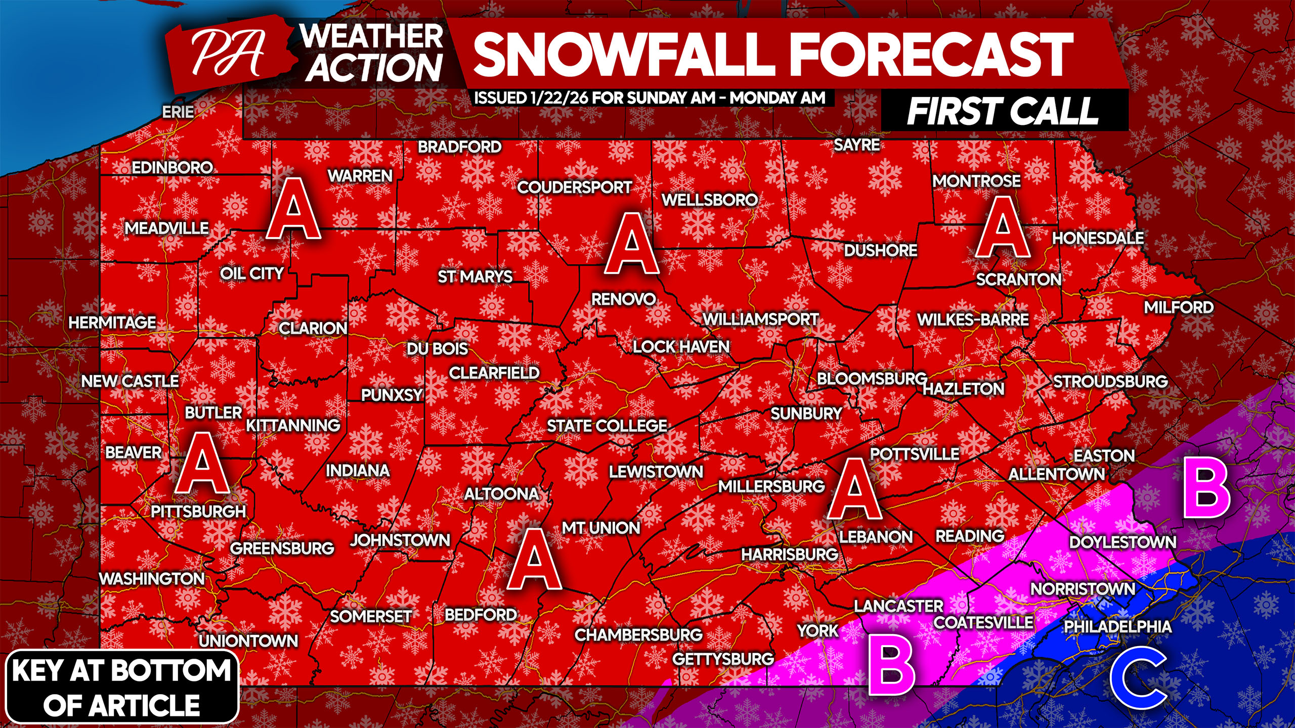
FIRST CALL SNOWFALL FORECAST FOR SUNDAY – MON AM
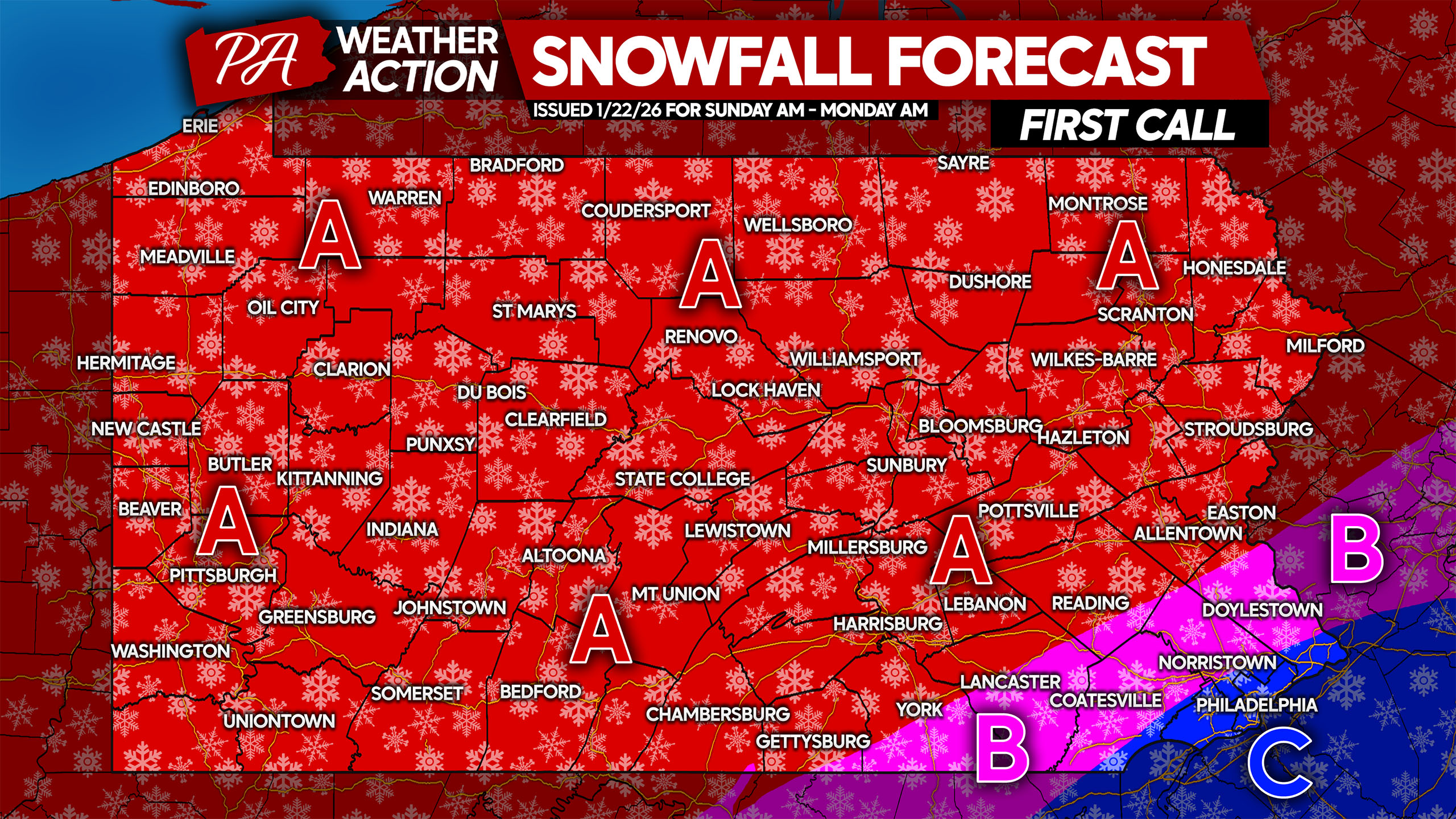
Please take 20-30 seconds to glance over timing and specific impacts. The information is concise and is very important to know heading into this storm.
Area A: Snowfall accumulation of 13 – 20″ expected. Do not travel Sunday unless in an emergency, as you may become stranded. Plan on cancellations and closings Monday and Tuesday.
Area B: Snowfall accumulation of 9 – 13″ anticipated. A glaze of ice is likely on top of the snow as well. Do not travel Sunday unless in an emergency, as you may become stranded. Plan on cancellations and closings Monday and Tuesday.
Area C: Snowfall accumulation of 6 – 9″ expected, followed by up to a tenth-inch of ice glaze. Do not travel Sunday unless in an emergency, as you may become stranded. Plan on cancellations and closings Monday and Tuesday.
Share this highly important information with family and friends below!

You must be logged in to post a comment.